Mountain range, region / State
Rila / Bulgaria
Season
Summer
01. 08. - 05. 08. 2018
Difficulty
3 / 5
Elevation
↑ 5768 m
↓ 4564 m
Length
72.2 km
5 days
Altitude
max. 2345 m n.m.
min. 1134 m n.m.
Tourist map of the crossing of the Rila Mountains
Crossing the Rila Mountains with all equipment
Starting point
The hike starts at the Rilski manastir (Rilski monastery) - right next to it there is a red trail. About 1.5 km down the road behind Rilski monastery is the Bor camping site, where you can stay overnight and leave your car (either in an unpaid and unguarded parking lot or for a reasonable fee directly at the camping site).
The nearest grocery shopping is possible in the village of Rila (about 20km before the monastery). There is a refreshment stand at the Bor campsite. You can get water at the campsite or at the monastery. As far as transport is concerned, there is an asphalt road leading to the monastery and the campsite, so travelling by your own car is easy. There's probably a bus that goes to the monastery sporadically, but I wouldn't count on it too much (but there's definitely a bus to the village of Rila, from which you can access it).
Description of the hike
1. day
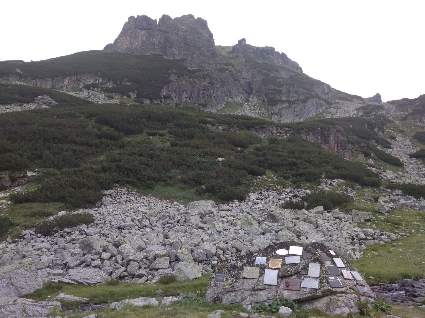
In the morning we will see the beautiful Rila Monastery and continue along the well-marked red trail to the Ivan Vazov hut. The ascent is quite challenging - long through the forest and then through the tall grass. The actual path, in contrast to the map, goes around the Baučer peak (2 152 m) on the left and behind it there is a nice shelter for bivouacing.
We're just having lunch at his place. We continue on the left side of the ridge, to soon cross it and open beautiful views of the opposite ridge with the peaks Damga 2 6 77 m above sea level and Dodov vrch 2 663, which will be our goal on the second day of the trek.
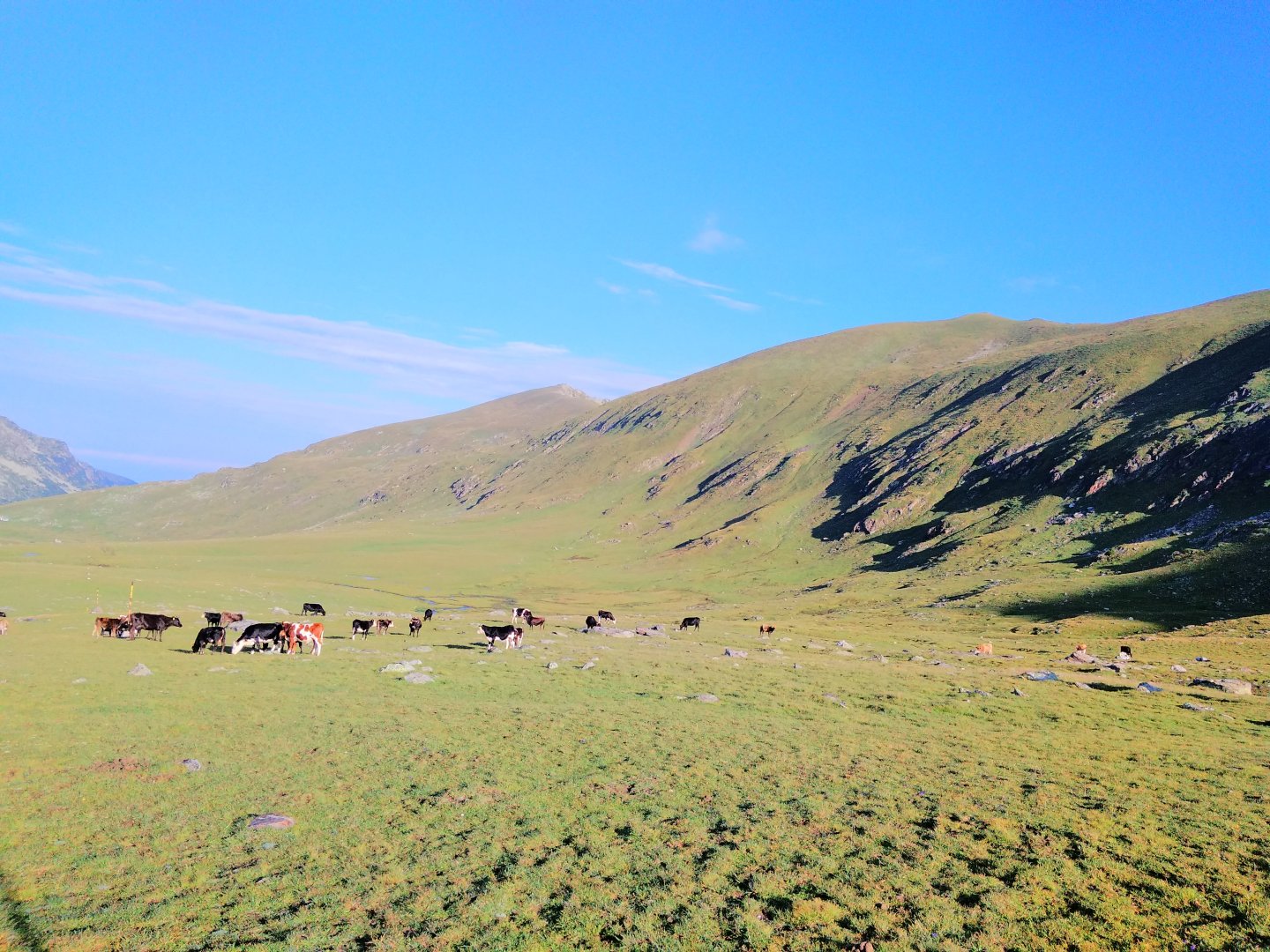
We continue along our ridge to the Ivan Vazov hut. The path leads through pleasant grass, but after 2 weeks of rain it is waterlogged and it is necessary to zigzag. There are lots of horses, sheep and cows and the path descends pleasantly to the still quite distant cottage. At this, the meadow is now one big bog and we decide to sleep inside the cottage. The price is 20 Leva per person with the possibility of booking . Ivan Vazov hut has a nice website where you can find out about the current weather on the ridge. In the evening I have problems with acclimatization, but in the morning everything is good.
Date of the first day:14 km; 1 600 m up, 450 m down.
2. day
From the Ivan Vazov hut we set off at about half past seven following the green sign in the direction we came from on the first day, but in a large meadow we turn off in the direction of the Razdela saddle (2,603 m above sea level). The path initially leads again on a soggy meadow, but then it turns into a pleasant and gentle climb through the grass.
In the saddle it is worth going about 500 m to the northwest. There is a fantastic view of the Seven Lakes. From the saddle a little to the northeast is again a nice view of the Majlovice massif. You could definitely sleep in the saddle, but there is no water and it can be really windy.
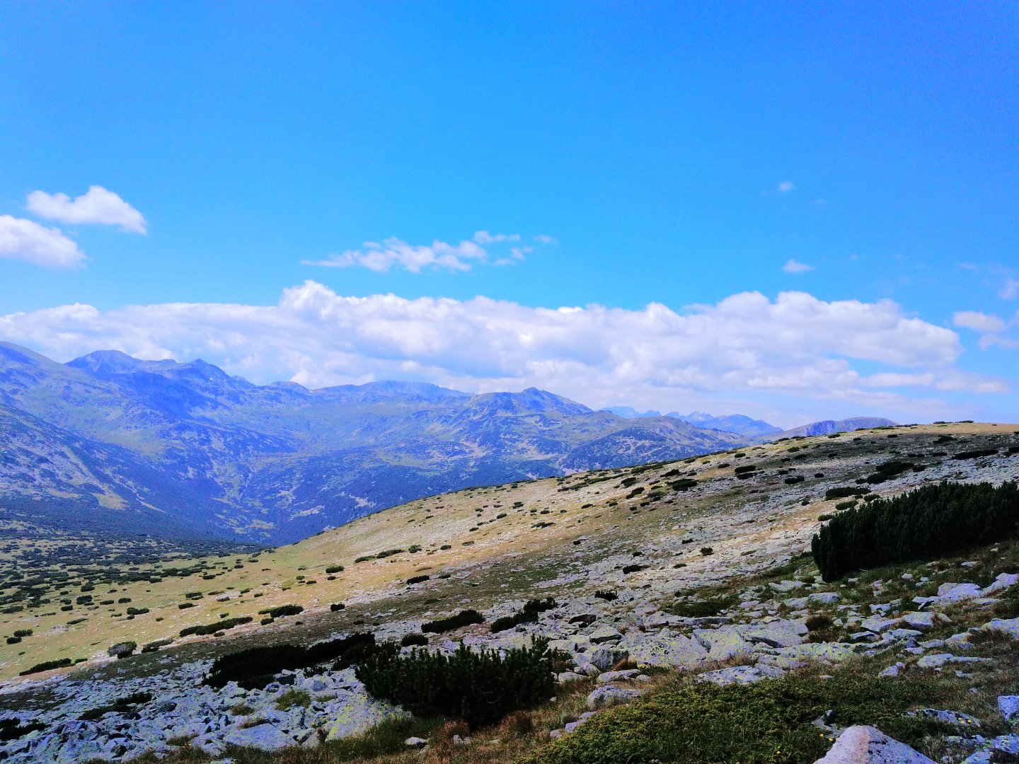
Continue southeast along the red trail to the top of Damga (2,669 m) and continue along a pleasant (but undulating) grassy ridge towards Majlovica. Yesterday's path is visible on the right. The terrain is a bit rockier on Dodova vrch (2 661 m), but it is the first place with mobile signal.
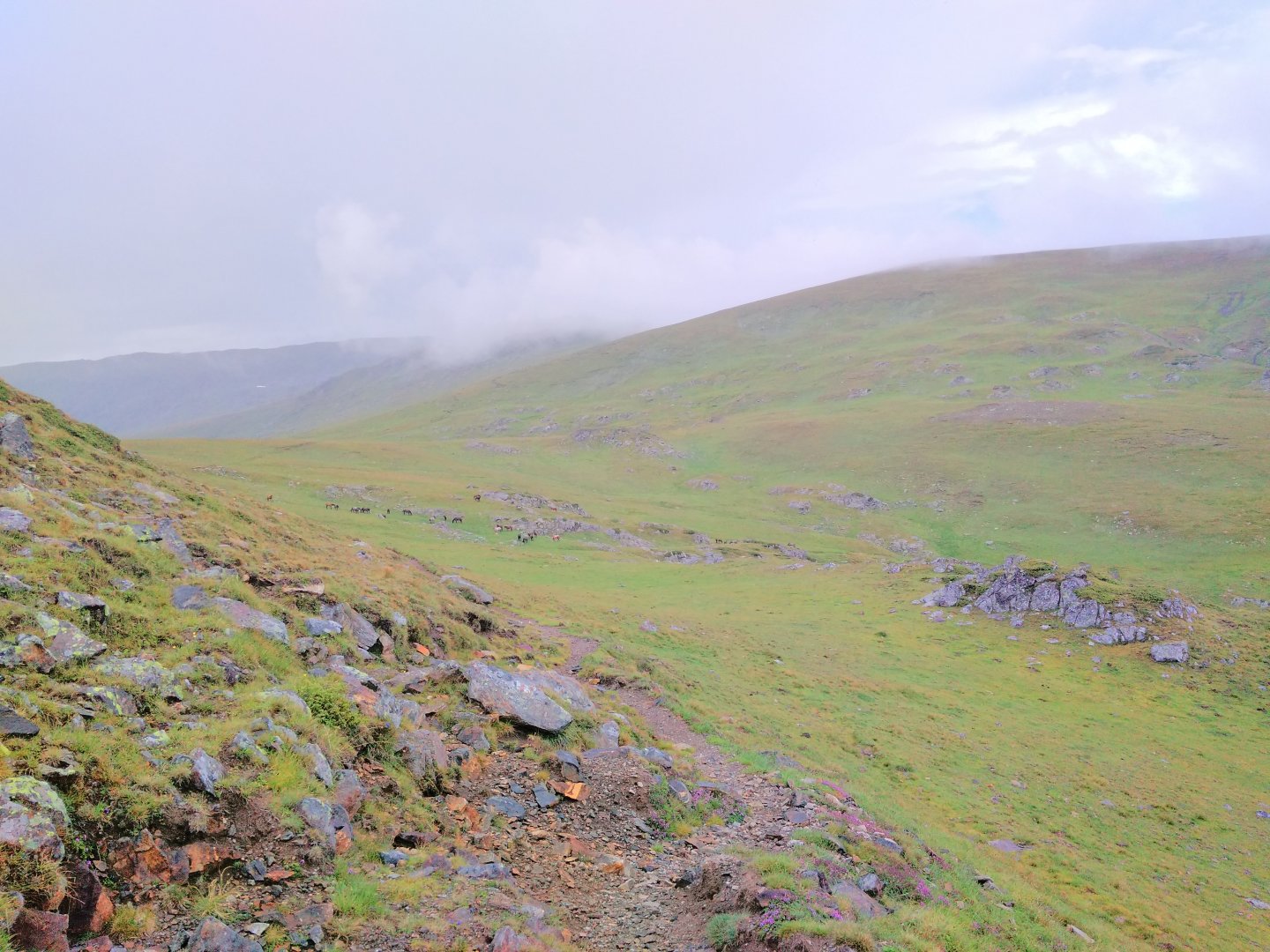
We didn't see water anywhere on the way (the last one is at Ivan Vazov's hut). We descend to the saddle, where the blue trail from Rilski manastýr joins from the right (it would be suicide to choose it for ascent/descent, it is rather a poorly marked stream bed). Here begins the ascent through the herds of wild horses to Majlovica. Climbing like a cow, but we are there quickly.
To reach the top of Majlovice (2 729 m above sea level) you have to turn left from the main trail a few hundred metres along the contour, but unfortunately it is all in fog. During our stay, this part of the mountains, i.e. the basin behind Majlovice and Orlovec, was regularly in fog from 11 am onwards. Continuing north from the summit on the unmarked trail would be dangerous in the fog and with backpacks, there is quite a steep slope.
Overall, the massif is a gently sloping meadow to the south and rocky cliffs to the north. We return to the red light and try to hit the unmarked continuation along the ridge towards Orlovec (2 686 m above sea level). The fog is even thicker and thunder is beginning to sound, so we descend on the red line to Elena's Lake, where we hide from the lightning. They are flying all around us, but surprisingly it is not raining.
The original plan was to go over the Orlovec ridge to Strasnot Lake, but because of the storm and the exposed trail to Orlovec we decided to go down to the Majlovica hut (1 960 m above sea level). During the setup, some marked trails back to Orlovec are dodging, but the best way (according to a local) is not to descend Majlovica ridge at all and continue to Orlovec on the unmarked trail - the path is said to be the safest and also the most passable.
Anyway, we definitely decide to go all the way down to the hut. The descent leads on nice terraces (partly flat on grass, partly steep descent on stones) along the river. On the way, the storm finally stops and the fog dissolves.
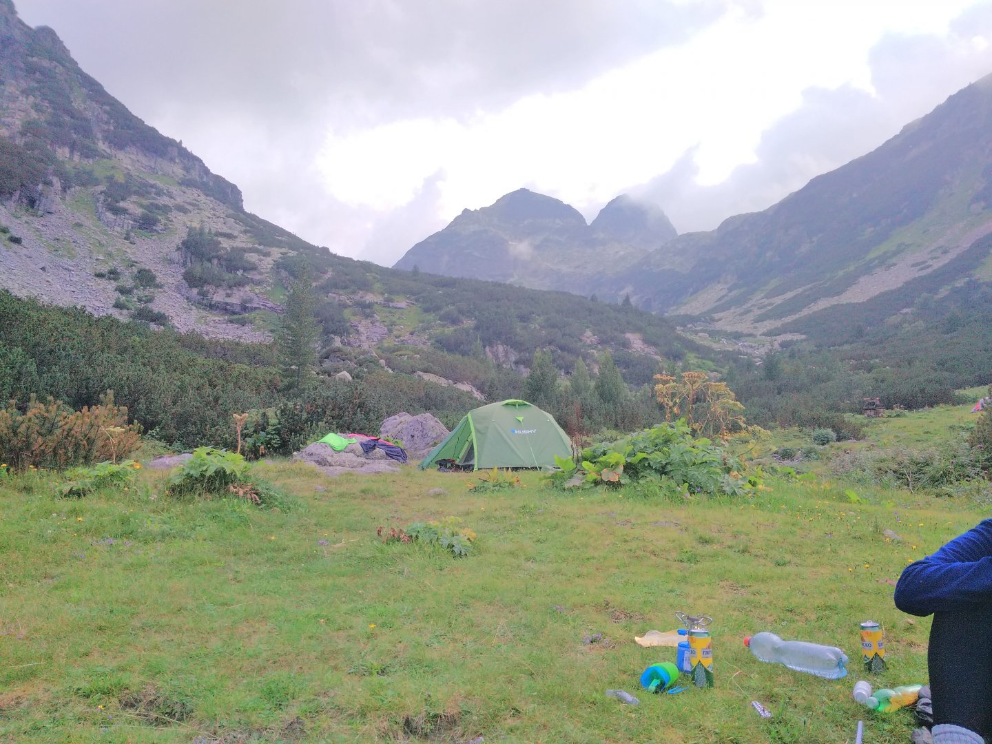
The descent was beautiful, but quite long and difficult. There is a beautiful area for tents near the Maljovica hut and it is free. Jen is by the river, but it is not cold here. Pivko and šopáček at sympathetic prices.
Date of the second day: 14 km; 950 m up, 1,250 m down.
3. day
Brutal massacre... There is a lot in the plan (crossing two ridges), which will be done with great effort! In the morning, at about 7 o'clock, we set off on the red road towards Strasnoto jezero. The road leads through dense rhizomes and in some places water is flowing. Then it follows the river, but as soon as the road turns south, the slope flattens out, the cursing subsides and it climbs quite pleasantly up the terraces again.
Although it is beautiful all the time, around 10 o'clock the fog falls again, a pity. We pass Malomajlovice lake, where there should be a nice place to sleep, in the fog, and a nice place to sleep is just below Strašnoty lake. But until then, sleeping at Majlovica hut is a better choice. However, there is a fantastic bivouac with free beds and stones at Strasnot Lake.
To the right we can see a trail paved with stones to Orlovec (where we originally wanted to go). With heavy backpacks it would be only for experienced mountaineers. Our route continues on the red stone path up to the Popovokapski preval saddle. We are surprised by a slightly exposed section secured with ropes.
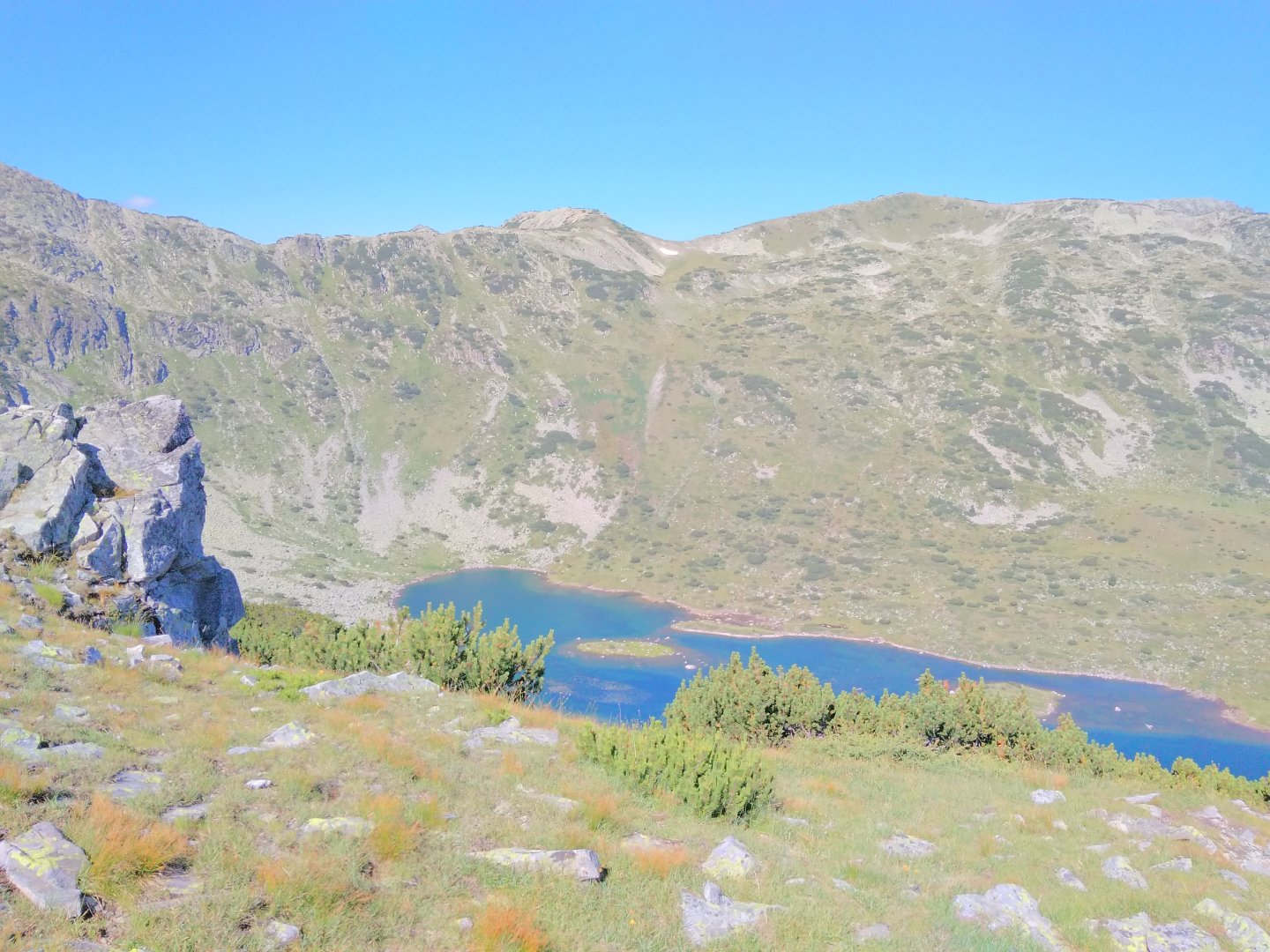
After the saddle, we leave that mist-filled basin and continue on the red trail (beware, the sign is lost in the saddle) down to Popovokapskie Lakes. The water is clear, but there is a lot of mud and a lot of tadpoles, so the last chance to get drinking water is at Strašnota jezero, when you get to Ribny jezero! From P. Lakes there is a nice grassy trail that follows the contour line to the Kobilin Branch, but it's quite a hike. At least it's beautiful - the fog really only stays north past Orlovec and Majlovica.
At Kobilina braništi we have lunch and take a break. There is also a bivouac hut here, but overall the place doesn't look too inviting (there are carcasses of dead horses and smelly water). From K. braniště there is a possible ascent/descent comfortable forest path back to Rilski manastir.
We are done, but must continue to the nameless peak next to Vodnija Čal (2642). The road climbs all the same and quite pleasantly, so we are on the top quickly. The views from the top are very nice. Further on, the road swings along the ridge for a while and then finally starts to descend. In keeping with the map, we meet two smaller (but clear) trickles.
We reach a valley to a stream where we could sleep, but there are lots of mosquitoes, waterlogged grass and generally not much to do, so we just cool our feet and go to reach the last two kilometres over a small hill in front of Ribny Lakes.
As the sun sets we set up our tents, cook our food and go straight to sleep, totally exhausted. It was windy at night and really cold (August). Personally, I recommend to consider splitting this day into two, or to walk to Strašnotu jezero the next day (ideally via Orlovec).
Dates of the third day: 18 km; 1 350 m up, 1 100 m down.
4. day
A more relaxing day was promised, so we sleep really long and start at half past ten on the blue trail to the Kanarski preslap saddle. The road is ok, winding through serpentines and pretty soon we are in the saddle.
From here we follow the contour with nice views of Musala and the destination of today's trip, the Dzhanka saddle. There is a short climb up the rocks below the summit of Kanarata (2 691 m above sea level), from where we are told there are good views of the southern Rila and Pirin. Supposedly, there is an unmarked exposed path leading up to it, secured with ropes, but I didn't see a turn-off anywhere.
Then we continue along a long quiet swinging grassy ridge with views of Musala and Majlovica. You can see the slope of the southern ridge of Rila and Pirin rising in the distance. On the Vapa hill (2 528 m above sea level) we take a late gable and continue at a fast pace across the meadows below the Kovač hill (2 634 m above sea level).
About halfway from Vapa there is a beautiful strong spring, otherwise there is no water. It is beautiful all day, but it is windy. We will climb Kovač once or twice, it is the last climb of the day. Only from here we can see Majlovice, Orlovec and actually the whole yesterday's hike in its full glory.
Behind Kovac we try to find a hidden place to sleep (we are in the heart of the national park). We eventually reach the Dzhanka saddle, where we meet some people camping and learn that it is tolerated here. So at the saddle, we pitch our tent on a nice patch in the lee behind the kneeling area and the only thing missing is water. I go down to the Grančar hut to get it. Here they charge 3 Leva per person for tents, but it is not in vain.
Date of the fourth day: 14 km; 900 m up, 800 m down.
5. day
Last day. We leave early, somewhere between 6 and 7. We follow the red road, and even though there should be springs with water near the road just behind Dzhanka, we don't see any. The Juruški Čal peak (2 769 m) is crossed just below the peak from the right and the Mariški Čal peak (2 765 m) is completely avoided from the left.
Then the rocky-grassy ridge swings over the peaks of Goljam Bliznak (2 779 m) and Malak Bliznak (2 777 m), which gave us quite a hard time in the high pace (we are in a hurry to be on Musala before the fog comes).
The path along the ridge from Dzhanka is not completely short and is entirely without water (you have to pick it up at the Grančar hut). It's going well, it's beautiful there and mainly we are driven by the vision of the goal, so after about 3 hours we are standing below Musala (2 925 m above sea level). The final climb doesn't look too difficult on paper, but it was quite a climb. After another hour, we are happily at the top and enjoying the views of the whole Rila before the fog sets in.
Moreover, we are still alone here, because the people from the cable car from Borovets have not arrived yet. There is a weather station at the top, where they sell tea, so we go there and rest. After a while the first people arrive and after an hour a procession of people comes from below.
At about one o'clock we start to walk down the red trail to Leden Lake. The trail is steep and on rocks, so the meters disappear quickly, but we walk in a line of people. From Leden Lake, we follow a similar trail to the Musala Hut, where the fog has cleared and it has turned beautiful.
The last few kilometres remain on the foamy path to the top station of the cable car on Jastrebec. The cable car has ticket offices only at the bottom, so you had to tell the lift operator at the turnstile, go down to the black and pay 8 Leva each there. The cable car ends right in the town of Borovets, where we found very cheap accommodation in a local hotel via airbnb.
Day 5 dates: 14 km; 1,100 m up, 1,100 m down.
Difficulty
The path leads mostly on beaten hiking trails, which are relatively well marked and very easy to follow. Mountain meadows predominate, in places rubble. There are a few stretches of rocky terrain. One section is protected by chains, but it is not exposed. The steep slopes are found only in rocky terrain and are well navigable even in wet conditions. We hiked from the end of August and after heavy rains, so some of the meadows were very waterlogged.
We didn't encounter any snowfields - but in the earlier months you have to reckon with their remnants. The whole crossing is challenging mainly because of its length (5 days without the possibility to buy food) and then specifically its third day (when you have to cross 2 ridges). However, the mentioned third day can be divided into two easy days.
Water availability
There is no problem with water on the trek and we always had enough water for 3 liters per person / day (we went on hard). Except for the many streams and springs, there is a tourist hut every day along the way where you can refill the water.
Sleeping options
We slept in tents in places marked on the map. It would always be possible to sleep in huts (price 5 - 15 Euro per person per night), but you can't expect any great quality - most of the huts smelled quite strange and strong inside. There are also two nice bivouac huts along the way (Strasnoto ezero and Kobilino braniště).
Mountain peaks
The route leads over several peaks, in fact the highest mountains of the Musala mountain range and the whole Balkan region. The views are therefore great.
Danger
There is no danger on the way (except for the classic mountain weather, which can change very quickly and you have to react in time). However, there is no signal in the mountains and except for the mountain huts the trek is crowded - this must be taken into account. There is only one section above the Haunted Lake that is a bit exposed, but it is secured with chains - nothing exposed.
Food
We ate classic "trekking food" - biscuits, salami, dried meat. We also had a cooker and cooked instant stuff and couscous. It is possible to eat in the huts for reasonable prices (so basically every night of the trek). I recommend the Chopped salad and Pirin beer.
Attractions
The last peak Musala 2 926 m above sea level is the highest peak in the Balkans. That is why it is full of people (especially at the weekend) who come to it from the north by cable car from the village of Borovets. The rest of the trek is literally deserted. Herds of wild horses can often be found on the ridges. They are very beautiful and if you don't holler, they won't run away from you. You can "spice up" the route by climbing some peaks along the way (for example Orlovec or Redzepica), where more difficult passages lead.
The Orlovec ridge can also be walked all the way to the Strašnot lake and you can save yourself a lengthy descent to the Majlovica hut (which must then be picked up) - but the terrain on this ridge is very exposed and without protection. The publishing house DOMINO publishes a very nicely made paper map of Rila. The trails fit, but the colours of the hiking signs are different in reality than on the map for some reason. However, the whole crossing is well marked, and there are even iron poles on the ridge with a sign indicating the distance and bearing to the next pole (so it is possible to cross the mountain in winter).
Photos