Mountain range, region / State
/ Austria
Season
Fall
23. 10. 2022
Difficulty
3 / 5
Elevation
↑ 1544 m
↓ 1543 m
Length
14.4 km
7 hours
Altitude
max. 1599 m n.m.
min. 549 m n.m.
Tips for hikes in the mountain range
Ascent of the Rossschopf mountain in the Kasberggruppe
Steinerner Jäger Spring Ridge in the Hornorakous foothills of the Alps
Spring Ridge Route through Gaisberg and Schoberstein
Autumn climb to Kremsmauer
Starting point
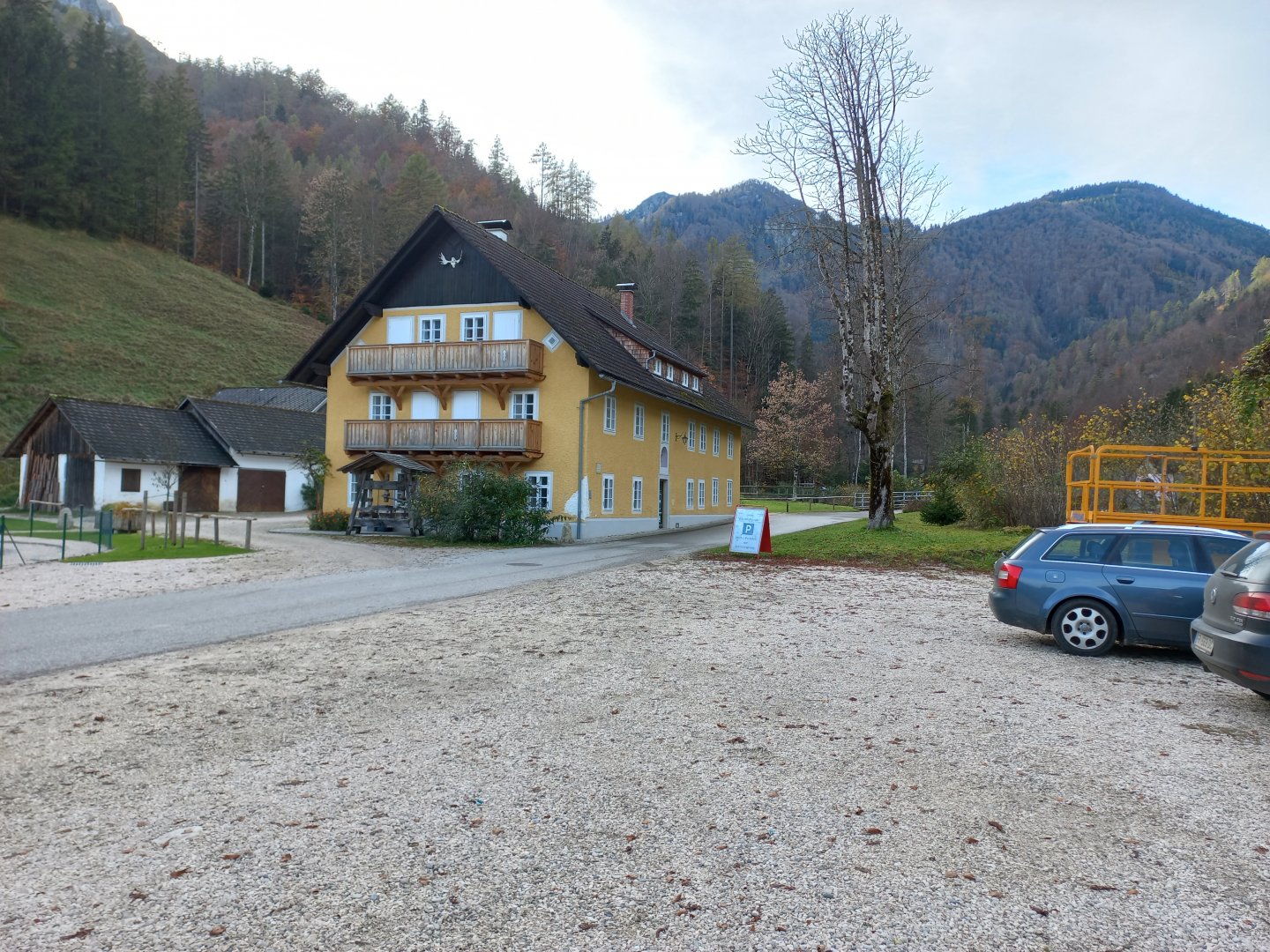
Free parking at the end of Micheldorf in Oberösterreich - In der Krems. It is located at the A9 motorway, exit to Kirchdorf an der Krems.
Description of the hike
The Kremsmauer (1604 m) is the first alpine massif in the Upper Austrian foothills south of Linz. The mountain towers a thousand metres above the Krems River valley and the district town of Kirchdorf an der Krems. From the A9 motorway I take exit 28 towards Klaus and return to Kirchdorf. After about four kilometres, the Georgenberg hill appears on the right with the Kirche des hl. Georg. Directly below is a signposted turn-off to the source of the Krems River (Krems Ursprung).
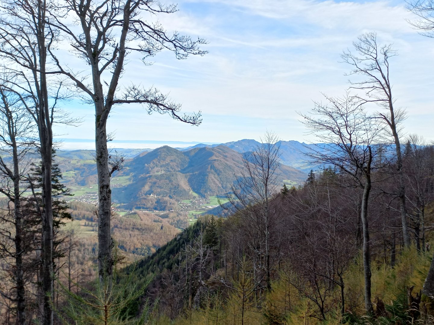
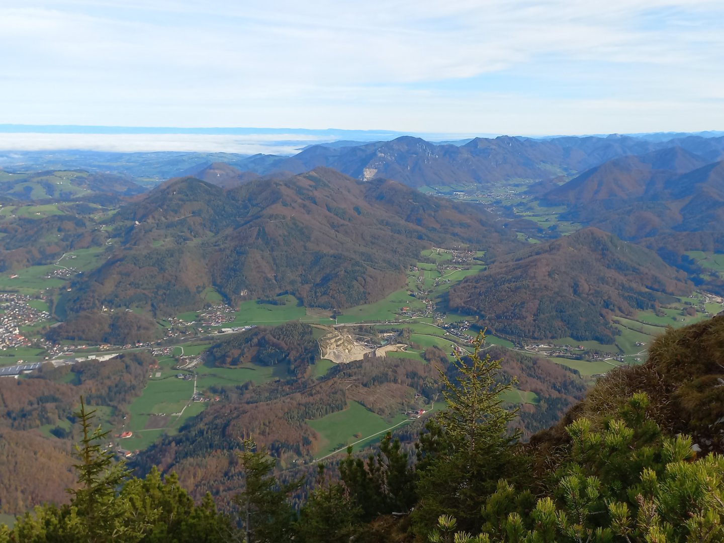
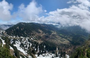
I leave the car in the free parking lot of the big yellow house and follow the path between the houses of the village Micheldorf - In der Krems towards the spring. After a few hundred metres there is a signpost by a wooden bridge. From it, a marked AV route leads up the ridge, to the stone Törl window and to the top of the Kremsmauer. It should take 2.5 hours to reach the Törl, and an hour more to reach the Kremsmauer. Just after the bridge a very steep climb through beech and spruce forest begins. The slender beech trees without leaves allow views between the trunks into the valley, but the fallen leaves on the ground are unpleasantly slippery. The climb is challenging - always up, over roots, rocks, no straight section to stretch your legs. Occasionally there is a small clearing or a break in the trees and you can see down - to the church of St. Georg, the houses of Kirchdorf, the thousand-year-old castle of Burg Altpernstein and on to the hills of the Hornorakous foothills. I recognize the Dürres Eck - Schoberstein ridge, which I hiked in the spring (described in NaTrek).
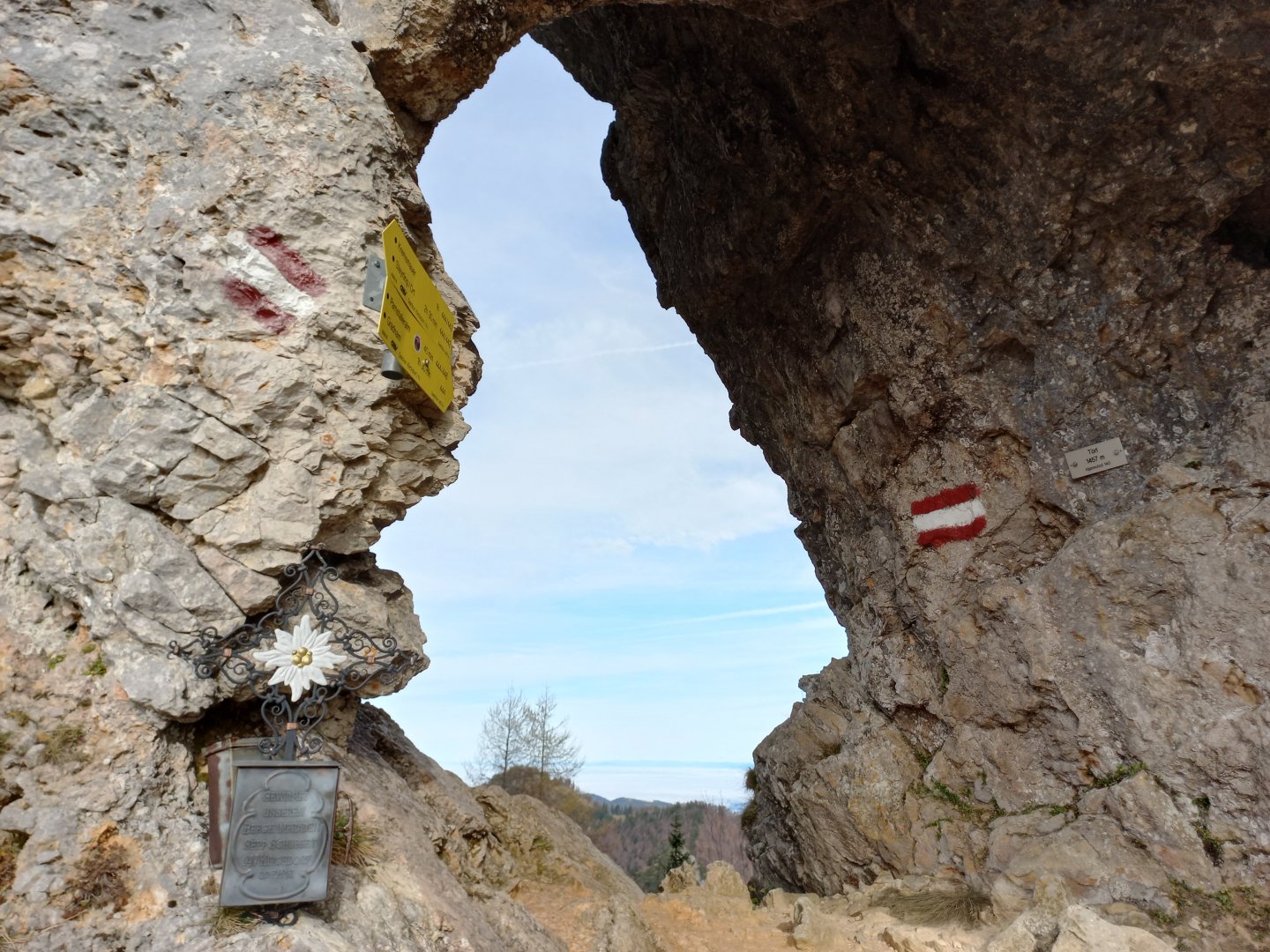
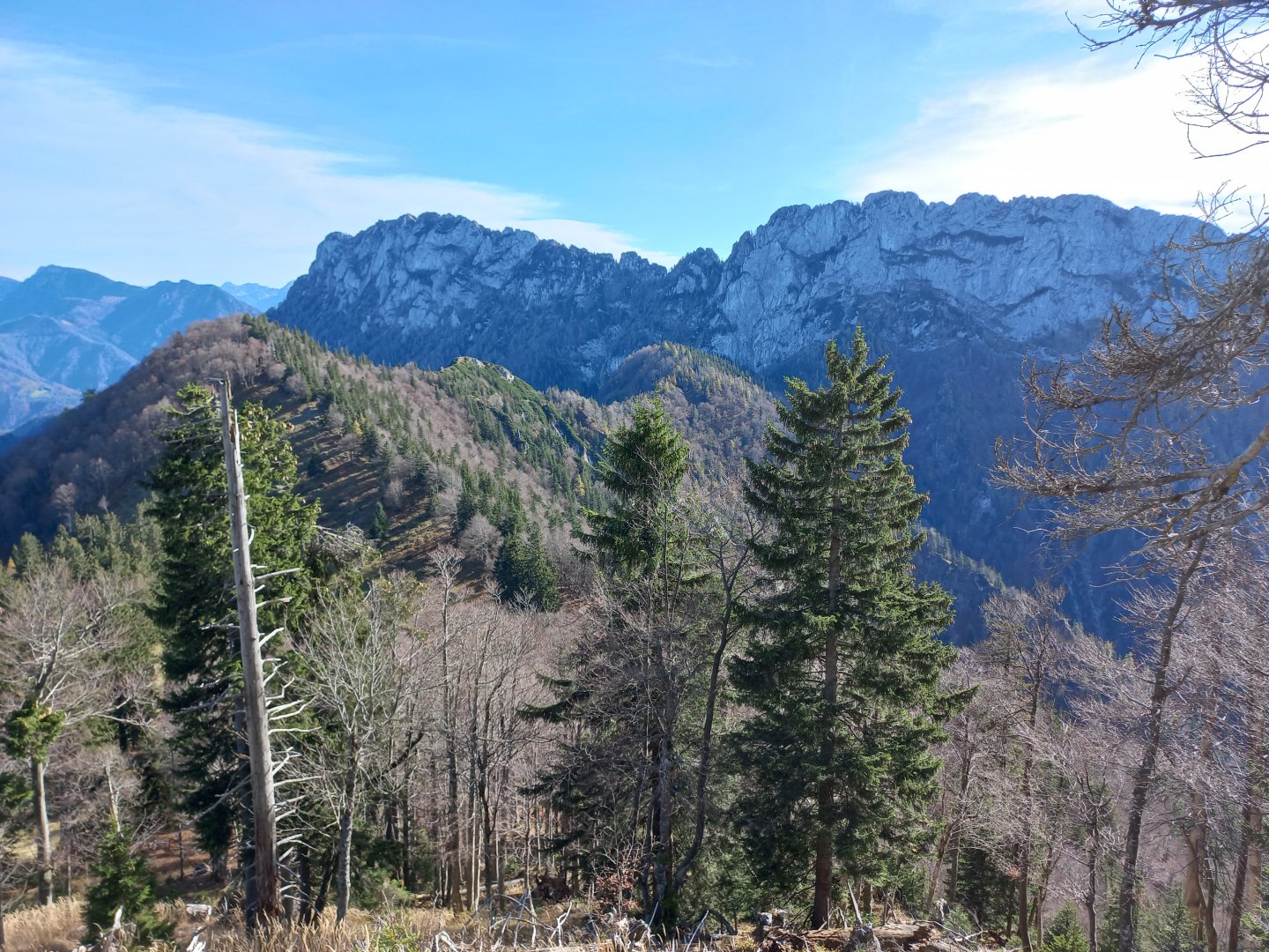
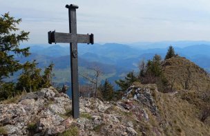
The visibility is perfect, maybe around 100 km - towards Bohemia, behind the fog over Linz and the Danube stretches a dark belt of border mountains. After an hour and a half I reach the signpost below Törl. This is where I'll be returning from Kremsmauer, and it's also where the only possibility of shortening the journey lies. After the crossroads the more difficult part begins. It's still a hiking trail, but there are difficult places to climb, secured with chains, crampons and metal handholds. It is not a ferrata, no special equipment is required. However, it is good to have at least some experience with mountain terrain, it would be very challenging for beginners and children. Slowly I continue up the technical terrain and in another half an hour I am standing in the rock window of Törl (1457 m). There is a small cross with a summit book. The views on the other side are fantastic - directly opposite the highest peaks of the Totes Gebirge - from the east Warscheneck, Kleiner Priel, Grosser Priel, Rotgschirr and others. And to the far right in the distance, Dachstein with its glacier.
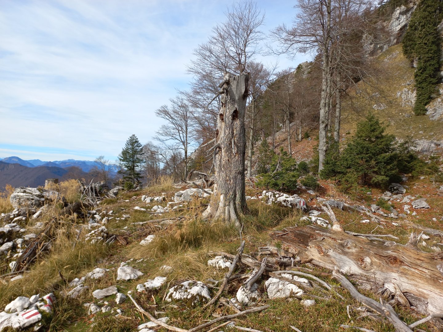
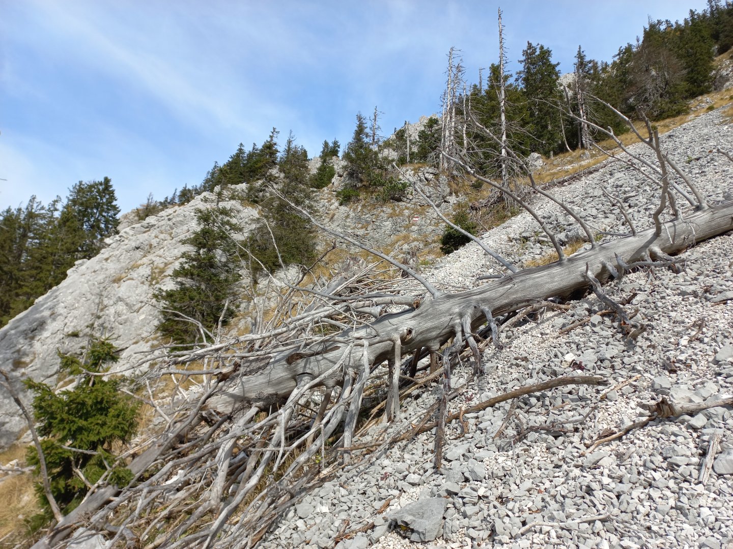
The trail passes through a rock passage to the south side of the ridge. Its character is a bit different - there are stone seas, logs with dead trees, clearings. A short descent (again, secured sections) brings me to a fork where the path branches off towards Steyrling. Beyond the fork I have the last part of the climb to the Pyramid summit (1599m) - 250 vertical metres, the steepest part of the route, most of it secured with ropes. My legs are aching like hell, the sun is beating down on the south side so much that even in October I'm wearing nothing but a t-shirt. Half an hour later I'm at the top by a massive cross, all hardships forgotten and I admire the magnificent circular views. The mountains to the southeast are newly appearing - the nearby Sengsengebirge with the highest Hoher Nock, behind them the Haller Mauern, the Gesäuse, much to the east even the Ötscher in the Ybbstal Alps can be seen. On the other hand, to the west, the Salzkammergut and the square solitaire of Traunstein. There are groups of people sitting on the top, I also take a break and recharge my batteries. The highest point of the Kremsmauer massif (1604 m) is only a few tens of metres away, according to the map a path leads to it, but the ridge doesn't look very passable so I take the same way back.
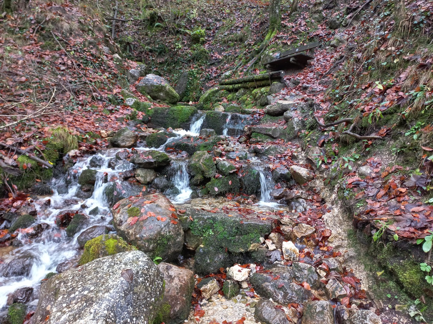
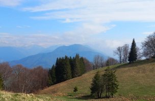
It goes down much faster, through the rubble and glades I am soon in Törl again. A few dozen metres more, secured by a rope, down to a fork and then a rocky traverse under the Törlspitze wall to a ridge with the peaks of Nackter Kalbling and Rauer Kalbling (1368 and 1381 m). Behind them I can see the meadows above Gradnalm, the only hut on the way. A short detour to the top of Pfannstein (1423 m), which offers a view of the continuation of the ridge to Traunstein. From Gradnalm, the marked route alternates between a wide forest path and a path through a ravine down to the source of the Krems (approx. 1.5 hours). It is then only a few hundred metres along the asphalt road to the car park.
Difficulty
The path leads along the marked Alpenverein route. Still hiking, but with difficult places secured with fixed ropes. It is necessary to have at least minimal experience with mountain terrain. In addition, there is a lot of elevation gain over short distances on the route, so good physical fitness is required.
Water availability
Water with you, at least 1.5 litres. Refreshments are at the Gradnalm hut.
Sleeping options
This is a one day trek, overnight stay is possible in the valley.
Mountain peaks
Ascent to the Pyramide peak 1 599 m above sea level, views of the Hornorakous foothills (Dürres Eck, Schoberstein), Totes Gebirge (Warscheneck, Kleiner and Grosser Priel), Dachstein, Sengsengebirge (Hoher Nock), Haller Mauern, Grosser Pyhrgas, Traunstein and others.
Danger
On part of the route there are exposed sections secured with a steel rope and other aids. It is not necessary to have klettersteig equipment, but the use of hands is essential. The route is often in rocky terrain. The route is intended for at least a little more experienced hikers.
Food
It is necessary to have food with you, some refreshments are available at the Gradnalm hut.