Mountain range, region / State
/ Czech Republic
Season
Summer
02. 07. - 05. 07. 2022
Difficulty
2 / 5
Elevation
↑ 2670 m
↓ 2467 m
Length
115.1 km
4 days
Altitude
max. 1010 m n.m.
min. 167 m n.m.
Tips for hikes in the mountain range
Trip through the Modlivý Mine and Svojkov Castle
March Mělník - Liberec
Starting point
Beginning: Mělník bus or train station (depending on the connection).
Boarding point not paid. I don't expect anyone to drive, but it should be possible to leave the car almost anywhere in the city in a parking lot. The best connection is train or bus.
Description of the hike
1. day
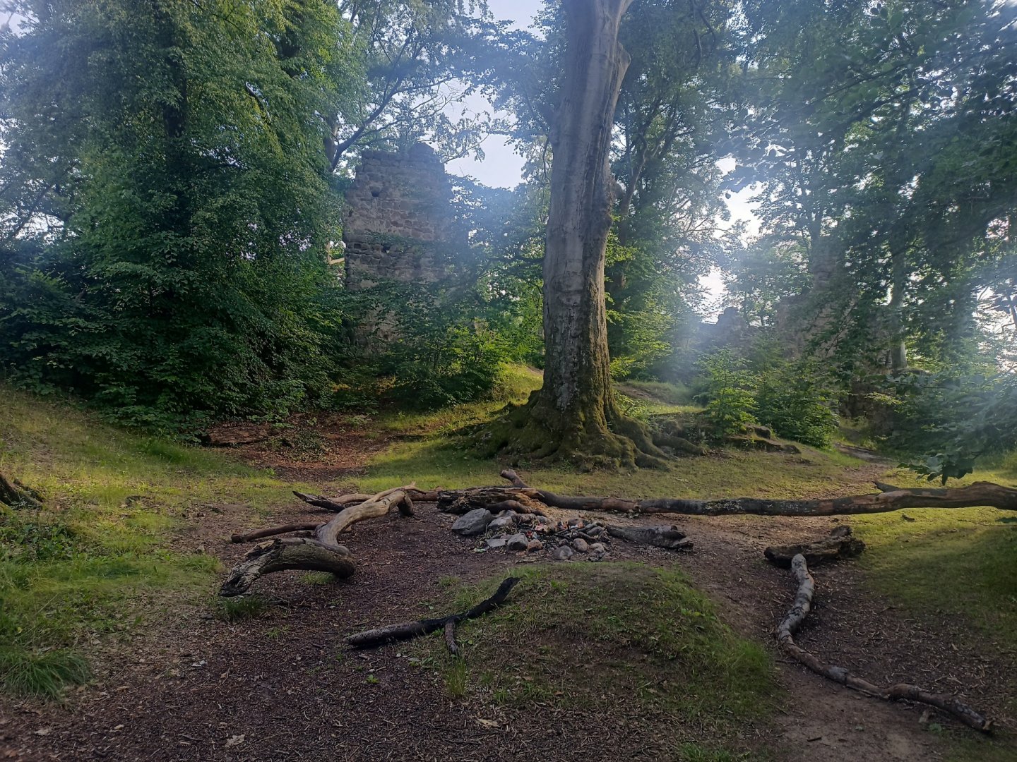
We start in the picturesque town of Mělník and follow the Mácha's Way, which will take us through beautiful nature and historical monuments. We will be following this red trail all day, except for one small detour that is worth it. The first stop is at the Harasov pond, where we can refresh our bodies with water in the summer months or enjoy relaxing by the water and taste our favourite snack. If we don't want to stop by the water, we can continue on. Shortly after the village of Olešno, we decide to turn off the Macha's Way and follow an unmarked forest path that will lead us to the fascinating Petrified Castle. Here we can check in and spend the night if it is too much for us. The most interesting stop on our journey follows - Houska Castle. This imposing structure is famous for its secrets and legends associated with it. If you have time, make sure to stop here and let yourself be drawn into the world of mysterious legends. The first day ends at a stop outside the village of Kruh, where we can check in and rest after a full day of wandering. This day the journey is very pleasant and without any dangers. Map of Day 1: https://mapy.cz/s/jufepubaho
2. day
On the second day, I recommend getting up early to avoid the crowds and enjoy the first tour of Bezděz to the fullest. The route continues along the red Mácha's path. Bezděz is the first main point of the whole route. I strongly recommend buying a tour (~150 CZK/person) which includes a view from one of the towers. If the visibility is good, you can also see Ještěd! After that, the route continues to Lake Macha. (I got a bit lost there, but it can be walked straight through). It must be said, however, that the beach at point 8 on the map is chargeable. So I decided to continue to point 11, where I had an early lunch and a swim. At the signpost Staré Splavy - railway station I followed the yellow tourist marker and then joined the blue tourist marker towards Hradčany. I had planned in advance that I could spend the night somewhere near the Kraví rokle signpost. I arrived there relatively early, so I decided to continue my journey. In Hradčany I bought some snacks at a kiosk. Then I continued towards Mimoň and finally decided to spend the night by the side of the road, as it was already dark. Map of day 2: https://mapy.cz/s/gebolapuju
3. day
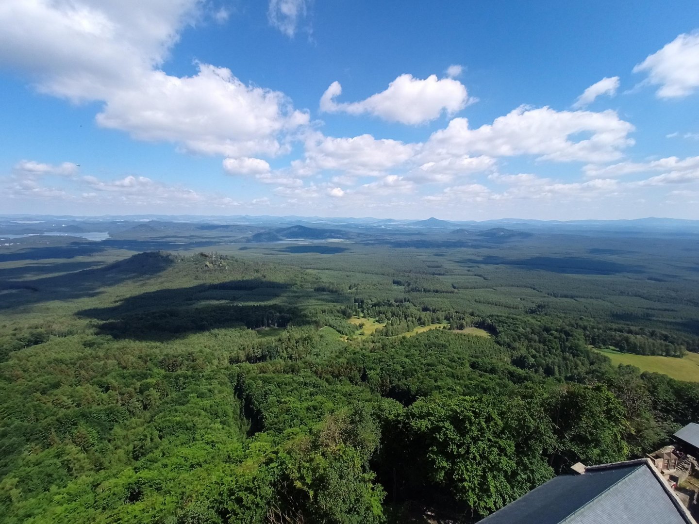
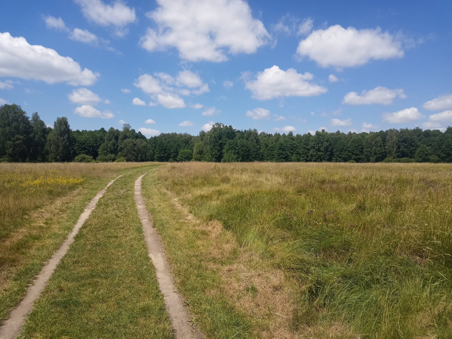
The third day I woke up bitten by a mosquito. Without further ado, I decided to hit the road. In Mimona one can replenish small supplies, I had enough, so I just ran through it. After leaving Mimona, we found ourselves in the beautiful Vranovská avenue, which was humming like a beehive in early July. A slightly more difficult hike to Ralsko followed. The views from Ralsko are worth the effort to climb it. From Ralsko we continue to Stráž pod Ralskem. This section is probably the most unpleasant on the whole route, as we had to walk about 5 km on asphalt along the expressway. On the way we can see the Ploučnice gorge.
In Stráž pod Ralskem there is an opportunity to go to one of the restaurants and have lunch or refresh yourself in the water reservoir. Then continue along the red road to the ruins of Děvín. Along the way we can notice the change of environment to pine forests with sandstone bedrock. After ascending Děvín, we continue along the red trail towards Osečná. I definitely recommend to go and see the beautiful viewpoint. Before Osečná you can spend the night in a nearby tourist shelter. Map of day 3 https://mapy.cz/s/hojatugoja
4. day
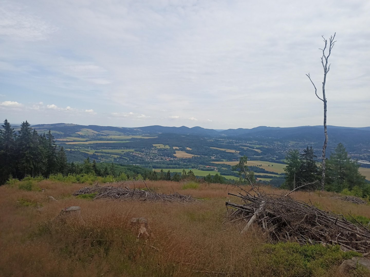
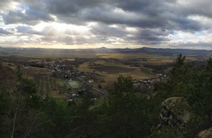
The next day starts with a climb to Ještěd. The ascent is not extremely difficult, but the long climb requires endurance. We continue on and a little below Výpřeží we can look at the rock formation Červený kámen. Your heart is pounding in your throat when you finally reach the top of Jested. Here you can rest and enjoy the magnificent view of the surrounding landscape. If you look carefully into the distance, you will see the pair of hills Bezděz and Malý Bezděz rising on the horizon.
After resting and enjoying the beautiful view, continue down. You can go straight to Liberec and walk to the main railway station, or like me, you can walk from Výpřeža along the ridge through Rozsocha to Machnín. On the way you continue through the Bedřichovec forest until you reach the railway station Krásná studánka, where our adventure ends. With a feeling of success and joy in your heart, you realize that you have managed to conquer this challenging route and discovered the beauty of nature, which filled you with new energy.
Difficulty
The trek should be done by any slightly experienced hiker with basic equipment. The route is chosen, as much as possible on forest paths least paved. The longest road section is the section between Noviny and Straz pod Ralskem. The total elevation is 2.3 km ↑, 2.1 km ↓ which is climbed and descended in three hills - Bezděz, Ralsko and Ještěd. Their difficulty is not very high. I climbed Ralsko and Jested for about an hour. The paths are not dangerous. Almost the whole way I had nice weather, only during the ascent to Jested it was drizzling a bit, which was rather pleasantly cool. I didn't go with my dog, but I don't think it would have been a problem to take him with me.
The route is not suitable for strollers.
I walked very lightly with a 40L backpack:
Feather sleeping bag, glow stick, foam mattress, sleeping bag cotton, clothes, food and water. All around 10 kg.
Water availability
The route leads through countless villages where water can be bought. Mostly I try to refill water in restaurants. Only once on the way did I have a situation where they refused to refill my water in a restaurant. I walk with 3 L of water.
Sleeping options
Overnight stays are possible in bus stops, tourist shelters. On the second day of the overnight stay, there is no sheltered place. I slept in a gillnet, but it is possible to bring a tent or tarp.
Mountain peaks
We will ascend to Bezděz, Ralsko, Děvín and Ještěd.
From Bezděz you can see the Ralská hills. In good weather Ještěd-Kozak Ridge and Bohemian Paradise. From Ralsko you can see the Lusatian Mountains. From Ještěd you will have an unobstructed view of all sides of the world. In good visibility you can see even Prague.
Danger
There are no major hazards on the route. The route follows hiking trails the whole time.
Food
My food was bread, salami and vegetables. I generally try to have at least one hot meal a day in a restaurant, which can be achieved in larger towns.
Attractions
The trip was significant for me because I live in Prague and I was born in Liberec. The original route was supposed to lead from Prague, but I decided to "deprive" myself of the asphalt section of Prague-Mělník. That's why I also leave the end of the route in Liberec slightly open and lead it to a railway station from which it is possible to leave.