Climb to the roof of the world - Chimborazo
Mountain range, region / State
/ Ecuador
Season
Spring
15. 06. - 18. 06. 2018
Difficulty
5 / 5
Elevation
↑ 2695 m
↓ 1732 m
Length
16.2 km
4 days
Altitude
max. 6263 m n.m.
min. 3912 m n.m.
Tourist map of the Chimborazo mountain area
Three-day trek to Chimborazo volcano in Ecuador
Starting point
The foot of the volcano from the southeast, on the road leading from the town of Riobamba. The best way to get to the entrance of the national park is by jetaxi from Riobamba.
Description of the hike
1. day
First, we will do acclimatization climbs: after arriving in Quito, we will climb the Rucu Pichincha hill, which offers a beautiful view of the city and the Cotopaxi volcano, with beautiful flora all around. It can be hastened by cable car and then summit at 4,696m in some 3-4 hours. Next we will bypass the beautiful volcanic lagoon Quilotoa, the peaks of the crater are also around 4 thousand.
2. day
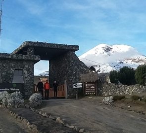
We get to Riobamba by bus, find a pick-up taxi to take us to the hut below Chimborazo. We arrive at the gate of the national park... the entrance is closed. The ranger appears, saying only until 4pm, it's 5:30pm and on principle they won't let us in.
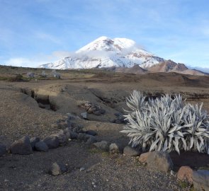
What follows is about 1/2 hour of complicated English-Spanish-Italian negotiation, where in an attempt to circumvent him, unsuccessfully. They allow us to stay and sleep at the gate and continue in the morning. Well, what can you do. We are rewarded with a beautiful sunset illuminating the looming mountain with the vicunas running about. Then a not-so-good night at the front of the visitor centre.
3. day
We wake up to a gloomy day, a heavy load on our backs and 8 km of dirt road ahead of us. But the clouds gradually part, after a few km a car appears with a friendly family who takes our packs and one member, the rest of the way we head upwards across the serpentine lava gravel. The latter, however, is fairly compact, with the occasional llama herd emerging.
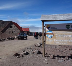
We find ourselves at Carrel's hut at 4800m. The hut is already comfortable, friendly friendly staff, no obstructions, rather encouragement that it should be nice and let's get going. To acclimatise we make another 300m climb past the hut of another Matterhorn conqueror, Whymper. Over a small lake we survey the climb and meditate. We wander around the lunar landscape with the occasional green clump, now a llama, now a Patagonian fox appears and around 6pm we all go to bed.
4. day
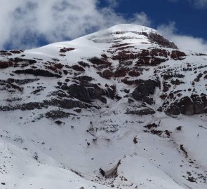
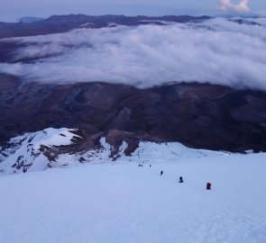
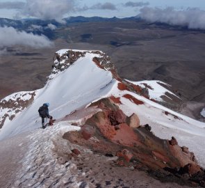
The next day starts early, at 11 pm it is already a buzz or the first expeditions start. We take one more hour and at 1 o'clock we are up from the hut. The other headlamps are already high above us, sometime at 5,200 meters into the crampons and up. The path is quite steep, not technically demanding, we go every man for himself, mostly on sticks, some prefer an axe. But the combination of thinning air and significant cold does its job. Adding to the killing monotony, the same steep terrain, the goal in sight, or lights high above us, although some groups finish and some turn around. A feeling of a kind of hangover emerges.
Every task is strenuous, moreover, it is necessary to get dressed, two thinner gloves are also insufficient, fingers are freezing, some people's feet are cold. The water becomes an icy slush, the tubes freeze completely, the chocolates don't melt. Oxygen is running low. I follow the 20-step system and breathe.
There are intense thoughts of turning around, so at least another 100m, so at least a meta of 6 thousand... But then the body somehow manages, plus the dawn, everything looks more optimistic and suddenly I find myself on a flat top. Others are coming, some reporting near-collapse. It is formally a pre-climax, so after a euphoric celebration and refreshments we still cross the saddle, formally linking up and reach the main one, according to various sources somewhere around 6,300m! It's 7am, freezing to bursting, but beautiful sunshine, views of endless moonscape.
We are about to descend. I pull out my ice axe instead, endless groping on my heels, tiredness, sleeplessness, feeling like we are sleeping while walking. We want to descend by a safe detour or with the melting snow there is a risk of some avalanches, but the frost still keeps the compactness and somehow we can't find our way along the ridge, so we descend the same way. It is already starting to snow, the snow is turning into slush. At the hut we arrange an afternoon drive, after a snack we want to take a nap, we barely get to sleep, the hut owner comes, a car is waiting for you... Quickly, somebody is losing their sticks, even South Americans steal...
Next we move on by bus from Riobamba through the green valley at the foot of the Tungurahua volcano to Baños, which otherwise here means toilets, but now probably the most touristy and therefore least authentic, the most chilled Ecuadorian city, living off thermals and adrenaline rushes. God knows why tourists flock here to ride, jump or swing on the swings. We're on the big frosty hill at 7pm, soaking in the warm water with local families at 8pm, frolicking on the slides and napping in a nice cheap hostel. What a contrast.
Difficulty
The hike is demanding not technically, but in terms of altitude. The first part of the climb is in rocky terrain, quite often off the trail. For the summit itself you need equipment for high mountain glacier hike:crampons, ice axe(even poles were enough). The biggest problem, however, is the thin air. It is necessary to have a good acclimatization before the ascent!
Water availability
The only water is at the Carrel and Whymper cabin. There's no chance to get water on the way.
Sleeping options
We spent the first night at the gate to the national park. The second night we stayed at Carrel's cabin.
Mountain peaks
The Chimborazo volcano is 6 263 m above sea level. Some sources indicate the altitude to be around 6 300 m above sea level. During the acclimatization climb we climbed the mountains Rucu Pichincha and Quilotoa.
Danger
No beasts, just adorable llamas. The most challenging from about 5,300-5,800 m - altitude, steep hill, cold, darkness. Without a good acclimatization there is a risk of altitude sickness. The ascent is not technically difficult, but you can always fall and go down. However, there were no cracks.
Food
The cottages are cooked, otherwise own resources, to output bars.
Attractions
Chimborazo NP - the peak is the furthest point from the centre of the earth, so at one time it was considered the highest mountain on the globe. The first Czechoslovak ascent was made in 1972 as part of the Cotopaxi 72 expedition.
