Mountain range, region / State
Karavanke / Austria
Season
Summer
22. 07. - 27. 07. 2021
Difficulty
3 / 5
Elevation
↑ 5880 m
↓ 5771 m
Length
79.7 km
6 days
Altitude
max. 2226 m n.m.
min. 459 m n.m.
Elevation profile of the route
Useful information
- Day 1 - arrival in Ferlach, drive through the Tscheppaschlucht gorge to the sleeping place, 11km, 550m climb
- Day 2 - climb to the top of Stol, 14km, 1600m climb
- Day 3 - mostly meadows along the ridge, 19km, 1100m ascent, 1500m descent
- Day 4 - partly through forests, partly through meadows, in places worse markings, 19km, 1700m ascent, 1800m descent
- Day 5 - similar route to day 4, 16km, 1000m climb, 1100m descent
- Day 6 - descent to Arnoldstein, 6km, 900m descent
Tips for hikes in the country Austria

Climb to the top of Scheiblingstein in the Ennstal Alps

Hiking up the Drachenwand wall in the Salzkammergut

Climbing the Schoberspitze in the Wölzer Tauern
Crossing the Karavanke Ridge
Starting point
We started the trek at the bus station in Ferlach. There are several car parks in Ferlach where you can leave your car, but we used the train and bus for transport from the Czech Republic.
Description of the hike
1. day
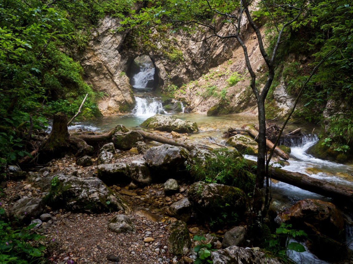
In the afternoon we arrived by bus in Ferlach and followed the red trail towards the mountains. The path starts with a road and after a while turns into a wide gravel road. Part of the way was along a clear river, where there is the possibility of a pleasant but cold bath, under one of the artificial cascades. A few kilometres after the village of Unterloibl we came to the beautiful Tscheppaschlucht gorge, which you have to walk through and there is an entrance fee (which the lady waived for us just before closing time). There is a nice cascade of waterfalls at the end of the gorge. We continued above the gorge for a few more kilometres to our first sleeping place. We slept on a patch next to an abandoned building that comfortably sleeps 5 people side by side. The only problem was the mice that chewed the caps off several of our water bottles overnight.
2. day
In the morning we arrived quite early in Bodental/Poden, where there is only one small shop where there is not much to buy, everything you need has to be carried from the beginning of the trip. The road gradually got smaller and started to climb more and more steeply. After a while we arrived at the Klagenfurter Hütte, where there is the possibility of refreshment and water. Then we continued towards Stol with a small detour to the top of Svačica, from which there are nice views of the surrounding white rocks. After crossing the climb through the rubble, we reached the saddle below Stol, where there is a possibility to turn to the Preseren Lodge at Stol (chalet) or to climb to the top of Stol. We stayed here and chose one of the flat places to sleep.
3. day
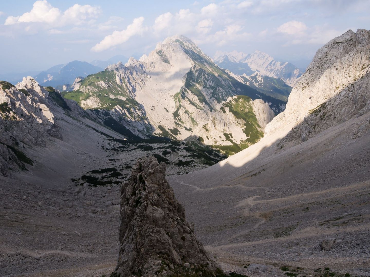
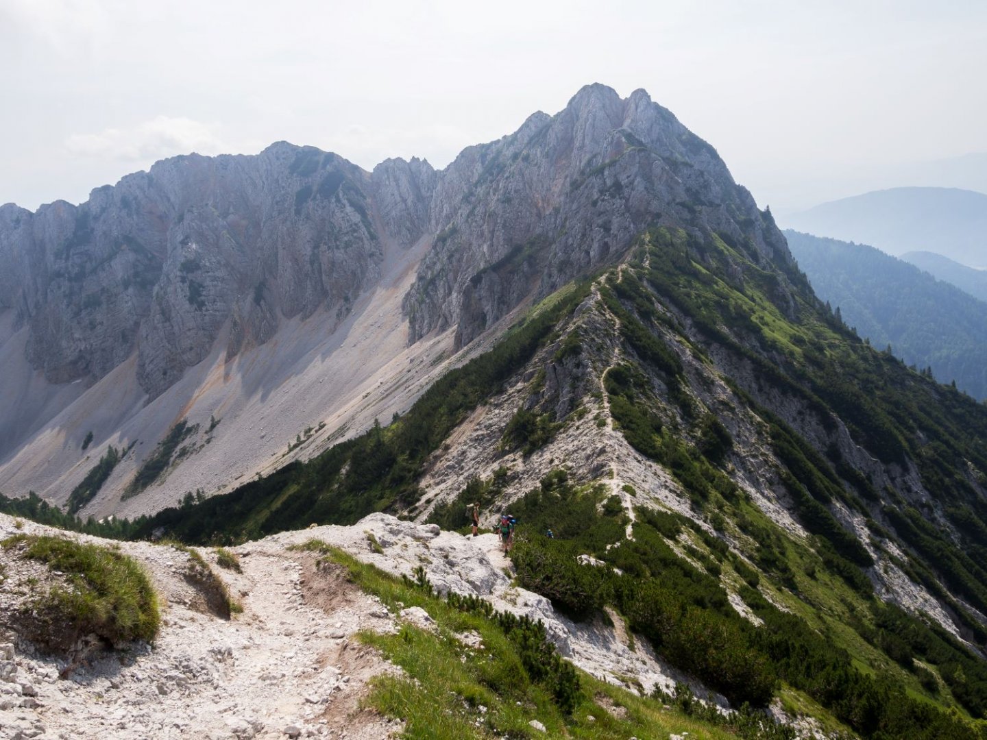
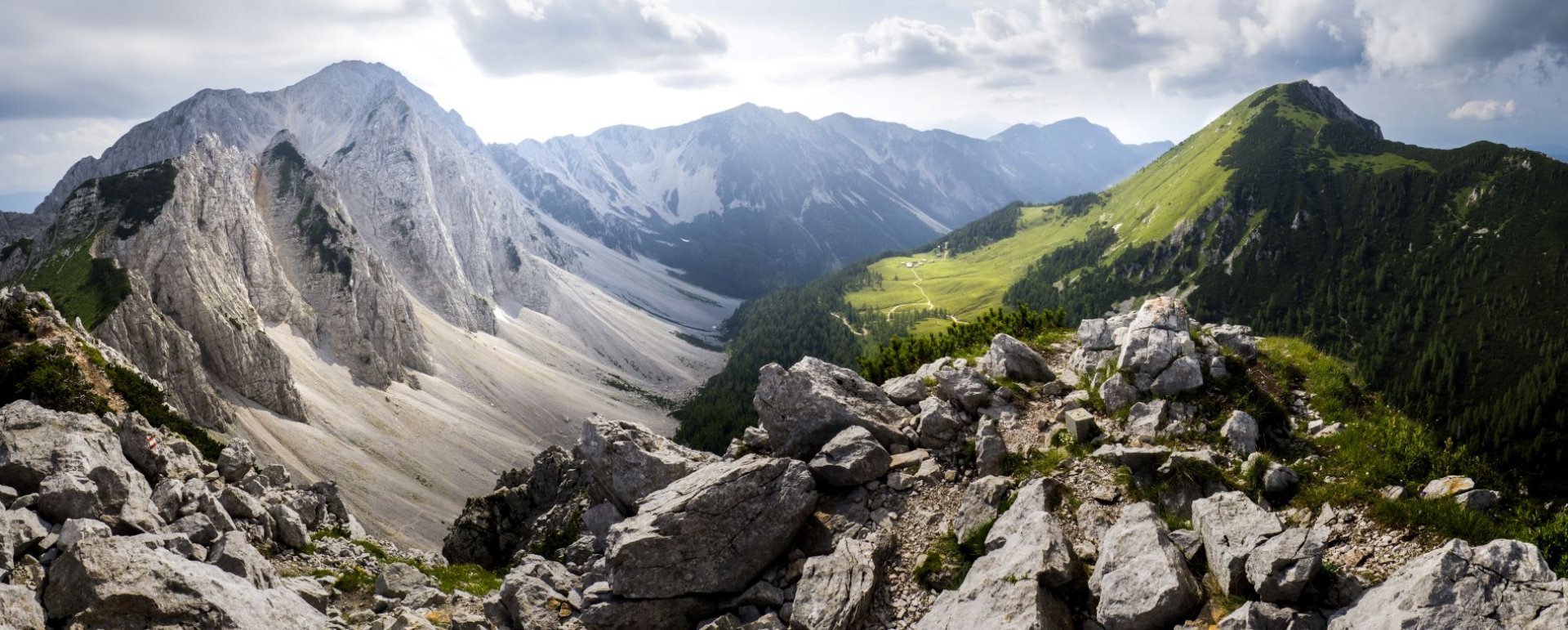
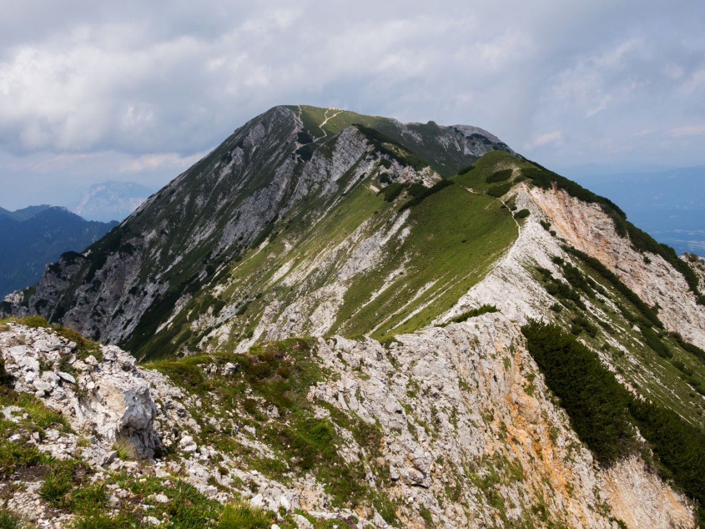
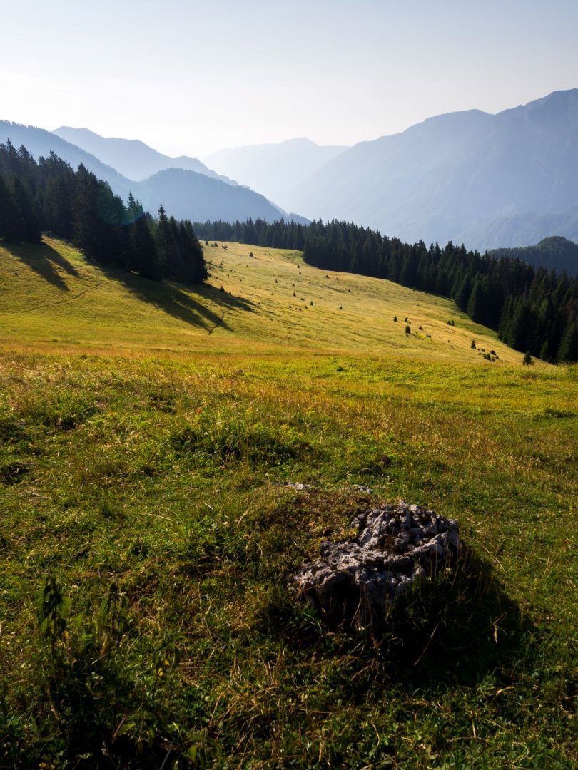
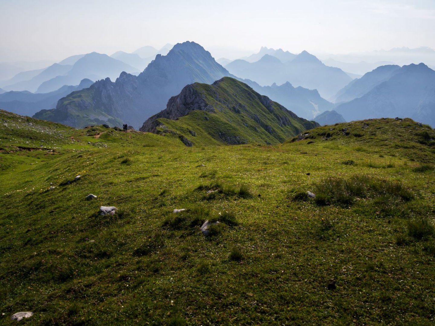
Day 3 started with the sunrise from the top of the Table. Then we continued along the ridge with beautiful views of Austria and Slovenia. Along the way, there is the possibility of switchbacks and several peaks, which the marked route bypasses on the slopes and it is up to everyone whether they want to add a few more vertical meters. About halfway there is a Planinski stan on Belski planina, where you can eat, buy something cold to drink and refill your water. After a few more kilometres we pass the Golica Lodge, where there is also the possibility to eat and, if you would like, you can even spend the night here. We continued on a little further and just below the top of Hruški Vrh there is a clearing between the kneelers where we decided to spend the night.
4. day
In the morning I recommend the sunrise from the top of Hruški Vrh. After just a few kilometres of walking we reached a farmhouse with a trough with running water, so we replenished our supplies and continued on. The trail is quite varied during day 4, with forest alternating with pastures and a short section secured with ropes to be crossed at about the halfway point. The rest of the day is a leisurely walk to the place where we slept. We had originally planned to sleep in a meadow, but very curious cows eventually forced us to move to a shepherd's hut where we discovered an open loft with beds to sleep in, so we were in for a supremely comfortable night. This shepherd's hut is located on the edge of the Bleka Plain (see map)
5. day
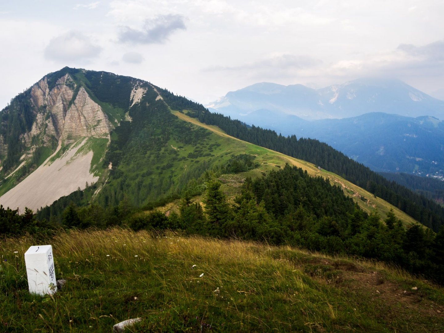
The journey on day 5 was very similar to the previous day. After about 4 km there is a possibility to refill water. After about 13km there is a small restaurant at the border crossing, but just a few kilometres further on there is a large restaurant at the top of one of the ski lifts (the top of Taubenkogel), so I would recommend waiting until you get here to eat. Here is the first opportunity to descend to Arnoldstein and finish the trek on day 5. However, I would recommend going 1km further to the next peak Monte Forno, where the border of 3 countries (Italy, Austria and Slovenia) is located. From this peak there is also the possibility to descend to Arnoldstein. We were caught in a rather big storm here, so we decided to spend the night in a shelter, which protected us from the rain quite well.
6. day
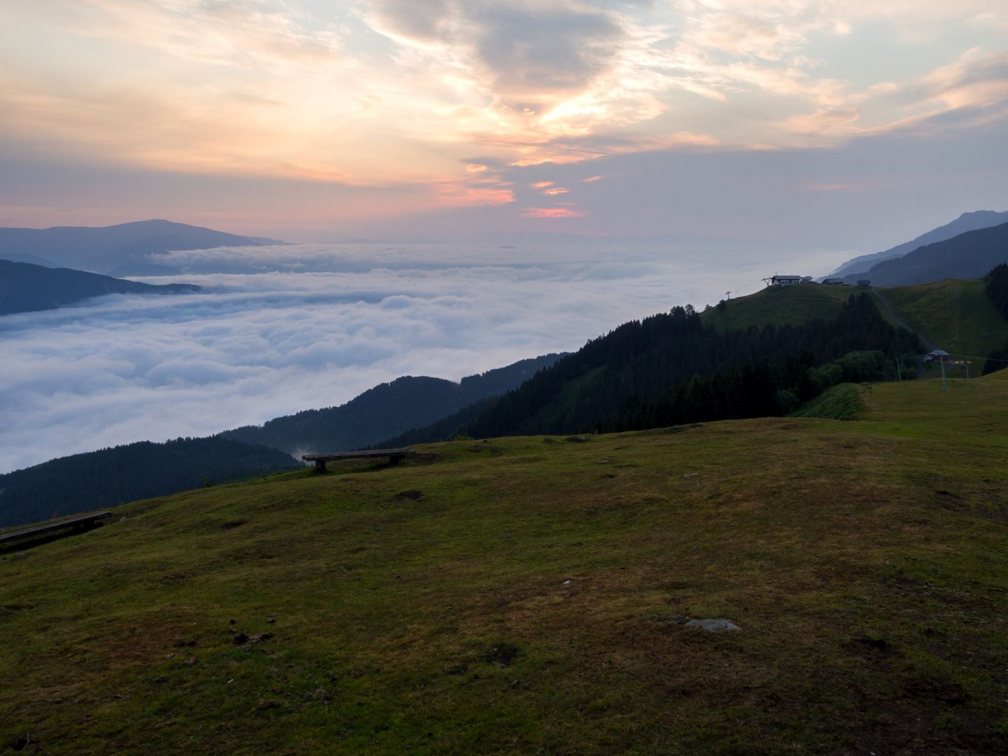
In the morning we enjoyed the sunrise above the clouds in the valley and took the train to Arnoldstein.
Difficulty
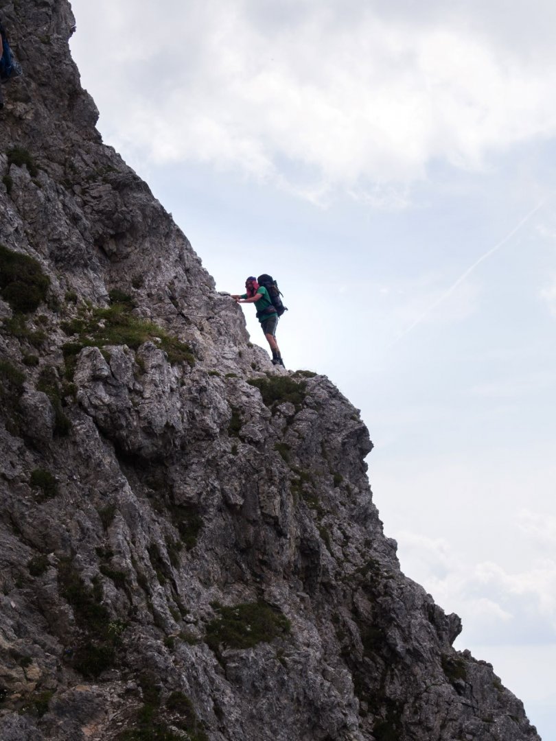
The trek itself is quite variable in difficulty. In the beginning the trail follows local roads and wide paved paths. Gradually, the path narrows to a narrow, and in some places rocky, footpath, which then remains for most of the trek. Only the actual descent back to civilization, i.e. Arnoldstein, is on downhill slopes, wider paths and at the end, a small local road is again unavoidable. About halfway up there is one more exposed section secured with steel cables that can be managed without special equipment. The trek is around 2000m above sea level and there were no signs of altitude sickness during the crossing.
The most challenging part of the trek is the beginning, when it is necessary to get from the starting point to the ridge, specifically almost to the top of Stol, so it is necessary to overcome a considerable load of height meters, in addition, part of the last 2km below the top leads through the rubble and is quite loose underfoot. We also encountered a few showers along the way, but it didn't affect the safety of the route. We walked the route without a dog, but I think a dog used to walking in the mountains should have no problem with the trek. I wouldn't recommend the trail for people with strollers or small children though. We had trekking boots, waterproof jackets, tarpaulin for shelter, food water and change of clothes.
Water availability
On the trek there may be problems with water refilling in some sections. We normally carried 3l of water just in case and tried to refill where we could. In the first half there is the option to refill water at the huts, somewhere for a fee bottled, somewhere from the tap, but they are not entirely happy to see this. In the second half we hit a few places for water at herding and hunting lodges. We didn't filter the water anywhere, and no intestinal upsets occurred.
Sleeping options
We slept under a tarp the whole trip. In the first half there is a possibility of sleeping in huts.
Mountain peaks
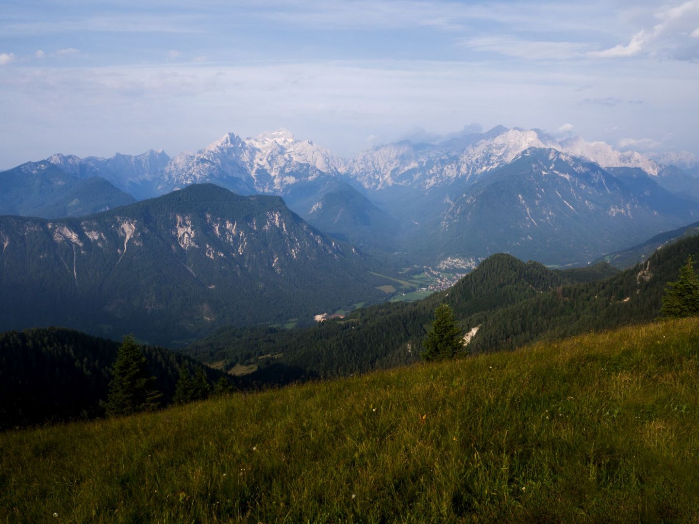
Most of the trek offers beautiful views of the Julian Alps as well as the nearest mountains in Austria.
Danger
There are several exposed sections on the route, which are secured with ropes. However, special equipment for ferrata is not necessary. Even so, the route is suitable for more experienced hikers.
Food
We carried our own food for the whole trip, but there is also the option of hot meals tied to the huts along the way. In the second half of the trek, there is not a hot meal option at the lodge every day.