Mountain range, region / State
Západní Tatry / Slovakia
Season
Summer
10. 07. 2020
Difficulty
2 / 5
Elevation
↑ 1018 m
↓ 1018 m
Length
10.2 km
4 hours
Altitude
max. 1566 m n.m.
min. 750 m n.m.
Tips for hikes in the mountain range Západní Tatry
Spring climb to Baranec and Plačlivé in Rohace
Ascent to the Babky mountain in the Western Tatras
Starting point
Unpaid parking behind the village of Jalovec. It is located on the road to the hotel Mnich, which leads from Liptovský Mikuláš.
Description of the hike
From the parking lot I took the asphalt road that leads to the huts under the mountains. After the last hut, however, the road turns into a forest trail and starts to climb quite steeply. It often goes over roots and before it joins the wide forest path, you get pretty sweaty. On the other hand, the path climbs much more gently and I got a bit out of breath. After a few hundred metres I turned onto a green trail and started climbing up to the summit.
At first it is still in the woods, but soon I found myself in meadows and some beautiful views of the surrounding area opened up. I refilled the water from the spring and continued the steep climb. This part of the trail is probably the steepest and most strenuous. Eventually I successfully reached the top of Babka mountain at 1,566 m above sea level and was able to enjoy the views of the wide region.
After resting I continued along the mountain ridge towards the main ridge of the Roháče Mountains. After about 1 kilometer I left the marked path and descended steeply to the Pod Náružím hut. Here I joined the blue trail and started to go back along it. The trail soon joined the wide forest trail that I had been following as I climbed to the summit. I then returned to the car park by the same route.
Difficulty
A relatively simple trek for the Roháče. It is necessary to climb some elevation, but it is not so bad. There is a steep climb at the beginning in the forest and then along the meadows to the top of Babka mountain. The descent is steepest to the Pod Náružím hut along the mountain trail. Trained children and dogs can manage the route without any problems.
Water availability
There are several opportunities to refill water along the route. The first is at the beginning of the climb up the meadow to the top of Babek. There is a spring. Then there are wells around the mountain hut Pod Náružím. And of course the hut is open in summer. For me 1 liter of water per person was enough for the trip.
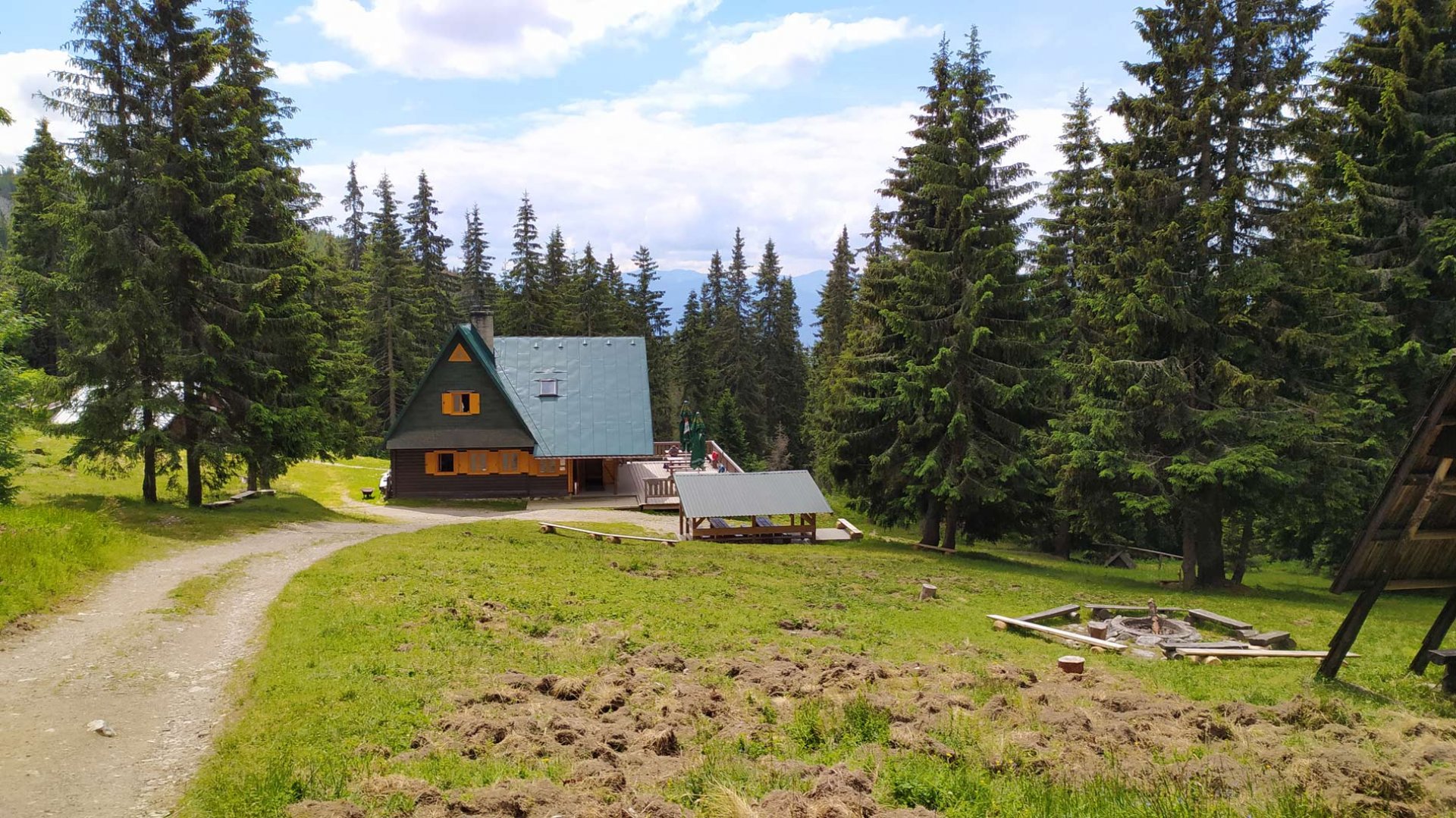
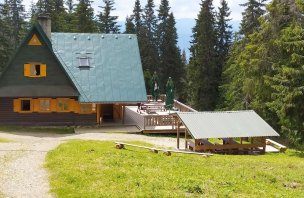
Sleeping options
After ordering it is possible to stay overnight at the cottage Pod Náružím - Červenec.
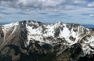
Mountain peaks
From the top of Babka 1 566 m above sea level you can enjoy great views of the Low Tatras, Malá Fatra, Velký Choč and the western part of the Roháče Mountains.
Danger
The route is technically simple. It is on mountain trails or wide forest paths. The descent to the Pod Náružím hut is steep, but there is also a well-trodden mountain path. The problem in summer is of course the storms, which must be watched. I also saw bear droppings along the way, so it's good to look around :-)
Food
There is no cooking at the Pod Náružím hut and there is no other possibility of refreshment on the way. It is necessary to have some snacks with you.
Photos