Mountain range, region / State
Durmitor / Montenegro
Season
Summer
06. 08. - 08. 08. 2010
Difficulty
3 / 5
Elevation
↑ 3157 m
↓ 3157 m
Length
45.6 km
3 days
Altitude
max. 2523 m n.m.
min. 1174 m n.m.
Tourist map of Durmitor National Park
Elevation profile of the route
Useful information
- 6.8. - from the settlement of Trsa we set off across the plains towards Durmitor. Descending into the Sušica canyon and then entering the Durmitor mountains, reaching the lake Velké Škrčko, overnight.
- 7.8. - ascent from the lakes to Bobotov Kuk, continuation of the Durmitor crossing northwards. Overnight among slash-and-burn forest.
- 8.8. - gradual descent to the Ograde shepherds' huts, descent into the Sušica canyon, hitchhiking about 16 km back to the settlement of Trsa.
Beautiful trekking in the Durmitor Mountains in Montenegro
Starting point
The settlement of Trsa, northwest of the Durmitor Mountains. We chose to come here via Hungary, Croatia and Bosnia and Herzegovina. Here we visited Sarajevo on the way. From Sarajevo we drove south to the Šcepan Polje border crossing. From there we followed the Piva River along local roads to the settlement of Trsa.
Description of the hike
1. day
The journey to the Durmitor Mountains was an experience in itself. For example, we made the journey more pleasant by forgetting our green car card and then negotiating bribes at the border. On the other hand, sightseeing in Sarajevo was an interesting experience. After successfully reaching our base, the settlement of Trsa, we were delighted to discover that there was also a tavern, where the owner allowed us to set up our tents. Then followed a friendly drink.
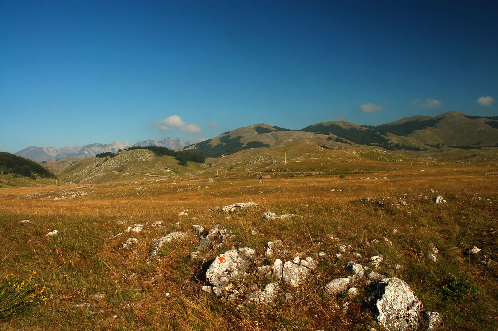
The next morning we finally set off. From the village of Trsa we set off towards the Durmitor mountains, off any roads, just along the beautiful meadows of the Pivska plain. However, orientation is very easy, as the Durmitor Mountains are beautifully visible and we just walked straight towards them. There is no danger on the plain.
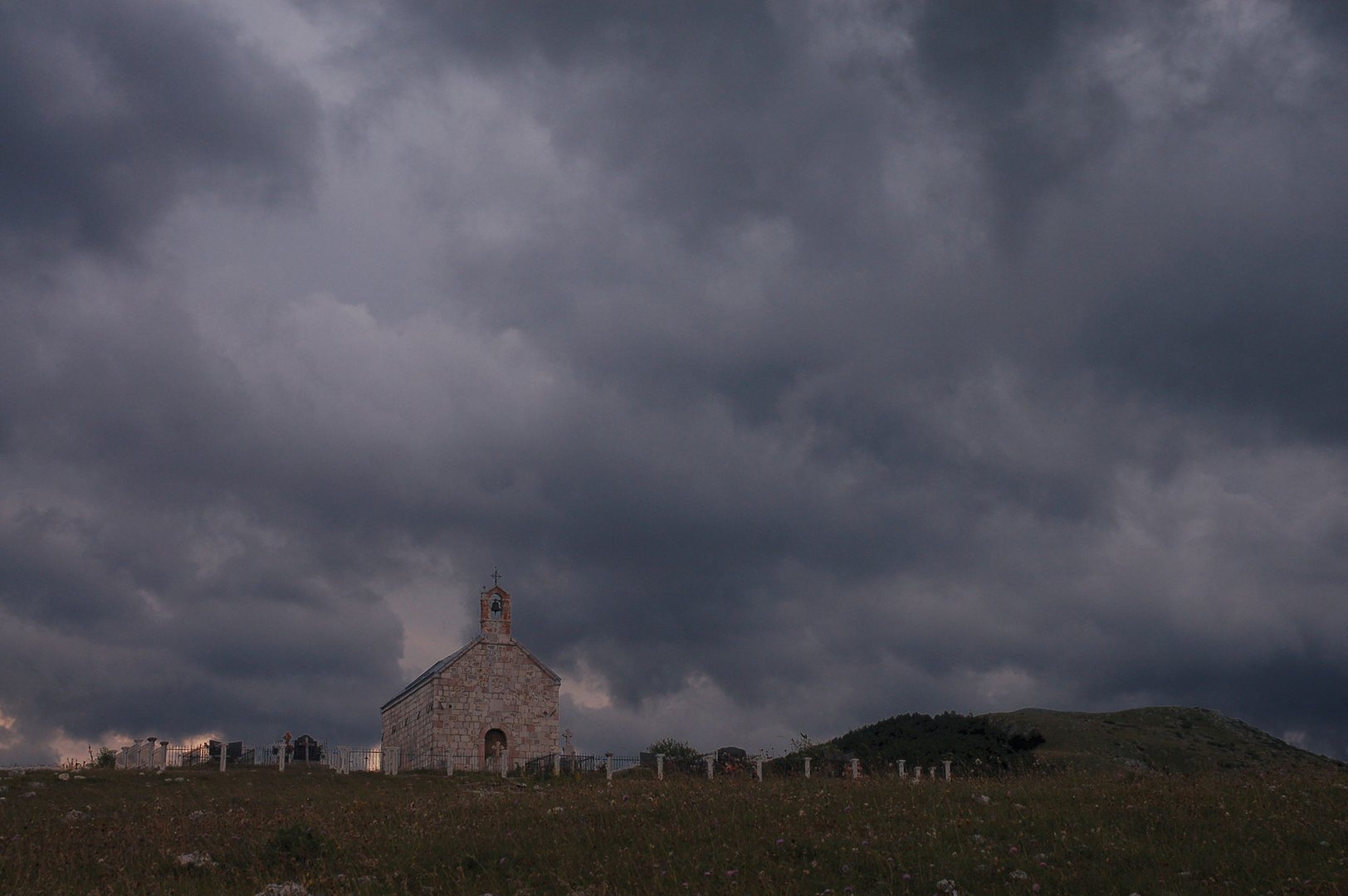
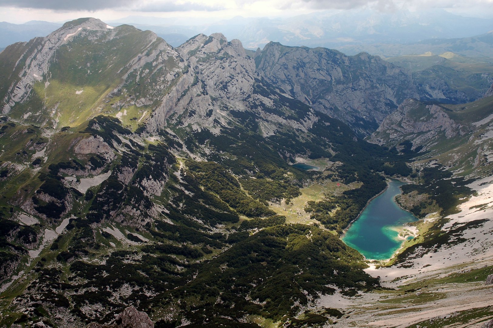
After a few kilometres we thought we were about to enter the Durmitor Mountains, but suddenly the deep canyon of Susica opened up in front of us. There is a beaten path leading out of the canyon and we reached the lakes of Mala and Velika Škrčko. There is also a conservationist's hut where you have to pay a fee to enter the Durmitor Mountains. We pitched our tent by the lakes and spent our first night there.
2. day
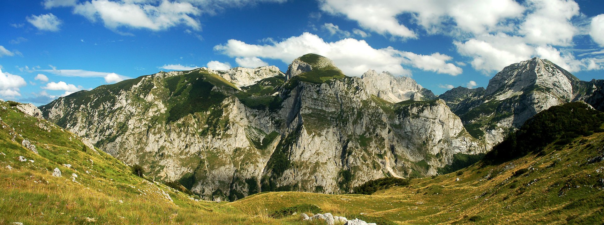
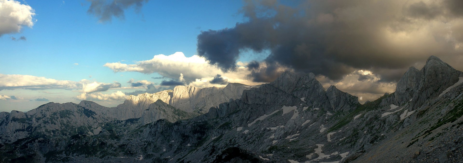
In the morning we had breakfast by the lakes, packed our tent and started to climb up the Durmitor mountains. From the lakes there is already a well-trodden path, so orientation was not a problem. The climb was very steep, but with a few exceptions without any problems. This is how we got to the saddle below the Bobotov Kuk mountain 2 523 m above sea level. Here we left our backpacks and easily ran to the top.
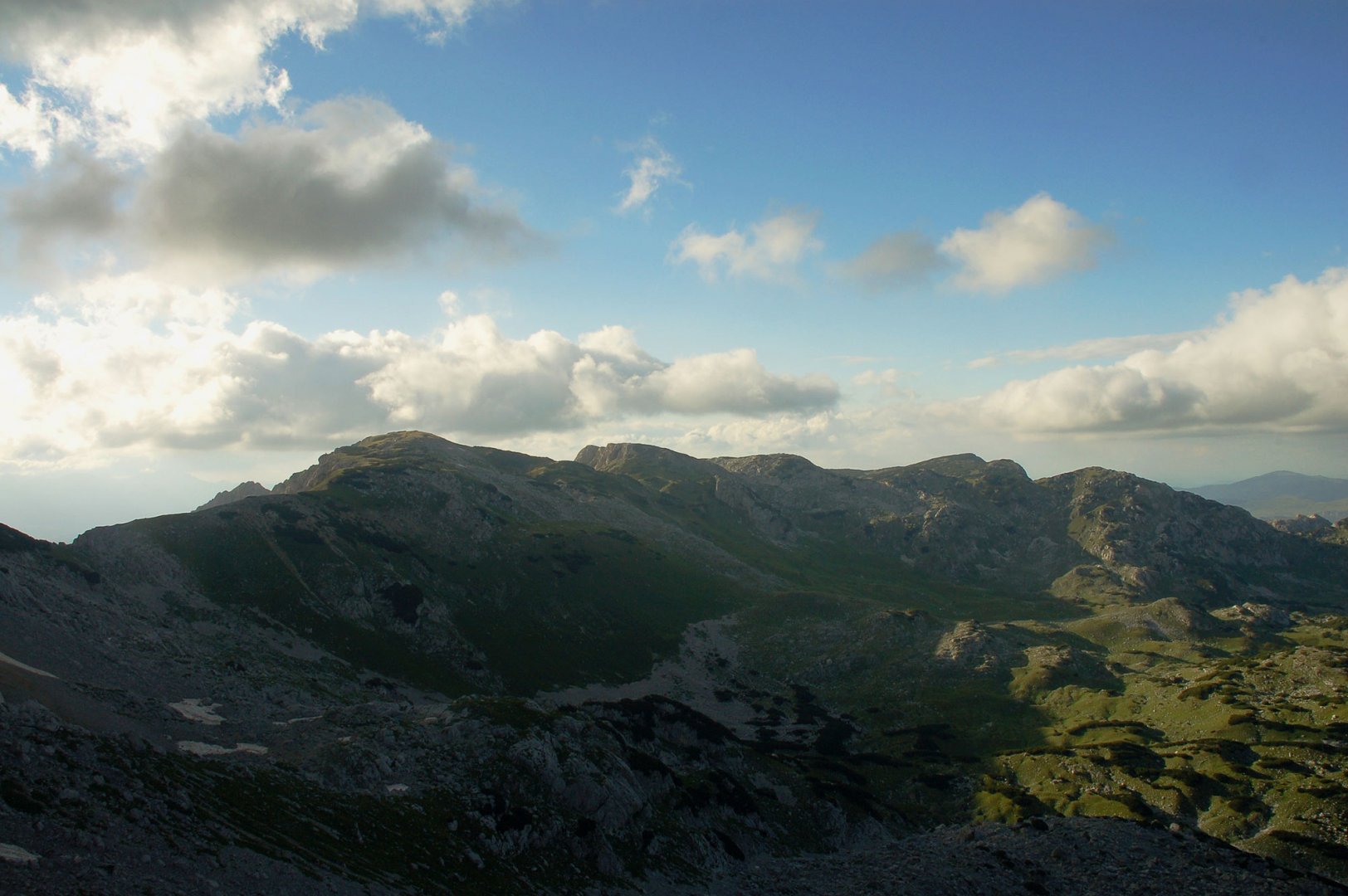
Then we returned to get our packs and continued our easy descent. Sometimes the debris field gave us problems, but otherwise it went without problems. At the bottom of the mountain we turned north, left the hiking signs that led to the resort of Zabljak and continued on the trail. The landscape changed and instead of rocks we were greeted by meadows and slash and burn. As it was getting dark, we pitched our tent right among the slash and burn.
3. day
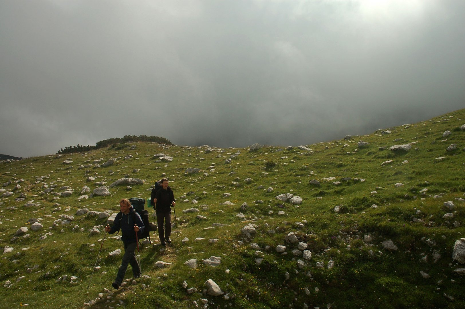
In the morning we woke up to thick fog. Which was a complication because we were in an area where there was a lack of beaten paths and slash and burn everywhere. It was very difficult to find our way through the slash and burn. Although we were successful, progress was very slow. Fortunately, the fog cleared and we could see the landscape around us.
We also found a beaten path and continued northwards, slowly leaving the mountain range. The descent was very gradual. Eventually we reached the edge of Sušica Canyon and in the distance we could see the settlement of Ograde, which was our destination. Unfortunately, the way to it was again made very difficult by the slash and burn. Eventually, we somehow wriggled our way through and reached the settlement.
Unfortunately, the path from the settlement was unambiguous. Down into the Sušica Canyon and then up the other side of the canyon. At the bottom of the canyon we were very lucky. First we found a spring here, so we replenished our supplies. And then two jeeps came up the road to us.
After a short conversation, they picked us up and drove us the remaining 15 km back to the Trsa settlement. This saved us a day of travel. In the settlement we then celebrated everything with the owners of the pub. And the next day we had to move by car to our next destination - crossing the Maglic Mountains on the border of Montenegro and Bosnia and Herzegovina.
Difficulty
A wonderful hike to the highest mountain of the Durmitor mountain range. It is not technically demanding, but it requires good fitness, as it is difficult to walk. However, it is very demanding for orientation. The paths here are not marked and especially in places where there is slash-and-burn forest there was a big problem with orientation. We found it partly complicated by the thick fog.
Water availability
We took water in the settlement of Trasa. You can buy water at the lakes Big and Small Škrčko. Water from the lakes is not drinkable. The last possibility to replenish the water is the spring in the Sušica canyon near the Ograde shepherd's hut on the way back to the settlement of Trsa.
Sleeping options
We had our base in the settlement of Trsa, where we left our car at a local pub and set up our tents right next to it. We spent the first night in the Durmitor Mountains by the lake Velké Škrčko, the second night on the plains in the northern part of the mountains.
Mountain peaks
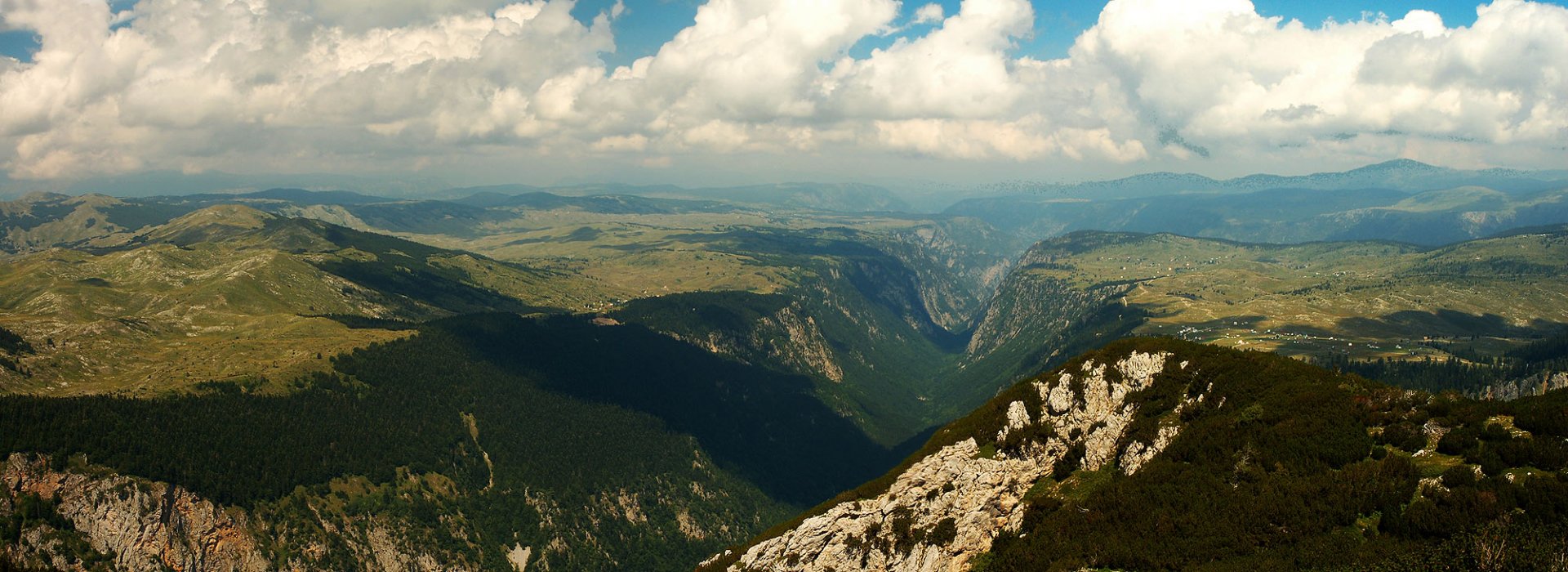
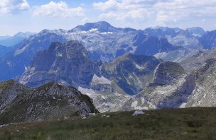
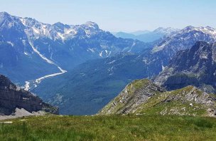
From the top of Bobtov Kuk 2 523 m above sea level you can see the whole Durmitor mountain range. The deep canyons of Sušica and Tara can be seen as well.
Danger
The main danger is loss of orientation in deep fields of slash and burn. Especially when descending from the Durmitor mountains to the settlement of Ograde we had a big problem with orientation, because there is no marked path and the passage through the slash and burn was very difficult. We also occasionally met vipers along the way, so it is good to have hiking poles and especially in the tall grass of the Pivska Plateau to occasionally bang your poles in front of you. (We almost stepped on one viper anyway).
Food
Na treku se nenachází žádná turistická chata, proto je nutné mít veškeré zásoby sebou. My jsme si vařili na plynových vařičích.
Attractions
This is truly a wonderful trek. From this side of the mountains, the landscape is untouched by tourism. The canyons that ring the Durmitor Mountains are also fascinating. During the trek you have to descend into the canyon twice, which is an unexpected complication. Especially when coming from the settlement of Trsa to the Durmitor Mountains, you think that you have already reached the mountains, but the deep canyon Sušica stands in your way and you have to descend into it.
Photos