Mountain range, region / State
Jeseníky / Czech Republic
Season
Fall
22. 10. 2022
Difficulty
1 / 5
Elevation
↑ 730 m
↓ 730 m
Length
21.9 km
7 hours
Altitude
max. 1048 m n.m.
min. 605 m n.m.
Tourist map of the route to Paprsek and Dalimil lookout tower
Tips for hikes in the country Czech Republic

A short hike with children to the Žižkov Memorial at Trocnov

Two-day crossing of a part of the Javorníky Mountains with children

A trip to Psana Rock and the Slapy reservoir viewpoint
Circular trek from Ostružna along the green trail to Paprsek and Dalimil lookout tower
Starting point
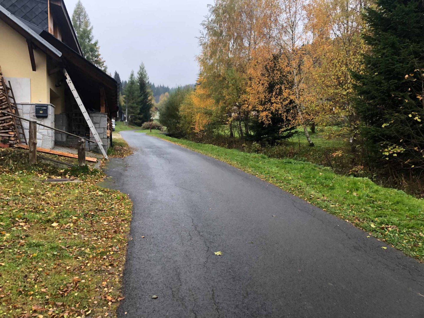
We start from our accommodation in Chaloupka na Splavu, which is situated in a secluded area between Branna and Ostružná on the green hiking trail.
Description of the hike
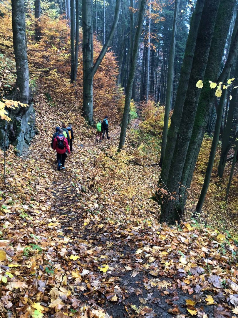
From the cottage on the raft, follow the green NS Pasák sign towards Ostružna. Just after the cottage we pass a small cottage. The dirt road to Ostružná is almost flat, we walk briskly.
In Ostružná we cross the road 369, pass the Skiland area and continue on the asphalt road up a slight hill following the green sign. On the way you will meet the Cestář Brewery (mostly closed) and the Jonas Park ski area. At the end of Ostružna, the green trail starts to rise steeply.
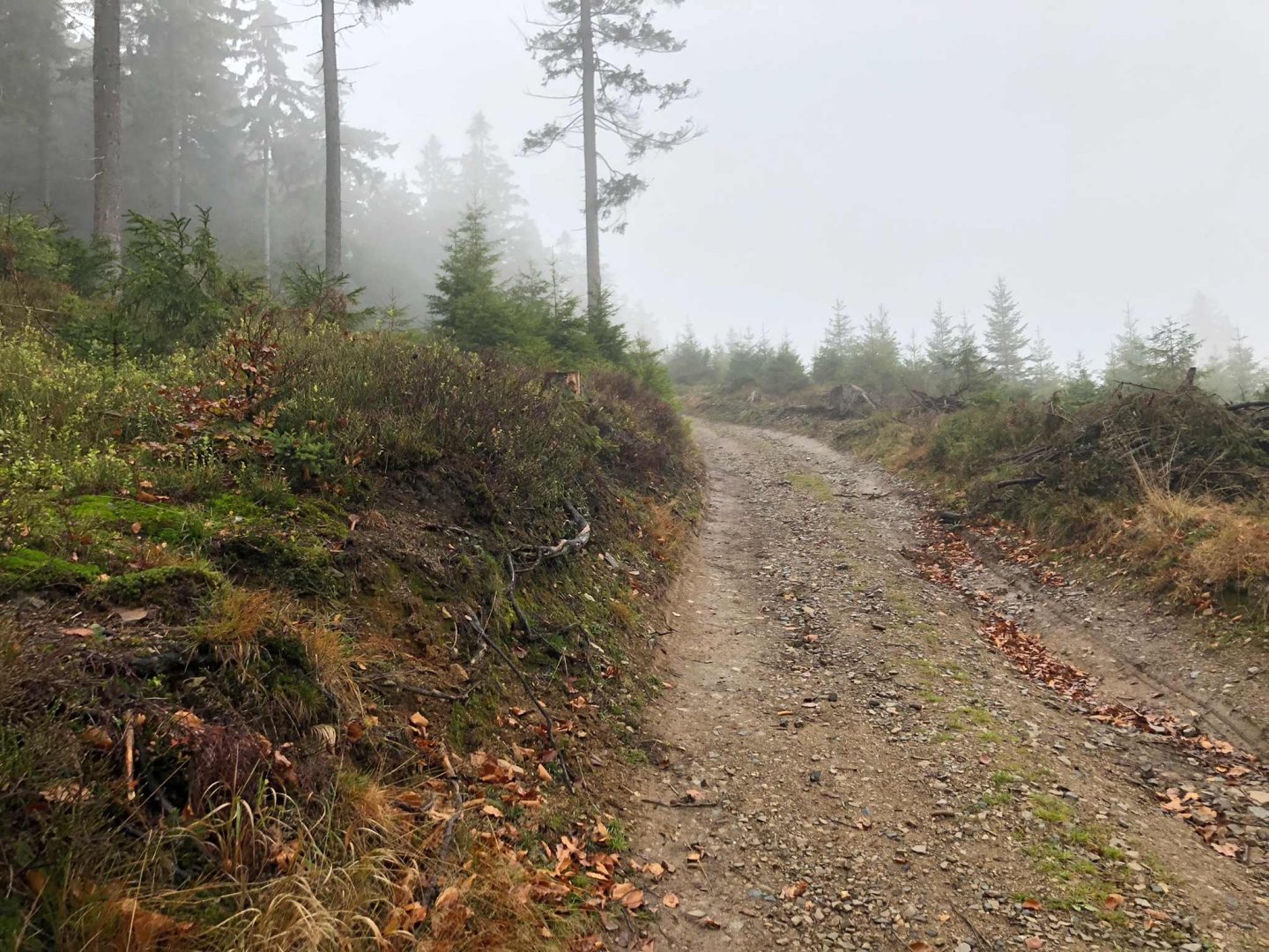
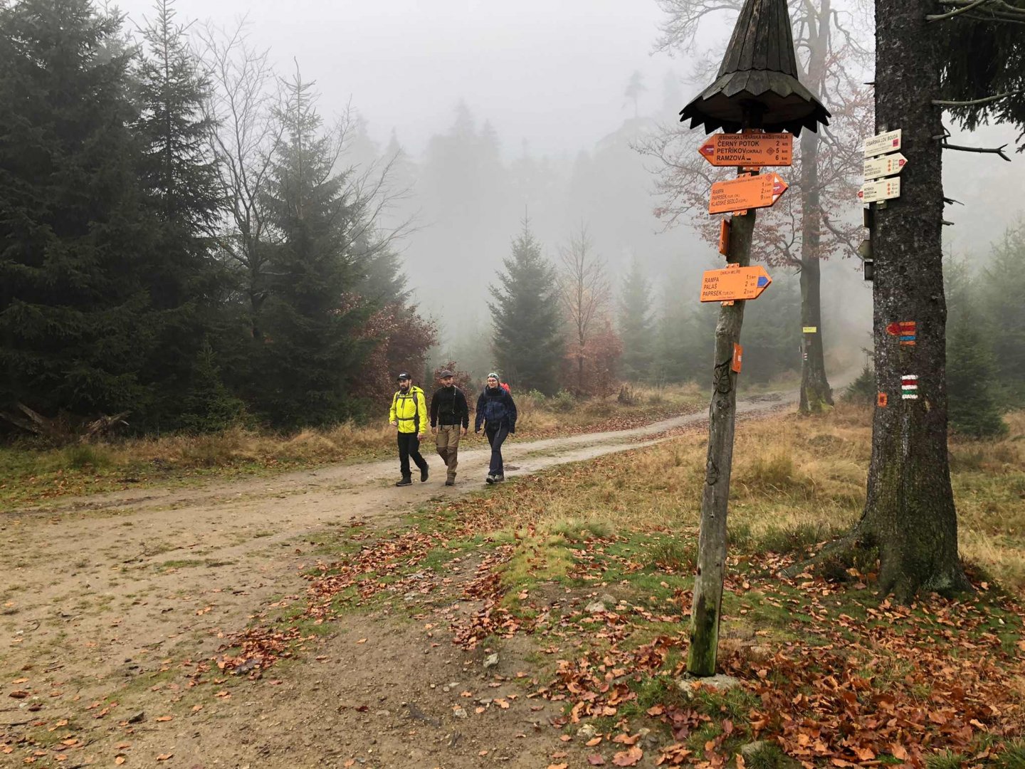
The path continues through the forest to the Ostružník crossroads, where the green and blue trail crosses. Continue on the green trail mostly uphill to the Emperor's Hunting Lodge. Here, at the crossroads, we join the red marker E3 Hřebenovka - Trail through the Czech Republic, which leads along the plain to the mountain hut Paprsek. At Paprsek we have a beer and blueberry dumplings, which are typical for Jeseníky.
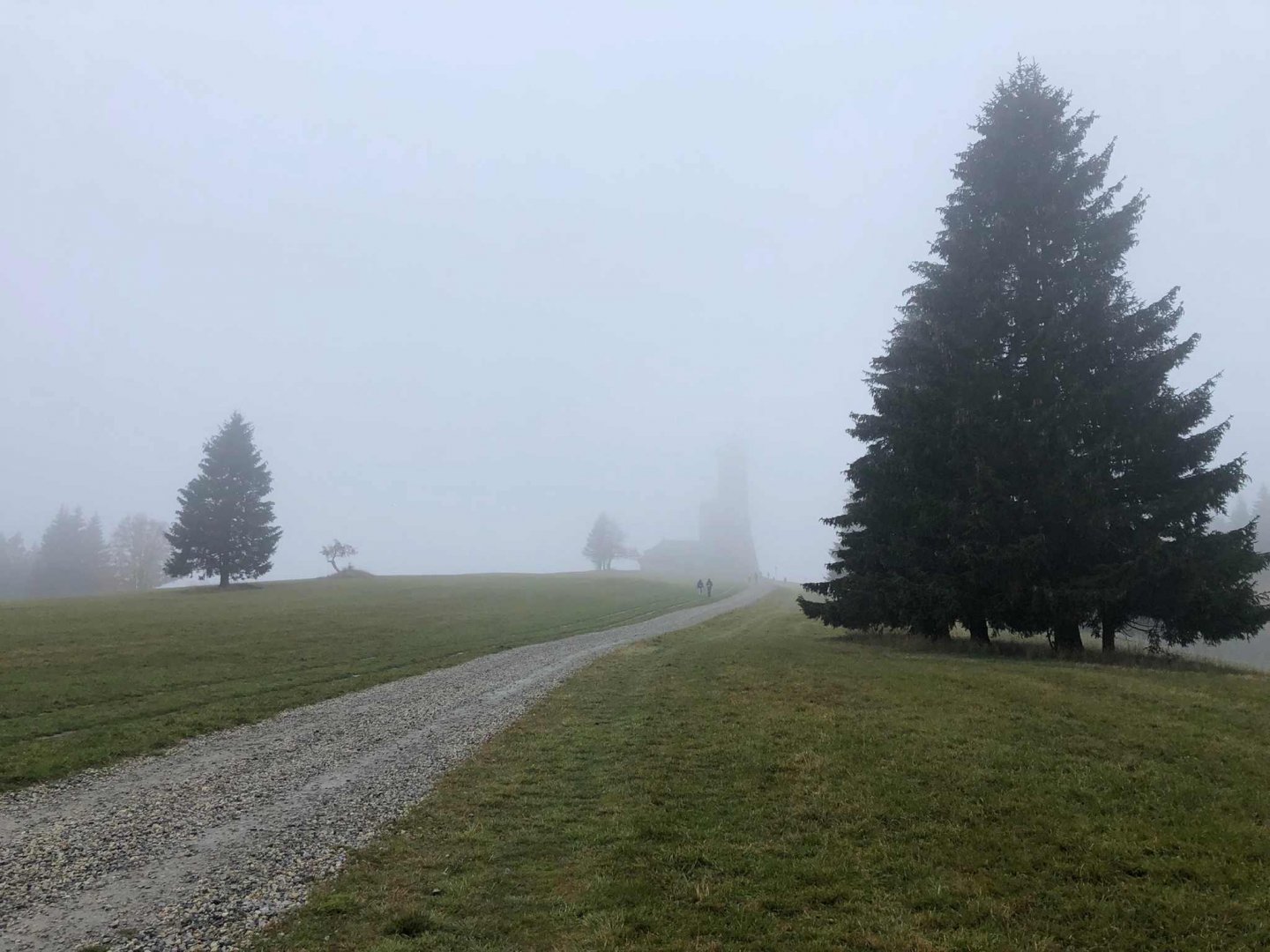
From Paprsek we continue down a slight hill following the green trail towards Dalimilova rozhledna. On 22 October we find it shrouded in fog, so we do not go up. From the lookout tower we return a little and follow the blue trail to Velký Vrbno. From there we continue along the yellow sign on the road, from which we turn into Medvědí rokle. Follow the yellow marker through the ravine until you reach road 369 again just before Branna.
In Branna I recommend going to the square to the Confectionery U Zámku, where they have great tubes for 12 CZK (year 2022). From Branná we return along the green nature trail Under the bird plain to the Branná river, which will lead us to our accommodation.
Difficulty
It is an easy hiking on field and forest paths, sometimes also on asphalt. The route can be easily managed by both smaller school-age children and more active pensioners. The most difficult part of the route for some may be its length of over 20 km, but not the terrain profile or difficult places. Most of the route could be done with a sports buggy.
Water availability
There is no official spring on the route where you can get water. However, the trail leads through civilization, so you can refresh yourself in Ostružna, Petříkov or at the Paprsek cottage and Dalimilova lookout tower. For the whole trip you only need to bring 1 litre of water per person.
Mountain peaks
We will not pass any mountain peak on this route, although, for example, Palasz 1 027 m above sea level is a short distance from our route - just above the Paprsek hut.
Danger
This route is perfectly safe. There are no difficult or exposed places. At most you will go up a steeper hill. This makes it suitable for active seniors or smaller children. It is not suitable for strollers because it goes over many roots.
Food
You don't need to take much food, even if it's a route longer than 20 km. You will go through the village of Ostružná, where there is a shop and restaurant, as well as through the mountain hut Paprsek, where you can find a good place to eat and drink all year round. Even so, it is advisable to bring some water and a small snack, a bar or a piece of chocolate.
Photos