Mountain range, region / State
Ennstal Alps / Austria
Season
Fall
24. 10. 2021
Difficulty
3 / 5
Elevation
↑ 1607 m
↓ 1607 m
Length
14.5 km
7 hours
Altitude
max. 2172 m n.m.
min. 866 m n.m.
Tips for hikes in the mountain range Ennstal Alps

Climb to the top of Scheiblingstein in the Ennstal Alps
Hike to the Wasserklotz lookout in Kalkalpen NP
Climb to the Eisenerzer Reichenstein from the Präbichl saddle
Viewing peak Natterriegel and ascent to the Hexenturm
Starting point
Parking is free at Buchauer Sattel. It is located on the road connecting Admont and St. Gallen.
Description of the hike
I am fascinated by the names of Austrian mountains. Kogel is a cone, Eck is a corner, Zinken is a spike or a tooth, Spitze is sharp and under Wand or Mauer you can guess a really steep wall. Sometimes I run my finger over the map and wonder what the mountain looks like and what I might encounter on it. Reality often lives up to expectations - Predigstuhl looms above the surrounding mountains like a church pulpit, Kammspitz is a spiky ridge above Ennstal, chamois graze on Gamsfeld and I stroke the grass on Edelweisskogel. Hexenturm - the witches' tower, what can I expect there?
In Admont, I turn off the B117 road towards Sankt Gallen and drive up to the Buchauer Sattel saddle (about 900 m above sea level), where there is a starting point for hiking trails. There is a dense inversion fog, and I can just make out the Haller Mauern above me, the rocky border ridge that separates the two federal states of Oberösterreich and Steiermark. It's Sunday, 8:30 a.m., a sunny autumn day on the radio, and the parking lot for about 50 cars is almost full. The hiking route leads to the scenic peaks of Mittagskogel and Natterriegel and then continues on to the Hexenturm. Ferratisti can vary their route with the two secured Jungfernsteig (difficulty A, B) and Hexensteig (B, short C sections).
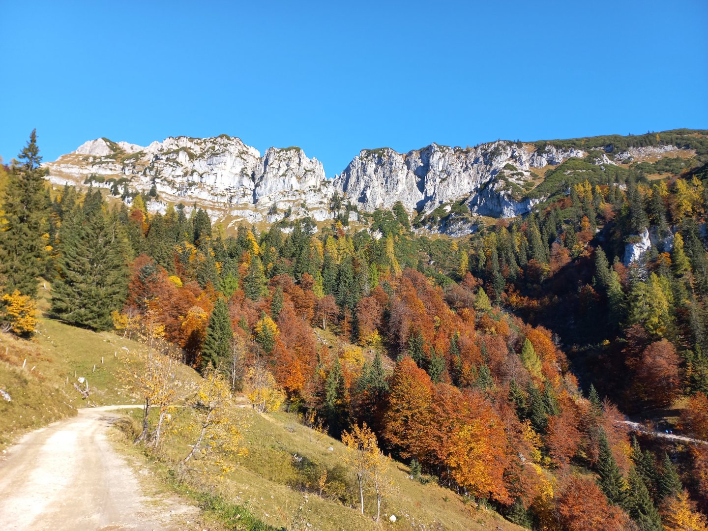
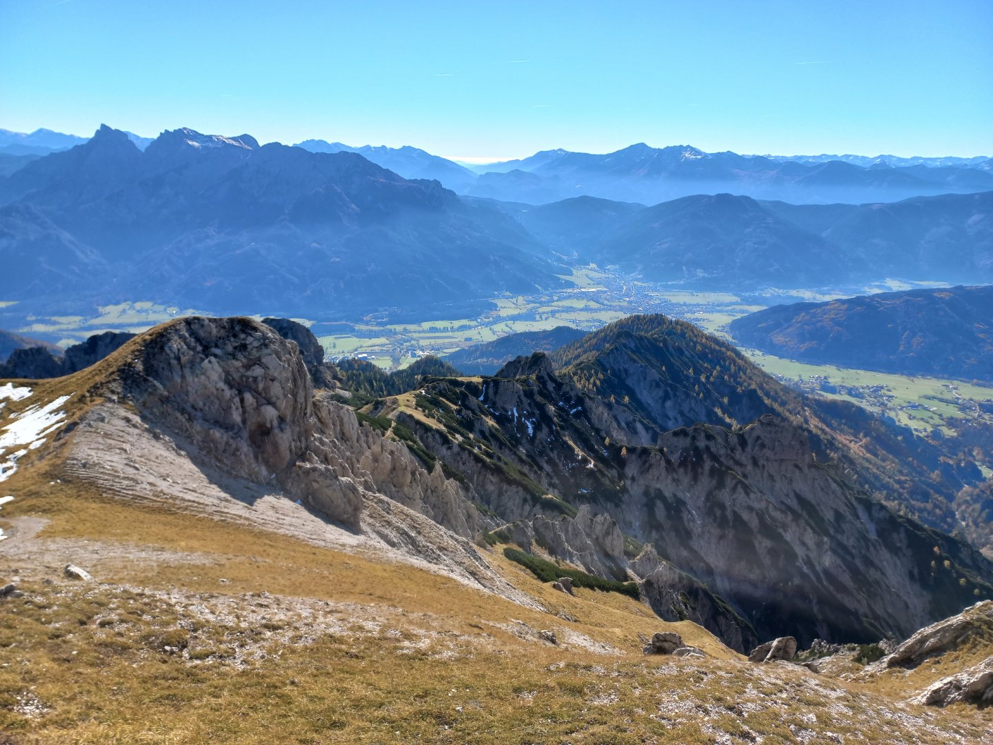
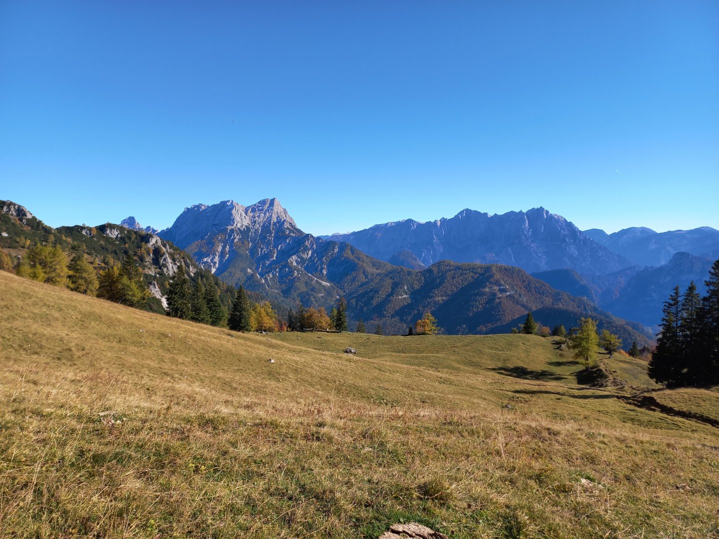
I set off along Wanderweg 636, which leads along a wide gravel path to the Grabneralmhaus hut (1,391 m). Along the way I pass groups of people, often families with children. The sun's rays are laboriously making their way through the fog and the forest. But at Grabneralm there is already blue sky and a wide view of the valley, where the fog bubbles lazily. Above the valley rises the Admonter Reichensteigruppe - Admonter Reicheinstein, Sparafeld and Kalbling. To the east, the jagged Hochtorgruppe and the peaks of the Gesäuse NP with the dominant Buchstein at the head. In the distance you can see the snow-capped Rottenmann Tauern.
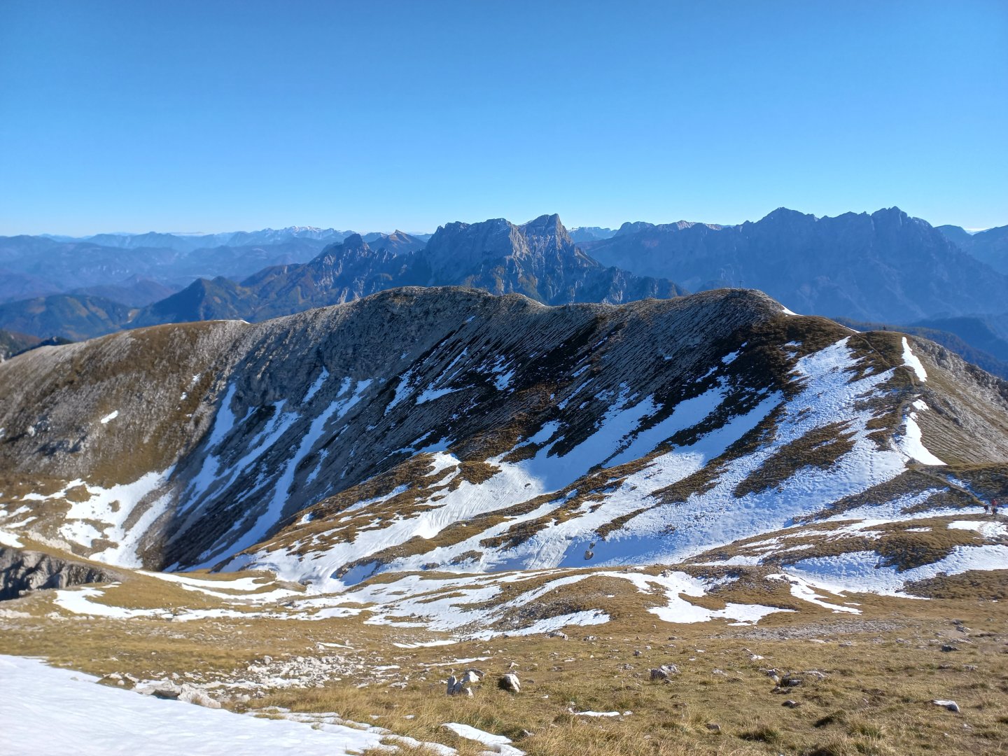
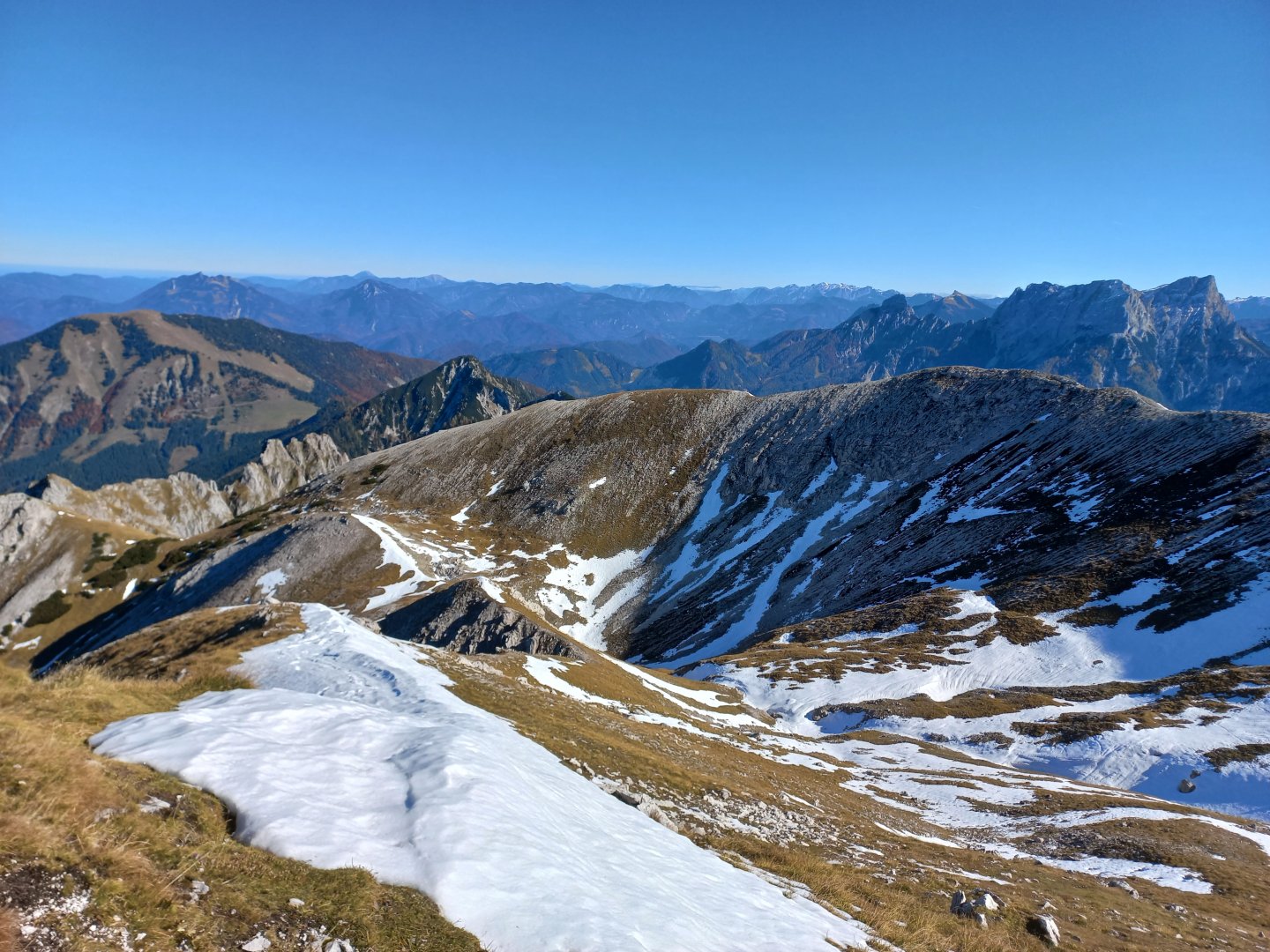
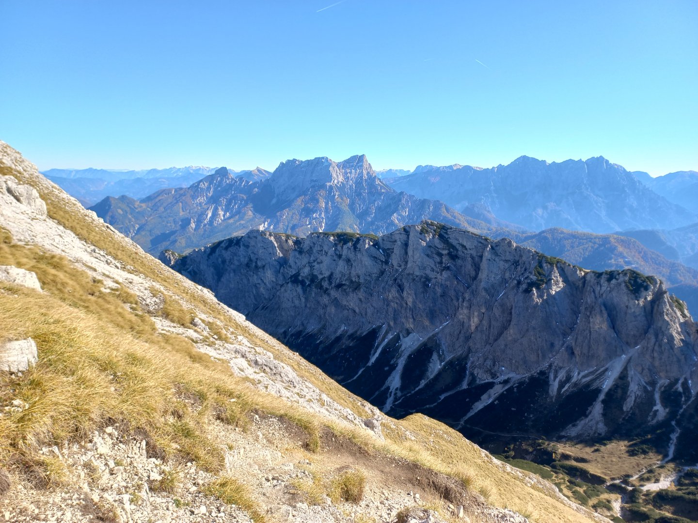
Behind the Grabneralmhaus on the right, the hiking trail to Grabnerstein (1 848 m) and the continuing Jungfernsteig via ferrata (here marked Versicherter Steig - nur für geübte) separate. Some of the hikers finish here, and you can have a snack at the hut and enjoy the views of the valley and the surrounding rocks. Above the hut is the Admonter Warte rock wall (1 804 m), climb around it on the left to the next hut, Admonter Haus (1 723 m). From Admonter Haus the path goes down into the valley, but I keep heading up to the first peak, Mittagskogel (2 041 m). The route leads across a meadow to the edge of a ridge that surprises with a perfect view of the whole Ennstal. The green Pleschberg emerges from the morning mist, followed by the tunnel-bored Bosruck and the two nearby peaks of Grosser Pyhrgas and Scheiblingstein. Further down the valley, the Grimming, the wrinkled Warscheneck and, at the very back, the snow-covered Dachstein, the Schladming and even the High Tauern, visibility around 100 km. A few more vertical metres and I'm on the Mittagskogel.
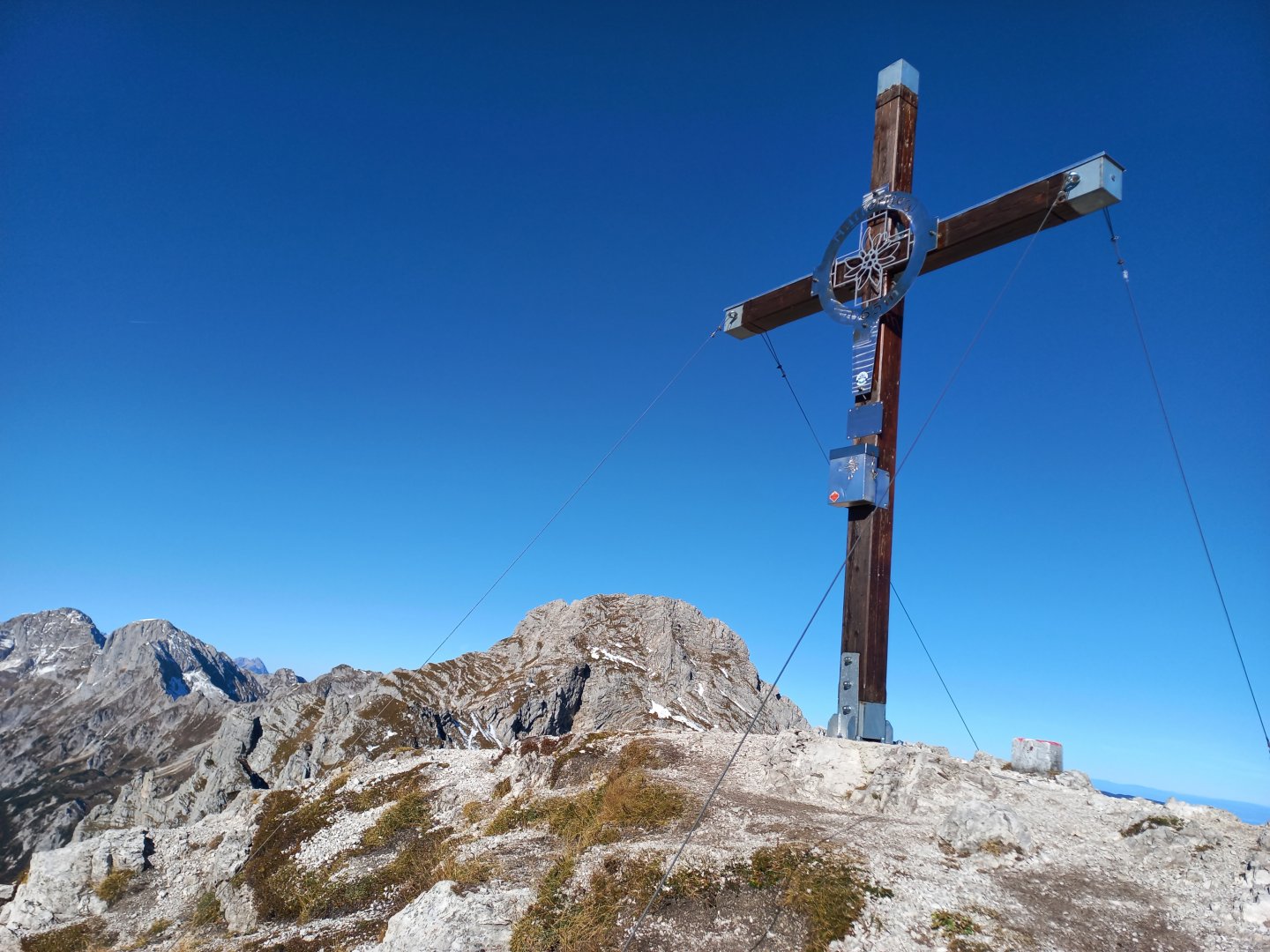
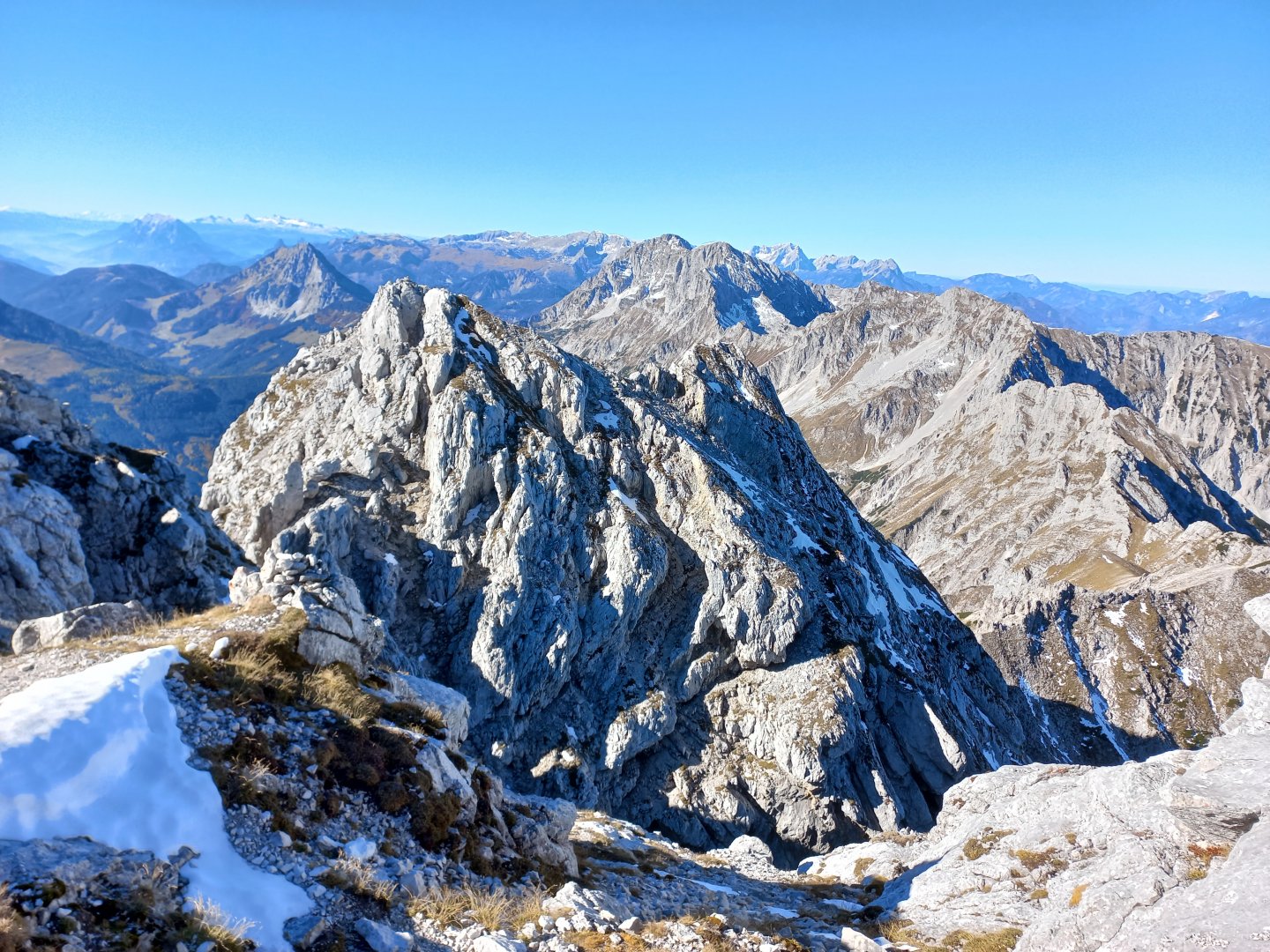
From the cross there are further views eastwards to the nearby Grosses Maiereck, Gesäuse to the white Hochschwab. To the left of it are two small bumps of Ötscher and Dürrenstein. I don't stay long, the Natterriegel (2,065 m), the second peak on the route, awaits me. I'm on Natterriegel around 11:00 (about 2.5 - 3 hours from the parking lot) and stay to watch the massive Hexenturm (2,172 m). I am considering whether to go further or not. There are two routes to the Hexenturm, the tourist route via Rosskar and the secured Hexensteig. According to the information, both for about an hour. I don't know the ferrata and the tourist one, traversing the east side of the ridge, is visible but largely under snow (October). There are tracks in the snow, though, so I decide to try it as far as I can.
I descend about 150 vertical metres on a gravel path sometimes secured with fixed ropes. When I am at the bottom of the snow field, I realize my mistake - the trail is trodden, but by chamois, no human tracks. The traverse doesn't look dangerous though, so I carefully descend it, the snow softened by the sun, I don't slip, I don't fall. Below the Bärenkarmauer ridge I turn left between the rocks, across a stone field and I'm in the saddle below the Hexenturm, where the trails rejoin. There are only about 100 vertical metres left up to the cross, mostly on stones and rock. The last metres of the climb are more challenging, but safely belayed with ropes. Finally I see a metal gipfelkreuz and in a few minutes I am standing on the narrow summit.
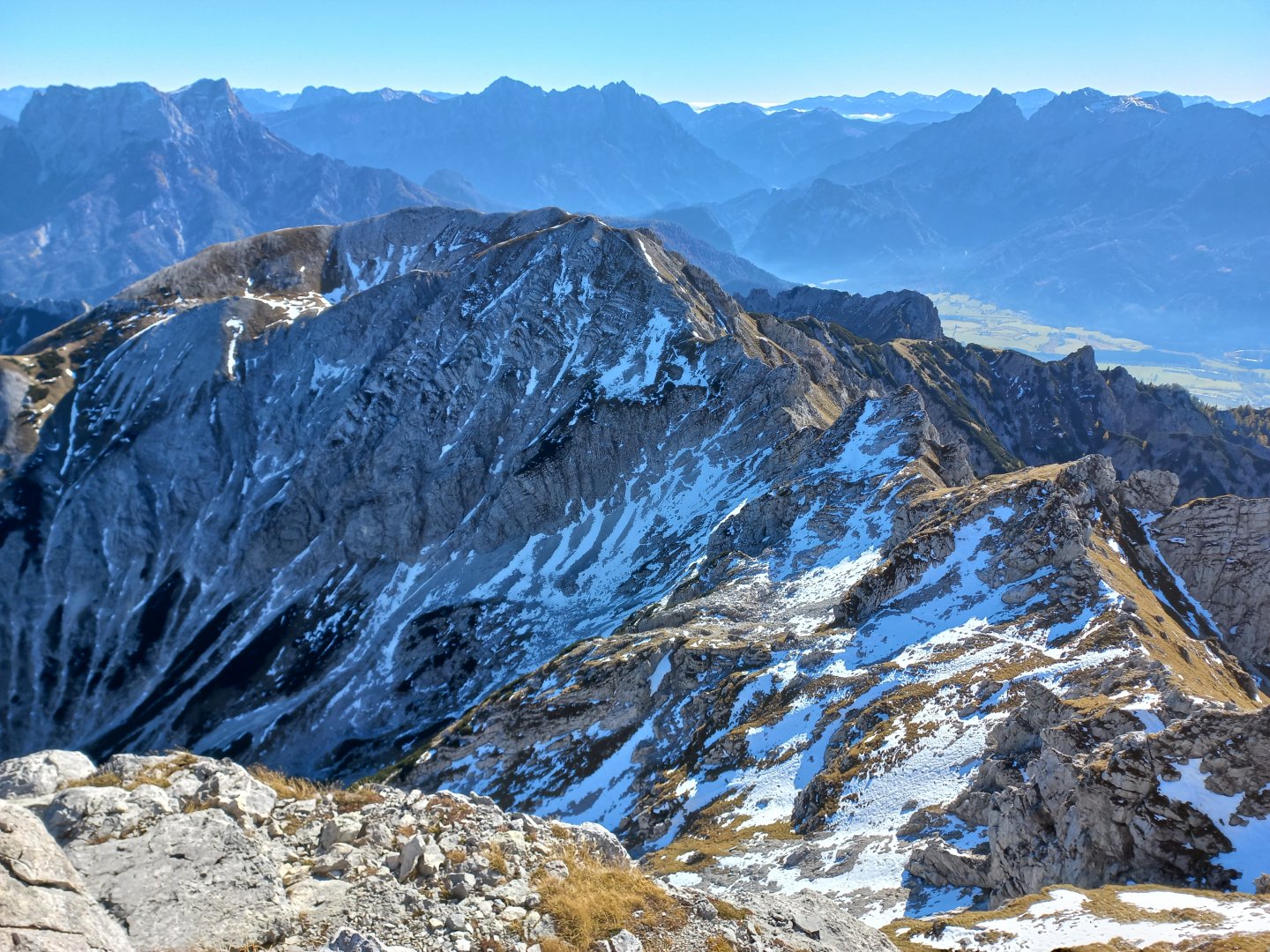
The views are stunning again - the parachute down to the north, the Totes Gebirge to the north-west and the highest peak Grosser Priel and its smaller brother Kleiner Priel, the Sensengebirge and Hoher Nock across the valley. The Seckauer Alpen peek out in the south behind the Reichensteingruppe. I descend and meet groups of people coming down from the klettersteig. They have no ferrata equipment, harnesses, crampons or helmets. I don't want to go back through the snow, so I ask if the klettersteig is challenging. They say not really. Okay then, I'll try the Hexensteig back.
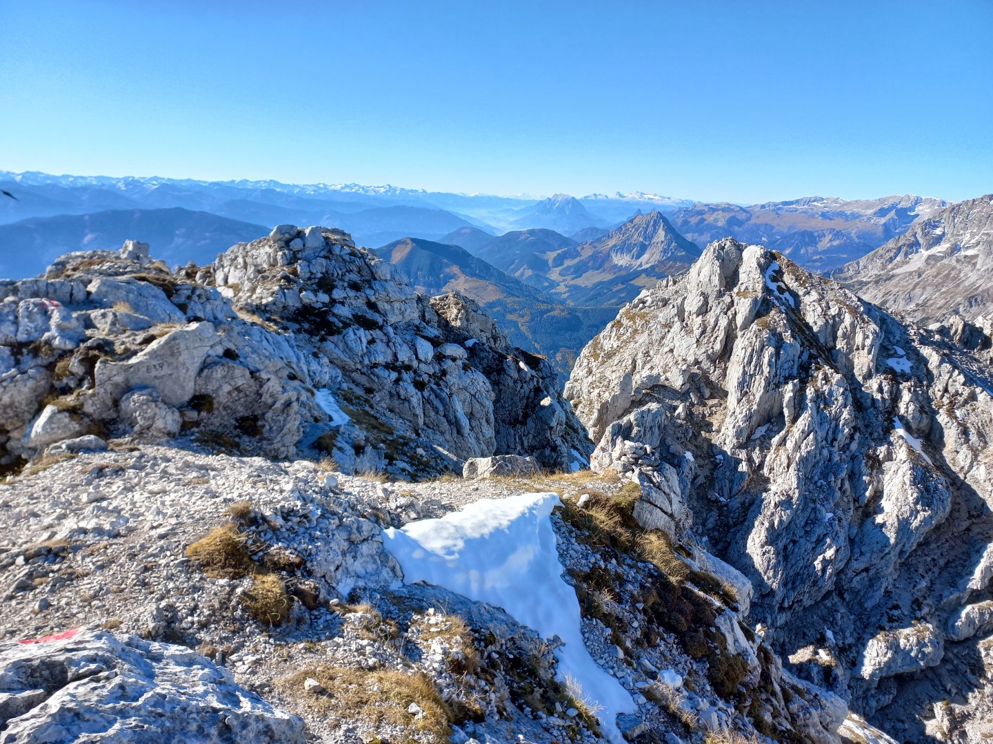
The ferrata follows the Bärenkarmauer ridge. I climb over a sharp rock, behind which ropes appear. I hold on to the rope and carefully climb down and around the walls. The Hexensteig is popular, I dodge with a few people in the opposite direction, releasing the rope to the two faster ones. After a while, a flatter section with a ferrata book. And up again to perhaps the last rock, it's probably the steepest, but the rope is tight, it's on. I can see the signpost below Natterriegel and in less than an hour the klettersteig is behind me.
For experienced ferratisti probably a piece of cake, my hands and knees are shaking a bit. Then it's the familiar route down from Natterriegel, where I enjoy the afternoon views. The mountains are bathed in sunshine, the fog has long since disappeared. The descent is quicker, in less than two hours I'm at the car. 6.5 hours on the road, about 13 km and 1500 vertical metres trodden.
Difficulty
Medium trek. Firstly, it is necessary to overcome an elevation of about 1,500 m., but also technically the route is moderately demanding. There are fixed ropes, and in autumn there was snow at higher altitudes, especially the traverse between the mountains was so difficult. The ferratas themselves are rather easier.
Water availability
On the way there is a stream below the Grabneralm shepherd's huts, refreshments are available at the huts. Bring at least 1.5 litres of liquids.
Sleeping options
Accommodation is available at huts along the way - Grabneralmhaus and Admonter Haus, or somewhere in the valley.
Mountain peaks
The following peaks are on the route - Mittagskogel 2 041 m above sea level, Natterriegel 2 065 m above sea level and Hexenturm 2 175 m above sea level.
Danger
A classic alpine trek - mostly on meadows and gravel paths. However, there are also some easy, sheltered sections on the route. This is the section between the Natterriegel and Hexenturm peaks. Here a fixed rope is stretched to make the way easier. At the traverse it was necessary to be careful of the snow that was present. The ferrata themselves are easy and experienced hikers can manage them without belay devices.
Food
Takeaway food, refreshments at Admonter Haus and Grabneralm Haus,
Cheese shop (Käserei) on Grabneralm.
Attractions
Grabnerstein is described as the schönster Blumenberg der Steiermark - the most beautiful flower mountain in Styria - educational boards with descriptions of mountain flowers.