Mountain range, region / State
Korab / Albania
Season
Summer
04. 08. 2022
Difficulty
3 / 5
Elevation
↑ 1567 m
↓ 1567 m
Length
19.6 km
9 hours
Altitude
max. 2764 m n.m.
min. 1258 m n.m.
Tourist map of Velky Korab
Tips for hikes in the mountain range Korab
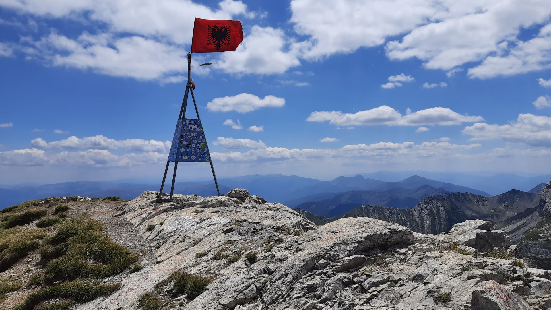
Climb to the highest mountain in Albania - Mount Korab
Circumambulation hike to Great Korab, the highest mountain in Albania and Northern Macedonia
Starting point
The trek starts in the village of Radomirë. A winding 50km asphalt road leads to the destination village from Kukës. There are a couple of parking places near the hotel. You can stay with a nice guy, or pitch tents a little higher up.
Description of the hike
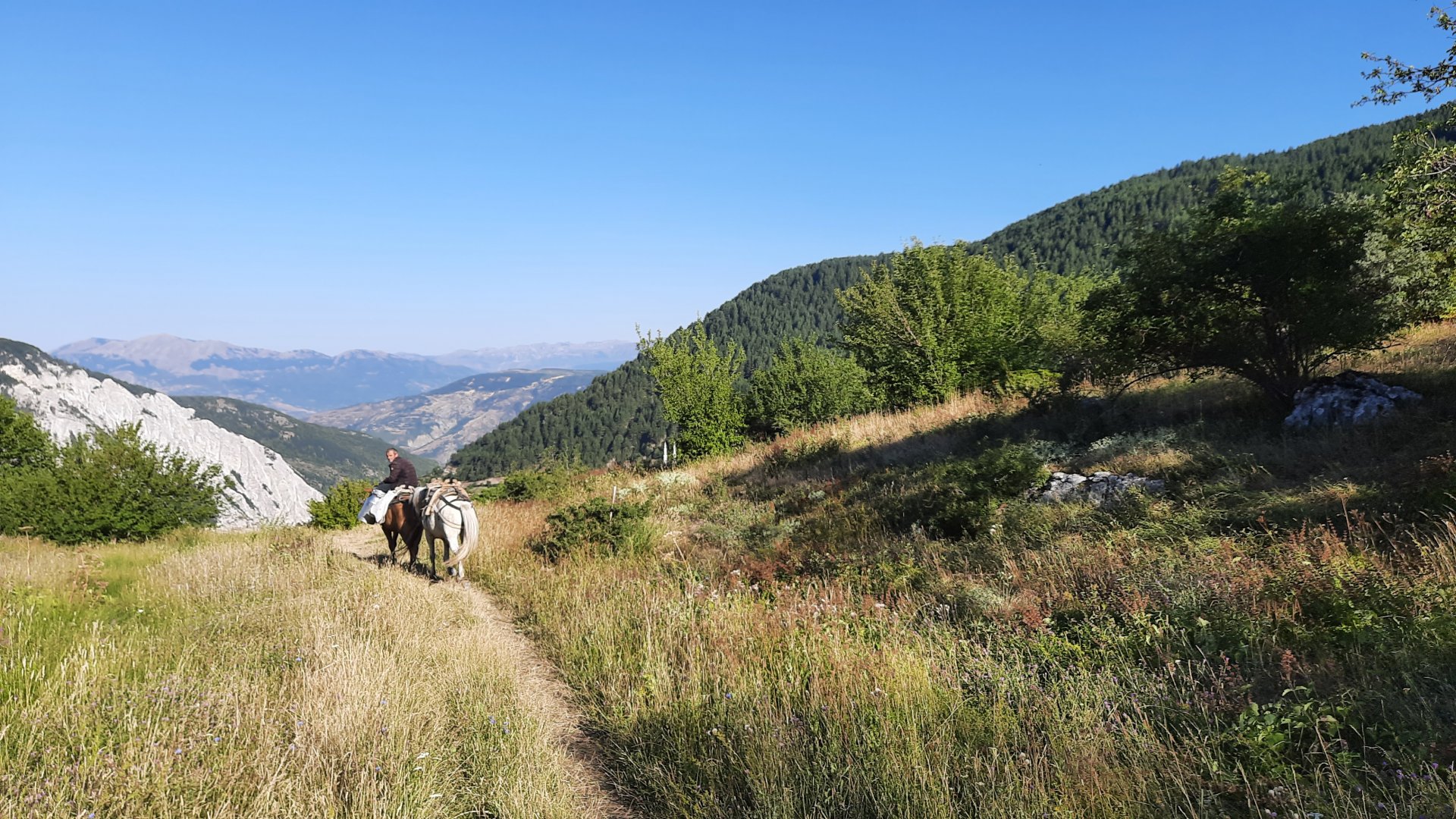
The hike starts in the village of Radomirë at a bend near the hotel with a small river. Keep to the right at the start, occasionally watching the sign and the map. It goes through mountain meadows, occasionally a bit of trees, and then through the open mountain landscape. Nice flora around, but also lots of pesky flies. Above a dry ball, the trail flattens out for a while, traverses, follows a stone field to a spring where there is a nice refreshment.
However, he would look for a red marker, or perhaps a mission with an older route that heads more perpendicular to the summit. Above the spring it heads up to a saddle where there is a nice rest and a view of Macedonia with Lake Mavrovo. The last section is no longer steep, mostly a grassy ridge to the summit. Earlier there are described snow fields, but in August already completely without snow. We choose to descend, despite some warnings about dogs, by the circular northern route. We go past a muddy lake, then take a steep left. Descents alternate with crossings of flat meadows. At the end are less pleasant dusty switchbacks into the village.
Difficulty
The hike is not difficult, alternating between flatter and steeper sections. At the beginning a bit of trees, then through an open grassy-rock landscape with views of the surrounding rock massifs and the main objective, which is bypassed through the saddle from the right (from the south). In places the signposting is a little difficult to find, but there it is. If so, maps.cz will help. Over the debris field you reach a well at about 2350 m above sea level, then to the saddle on the border with Macedonia and then follows a fairly easy climbed mostly grassy ridge.
We chose the circular route, descending via the longer, more interesting northern route, but where they warn against herding dogs. We met one and he avoided us. The route is also marked, but on the maps.cz it is just a grey line. The descent is quite long, with flat plateaus at times. The very end then dusty steeper serpentines. Apart from a few horses, sheep and that one dog, we met no one. Three couples on the ascent and summit.
Water availability
For a trek, the usual 1.5l/person is enough. The last well at 2350 m above sea level, still flowing in August.
Sleeping options
We spent the night with a nice boy and his father in a run-down but clean little hotel on a curve. There's another one next door. Trekkers with tents then spend the night mostly on a small pallet about 200 m. above the hotel, a clear stream flows nearby with a nice refreshing pool...
Mountain peaks
Mount Golem Korab 2764 m above sea level is a double peak. On the northern one there is an old marker, but it is quite tricky terrain, in places so II. climbing, so I do not recommend it definitely not in wet weather. There is a comfortable trail to the main summit.
Danger
Quite easy but longer trek, no climbing. They warn of herding dogs on the descent down the north side.
Food
There is no refreshment option on the route, it is necessary to have supplies with you
Attractions
Still a relatively deserted region, nice people and a minimum of people on the trip.