Mountain range, region / State
High Tauern / Austria
Season
Spring
18. 06. 2022
Difficulty
3 / 5
Elevation
↑ 1636 m
↓ 1636 m
Length
16.8 km
8 hours
Altitude
max. 2287 m n.m.
min. 1332 m n.m.
Tourist map of the foothills of the High Taur
Tips for hikes in the mountain range High Tauern
A circular hike in the High Tauern with a climb to Draugstein
Circular trek Heukareck - Schuhflicker in the foothills of the High Tauern
Starting point
Grossartal - Schied, parking lot at the transmitter (Sendeanlage Holzliehen).
Description of the hike
Sankt Johann im Pongau, Alpendorf and Groβarl are the famous ski resorts of the Sportwelt Amadé ski region south of Salzburg. But the surrounding mountains also have plenty to offer in summer - there are dozens of kilometres of marked trails, beautiful summits and easy paths along the alps. I chose the home mountain of St. Johanna, Heukareck (2100 m), from which you can make a nice day hike to the summit of the pointed Schuhflicker (2214 m).
From Sankt Johann, I'm heading down the road to Groβarltal. At the village of Schied I turn after the bus stop towards Mooslehenalm/Viehhausalm to the parking lot of the transmitter (Sendeanlage Holzliehen). The turn-off is well signposted and a narrow asphalt road leads to the car park. The car park is at about 1300 m, it is spacious and free, but in high season when the weather is nice there are a lot of cars. Hiking and walking trails start directly from the car park and there are wonderful views of the Groβarltal and the snow-capped three-thousanders Ankogel and Hochalmspitze.
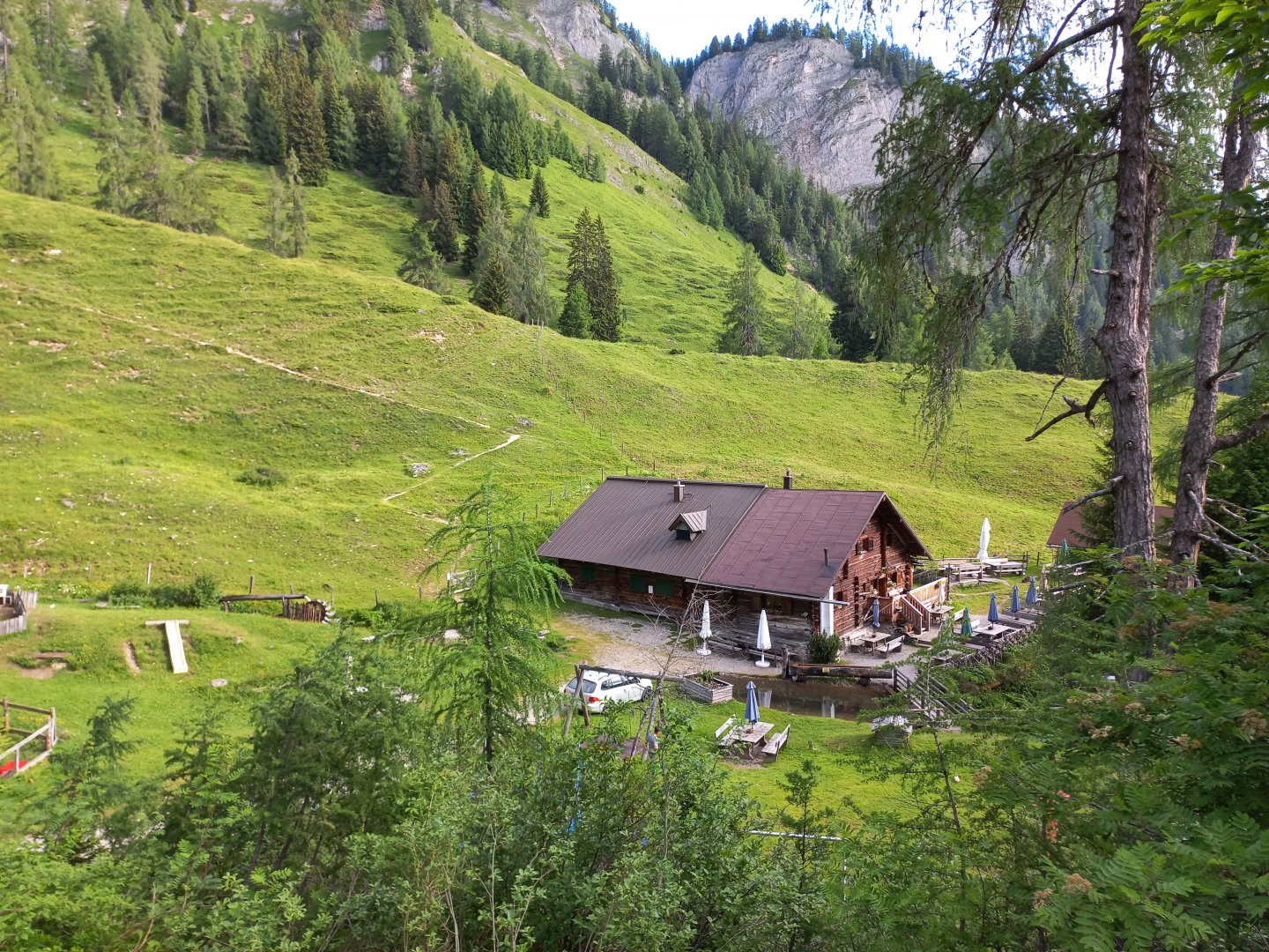
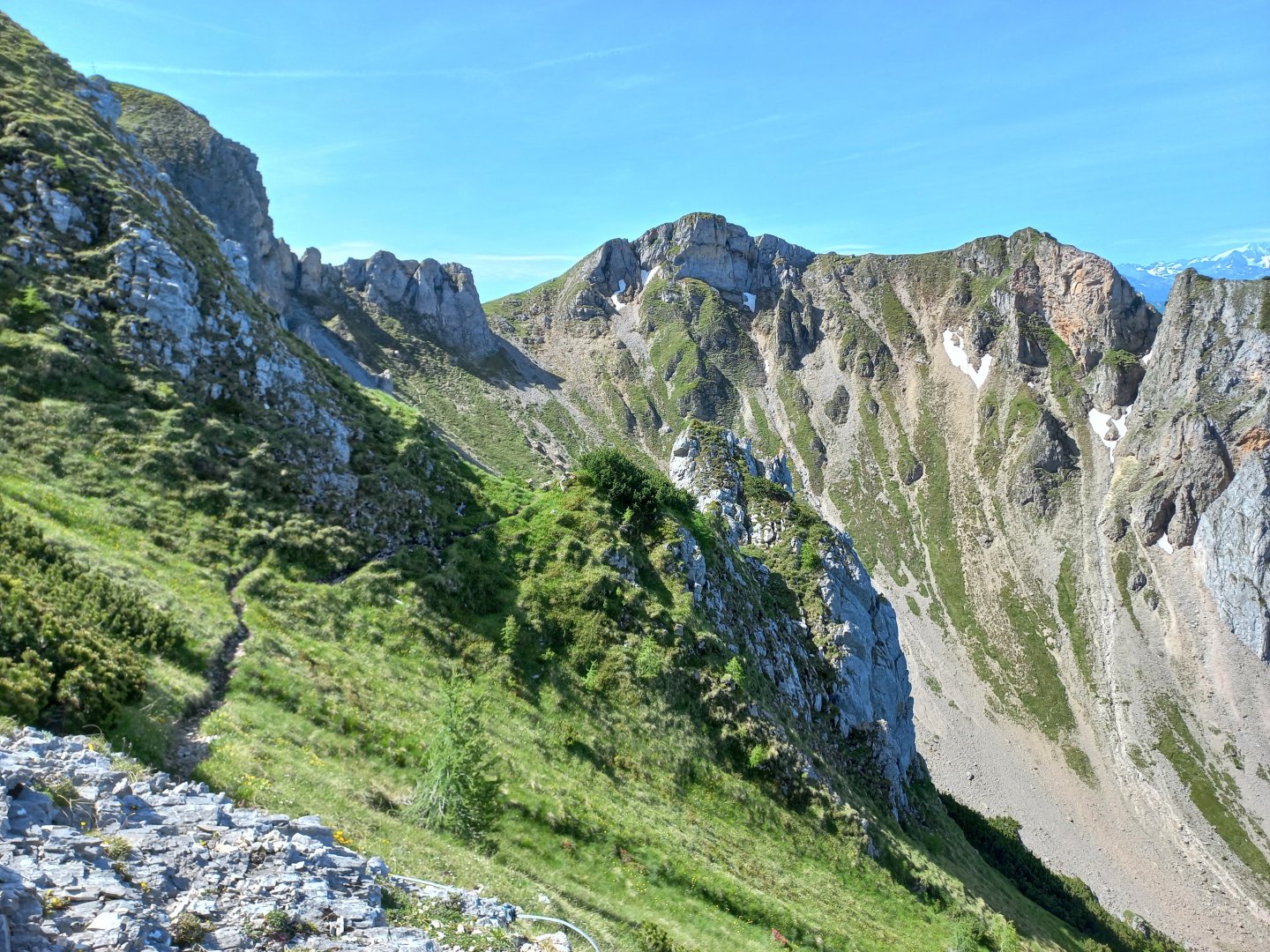
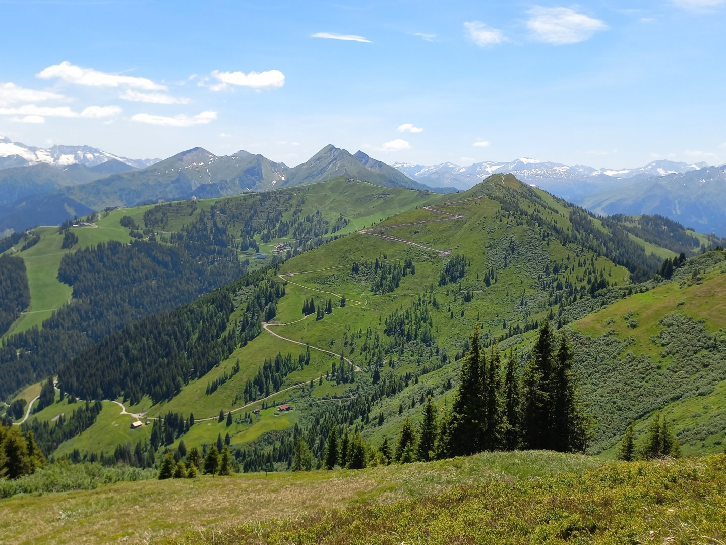
I take the wide forest road towards Igltalam and Heukareck and slowly gain metres. Igltalalm comes around a bend about half an hour into the journey, there are refreshments on offer and a nice waterwheel on the stream above the hut. From the Igltalalm, the climb starts across the meadow towards the Höllwand (2287 m) and Sandkogel (2249 m) double mountains.
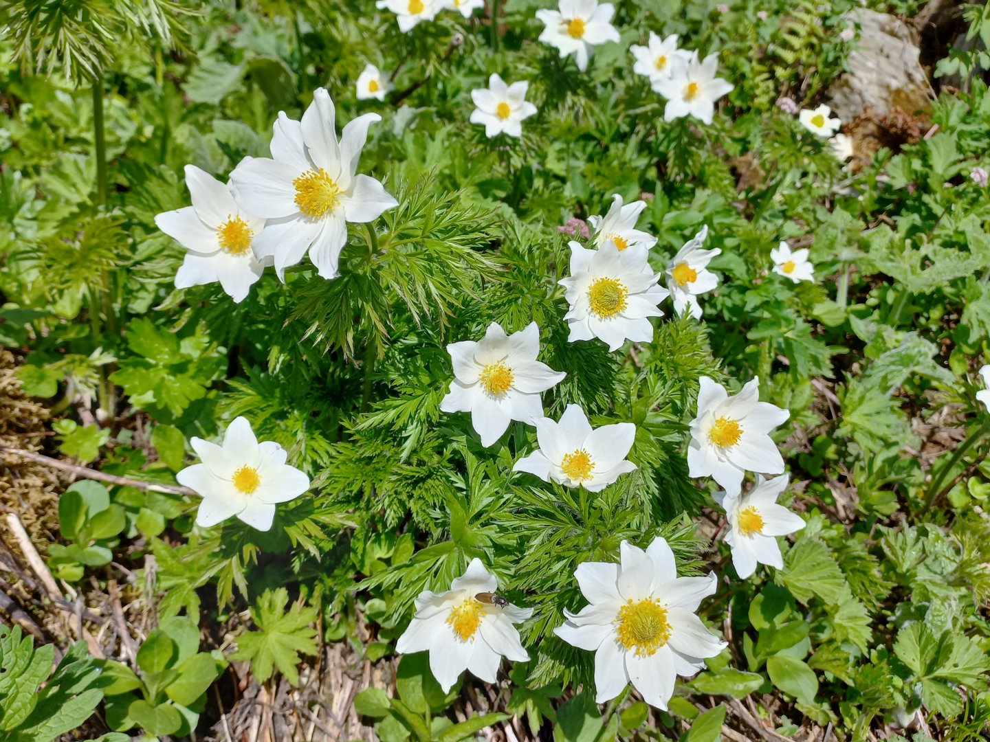
The Alpine meadows are like a Swiss chocolate advertisement in June, with lots of blooming flowers, spotted cows, butterflies everywhere. In another half an hour I'm below the Höllwand wall, there are still a few snow fields, but the snow melts quickly in the sun. I am tempted by the turn to Schober (1997 m). After a few minutes I come across an aluminium cross, which is not on the summit, but still in a beautiful spot. It has a large quartz crystal in the centre in a glass field.
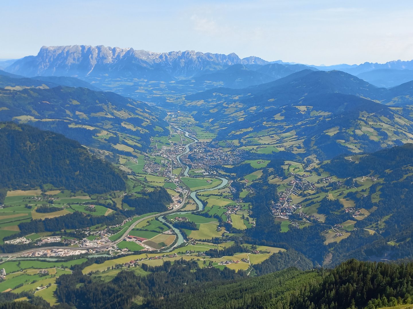
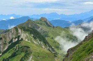
I continue to the top without the cross, where a beautiful view of the Salzach valley opens up. The blue river meanders through the Pongau valley towards the Tennengebirge and on to Salzburg. To the north, I can already see the Heukareck cone and the almost three-thousand-foot Hochkönig massif (2 941 m) rising behind it. East of the Tennegebirge is the Gosaukamm and the Dachstein, which is confusing because from this side it does not show its typical trident, nor the glacier on the north face. The ascent of the Heukareck takes about an hour.
There are several paths leading up from the valley, so I've already met a few people here. The Hochkönig massif is right there in the palm of my hand, and the view into the valley is also breathtaking - there is a large railway station deep below me, the houses around and the busy road resemble a model railway. To the west, the snow-capped peaks of the High Taurus rise, to the northwest, the German Berchtesgaden Alps are already in the haze
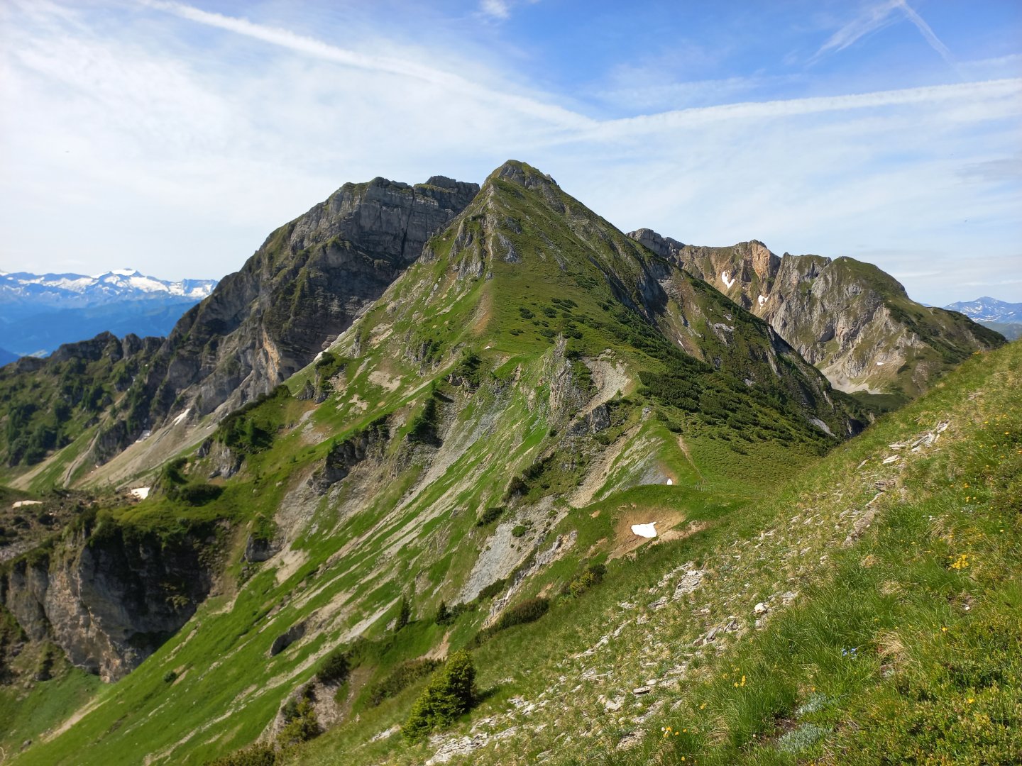
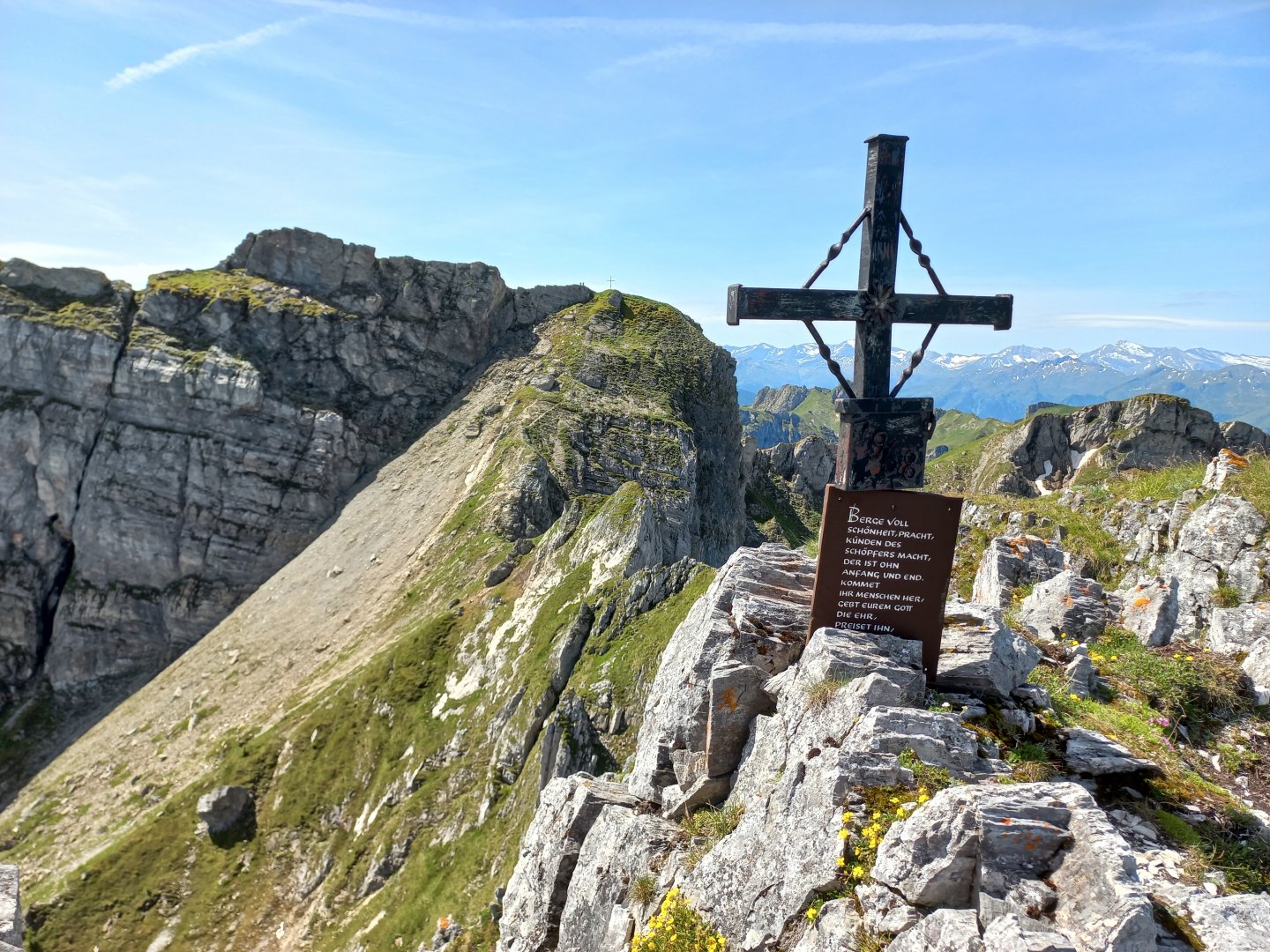
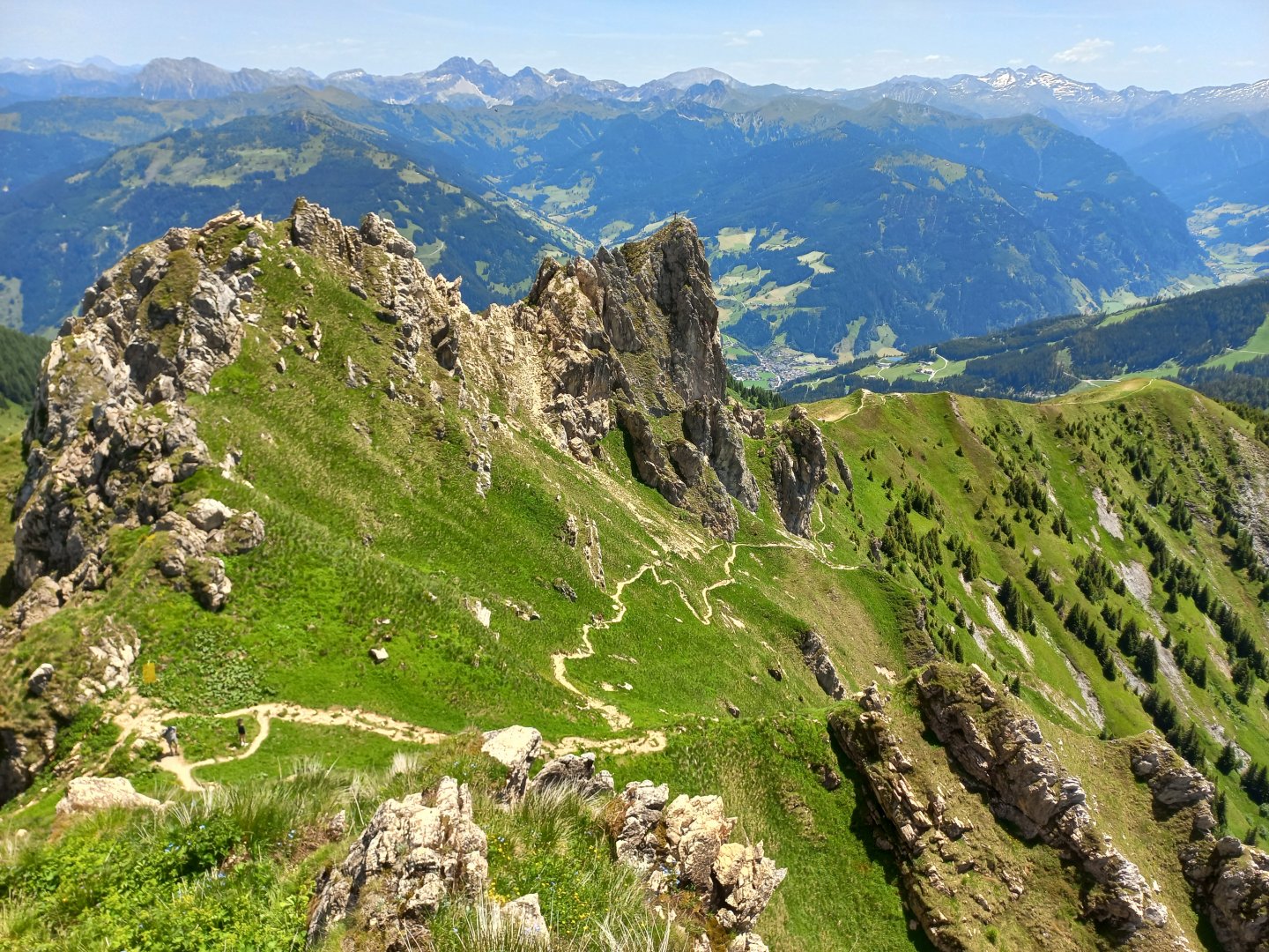
After a moment of rest I set off along the black marked trail towards Schuhflicker. The difficulty of the marking seems to me to be exaggerated - the trail goes first kneeling, then gains more vertical metres by serpentines of grassy steps and then traverses from the west around the walls of Sandkogel and Höllwand, nothing difficult. There is a trodden switchback to both peaks, the summit crosses are only a few vertical metres from the trail and the circular views are well worth it.
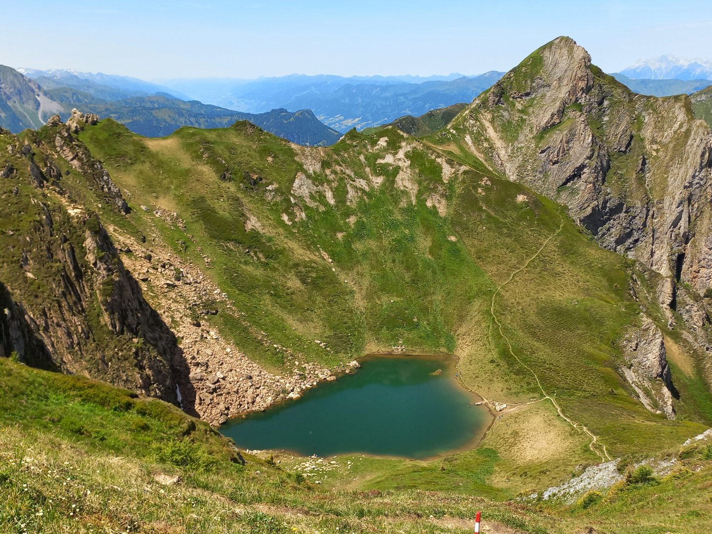
Beyond the saddle with the turn-off to Höllwand, a view opens up across the meadow to the last summit of the trail - the top of the Schuhflicker. The meadow is flat, just over a kilometre long and gives tired legs a rest. After the meadow it's just a short climb up to the Schuhflicker, a few metres are secured with a fixed rope, but more in case it's wet and slippery, there's no parachute. Over the edge at the fork, the blue Schuhflickersee peeks out in the depths, where a few people are refreshing themselves on a hot summer day.
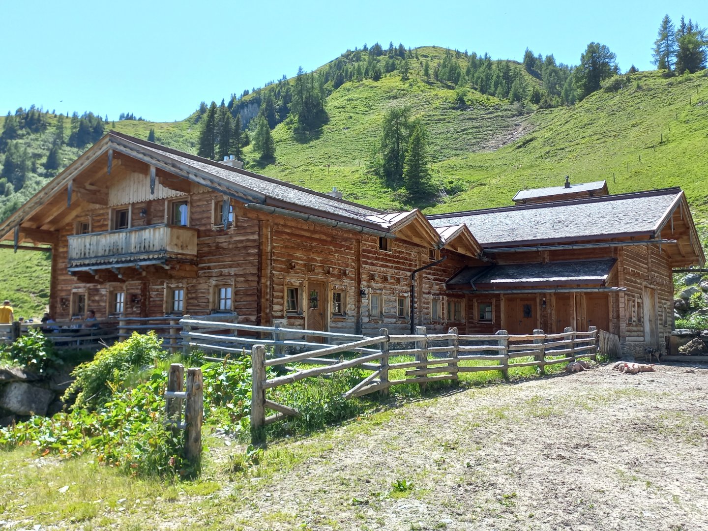
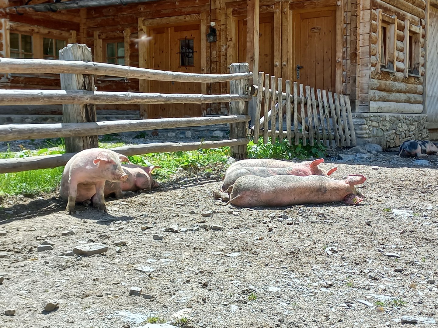
Schuflicker is quite busy, with good access from Aualm (1795 m), about an hour away, with a car park below. I descend to the Aualm and continue along the forest path towards the Mooslehenalm (1449 m). There are fewer people here than at Aualm, so I stop for coffee and cake. The cakes here are excellent, and on a nice day they sell them before they have time to cool. I get a plum one, those who come a few minutes after me have an apricot one. I walk down the wide Forststrasse from the almo to the nearby car park.
Difficulty
A wonderful trek in the foothills of the High Taurus (Ankogelgruppe) with beautiful views of Salzburg. The path leads mostly through grassy meadows, along mountain trails. No exposed sections, but can be dangerous after rain when the grass is wet and it slides. The route is slightly challenging in terms of elevation gain, but nothing special as far as the Alps are concerned.
Water availability
At the beginning and at the end of the route there are springs and almshouses where you can refresh yourself. There is no water between Heukareck and Schuhflicker.
Sleeping options
Accommodation options are in the valley below the mountains.
Mountain peaks
From the path you can climb to the peaks Schober (1997 m), Sandkogel (2249), Höllwand (2287 m), Schuhflicker (2214). Views of the High Tatras, Tennengebirge, Hochkönig, Grossarltal, Pongau.
Danger
The path goes mostly through alpine meadows, it can be dangerous after rain. There is a steel fixed rope stretched along part of the route, but only for the safety of the step. This is not an exposed section.
Food
One day trek, refreshments available at the beginning and end of the hike at the almshouses (shepherds' huts). It is definitely good to have some snacks with you.
Attractions
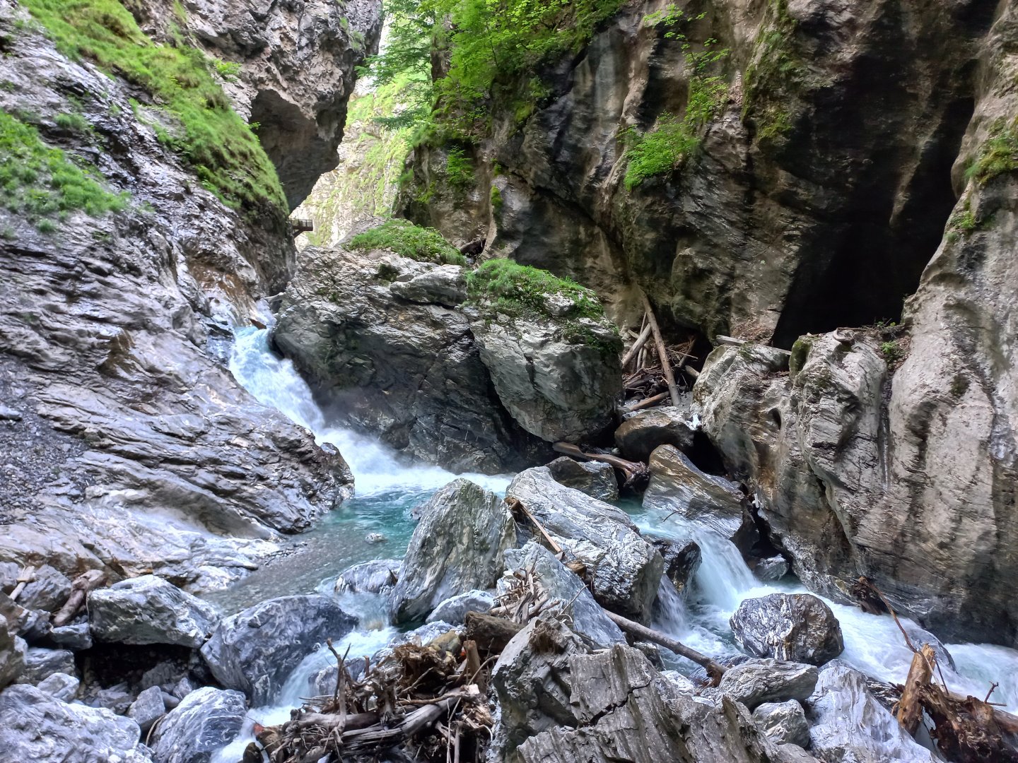
On a hot summer day, the nearby Liechtensteinklamm Gorge offers pleasant refreshment. The turn-off to the gorge is just before Sankt Johann. There is a fee to enter the gorge (in 2022 adults €11, children €6), but the gorge is definitely worth a look. Here, masses of water carve their way deep into the rock, ripping fallen logs with them and digging cauldrons full of boiling water.
The gorge was opened at the end of the previous century by the Prince of Liechtenstein. He built metres of wooden walkways along the rock and cut long tunnels through the surrounding slopes. The confluence is several hundred metres long, and at the end a large waterfall falls from a height of 30 metres. The confluence was severely damaged by a landslide in 2017 and took 3 years to rehabilitate. Since 2020, it has also been decorated with a beautiful spiral staircase.
Families with children will also be interested in the nearby Gerkogel - Geisterberg, the ghost mountain, where the cable car from Alpendorf also runs in summer and where you can have fun in the natural amusement park below the top of the hill.
A few dozen kilometres in the direction of Salzburg, one of the largest ice caves in the world, the Eisriesenwelt, is located in the Tennergebirge.