Mountain range, region / State
High Tauern / Austria
Season
Summer
16. 07. 2022
Difficulty
3 / 5
Elevation
↑ 1660 m
↓ 1658 m
Length
14.4 km
6 hours
Altitude
max. 2290 m n.m.
min. 1247 m n.m.
Tourist map of the High Tatras with ascent to Draugstein
Tips for hikes in the mountain range High Tauern
Trek to the Schuhflicker lookout mountain
Circular treking in Grossarltal
Starting point
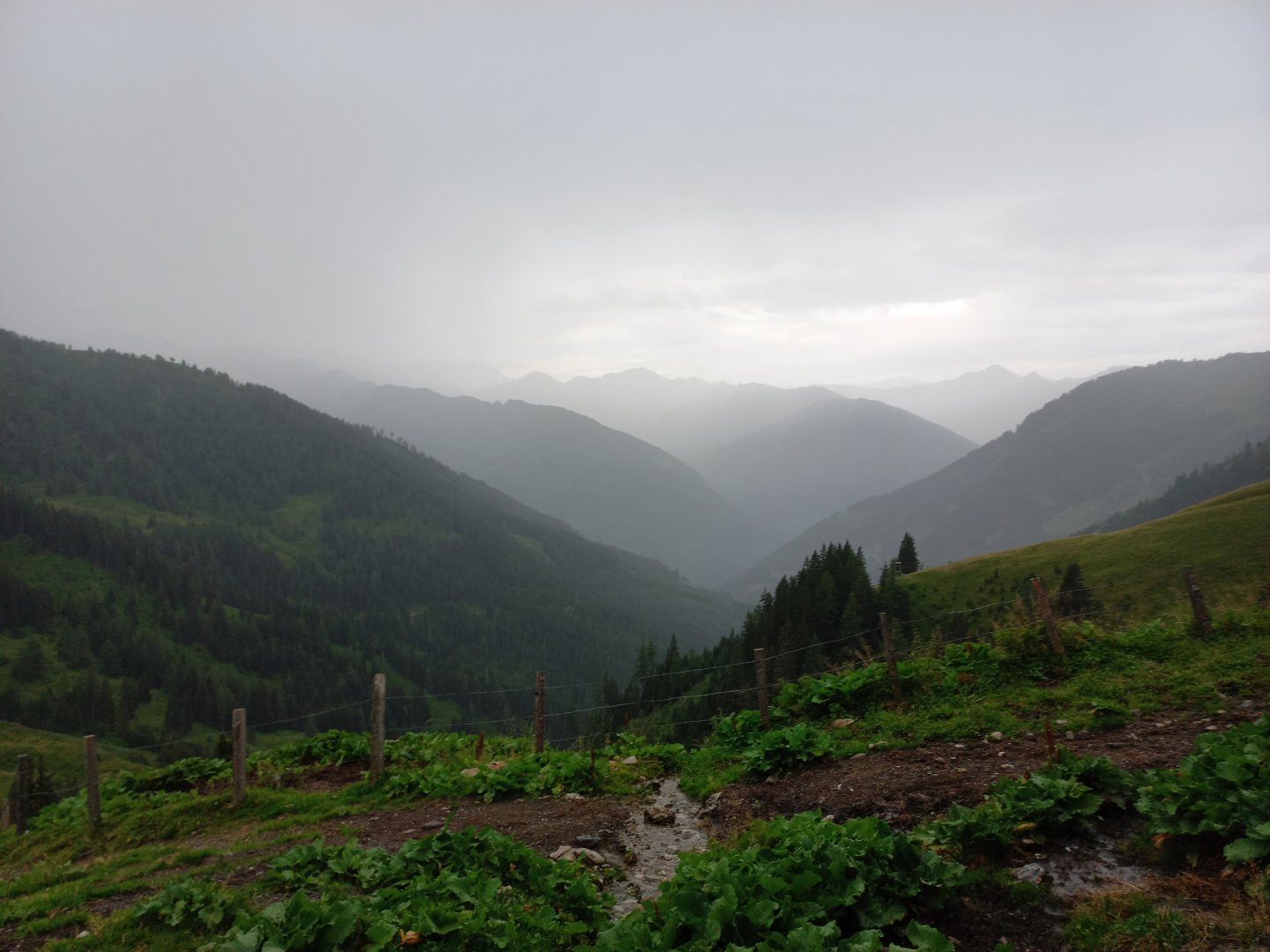
This time I choose the trek to Draugstein (2358 m) in the back part of the valley, behind the village of Hüttschlag. I turn off the road at the Karteiskapelle chapel uphill towards Hallmoosalm. The road takes me to a parking lot at about 1300 m above sea level. The car park is free and there is space for about 30 cars. Right next to the car park there is a signpost for hiking trails. I head towards the Draugsteinalm hut (1779 m).
Description of the hike
Groβarltal, the valley around the town of Groβarl, is surrounded on all sides by the green peaks of the foothills of the High Taurus. On my first visit I walked a beautiful scenic circuit through Höllwand and Schuhflicker.
A gravel path leads from the car park at 1,300 m above sea level, from which a footpath turns off after a while at the holy picture to the hut. I climb along the stream and am a little worried by the black sky and the thunder behind me, from the High Taurus. The first drops of rain catch me right at the hut and I take shelter under the terrace. After twenty minutes the sky thankfully breaks a little, the rain stops and I can continue on. I climb through the grassy pasture to the Filzmoossattel (2 064 m above sea level). A turn to the right sends me to Draugstein.
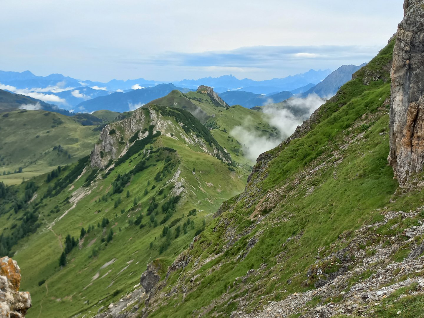
I have a sharp 300 metres to climb to the top of Draugstein at 2 358 m above sea level. Finally, however, the sun begins to shine and views of the surrounding mountains open up. Just below the summit there are a few fixed ropes for safety when climbing over the rocks, but nothing dangerous, there shouldn't even be ropes.
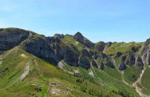
The summit is narrow and rocky, the views are perfect. To the south the three-thousanders Hochalmspitze and Ankogel, to the west the green hills of Groβarltal and beyond them the High Tauerns, to the north Hochkönig and Tennengebirge, in the distance the trident of the Dachstein and the Schladming Tauerns, and to the east the mountains above Kleinarl - Ennskraxen/Kraxenkogel, the jagged Faulkogel, the tip of Mosermandl and the white Weisseck - are all within easy reach.
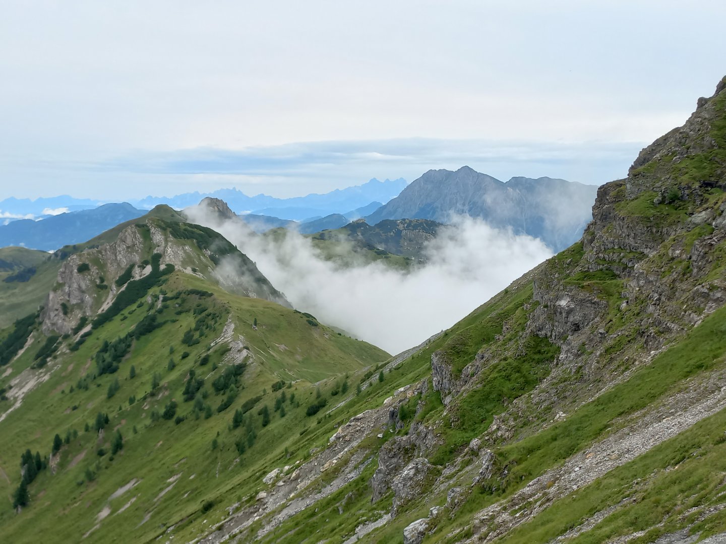
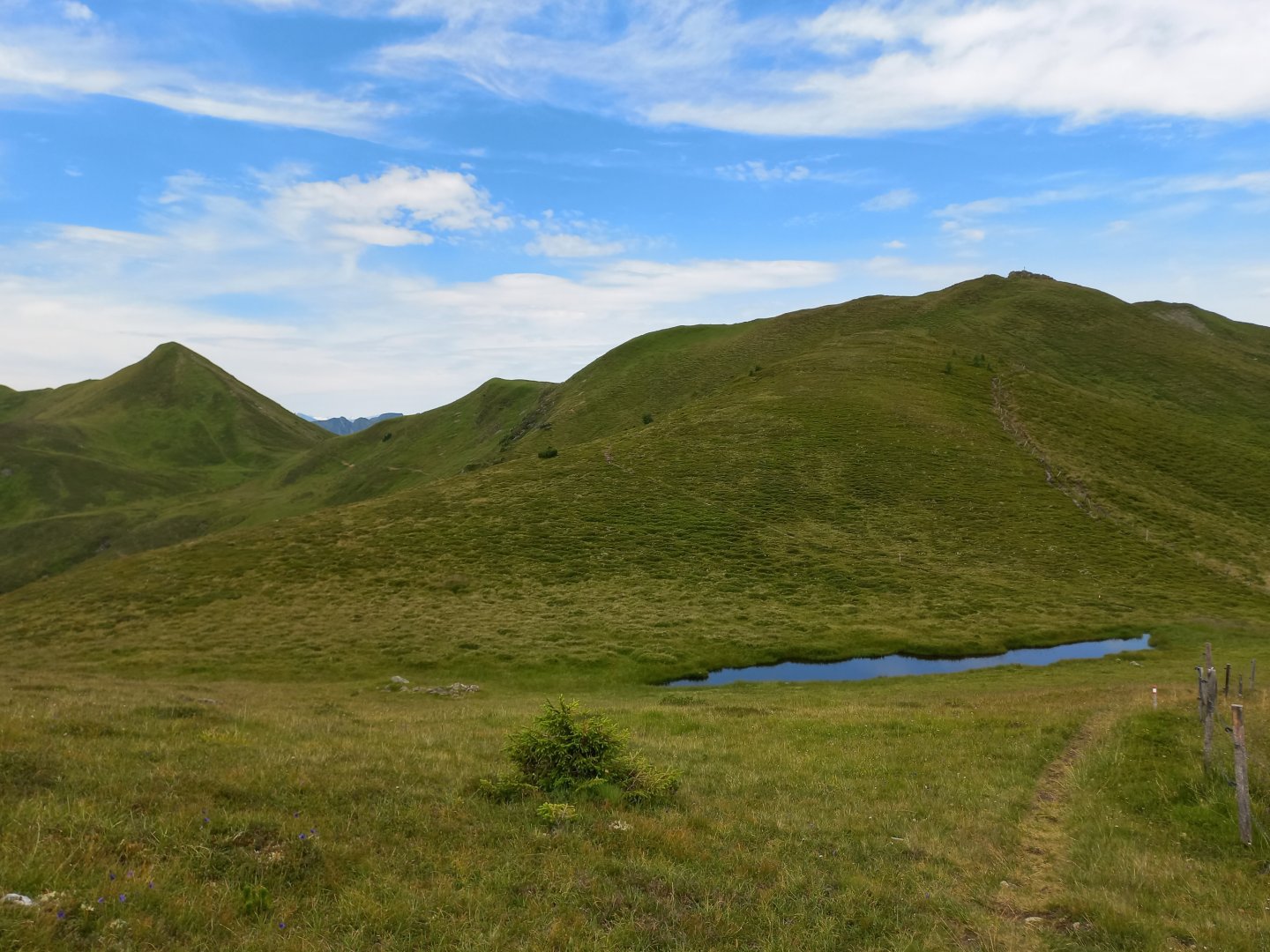
Fog and clouds roll in between the mountains after the rain, but the weather is slowly picking up. I descend back to the saddle and continue on along the grassy undulations of the Filzmooshöhe to the second summit of the route, Filzmooshörndl (2189m). At the cross I take a break and admire the views of the hills around Grossarl - I can make out Höllwand and Schuhflicker, and on the other side of the valley the long green ridge between the Gabel and Gründegg peaks.
Some of the peaks are accessible by the Panoramabahn cable car in Groβarl, and the Gernkogel cable car also operates in summer. From Filzmooshörndl I descend a grassy ridge, then traverse around Spielkogel to the last peak of the route, Hundegg ( 2079 m). The wooden cross on it is dedicated to the memory of the fallen and missing in the world wars.
From Hundegg the path descends quickly down to pastures and wooden almshouses. From the almshouses a wide gravel path leads back to the car park. On the way 6 hours, 4 people met at the hut, several cows and sheep and one frog.
Difficulty
A fair alpine trek through mountain pastures with a climb up to the Draugstein mountain. There are aid ropes leading up to the summit, but it is not difficult - for an experienced mountaineer there might not even be any. The hike is also suitable for older children or active seniors.
Water availability
Water can be replenished at the start and end of the trail from the stream, refreshments at the start of the trail at the Draugsteinalm hut.
Mountain peaks
Ascent to the summit of Draugstein, views: to the south the three-thousanders Hochalmspitze and Ankogel, to the west the hills of Groβarltal and behind them the High Tauern, to the north Hochkönig and Tennengebirge, Dachstein and the Schladming Tauern, to the east the mountains above Kleinarl - Ennskraxen/Kraxenkogel, the jagged Faulkogel, the tip of Mosermandl and the white Weisseck.
Danger
There is no danger for a mountain hiker on the route - it is a classic alpine trek along the marked red AV route.
Food
Refreshments are only available at the start of the Draugsteinalm