Mountain range, region / State
Seckauer Tauern / Austria
Season
Spring
18. 06. - 19. 06. 2022
Difficulty
2 / 5
Elevation
↑ 1211 m
↓ 1211 m
Length
14.9 km
2 days
Altitude
max. 2202 m n.m.
min. 1200 m n.m.
Tourist map of the Seckauer Tauern
Tips for hikes in the mountain range Seckauer Tauern
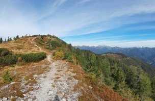
A leisurely hike over Mount Bremstein in the Seckauer Tauern
Two-day trek in the Seckauer Tauern
Starting point
Paid parking at the Bergerhube pub. Parking costs 5 Euro per day (2022). The car park is accessed by an asphalt road that turns off the road connecting Trieben to Hohentauern.
Description of the hike
1. day
Upon our morning arrival, we first struggled a bit with the vending machine in the parking lot. It was only after a while that we understood that it was possible to put only 5 Euro for a day or 10 for two days. Nothing in between. And since the machine is only for change and we didn't have much, we only gave 5 Euro. But in the end it was exactly enough and we were back in 24 hours.
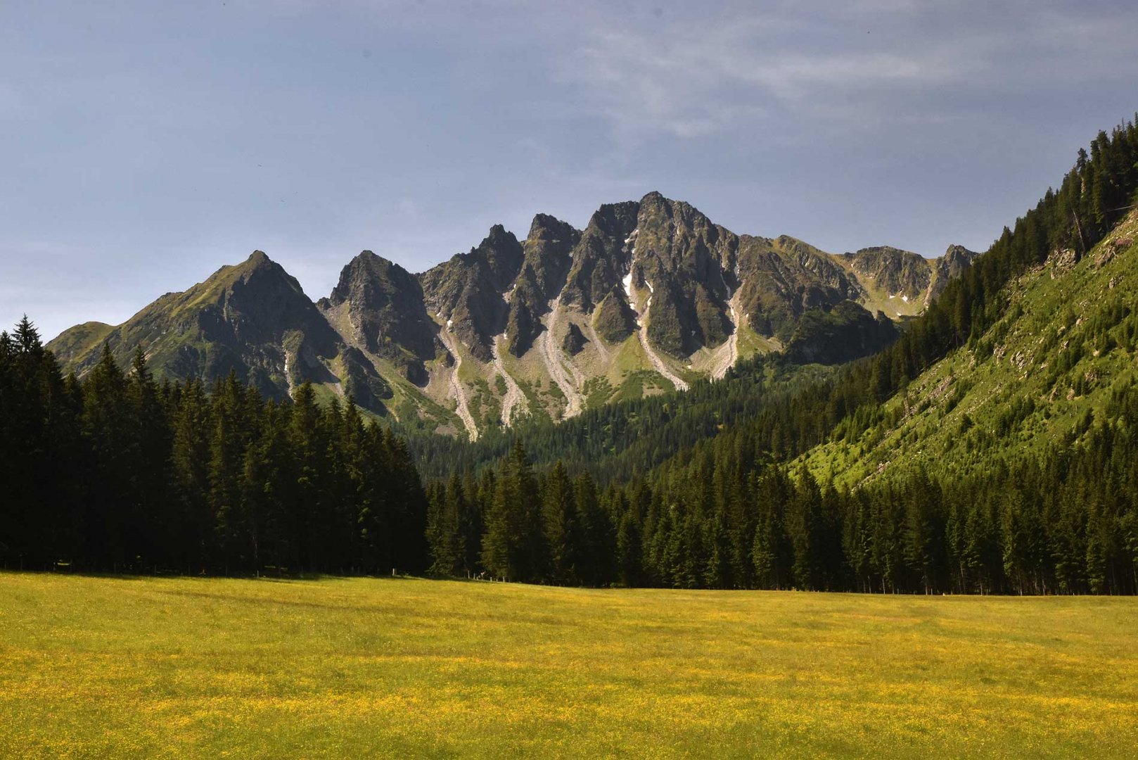
From the pub we followed the red trail towards the Bärensuhlsattel saddle. The sign leads through the forest on a wide path. We weren't so keen on that, so after a while we turned off and continued along the forest trail. This leads along the other side of the Königsbach stream. The path still climbs, but it is not a steep climb. After a while we joined a wide path with a sign. Soon, however, we turned off and this time climbed more steeply through the forest to the saddle. The trail leads through a beautiful mountain meadow at the end, when the first views of the surroundings open up. At the Bärensuhlsattel saddle we rested for a while and then continued on to the mountain ridge.
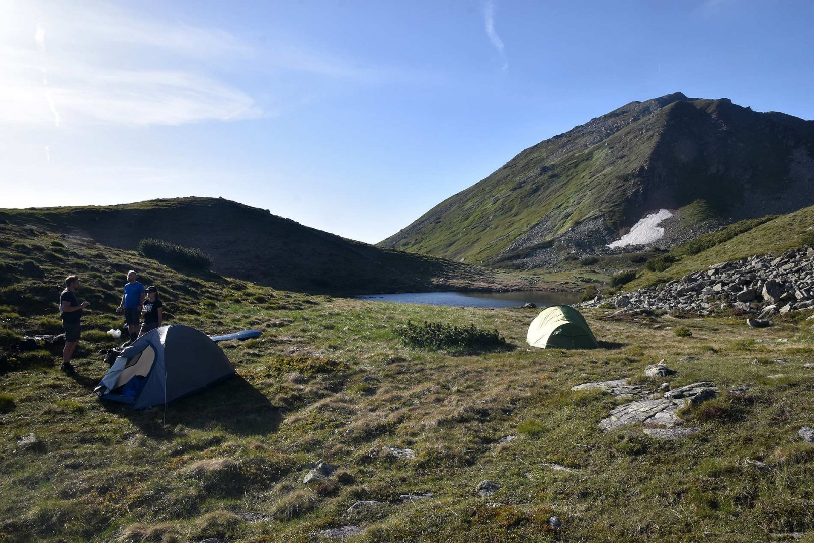
One by one we climbed one mountain after another. The climb to the top was always steeper, but safe and short. There is a clear trail along the ridge so there was no problem. The views all the time were breathtaking on all sides. Eventually we ascended to the highest point of the trek, Mount Kerschkern. After a short rest we descended down to the saddle. This part of the route is probably the steepest, but still safe. At the saddle, we left the ridge and the marked path and followed the beaten path to the Schaunitzsee lake, where we also set up our tents. There is also a water spring here, so an ideal place to spend the night. Only ibex kept us company and we enjoyed a beautiful sunset with them.
2. day
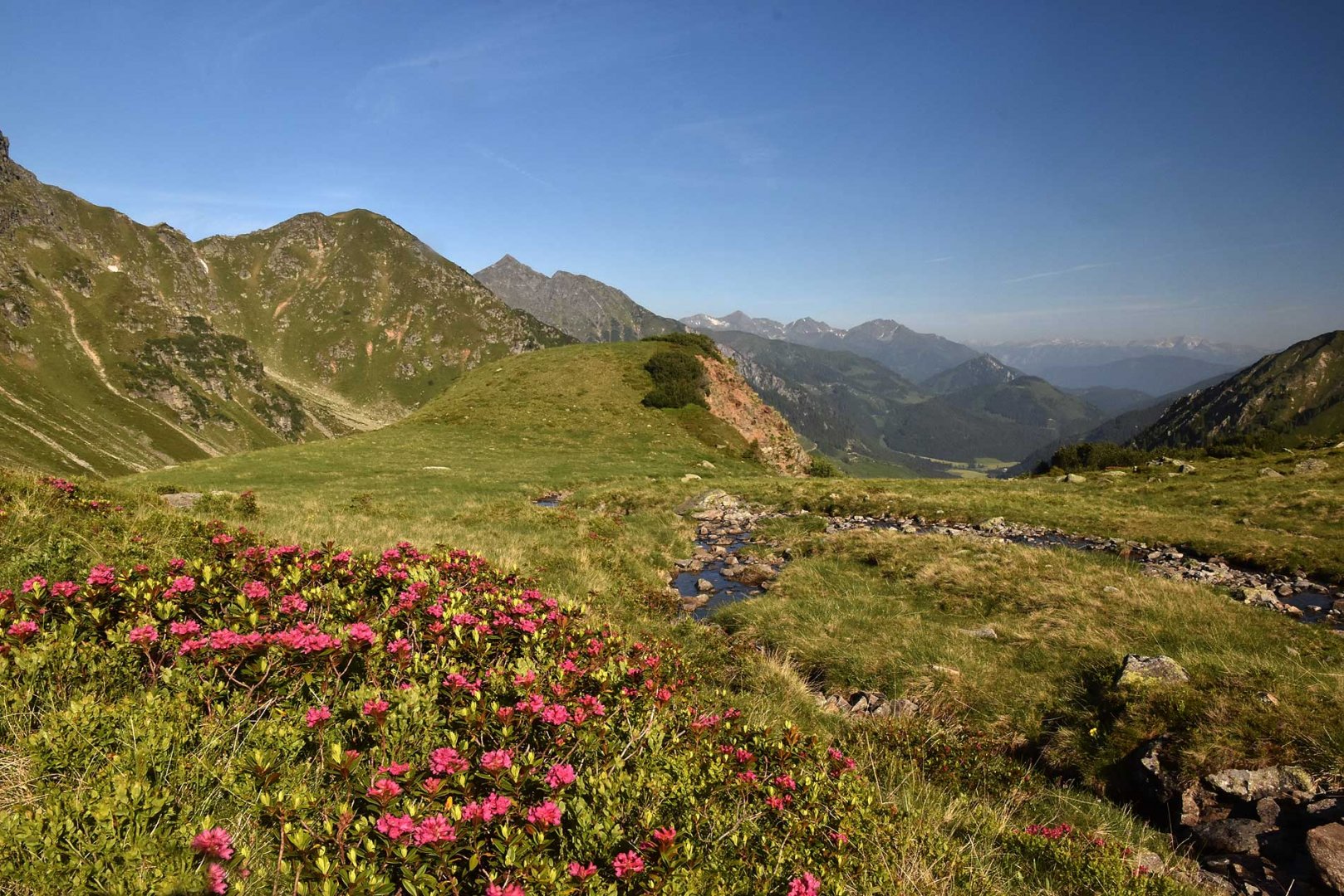
In the morning we were woken up by a rather strong wind, but otherwise the weather was still perfect. After breakfast we started to descend the mountains. A beaten path leads around a stream. It may not be a marked path, but we found it to be quite busy. We passed a few hikers who were climbing in the opposite direction. The descent is fairly smooth and we soon found ourselves in a pasture. We joined a wide forest track and followed it back to the pub by the car park. We managed to have one more departure beer and then headed back to the homeland.
Difficulty
A classic mountain trek. The elevation gain is about 1200 vertical metres. The ascents to the individual mountains are steep but short. The whole time you walk on mountain paths or trails. In some places it is necessary to use your hands for walking safety. The descent from the Kerschkern to the saddle is probably the steepest. We walked it with heavy backpacks and even less physically fit individuals made it without any problems.
Water availability
You can get water from the streams, which are quite numerous on the way to the Bärensuhlsattel. The last one is about 200 metres from the saddle in a meadow. The next stream is up in the saddle by the Schaunitzsee lake, where we spent the night. The next day you actually walk along the stream all the time, so refilling liquids is not a problem.
Sleeping options
We spent the night in the saddle at Lake Schaunitzsee. It is an ideal place for bivouacing. The saddle is wide and there is plenty of water.
Mountain peaks
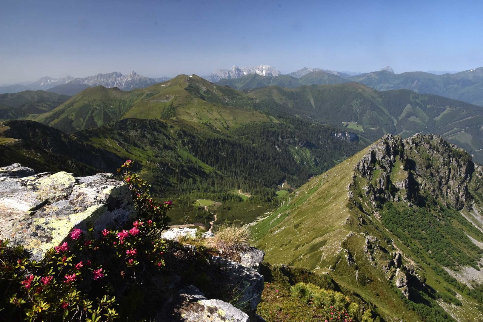
On the route we climbed the following peaks - Lattenberg 2 018 m above sea level, Goldkogel 2 080 m above sea level and Kerschkern 2 225 m above sea level. The views are great, especially of the Low Tauern, but also of the Ennstal Alps, Totes Gebirge, Dachstein and others.
Danger
There is no exposed section of the route. Some passages are steeper and it is good to help yourself with your hands. Especially on the descent from the Kerschkern mountain. However, you walk along the mountain path the whole time, so there really is no problem. In summer, of course, you have to watch out for thunderstorms.
Food
There is no hut on the route, so it is necessary to have all the food with you.
Photos