Mountain range, region / State
Seckauer Tauern / Austria
Season
Fall
24. 09. 2022
Difficulty
1 / 5
Elevation
↑ 693 m
↓ 693 m
Length
9.7 km
5 hours
Altitude
max. 1846 m n.m.
min. 1283 m n.m.
Tourist map of the Seckauer Tauern
Tips for hikes in the mountain range Seckauer Tauern
Circular hike in the eastern part of the Seckauer Tauern
Climbing the Bremstein mountain in Austria
Starting point
Grassy parking area at the end of the forest road leading from the village of Wasserleith.
Description of the hike
When we arrived in the mountains in the evening, we were unpleasantly surprised by a barrier about 1 km from the Untere Bodenhütte huts on the dirt road. On a previous visit we had parked right next to these huts. However, it did not complicate our plan too much. We were the only ones at this place and so we enjoyed a comfortable sleep in the boot of our car.
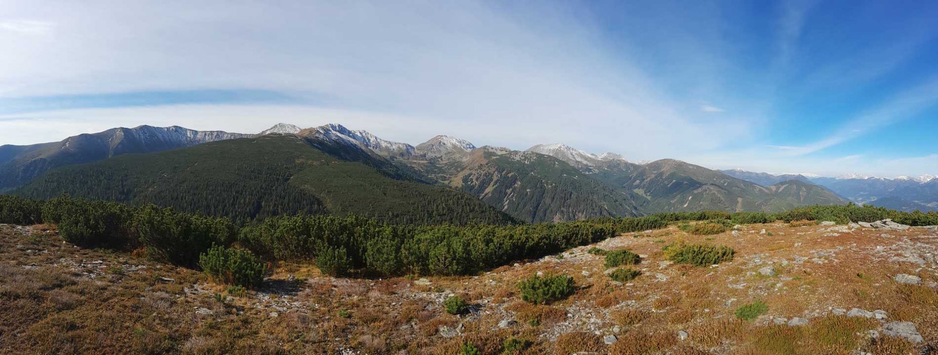
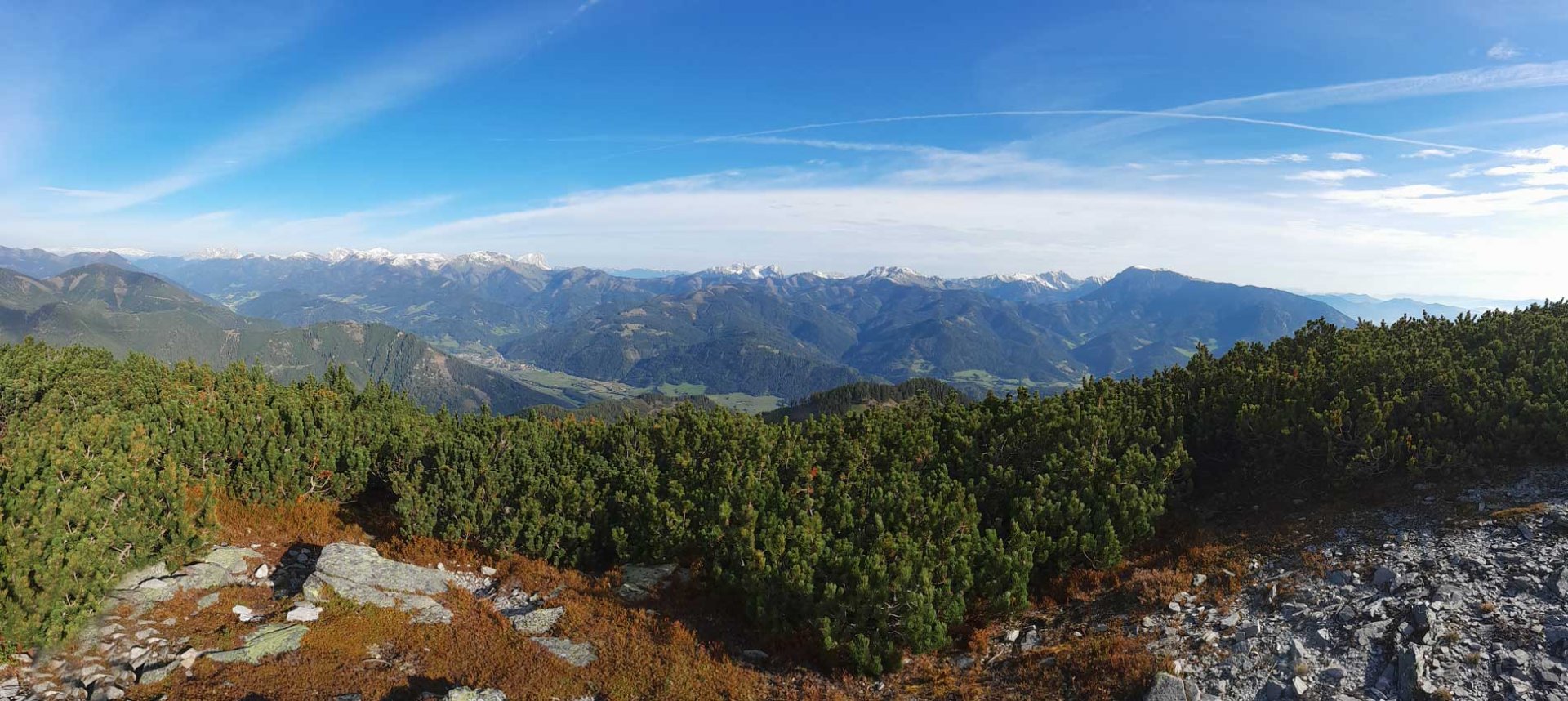
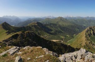
In the morning we set off along the road and reached the cottages first. We continued along the creek and started to climb a bit more. The wide path led us to the saddle below Mount Bremstein. Here we left it and climbed up the mountain along the trail. First on the meadow, then among the slash and burn. Mount Bremstein is a great scenic mountain. The views of the Seckauer Tauern or the Northern Limestone Alps are great. After a longer rest we continued along the broad ridge to the Mitterkogel.
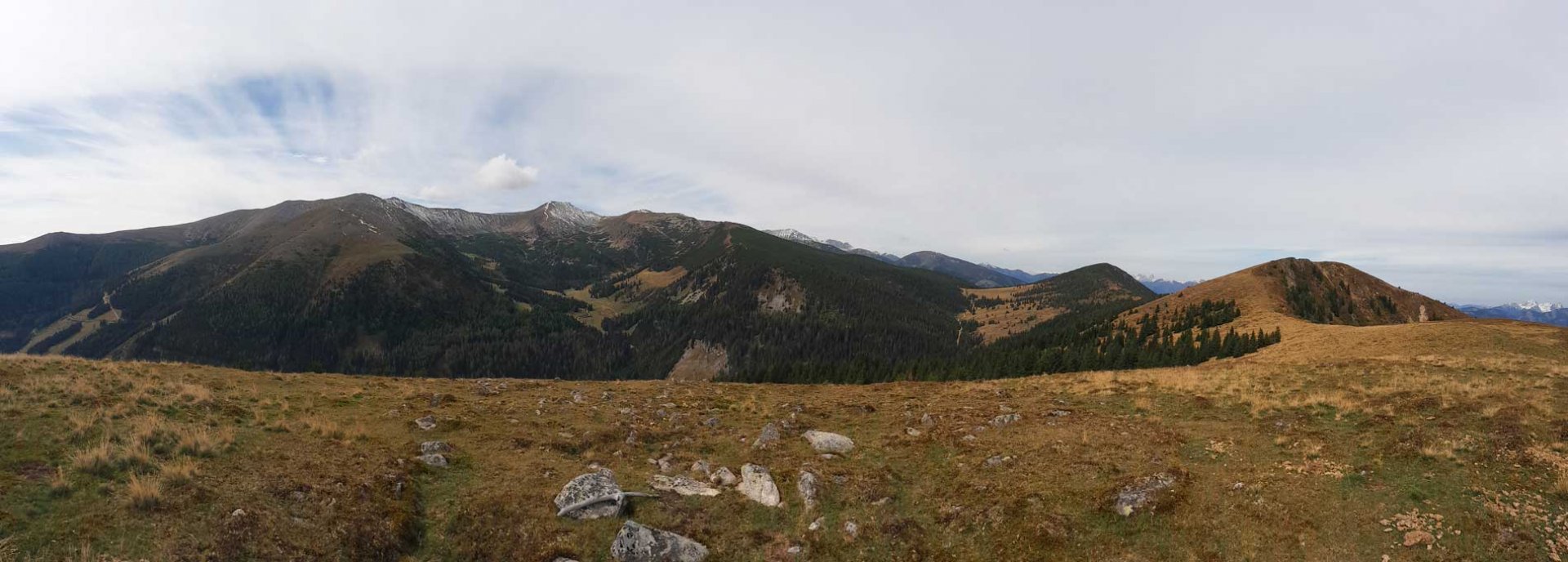
The path leads along a wide ridge to the Antonikreutz cross. Here we left the marked trail and continued on to the Mitterkogel mountain. The marked path does not lead to it, but there is a trail. After another rest at the top of the mountain, we started to descend.
Again, first on meadows, then we entered the forest. In the saddle below the Speikbichl mountain we left the ridge and descended to a wide forest path. After some time we descended steeply again through the forest to another forest path. By then we could already see the parking lot below us, which was already full of cars. The last shortening of the route was probably the most difficult, the slope was full of stones. Eventually we successfully joined the valley road and returned to the car.
Difficulty
A very easy hike in the lower part of the Seckauer Mountains. The vast majority of the trip is on wide roads or mountain trails. The elevation gain is relatively small for the Alps. There are no steep climbs. We made the descent a little more difficult by cutting the last section through open terrain. Which was not entirely pleasant and comfortable, but we saved ourselves about 2.5 km of the way to the parking lot. The route is ideal for a bit more fit children or dogs.
Water availability
On the way to the saddle below Mount Bremstein there are several streams, from which we also refilled water. There is nothing further on the ridge. There was more water only during the descent in the forest. We had 1.5 litres of water per person.
Sleeping options
After arriving at the barrier in the evening, we spent the night in the car.
Mountain peaks
On the route we climbed two peaks - Bremstein 1 868 m above sea level and Mitterkogel 1 847 m above sea level. Both mountains offer great views of the Seckauer Tauern, the Northern Limestone Alps. We had good visibility, so we could see the Schneeberg almost 100 km away.
Danger
The route is very simple and safe. Most of the trail is marked. There is a path from the Mitterkogel to the saddle, but it is obvious. We descended from the saddle about 3 times on loose terrain. These were steep descents and uncomfortable in places. However, it is possible to circumvent them on forest paths. We saved time and kilometres.
Food
We didn't come across a hut on the route where they cooked. Therefore, it is necessary to have your own supplies.
Photos