Mountain range, region / State
Šumava / Czech Republic
Season
Fall
16. 11. 2022
Difficulty
1 / 5
Elevation
↑ 734 m
↓ 734 m
Length
18.9 km
4 hours
Altitude
max. 1125 m n.m.
min. 624 m n.m.
Tourist map of the route to the southernmost point of the Czech Republic
Tips for hikes in the mountain range Šumava

A short hike with children to the Žižkov Memorial at Trocnov

5-day crossing of the Bohemian Forest from Železná Ruda
Winter trip from Modrava to Březník
A trip along the Czech-Austrian border with an excursion into history
Starting point
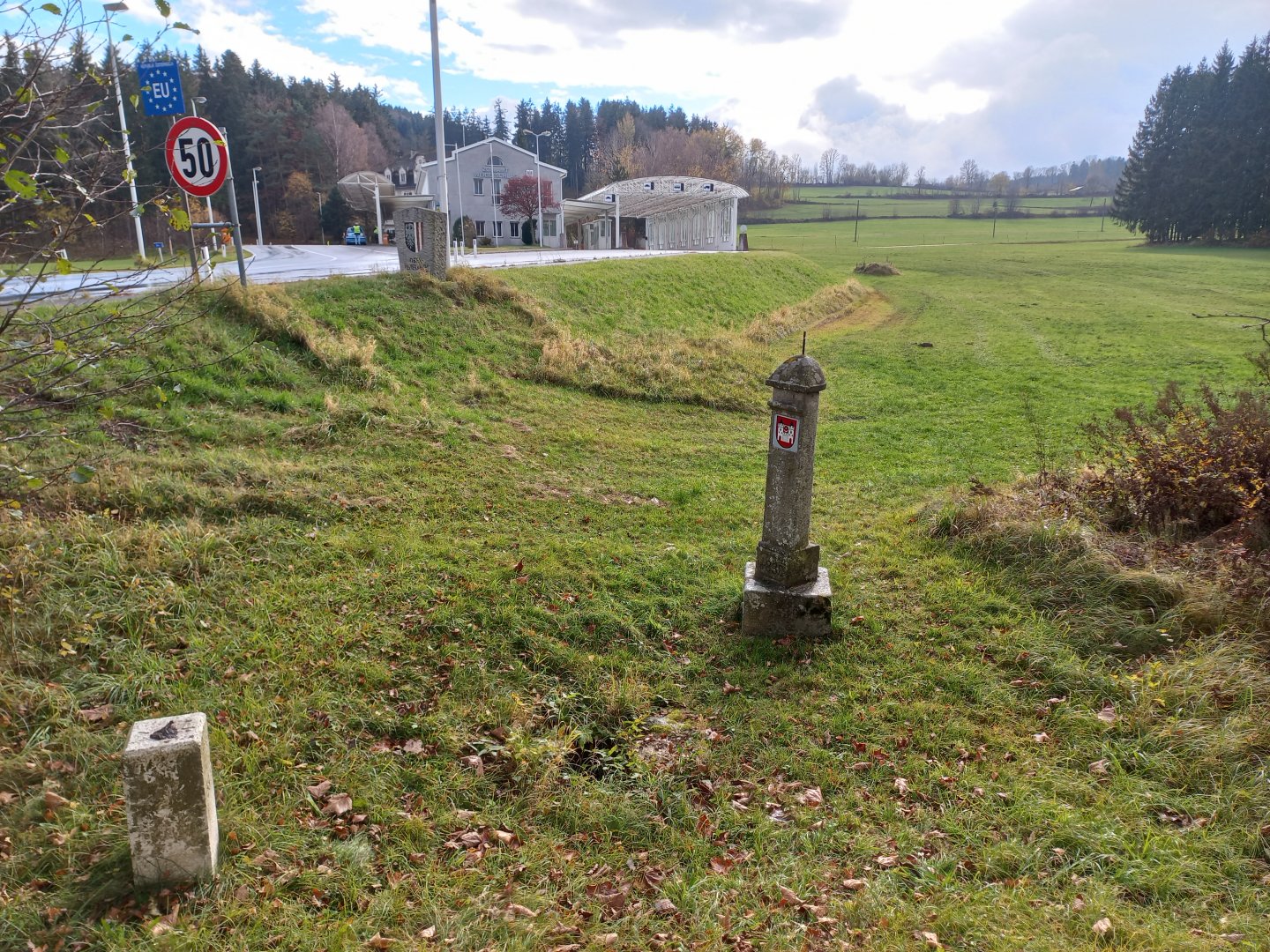
I leave my car in the unpaid parking lot right at the Studénka - Weigetschlag border crossing. At the parking lot there is a memorial and an educational board dedicated to the Czech border guards who defended the crossing in September 1938 against the German troops.
Description of the hike
I have wanted to visit the southernmost point of the Czech Republic for some time. When I studied the map, I discovered that there were other interesting things to see in the area - extinct Sudeten villages, a beautiful old lookout tower and granite cliffs hidden in spruce forests.
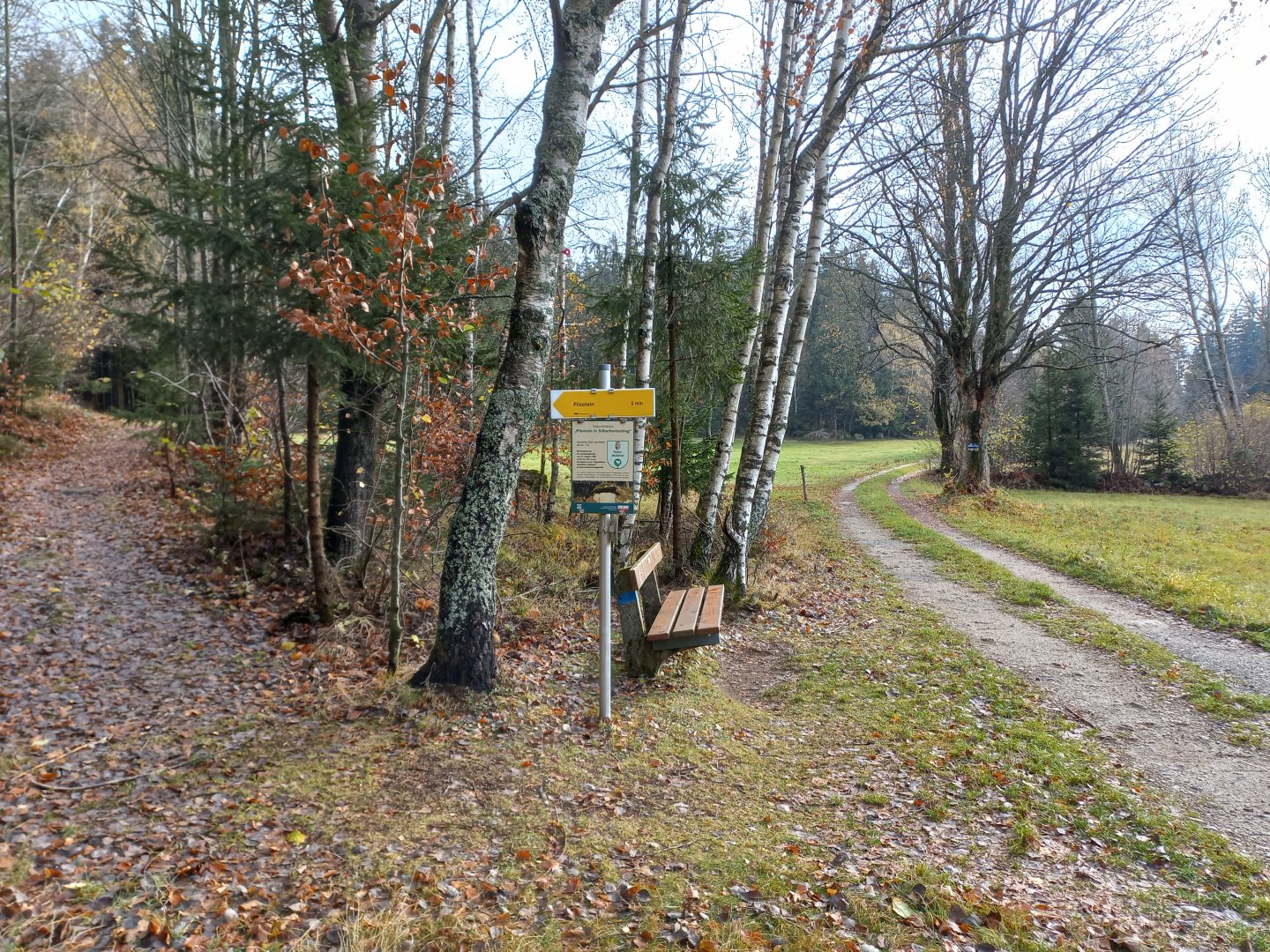
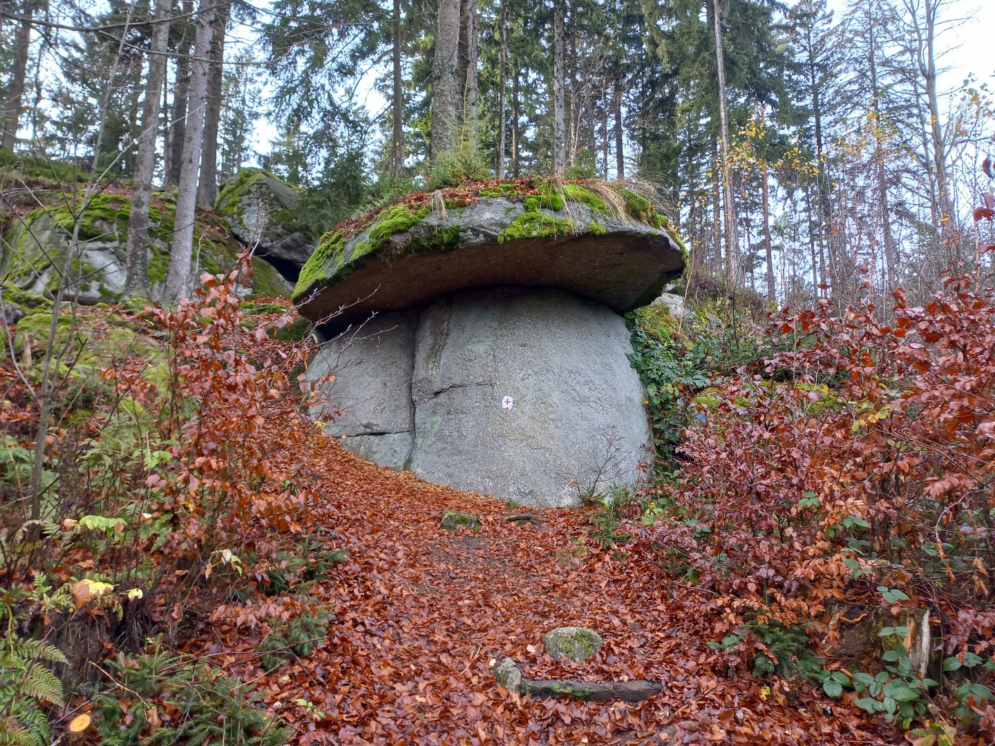
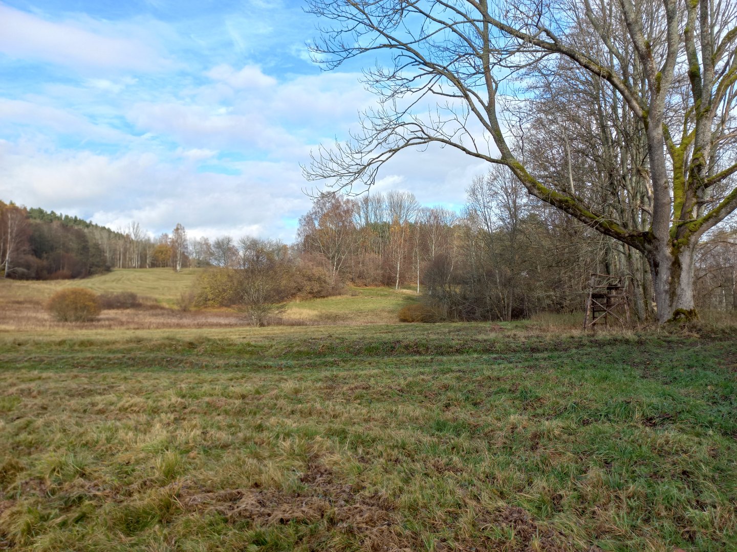
After the crossing at the car park, I turn onto the tarmac road leading to the village of Weigetschlag - a few houses, farm buildings, a small chapel at the top of the hill. After the cowshed the marked trail turns towards Pilzstein and Sternstein. After about half an hour I come to the turn-off to the Pilzstein rock formation (Pilz=mushroom, Stein=rock) and indeed after a few minutes I discover a rock ridge about five metres high.
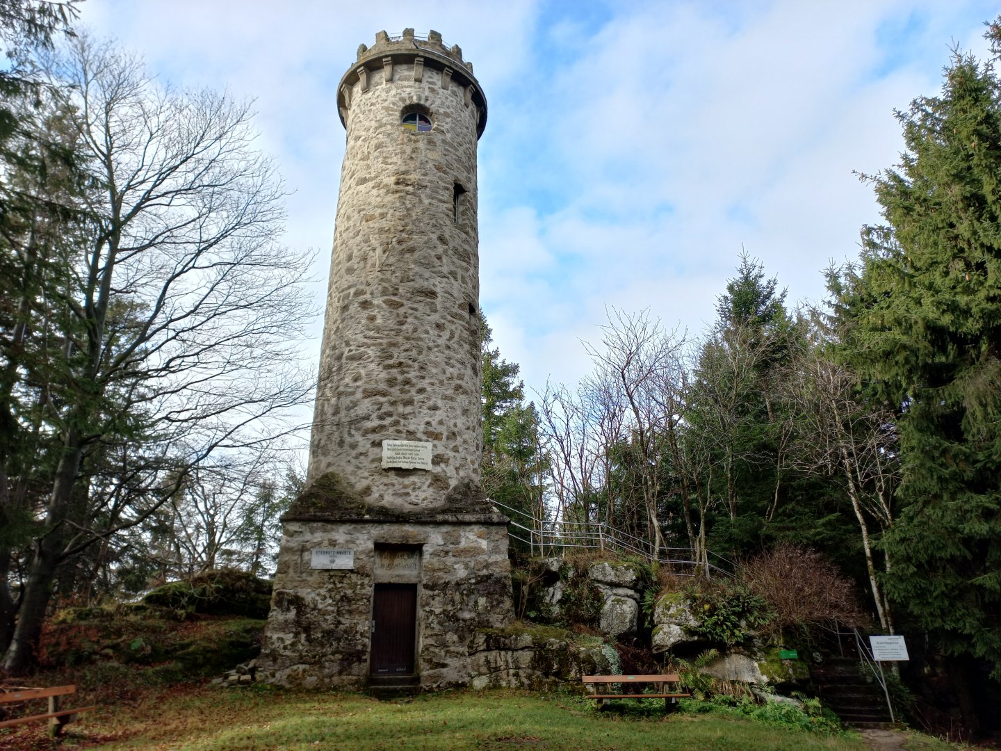
From the cap of the mushroom there is a partial view towards Bohemia. I return and continue up the Sternstein hill 1,125 m above sea level by the forest path along the cable car (only in operation in winter). At the top is the old Kaiser Franz Josef Jubilaeums Warte tower, a structure built for the 50th anniversary of the Kaiser's reign. I take a stab at the handle, the tower is open, although there is a sign on the door saying it is to be closed from November to March.
I drop a donation of 2 Euros into the money box and climb up the narrow spiral staircase. When the weather is good, the views are really far away - I'm told you can see Dachstein, well over 100km away, or Watzmann in Germany. From the lookout tower I descend to the lower station of the cable car and continue along the asphalt road to the village of Oberlaimbach. I cross the main road and turn back to Bohemia. The marked trail goes between fields along the forest.
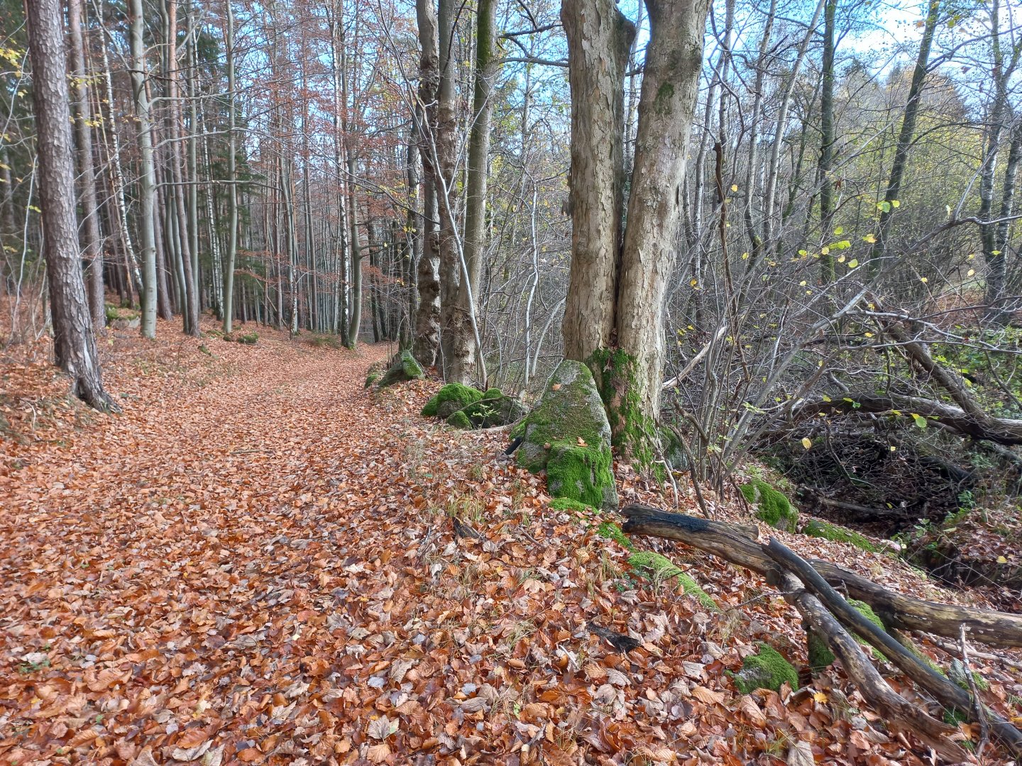
There are several interesting stops for hikers - tools made of local granite, painted signs with folk songs, or a corral with fallow deer that can perhaps be fed with grain from a vending machine. Within sight of the border there is a cascade of ponds for sport fishing. A little further on, I see a rampart with a wall of wooden poles - Swedish chances, a reminder of the fighting during the Thirty Years' War.
Below the hill in the valley is a pedestrian crossing into Bohemia and 100 metres from it the southernmost point of Bohemia, marked by a two-metre-high boulder with a metal plaque. After a short rest at the shelter, I head towards the place where the village of Radvanov - Raifmass used to stand. Since the 13th century Radvanov was the southernmost village of Bohemia, situated on the trade route from Linz.
In 1946, the Sudeten population was displaced and 4 years later the village was razed to the ground. The former village is now only commemorated by memorial plaques, a cross on the site of the former chapel and a few ruins by the roadside. I continue along the path between the fences. Along the way there are information boards on the Iron Curtain and the attempts to overcome it.
The cruel stories and period photos give me chills. At the crossroads I take the blue sign towards Studánky, but after the Boršíkovský brook I turn left and cross the meadows to return to Vyšebrodský Pass. In the place where there used to be another vanished village of Boršíkov - Woiserschlag, there is a small cross with a German inscription that brings tears to my eyes - Remembering the village of Boršíkov, razed to the ground in 1946 - We carry our homeland in our hearts. From Boršíkov it is only about a kilometre back to the car park. Below the car park there is another reminder of the old days - an overgrown pond with an embankment to the Boršíkov mill.
Difficulty
A half-day trip along the Czech-Austrian border with an excursion into history. Most of the way leads along marked hiking trails, through forests, between fields, across meadows. There are no exposed or technically difficult places on the route. Suitable for both active seniors and school-age children.
Water availability
Refreshments are available depending on the season. There are about 3 restaurants along the way (on Sternstein and in Rading), only the restaurant by the ponds in Rading is open at the beginning of November.
Mountain peaks
On the route I climb only one mountain peak Sternstein 1 125 m above sea level, where you can enjoy the view from the observation tower.
Danger
Easy route suitable for families with children.
Food
It is almost 20 km route, so I definitely recommend to bring a light snack and about 0.5 liters of water per person. You can refresh yourself at three restaurants, but they are open depending on the season (you can't always count on it).
Attractions
The history of the borderland over the course of eight centuries (from the educational sign on the Swedish chanches) The border between Bohemia and Austria originally lacked any greater significance because its crossing was made difficult by impenetrable forests. Since the Middle Ages, this was the route of trade routes that transported goods - copper, salt and other commodities - from the Alps and the southern countries to the north. The European watershed became a clearly defined land border only during the reign of Přemysl Otakar II (1246).
The state border was confirmed in place after the First World War, when in 1915 the German population on the Czech side (the so-called Sudeten Germans) unilaterally voted to annex the territory to German Austria. The border area was subsequently occupied by armed forces.
In 1938 Hitler "liberated" the Sudetenland and annexed the German-speaking parts of Czechoslovakia to the Third Reich. After the end of World War II, Czechoslovakia, on the side of the victorious powers, expropriated German nationals on the basis of the so-called Benes Decrees and expelled from its territory some 3 million people whose property was allocated to Czechoslovak nationals.
When the Iron Curtain divided Europe in 1948, the roads leading to the border disappeared and the land ceased to be cultivated. In the 1950s, most of the villages near the border were planned to be liquidated and replaced by a border zone. Over 200 villages were destroyed in Šumava alone, including cultural monuments.