Mountain range, region / State
Nockberge / Austria
Season
Fall
23. 10. 2021
Difficulty
2 / 5
Elevation
↑ 1160 m
↓ 1160 m
Length
20.4 km
7 hours
Altitude
max. 2320 m n.m.
min. 1398 m n.m.
Tips for hikes in the country Austria

Climb to the top of Scheiblingstein in the Ennstal Alps

Hiking up the Drachenwand wall in the Salzkammergut

Climbing the Schoberspitze in the Wölzer Tauern
Trek over the Bretthöhe and Großer Speikkofel mountains in the Nockberge
Starting point
Hochrindl Ski Resort. It is located southeast of the Nockeberge Mountains.
Description of the hike
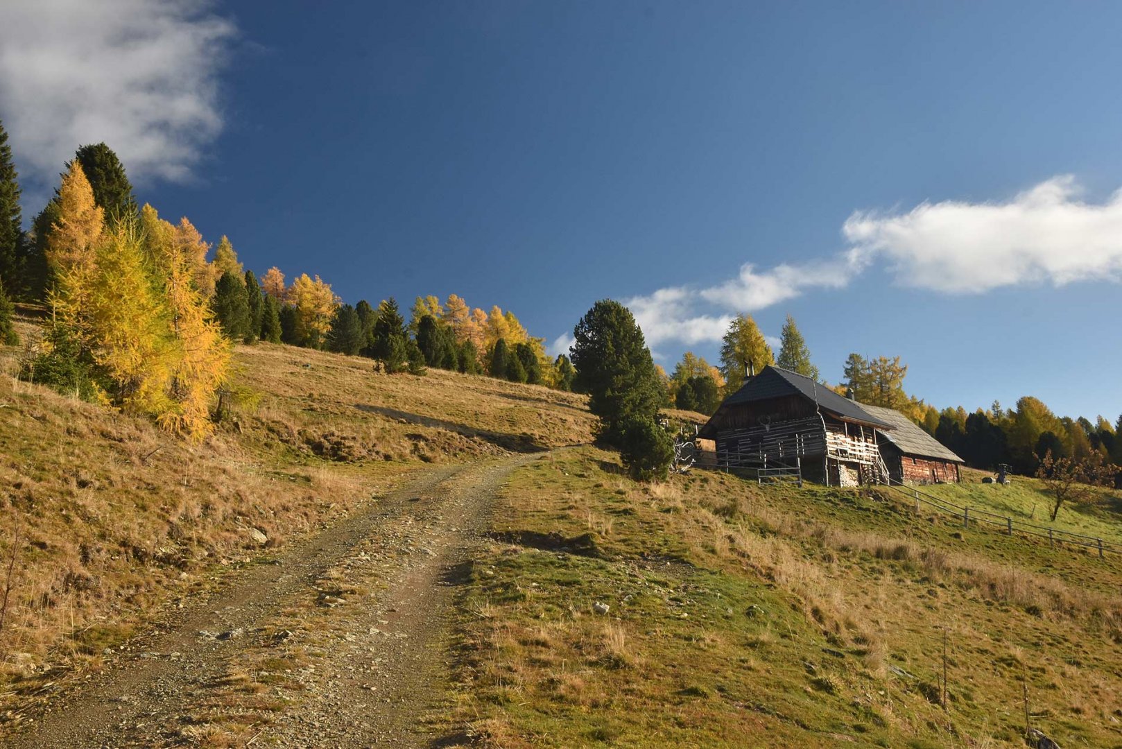
This visit to the Alps started rather unconventionally. Because of the freezing weather and some laziness (or wisdom) we decided not to spend the first night in the car or in a tent next to it, but in the warmth of the hotel. Moreover, we found the JUFA hotel right in the resort of Hochrindl, so there was nothing to worry about. A light beer in the evening, a good night's sleep, a hearty breakfast in the morning and off we went.
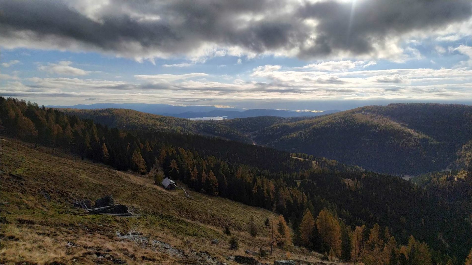
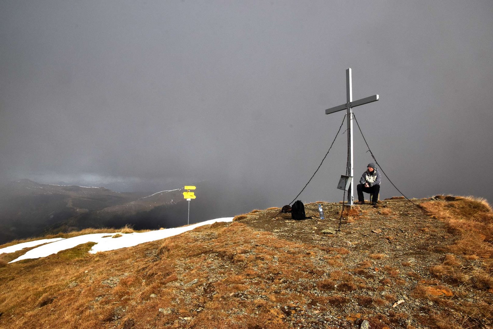
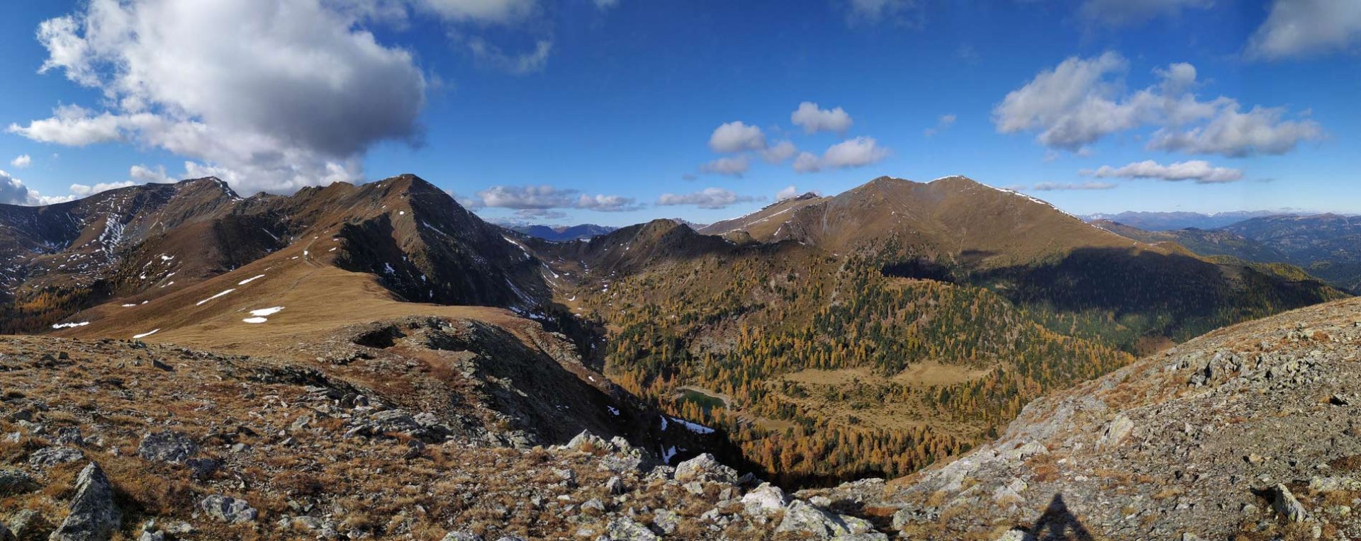
The ascent to the Nockberge ridge actually begins with a descent. We first had to descend by road and slope into the valley of the Gurk stream. Only from there did the right ascent begin. The route first follows a path through the forest. This gradually thinned out and eventually we continued on a faint path up the slope to the crest of the Großer Speikkofel. The view was slightly spoilt by clouds, but again they added the appropriate drama. We then climbed the ridge to the very large summit itself. To our surprise there is no summit cross, which is saying something in Austria. We then continued along the grassy broad ridge to Mount Bretthöhe. As we climbed it, clouds shrouded us and so for the first few moments on the summit nothing was visible. Fortunately the cloud cover partly broke and we had a view of Nockberge and the surrounding area.
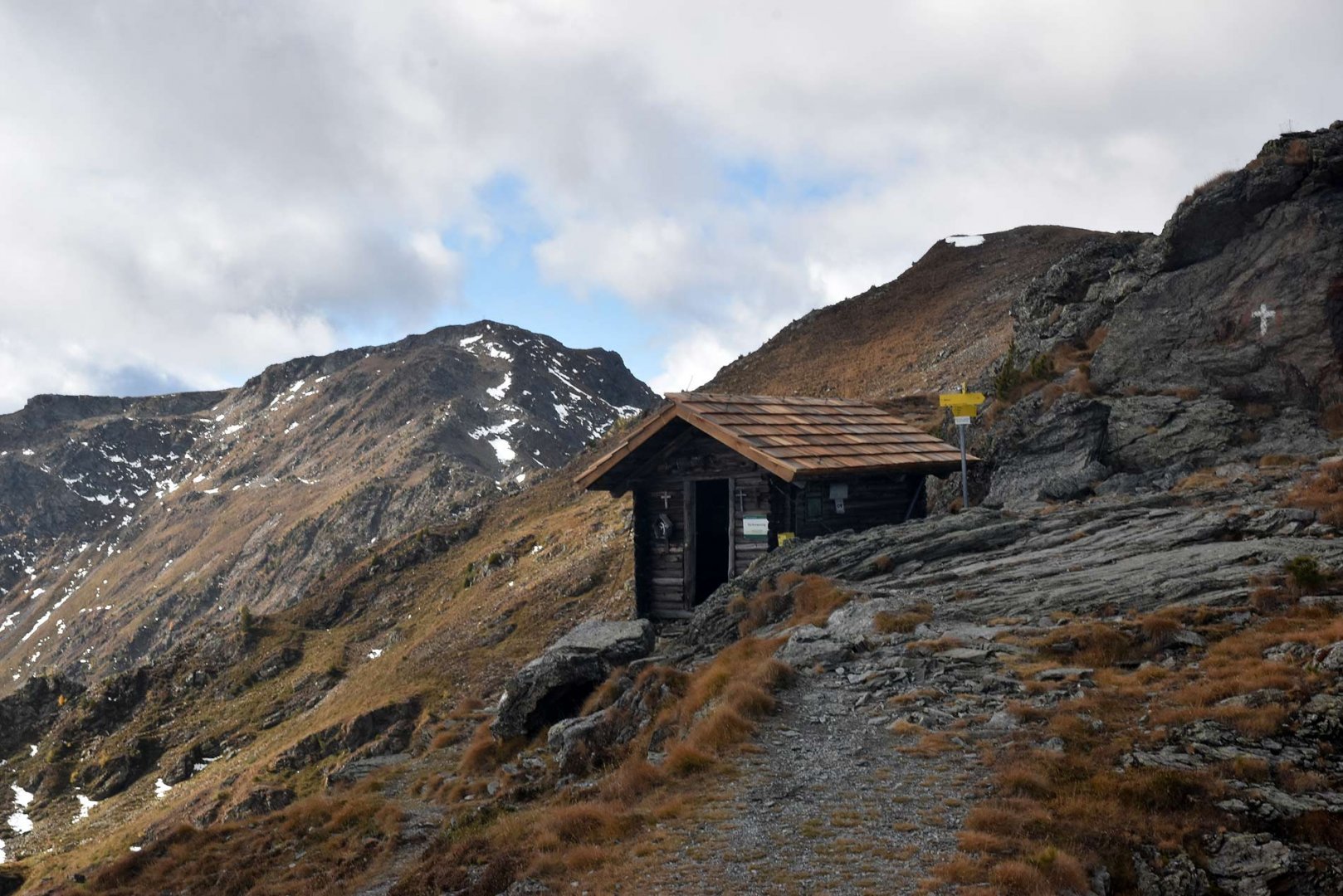
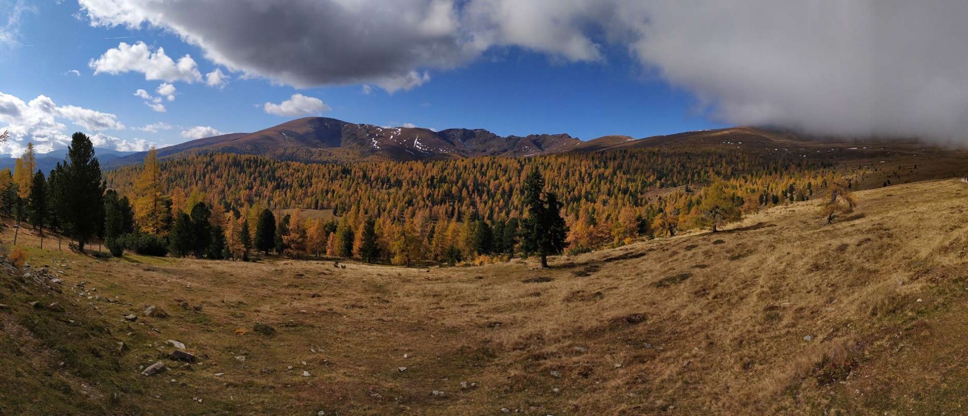
After a short rest we descended slightly into the saddle. This part of the route is the only one in rocky terrain. We crossed the trail to the Lattersteighöhe mountain. There is an emergency bivouac just below it. From the summit we continued along the wide path to the east. With this we started to leave the Nockberge ridge. The descent is very gradual and offers beautiful views of the surrounding area. Eventually the path turns south and gently descends to the tree line. Here we already met more hikers from Hochrindl. In the forest part we were again covered by a cloud, but as we were still walking on a wide path, we didn't mind. So we finally made it back to Hochrindl.
Difficulty
A classic alpine trek that is not technically demanding. The route leads along alpine trails and plains. Only the ridge between the Bretthöhe and Lattersteighöhe is more rocky. The descent from the mountains is very gradual on a wide path. The route is a bit longer, but trained children can manage it. As well as doggies.
Water availability
The fountain is during the ascent to the Großer Speikkofel near the Maieralm shepherd's hut. Then there were some streams on the way back, but since the meadows are used for grazing cows, I would probably not recommend drinking water from there. We had 1.5 litres of water per person.
Sleeping options
We spent the night after our arrival in the hotel JUFA directly in the resort Hochrindl. But there are more accommodation options. Right on the route there is the possibility of staying overnight in a bivouac under the Lattersteighöhe mountain.
Mountain peaks
The following peaks are climbed on the route - Großer Speikkofel 2 270 m above sea level, Bretthöhe 2 320 m above sea level and Lattersteighöhe 2 264 m above sea level. The views are not only of the Nockberge, but also of the High Tauern and Low Tauern mountains.
Danger
This is a classic alpine trek. The vast majority of the time it is on roads or alpine trails. There are no exposed places. Occasionally you need to lean on your hands when descending from Bretthöhe, but even here it is not difficult. Basically, this is an ideal route for hikers who have not yet had much experience in the Alps.
Food
There is no mountain hut on the route, so it is necessary to have your own supplies. The trail is quite long, so it is good to have a bigger bastion in addition to some bars.
Photos