Mountain range, region / State
/ Austria
Season
Spring
30. 04. 2023
Difficulty
3 / 5
Elevation
↑ 1269 m
↓ 1383 m
Length
16.6 km
6 hours
Altitude
max. 1372 m n.m.
min. 453 m n.m.
Tips for hikes in the mountain range
Winter trek to Mount Eisenstein in the Türnitz Alps
Spring hiking in the Türnitz Alps
Starting point
Village Sankt Aegyd am Neuwalde, plenty of parking space.
Description of the hike
Two hours drive from our border, the first Alps begin. They don't reach dizzying heights yet, but you can see the two-thousanders from them. One nice scenic route is the crossing from Sankt Aegyd am Neuwalde to the Türnitzer Höger.
I leave early in the morning from the village of St. Aegyd. The town basks in the morning sun and the snow-capped massif of Göller shines above. From the little church of Osterkircherl it's an almost kitsch view - colourful houses, green hillsides, white mountain peaks and blue skies. A short distance from the church, the Hans Wancura Steig begins, which takes me up the serpentine path to the first alm Bürgeralpe. The Wancura steig was marked out in 1937 and is copied by a more recent nature-themed nature trail for children. Bürgeralpe is a large pasture at 1000 m. Views of other mountains open up here - to the left of Göller is the rocky Gippel, and to the right are the mountains at Mariazell, Hochschwab, Dürnstein and Ötscher.
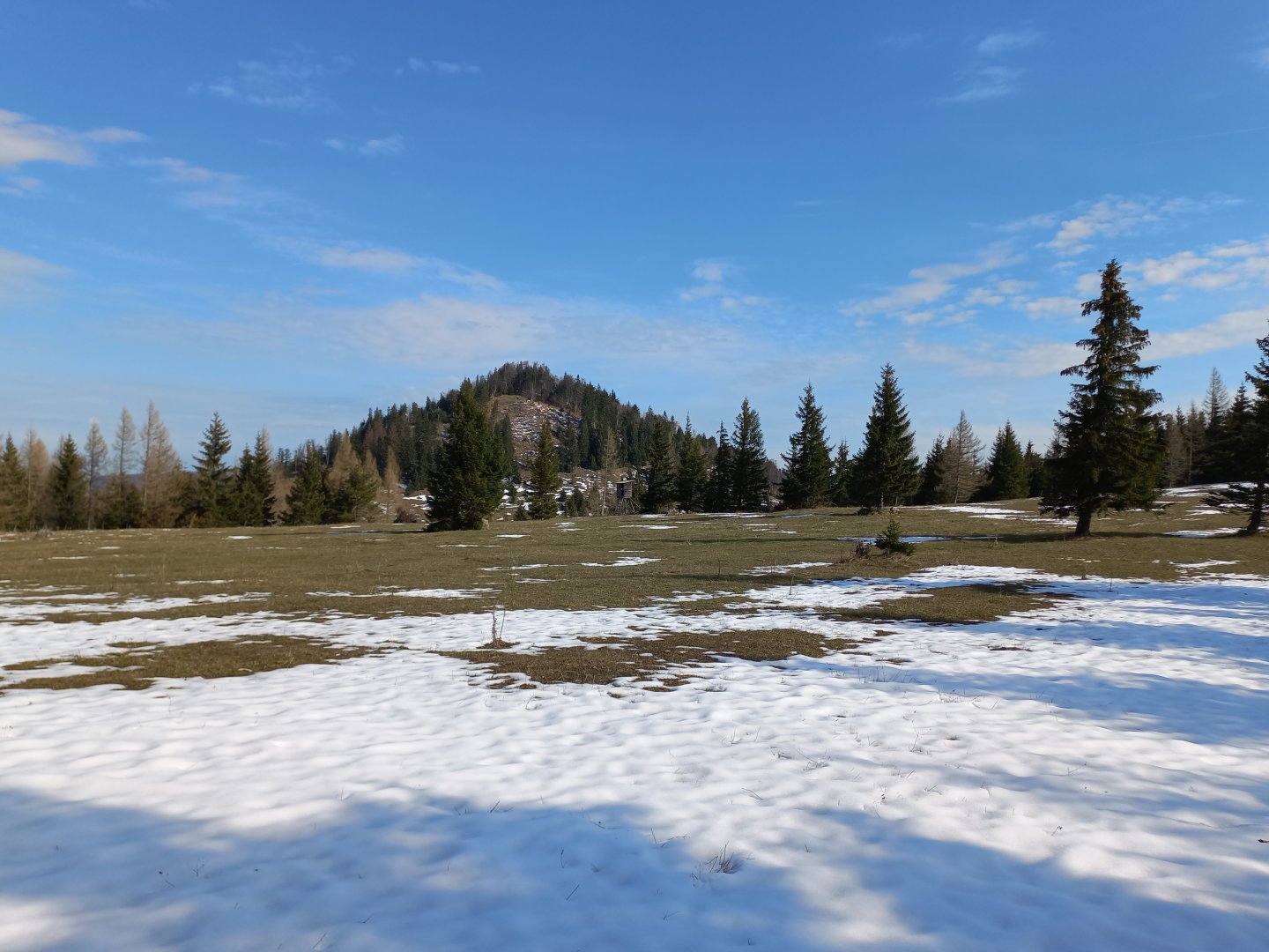
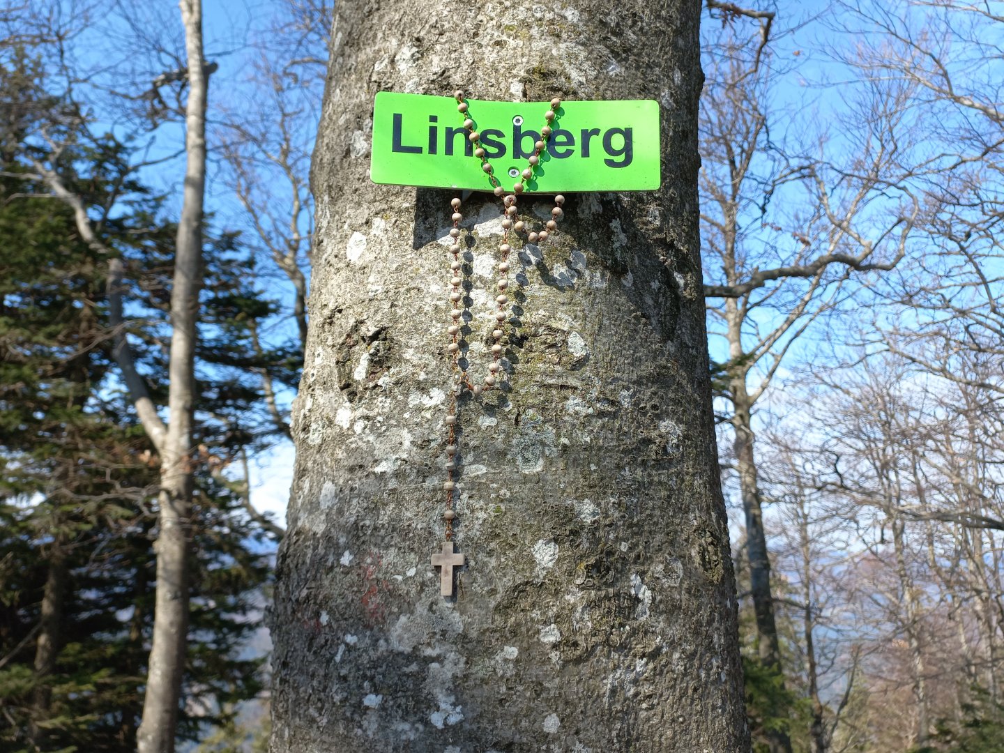
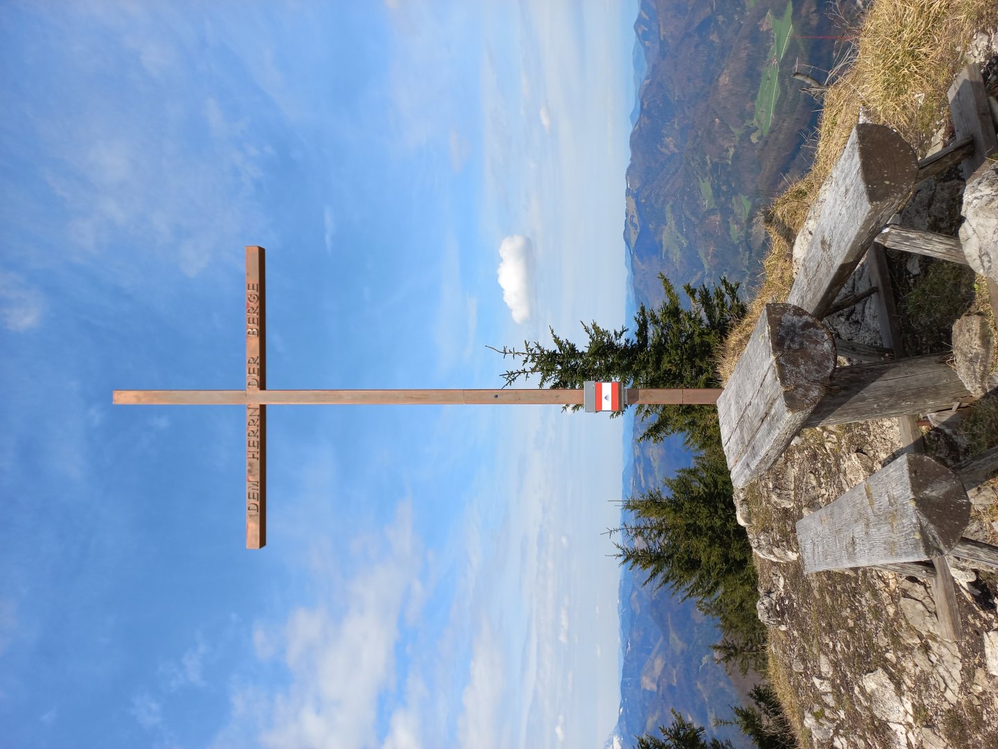
I continue along the wide path along the almo to the Zdarsky Hütte. After the hut I turn left into the forest. It's only a short distance through the trees, but after a while more pastures begin and the Paulmauer hill (1248 m), the first peak on the way, rises. Paulmauer looks inconspicuous from the south, but when you get to the cross, your head spins from the steep face and the deep view of the valley on the other side. Here you will see a wide panorama of mountains to the southwest with Ötscher dominating. In front of it on the lower Tirolerkogel you can make out the red roof of the Annaberger Haus. From the Paulmauer you can also see the next part of the road to the north - the smaller peaks of the Linsberg (1238 m) and Stadelberg (1226 m) and the higher Türnitzer Höger (1372 m).
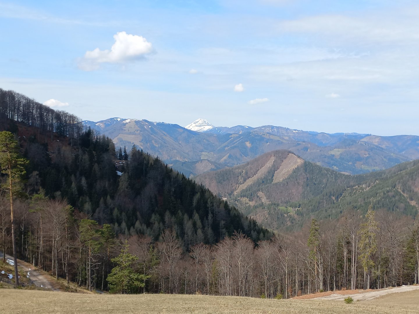
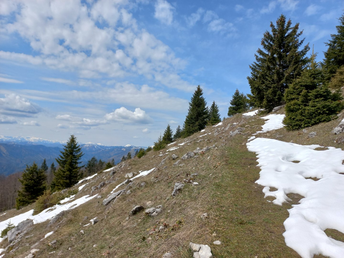
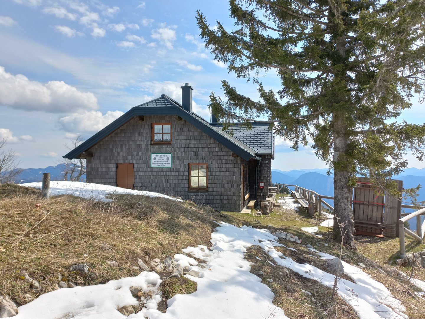
After resting for a while I descend through beech forest to another meadow and from there I climb slightly to Linsberg. The top of Linsberg is wooded, I almost miss the old rusty cross among the trees. Someone has hung a rosary and a small sculpture of the Madonna and Child on a tree. Between Linsberg and Stadelberg it is possible to descend a few dozen metres to the Gschwendt Hütte. Beyond Stadelberg the path leads down to a meadow at about 1100 m, the Türnitzer Höger looks like a huge molehill from it. I have already climbed about 800 metres and so my legs protest a bit. I slowly climb up through the trees and rocks and finally see the Türnitzer Hütte hut. I don't regret the climb, from the hut there is a perfect circular view - to the north the plains of Lower Austria, to the south the two-thousand-foot Schneeberg, Raxy, Gippel, Göller, Hochschwab, Mariazellnerland, Ötscher. The chalet is open on weekends and free days from May to October.
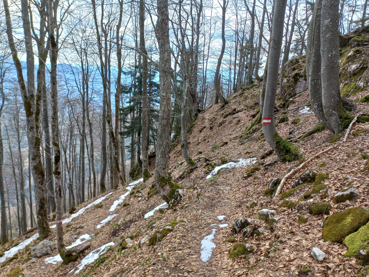
When I finally get some energy, I say goodbye to the mountains and descend towards the village of Furthof down in the Traisen valley. The beginning of the descent is quite steep, sticks are definitely useful. Across the clearings you can see the opposite ridge Mückenkogel (with the transmitter) - Hinteralm - Reisalpe. Below, there is a forest path and the wide Forststrasse along the stream. In the valley there is a bus and train back to St. Aegyd, or you can try hitchhiking and talk to the locals about the beauty of the local mountains.
Difficulty
A scenic route in the nearby Alps, following marked trails. The elevation gain is more than 1000 metres, so a good fitness is recommended. The most challenging is the ascent and descent of the Türnitzer Höger. The route is also suitable for children and dogs.
Water availability
There are several huts along the route where you can refresh yourself and replenish liquids.
Sleeping options
There is plenty of accommodation in the valley, you can also spend the night in cottages.
Mountain peaks
Ascent to the peaks Paulmauer, Linsberg, Stadelberg a Türnitzer Höger. Views of the mountains Schneeberg, Gippel, Göller, Mariazellnerland, Hochschwab, Gemeindealpe, Ötscher, Reisalpe.
Danger
The route is not dangerous, it leads along marked trails.
Food
Along the way there are several huts offering refreshments e.g. Zdarsky Hütte or Türnitzer Hütte, down in the valley there are inns.