Mountain range, region / State
Novohrad Mountains / Czech Republic
Season
Summer
23. 08. 2023
Difficulty
1 / 5
Elevation
↑ 294 m
↓ 293 m
Length
8.0 km
2 hours
Altitude
max. 778 m n.m.
min. 531 m n.m.
Tips for hikes in the mountain range Novohrad Mountains
Hike through the Tereza valley near New Castles
Trip from Kaplice to the lookout tower Hradiště Hill
Starting point
The town of Kaplice is located on the main road from České Budějovice to the state border with Austria. We left the car a short distance from the main square.
Description of the hike
Before visiting the Alps we decided to take a short acclimatization trip in the beautiful landscape of the Novohradské hory. The lookout tower Hradiště vrch was an ideal option as it is located on the route to Austria.
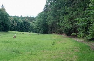
We left the car in the streets of Kaplice and set off to the lookout tower in the heat. First, we walked through the town and joined the red hiking trail. After the river we left the road and walked up the meadow above the town. We followed the dirt road for a while, but soon rejoined the road. This part of the road is unfortunately unpleasant as you have to watch out for passing cars. We passed through the village of Blansko and after it we turned onto a forest road. By then we were already on the blue hiking trail. We rested at the Chapel of the Holy Trinity and continued into the forest. At first the climb is gentle, but gradually it gets steeper. Eventually we reached the lookout tower and climbed the spiral stairs to the viewing platform.
The views were great, with the rocky peaks of the Dachstein and Totes Gebirge to the south. After a short rest at the lookout tower we headed back. We chose a slightly different route from the tower. First we reached the highest point of Hradiště Hill and then we started descending along an unmarked forest trail. It gradually turned and soon we joined the blue hiking trail, which we followed back to Kaplice. After the village of Blansko we disconnected from the road and continued along the dirt road to Kaplica. Above it we joined the red tourist marker and returned to the town.
Difficulty
A very easy hike, mostly on marked trails. The steepest ascent is just below the lookout tower in the forest. The route is not long, it is ideal for families with children or dogs. A stroller would probably have a problem with the terrain in the highest passages. The path is rocky and full of roots in places.
Water availability
We didn't come across any springs, so it is necessary to have at least 1 liter of liquids per person. The pubs are of course in the town of Kaplice.
Sleeping options
There is a large number of accommodation capacities in the surroundings of Kaplice.
Mountain peaks
The main destination of the trip - Hradiště hill 780 m above sea level offers a great view of the region thanks to the lookout tower. The distant peaks of the Alps - Dachstein, Totes Gebirge and others - are easily visible. Of course, there is a good view of the whole part of South Bohemia.
Danger
Technically, the route is very simple, mostly on forest paths or trails. Unfortunately, part of the route is on the road, so you have to watch out for passing cars.
Food
There are several pubs in Kaplice. There are no refreshments further along the route. Therefore it is good to have some snacks with you.
Photos