Mountain range, region / State
Radstat Tauern / Austria
Season
Summer
03. 09. - 05. 09. 2021
Difficulty
3 / 5
Elevation
↑ 2428 m
↓ 2428 m
Length
28.6 km
3 days
Altitude
max. 2680 m n.m.
min. 1212 m n.m.
Tourist map Radstaten Tauern
Tips for hikes in the mountain range Radstat Tauern
Circular hike in the Radstadt Tauern with ascent to Grosser Pleisslingkeil and Glöcknerin
Ascent of the Mosermandl mountain by the northern route
Ascent to the Mosermandl mountain in Radstater Tauern
Starting point
Large car park at the end of the toll road - 6 Euro/car. The toll is paid from Lake Jägersee. The road here leads from the tourist resort of Wagrain, north of the Mosermandl mountain.
Description of the hike
1. day
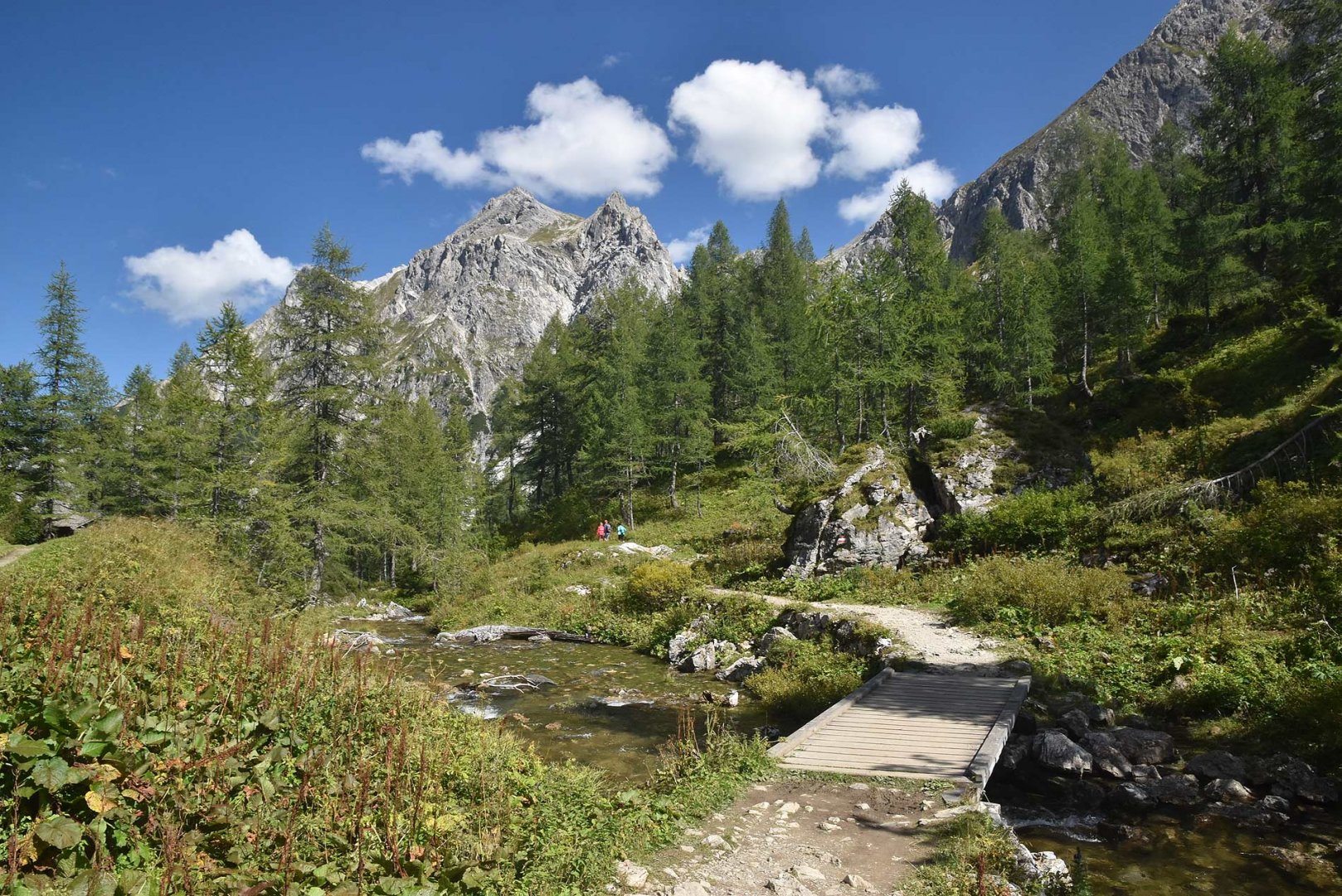
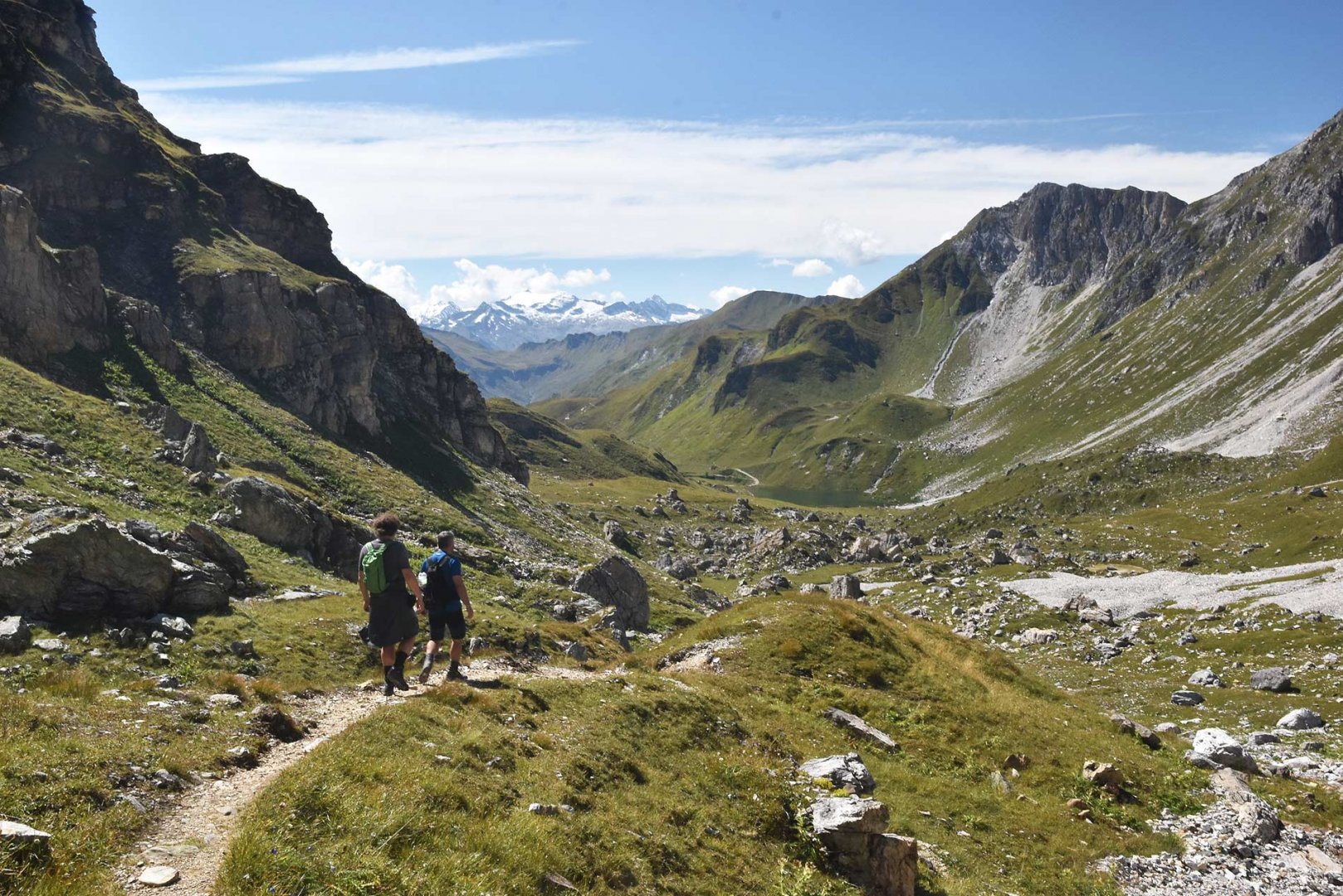
We arrived at the parking lot at the bottom station of the freight cableway a little after lunch. It was already totally full and it was clear that Lake Tappenkarsee is an attractive destination for tourists. This was also confirmed. There is a wide path leading from the parking lot to the lake, but it has to cover almost 600 vertical meters. There are plenty of serpentines to make the climb less steep. Even so, we worked up quite a sweat, especially when we had to respond several times a minute to greetings from tourists descending from the lake. Nevertheless, we still had plenty of strength. Plus, we were walking in the forest, so the sun wasn't beating down on us as much. Moreover, the journey was made more interesting by a beautiful waterfall.
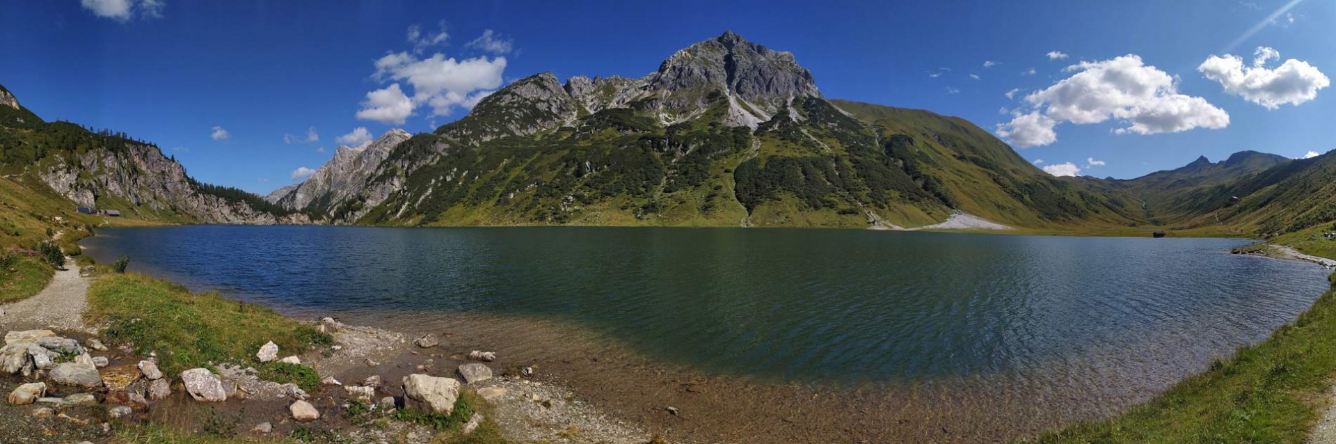
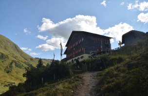
After reaching the lake, the climb finally stopped. We followed the trail around the lake to the end and had a beer at the Tappenkarseehütte hut above the lake. We rested a bit as we had another climb up the saddle. At the same time the assumption that all the hikers stayed at the lake was confirmed. We continued on our own. From the lake you go to the saddle along the trail. The climb is quite steep, so we walked quite slowly. From the saddle, we then had an amazing view of the Weißeck and Mosermandl mountains. We continued on from the saddle along the trail. We descended some 200 metres, but then we reached the Franz Fischer Hütte almost on flat ground. It is quite difficult to pitch a tent in its surroundings. Moreover, it is a protected area and it is forbidden. And the cottager was very accommodating, so he finally offered us to sleep in a winterraum for 10 Euro per night per person.
2. day
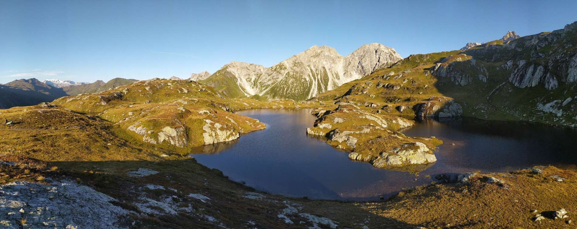
In the morning we had a hearty breakfast and set off in the direction of Mosermandl. The cottager advised us that it was better to ascend from the south and descend to the north. Therefore, we took the trail from the hut. We took only small backpacks, the rest of the stuff we left in the winterraum. The weather was great and the tiredness from the previous day had passed easily. The trail goes past the beautiful Essersee lake. After about 2.5 kilometres we reached a turn-off directly on the Mosermandl mountain.
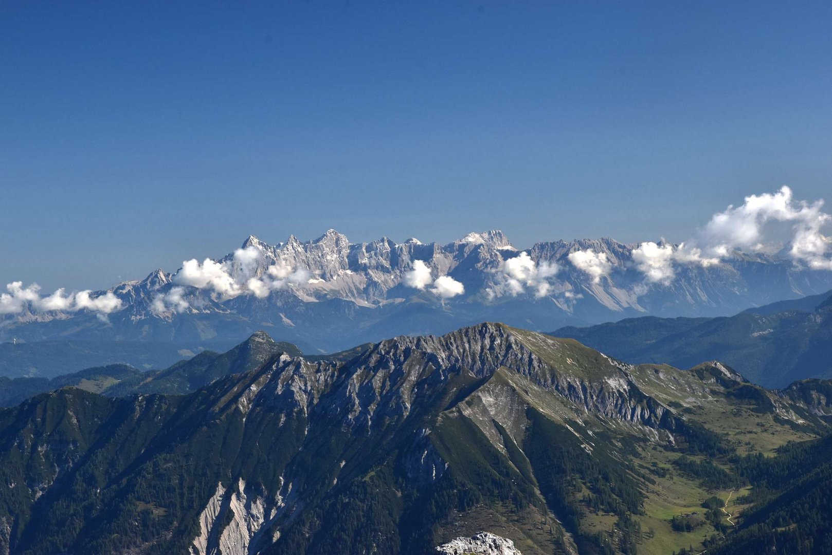
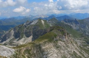
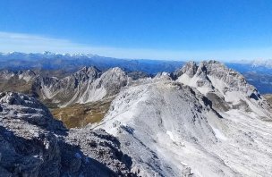
The first part of the ascent leads through a meadow, but then there is a steep ascent through a debris field. It goes straight on, there is no turning off. The end of the climb is already purely in the rock, but the climbing is very easy, there is not even a steel rope stretched. The view from the top is great in all directions - the High and Low Tauri, Dachstein, Hochkönig, Tennengebirge and more.
The descent from the mountain to the north is via a rock chimney, secured by a light klettersteig. The frozen snow and the icy steel rope were unpleasant. Otherwise the descent is not a problem for a more experienced hiker. A beginner should definitely have ferrata equipment. From the rock we descended to the saddle and again on the recommendation of the hutmaster we ascended the Windischkopf. It may be a 100m elevation gain, but we avoided the unpleasantness of traversing the mountain in rocky terrain. Eventually we descended steeply into the saddle and followed the trail back to the Franz Fischer Hütte. Here we had lunch and a good rest. Then we headed back to Lake Tappenkarsee. We followed the same path as the previous day. We again had a beer at the Tappenkarhütte and finally reached the top station of the freight cable car, where we spent the night in the open air.
3. day
This day was purely about the descent back to the parking lot. So in the morning we packed up and headed back. Once again we had serpentines, but at least there weren't so many people going against us and we could enjoy the trip more, including the views of the massive waterfall. After descending about 600 meters we were back at the parking lot, which was starting to fill up with tourists again. We, however, had completed our trek.
Difficulty
Quite a demanding trek, mainly because of its length - about 30 km. The total elevation is over 2,400 m and a large part of it is done with a heavy backpack. Most of the route is on footpaths or mountain trails. The actual ascent and descent of Mosermandel is something else. The ascent is very steep in a debris field. The finish is in the rock, but it is nothing technically demanding. However, you definitely need to use your hands to climb. The descent from the mountain is even guided on an easy klettersteig - difficulty A/B. However, the route leads through a narrow chimney, so it is not airy. We didn't use ferrata equipment, nor did any of the other hikers on the route. It is about 100 vertical meters. The route is definitely suitable for more experienced hikers.
Water availability
Water can be refilled at the huts along the way. In addition, there are plenty of streams along the route. Here you just have to watch out for grazing animals. There are a lot of them and they definitely exercise their needs directly into the watercourses. But there are certainly enough small streams and springs to drink from. Tested. For the climb up Mosermandl we had enough 1,5 liters per person. There are no more springs at the top.
Sleeping options
You can spend the night at the huts on the route - Tappenkarseehütte and Franz Fischer Hütte. Otherwise it is forbidden to camp around the Franz Fischer Hütte, it is a protected landscape. However, the hut master told us that if we could not see from the hut, it would not be a problem.
Mountain peaks
The main destination of the trek is the mountain Mosermandl 2 680 m above sea level.The next mountain on the way back is Windischkopf 2 609 m above sea level.Both offer great views of the High and Low Tauern, Dachstein, Hochkönig, Tennegebirge and more.
Photos