Mountain range, region / State
Radstat Tauern / Austria
Season
Summer
24. 07. 2022
Difficulty
3 / 5
Elevation
↑ 1203 m
↓ 1202 m
Length
12.6 km
6 hours
Altitude
max. 2441 m n.m.
min. 1631 m n.m.
Tourist map of Radstat Tauern
Trek across the Groβer Pleiβlingkeil and Glöcknerin mountains in the Ratstadt Tauern
Starting point
Free parking at the Felseralm Youth Hostel. A road leads here, which turns off the main road about 2 km before Obertauern in the direction of Radstadt.
Description of the hike
Obertauern is a ski resort that in summer is a bit like a ghost town. The apartments are empty, most of the shops in the centre are closed, and motorcyclists heading to Lungau are speeding through town. The only two lifts that run in summer are the one below the Seekarspitze to the Hochalm, where you can walk between the lakes and pastures back to Obertauern.
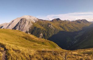
The opposite ridge with the peaks of Gamsleitenspitze, Zehnerkarspitze, Glöcknerin and Groβer Pleiβlingkeil is less visited and can be crossed on marked hiking trails. The whole tour from Obertauern takes about 8 to 9 hours, but can be split into two parts by using the link between Glöcknerin and Wildsee. By car I drive up to the Felseralm to the large youth hostel hut at about 1600 m. The car park for the Tagesgäste is on the right behind the barrier and is free.
There is a signpost right by the hut, the route to Glöcknerin is marked in red (medium difficulty). The trail heads into the larch forest above the hut and starts to climb steeply. After about an hour you get above the forest level to the Wildsee lake (about 1900 m). From the lake rise the slopes of Predigstuhl, Glöcknerin and Vordere Groβwandspitze with the shining silver cross. I go around the lake from the right and continue to climb gently through grassy pastures and small rockeries towards the Südwiener Hütte (off the trail).
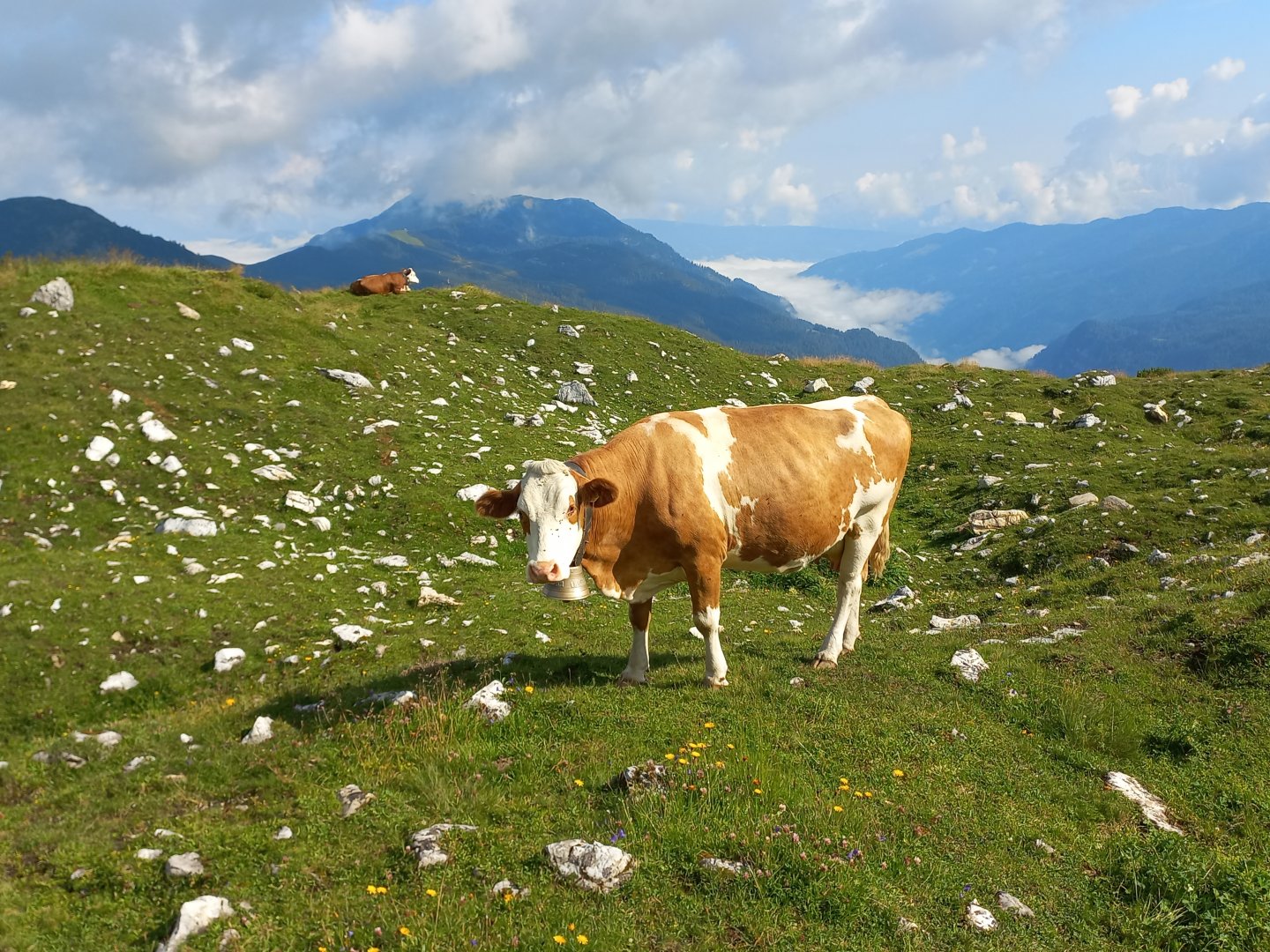
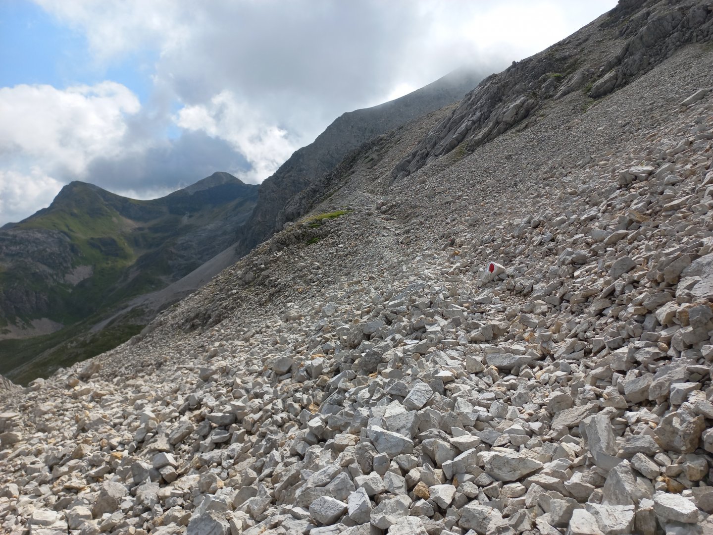
The walls of the Vordere and Hintere Groβwandspitze and Groβer Pleiβlingkeil tower above me. Cows graze among the rocks, falling rocks give away a chamois and I even spot a marmot. After another hour I reach the Hengst signpost (2076 m) and head left to Groβer Pleiβlingkeil. Here I gain metres of altitude faster. Between Kleiner and Groβer Pleiβlingkeil I cross the stone sea and see traverses in the wall that lead me to the summit.
The travers ascends gently on a gravel path, occasionally a larger rock has to be crossed or a rock face bypassed, but nothing exposed. In half an hour I am on the next peak, Groβer Pleiβlingkeil (2501 m). There's no cross here, just a pyramid of stones, but the views are stunning - Mosermandl and Faulkogel to the west, Steinfeldspitze to the north and the Ennstal valley beyond, Dachstein half hidden in cloud, the Schladming Tauern to the east with the nearby Lungauer and Steierische Kalkspitze peaks, but the highest Hochgolling is also visible, and the Hochfeind and Weiβeck massifs to the south.
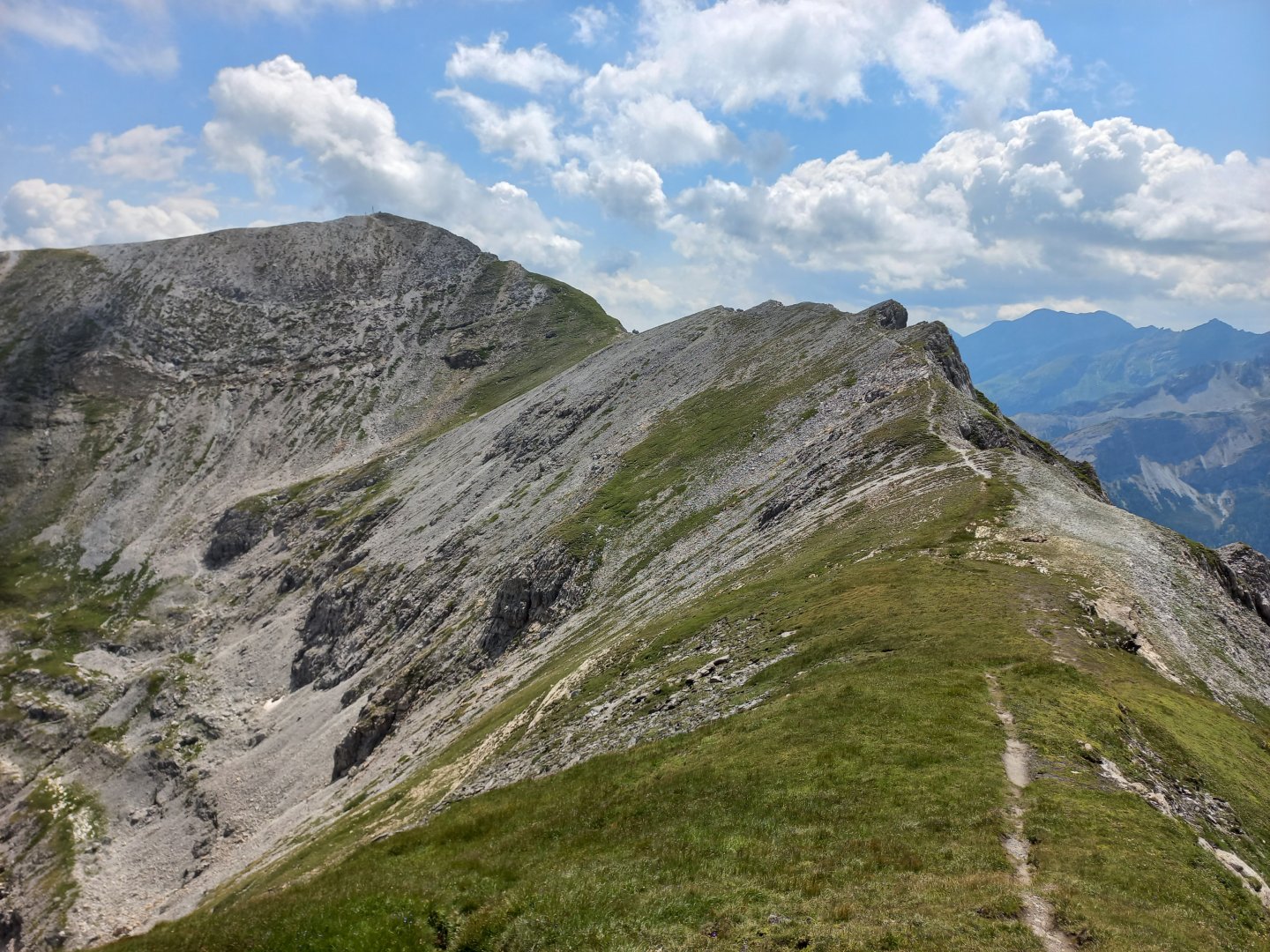
After a while I leave the top and head down. The first few meters are quite steep, the gravel is unpleasantly slippery and I pull out my poles for support. But then it's a smooth traverse to the saddle below Hintere Groβwandspitze, where I almost miss the turn-off to Glöcknerin. Hint - the turnoff is where the bedrock changes from limestone to shiny stone, perhaps slate, that glows in the sun. I walk along the ridge to the fork below Glöcknerin.
I turn back to Pleiβlingkeil, from this viewpoint it has a beautifully scalloped south face. The blue Wildsee is below me on the left, the valley chute on the bottom right. It's only a few metres to the top of Glöcknerin. I meet people here who have come from the Wildsee, it's apparently a popular route. Most of them come back down the same way.
On the top of Glöcknerin there is a wooden cross indicating the altitude of 2 433 m above sea level.I rest for a while and admire the views of the other hills above Obertauern - Predigstuhl, Zehnerkarspitze and Gamsleitenspitze. Those who want can continue on the marked route. Predigstuhl is traversed from the right by a grassy traverse, followed by a climb up the Zehnerkarspitze and then below the Gamspitzl peak to the oval retention basin by the cable cars. From here a wide gravel path leads down to Obertauern. I return to the saddle and descend back to the Wildsee. The descent is fast, in about forty minutes I am at the lake and in another half hour at the car at Felseralm.
Difficulty
A beautiful alpine trek along a marked AV route with a changing landscape - alpine meadows, rocky seas, traverses, ridges. Difficulty marked medium. Technically not demanding, even the elevation gain is pretty good.
Water availability
Water must be brought with you. Südwienerhütte, a short distance off the trail, where you can refill your fluids.
Sleeping options
Accommodation options are in the valley or in the Obertauern mountain saddle.
Mountain peaks
Ascent to Groβer Pleiβlingkeil (2501 m) and Glöcknerin (2433 m). There are great views of Mosermandl, Dachstein, Schladming Tauern, Hochfeind, Weisseck and more.
Danger
Moderately difficult route, on marked trails. There is no exposed section. Occasionally a stone field must be crossed. Probably the most challenging is the descent from the Groβer Pleiβlingkeil, where you walk on rocky terrain that slips quite a bit. Otherwise it is a classic alpine hike.
Food
There is no hut on the route. Therefore it is necessary to have food with you. A short distance off the trail is the Südwiener Hütte mountain hut.