Mountain range, region / State
Rottenmann and Wölz Tauern in Alps / Austria
Season
Summer
25. 06. 2022
Difficulty
3 / 5
Elevation
↑ 1192 m
↓ 1192 m
Length
11.1 km
10 hours
Altitude
max. 2448 m n.m.
min. 1649 m n.m.
Hiking map of the ascent to Grosser Bösenstein
Tips for hikes in the mountain range Rottenmann and Wölz Tauern in Alps

Climbing the Schoberspitze in the Wölzer Tauern
Trek to the Hohenwart in the Wölzer Tauern
Trek in the Rottenmann Tauern with ascent to the Hochrettelstein
Sport hiking in the Rottemann Tauern in the Alps
Starting point
The advantage of this hike is that the parking lot without a fee and thus the starting point is located at an altitude of about 1,800 m above sea level at the Edelrautehütte hut. The road to this mountain hut from the Hohentauern is a toll of 8 Euros per car (year 2022).
Description of the hike
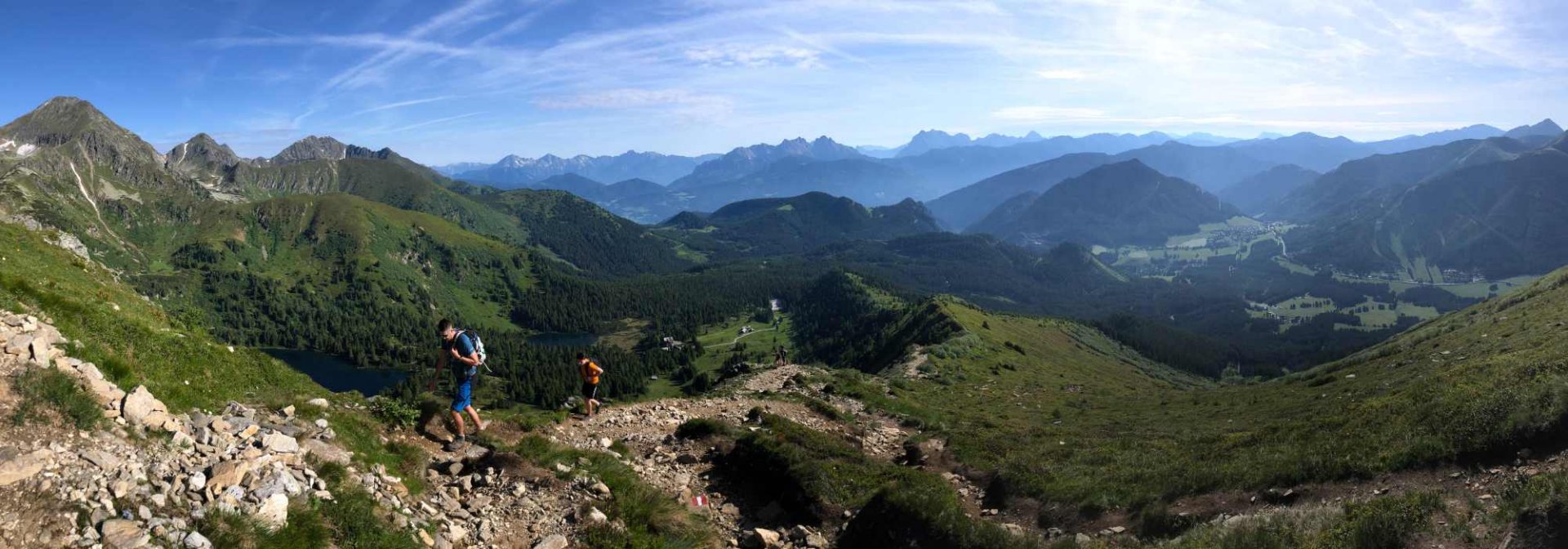
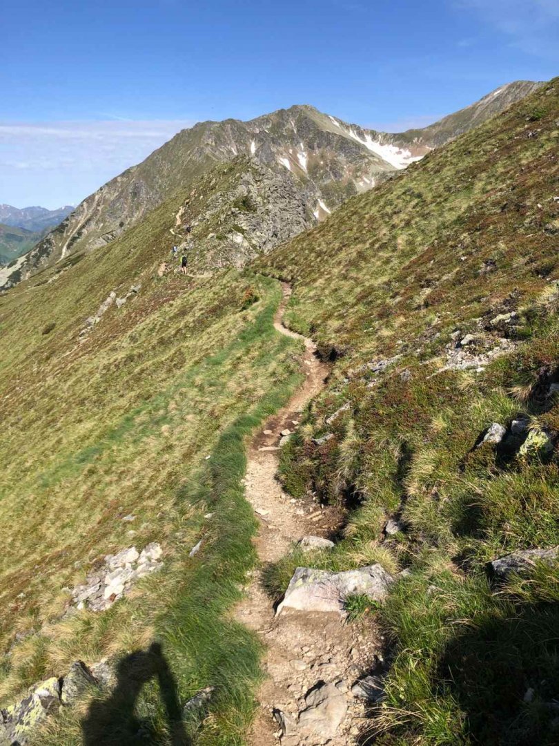
We leave the car in the parking lot below the Edelrautehütte. From the hut we follow the red sign towards Grosser Hengs. The footpath first leads steeply through the forest before reaching the ridge. It climbs gently and is quite steep towards the end - nothing too challenging. The ridge ends with the summit of Grosser Hengs at 2 159 m above sea level.
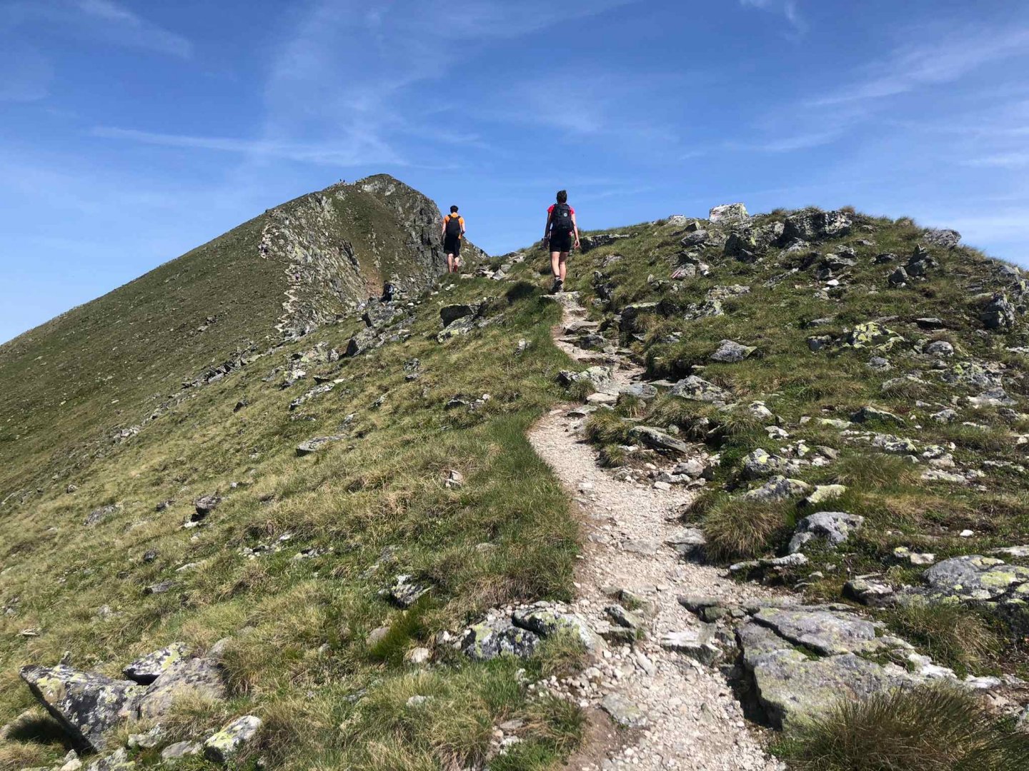
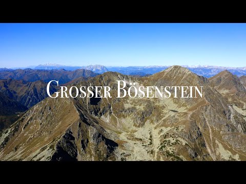
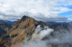
From here we follow the classic alpine ridge on a relaxing mountain path up to Kleiner Bösenstein 2 359 m above sea level. Then we continue over the Elendscharte 2 323 m above sea level to Grosser Bösenstein 2 448 m above sea level. The peak is a frequent and easy destination for many hikers in the summer season, so you will certainly not be alone on the weekend.
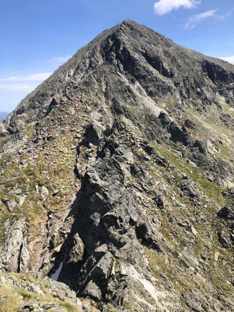
From the top of Boesenstein you can take route 946 back to the Edelrautehütte hut, but that would be a short and easy hike :). That's why we decide to go towards Sonntagkarspitze 2,350 m above sea level. Lots of chains and ancillary ropes await you on it. In places it is also an easier climb I. UIAA - for the experienced hippo hiker without vertigo, this is a fun variation on an otherwise classic alpine hike. Definitely not recommended for beginners in mountainous terrain.
From the top of the Sonntagkarspitze, a classic alpine path leads to the Gamsscharte 2,216 m above sea level, from which we turn our steps towards the valley on the 944a route. From the saddle we follow the mountain path past the Gefrorner See, where we can still see remnants of snow in May. We follow the red trail past fenced cow pastures to a small forest that starts behind the Ochsenkarbach river.
We follow the forest path for about 2 km and there is also a small ladder. This is a classic forest path, more rocky in places. About half an hour after entering the forest we come to the Edelrautehütte where we have Süßwasser and beer.
Difficulty
From the valley up to Grosser Boesenstein 2 448 m above sea level, it is a classic alpine hike on mountain paths, without exposed places, suitable even for beginners in the mountains. However, on the way from Gr. Boesenstein towards the Sonntagskarspitze 2 350 m above sea level, you will be faced with a rocky ridge, which in places requires climbing I. UIAA and lots of chains. This passage is not suitable for beginners or hikers with vertigo.
Water availability
The route is 11 km long and in summer you need at least 2 litres of water per person. There is no place to refill water during the hike. You can refresh yourself at the beginning or end of the trail in the mountain hut Edelrautehütte.
Mountain peaks
On the route you will climb four two-thousand peaks Grosser Hengst 2 159 m above sea level, Kleiner Bösenstein 2 359 m above sea level, Grosser Bösenstein 2 448 m above sea level, Sonntagkarspitze 2 350 m above sea level. In good weather you can also see the Grossglockner 3,798 m above sea level or the Dachstein mountains to the west.
Danger
Only the rocky ridge to Sonntagkarspitze 2,350 m above sea level is more dangerous on this route - however, the degree of danger depends on your experience with mountain terrain. For newcomers to the mountains this will be a more challenging affair, for more experienced mountaineers it is a pleasant diversification of a mountain hike. Otherwise, it is a completely trouble-free alpine hike.
Food
Refreshments are only available at the beginning and end of the journey to the Edelrautehütte. On the hike itself you are on your own, there is no hut on the trail. The described route is a fair 8-9 hours of walking, so don't underestimate the food and energy supplements (chocolate, snacks, fruit will definitely come in handy).
Photos and video