Mountain range, region / State
Ybbstal Alps / Austria
Season
Summer
03. 09. 2022
Difficulty
3 / 5
Elevation
↑ 1510 m
↓ 1510 m
Length
22.9 km
6 hours
Altitude
max. 1877 m n.m.
min. 691 m n.m.
Tourist map of the Ybbstalian Alps in Austria
Tips for hikes in the mountain range Ybbstal Alps

Spring crossing of the three Zellerhüte in the Ybbstal Alps

Climbing the Gippel peak in the Ybbstal Alps
Easy hike to the top of Hochkar
Climbing the Hochstadl mountain in the Ybbstalian Alps
Starting point
I leave the car at the Rotmoos farmhouse (road from Mariazell to Guβwerk, turn here in the direction of Wildalpen, about 15 km). There is also a smaller car park about 3 km further on at Dürradmer (it is possible to reverse the route and take the forest road back).
Description of the hike
The Kraüterin is an inconspicuous ridge about ten kilometres long, situated near Mariazell, between the Hochschwab and the Ybbstal Alps. The highest point is Hochstadl (1919 m), which is reached by a marked AV route. I leave the car at the Rotmoos farmhouse (road from Mariazell to Guβwerk, here turn towards Wildalpen, about 15 km). There is no car park here, but you can park your car at the crossroads by the big yellow house.
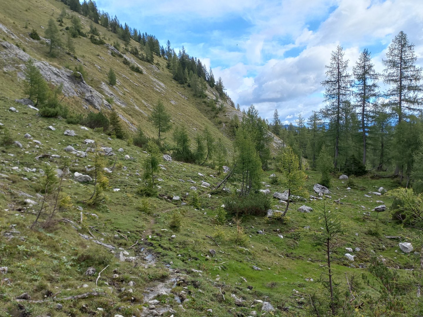
From the crossroads there is a marked hiking trail, it should take about 4 hours to get to Hochstadl. I take the path into the forest and a rather steep climb begins. Sections through the woods alternate with gravel paths for logging. After about an hour and a half, the path turns off the Forststrasse into pastures where I get my first glimpse of the top of Hochstadt. But it's still a long way to get to it among the knees and rocks.
There are no cows here, but just below the ridge I come across a herd of about 20 head of chamois. They stare at me as if they haven't seen a human yet, and only after a while do they start to run away. True, I didn't meet any tourists on the whole way, only hunters. The path leads me to the middle part of the ridge, it's nice - a big pasture, islands of knees, white rocks and cones of surrounding peaks - on the left is Fadenkamp (1804 m), on the right Graskogel (1704 m).
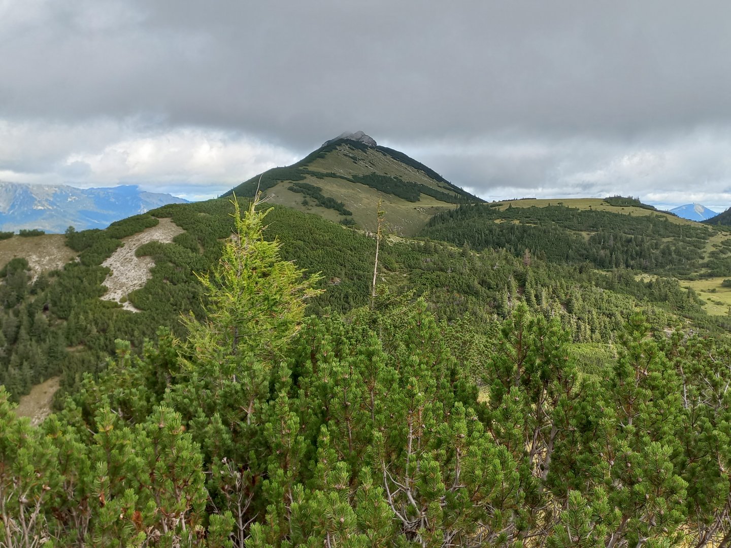
Unfortunately, the weather is getting worse, the sky is getting darker and the peak is disappearing into the clouds. It's still a bit clear over Mariazell, I can make out Gemeindealpe with a transmitter, Zellerhütte, Hohe Veitsch. But the nearby Hochschwab in the south is already in fog. Ötscher and Dürrenstein, the landmarks of Mariazellerland, should be visible on the north side of the ridge, but both peaks are hidden in the cloud. I turn left to the summit of Hochstadt.
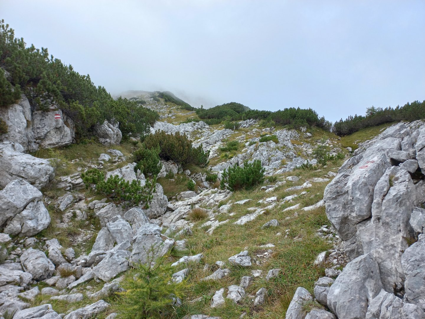
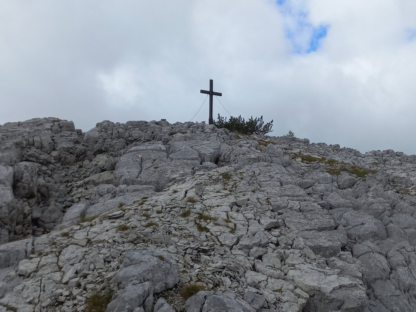
The hill is interestingly scalloped from the north, and a few hundred metres below the summit, the rock and limestone scree begins. But the path is well marked and I am soon standing by a cross. An arrow with the inscription Gipfelbuch warns me that the summit is probably a little further. I walk around the kneeling, about 100 metres along a grassy path between the stones and I am there. The clouds part for a while and I can see the steep drop down into the valley and the continuation of the ridge with the summit of Kleiner Hochstadl (1835 m). The road doesn't lead there anymore, it's too steep.
After a moment's rest, I return to the wooden cross with carved floral motifs. I descend down to the plain, but unfortunately it finally clouds over and the rain starts. The shower is brief, but the rain is replaced by such a mist that if it weren't for the tinkling of the bells, I'd probably trip over a cow. The plan was to continue on to the rocky Fadenkamp, but there is no marked path to it, perhaps just a path between the kneelers, which I have no chance of finding in the fog.
So I leave Fadenkamp for some other time and start descending towards Kräuterinhütte (1394 m). After a while the clouds part again, even a bit of blue sky peeks out. Below Kräuterinhütte, the route leads through pastures and grazing land, already on a wide forest path towards the Dürradmer farm. From Dürradmer, I turn right before the bridge between the cottages and continue on the forest path and return to Rotmoos.
Difficulty
A relatively deserted ridge near Mariazell, the route follows a marked AV route and forest tracks. The total elevation gain is more than 1500 meters, so it is good to have some fitness. The climb is steeper in places, e.g. in the initial part of the ascent.
Water availability
On the way there is no possibility of refreshment, stream below Kräuterinhütte, troughs in Dürradmer.
Sleeping options
There are no huts on the route, but there is plenty of accommodation in the valley and around Mariazell.
Mountain peaks
Ascent to Hochstadl 1 919 m above sea level, with good visibility you should be able to see Dürrenstein and Ötscher in the north, the hills around Mariazell in the east, Hochschwab in the south, Gesäuse in the west.
Danger
The trail follows marked or forest paths, there are no exposed sections.
Food
There is no possibility of refreshments on the route, food must be taken with you.
Attractions
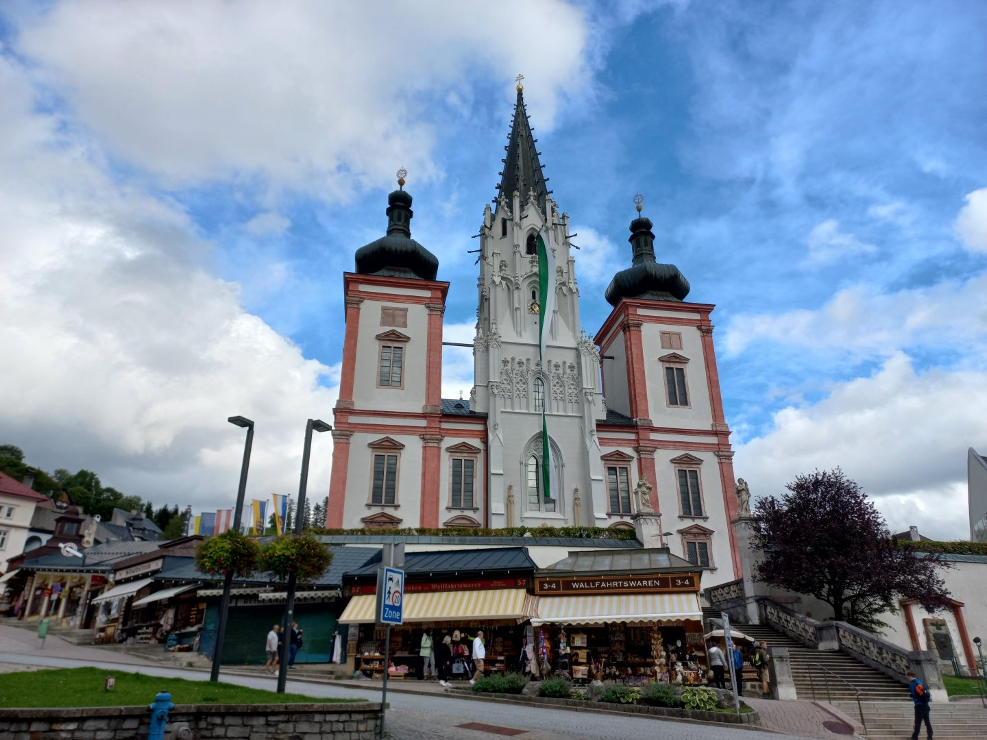
On the way back, the traditional stop in Mariazell to visit the basilica and to buy gingerbread. Mariazell is probably Austria's most famous pilgrimage site. In the 12th century, the Madonna appeared to the monk Magnus during his pilgrimage across the Alps and helped him to overcome the rock that blocked his way. He brought a statue made of lime wood to the site and built a chapel around it. Around the year 1200, Prince Henry built the first church here to give thanks for his recovery from a serious illness.
The legend began to spread and thousands of believers have been making the pilgrimage to Mariazell every year ever since. Several pilgrimage routes lead to the town, and chapels and churches dedicated to the Holy Family and other saints have been built on the surrounding hills (Annaberg, Josefsberg, Joachimsberg). Along the roads you will see many crosses, chapels and holy pictures. In addition to the basilica, Mariazell is famous for its honey gingerbread (Mariazeller Lebkuchen Pirker), beeswax candles and Arzberger herbal liqueur.