Mountain range, region / State
/ Austria
Season
Winter
05. 03. 2022
Difficulty
1 / 5
Elevation
↑ 661 m
↓ 660 m
Length
8.0 km
4 hours
Altitude
max. 976 m n.m.
min. 514 m n.m.
Tourist map of the Ysperklamm Gorge
Sightseeing trip to the Ysperklamm Gorge in Lower Austria
Starting point
Leave the car in the parking lot at the entrance to the Ysperklamm gorge (enter the village of Ysper in the navigation). There are well-marked turn-offs from the B36 road, the parking is free and large enough - expect a high number of visitors.
Description of the hike
The Waldviertel is a part of the state of Lower Austria adjacent to the Czech border under the Novohradské hory. It is an undulating landscape with villages of a few houses, hills rarely exceeding a thousand metres, an agricultural area with poppy and potato fields.
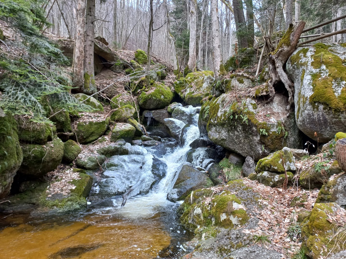
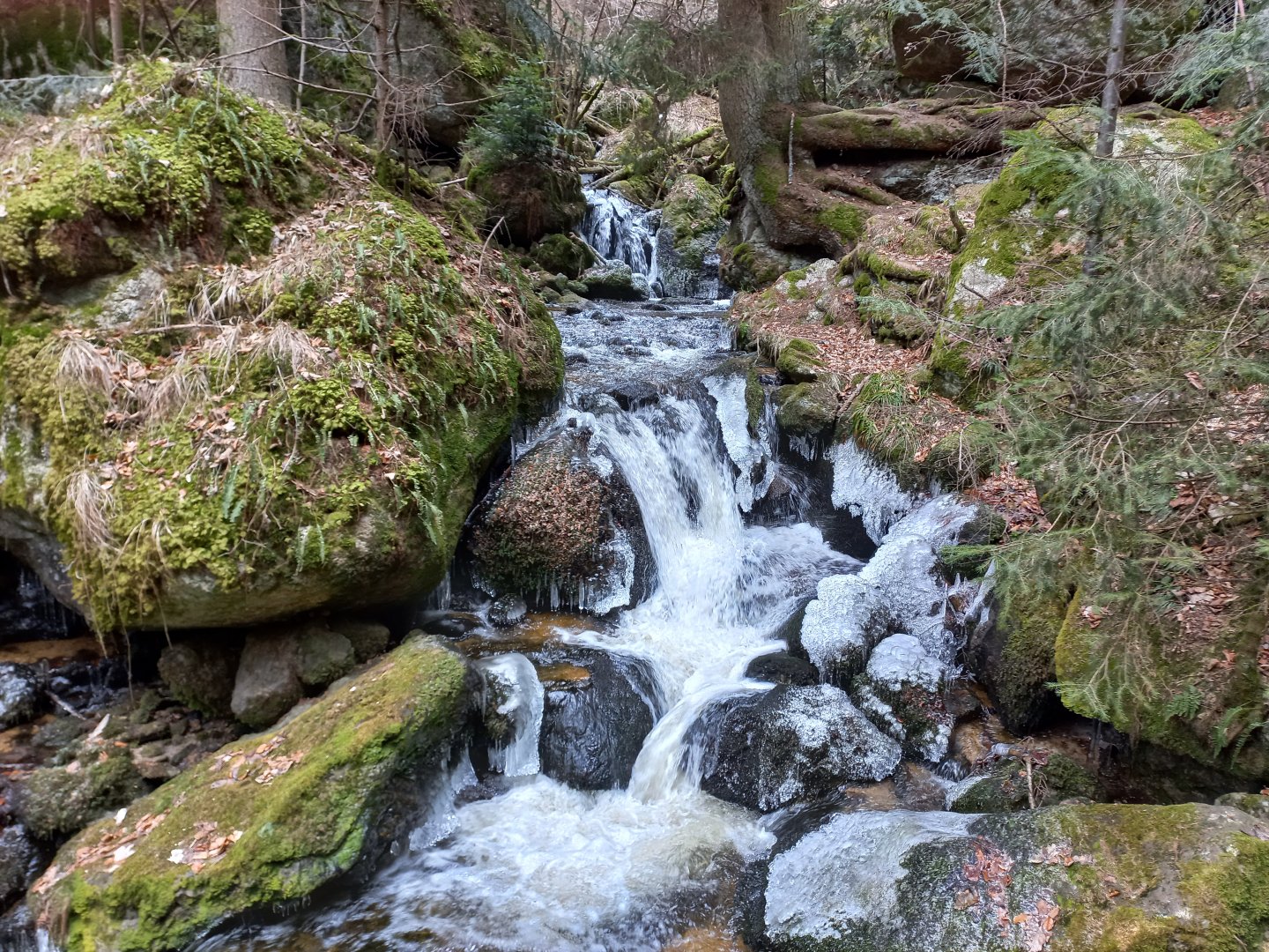
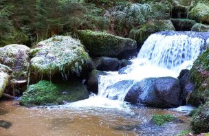
But that doesn't mean that you won't find interesting places here. One of them is the Ysperklamm Gorge. The Ysper River flows for 2 km between the rocks and overcomes an elevation of about 300 metres. Nature has created cascades of waterfalls, small and several meters high, clear lakes and gurgling streams.
The competition is open all year round, from April to October the entrance fee is 4 €.
I park my car in the large parking lot of the Forellenhof restaurant and head down the Druidenweg, marked by the Celtic rune ᛗ "Man", a symbol of man, male, but also of spiritual development.
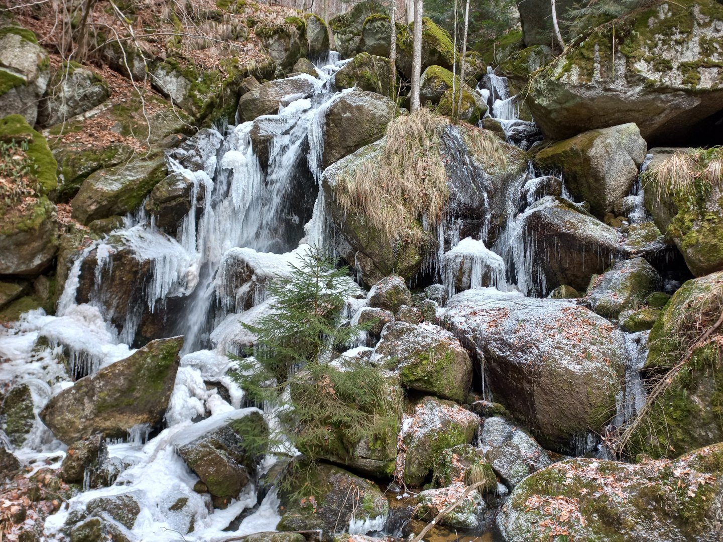
The forest trail runs closely along the stream, over rocks, wooden footbridges and bridges, past waterfalls and ponds. At night it is still freezing, so the water showers have conjured up hundreds of icicles, frosty pearls and ice curtains on fallen branches.
I enthusiastically hop from rock to rock, snapping photos of the beauty and exploring what lies behind the next boulder. If it wasn't around zero, I'd take off my shoes and wade through the shallow water. The lower gorge is calmer, the upper part steeper with bigger waterfalls.
The climb along the stream takes about an hour, then I come to Ödteich, a pond with no water. Well, there is no pond here, there used to be, a stone embankment used to float wood to it, but unfortunately it was badly damaged by a flood in 1956 and has not been restored.
After the wild water, I calm my mind in the spruce forest and gain more vertical metres along the wide forest path. I approach the rock formations. Do you also remember the game "what does the rock look like" from your childhood trips to the rocks? Elephant, sponge, turtle head, butt :-)
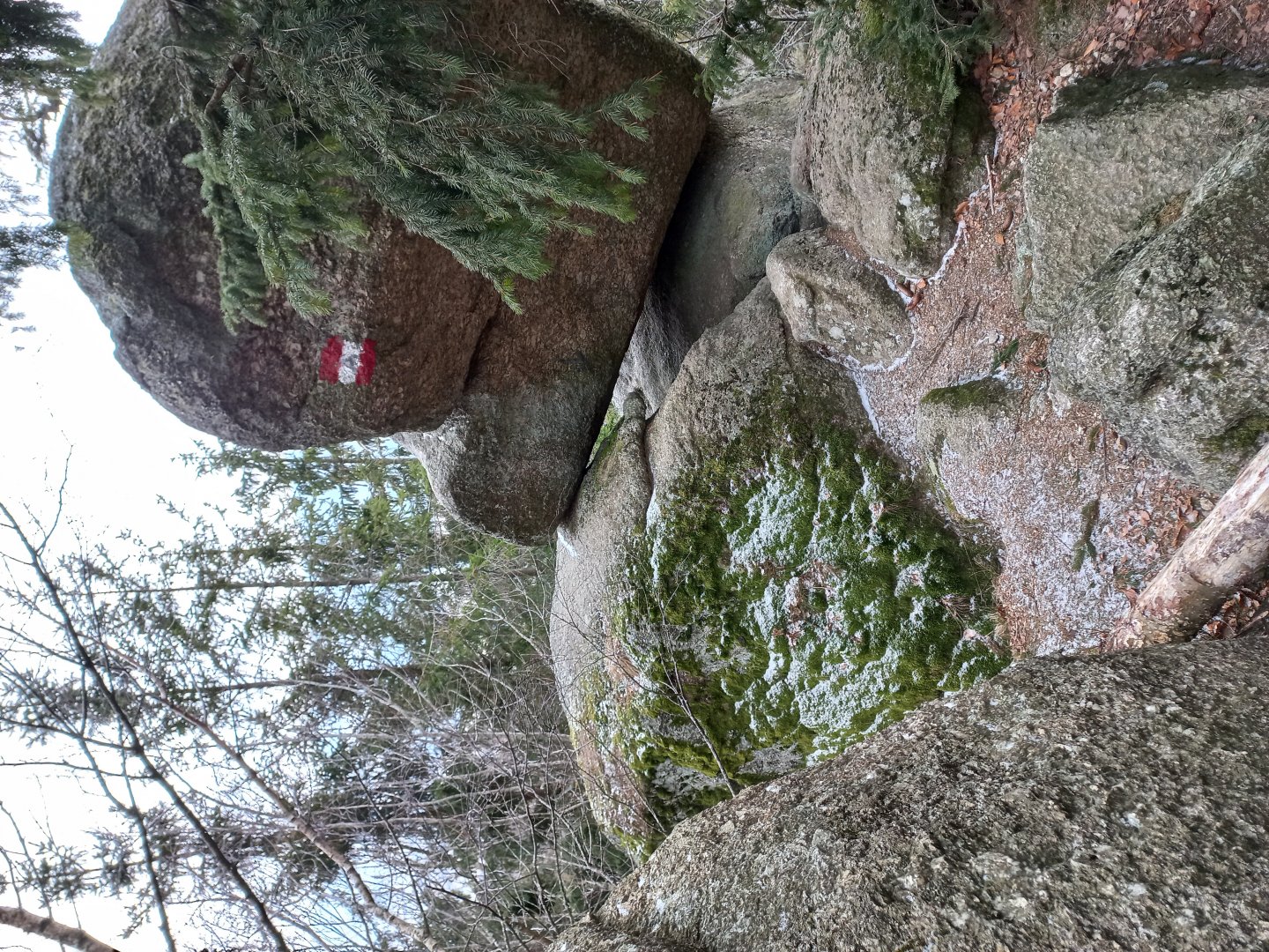
This is where it gets really rough - Phallus and Vulva. Fortunately, the interpretation is attached. The rock, named after the male fertility symbol, rises perpendicularly above the valley, its rounded top leaning against the second stone to form a window, an opening, which in turn evokes the symbol of femininity.
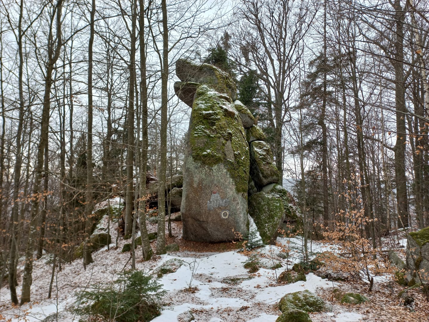
The other rock formations are easier to understand - the Sitzende Hund does indeed look like a sitting dog, the Schalenstein - a stone with a bowl in it has a depression. The Druidentreffpunkt, a place of Celtic ceremonies and worship, is located at the top of the hill.
There are large boulders scattered here, the place is said to have magical powers and the stones give energy, but beware, some positive and some negative. In the centre of the stone circle stood a square altar and the throne of the high priest, in the other boulders are carved bowls for offerings.
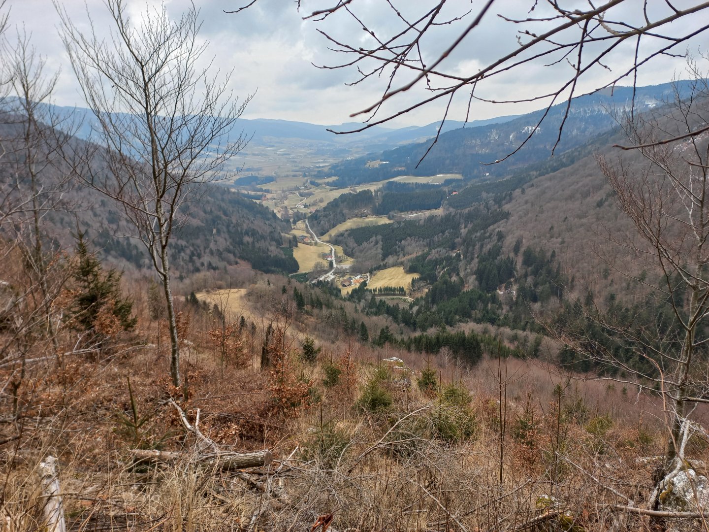
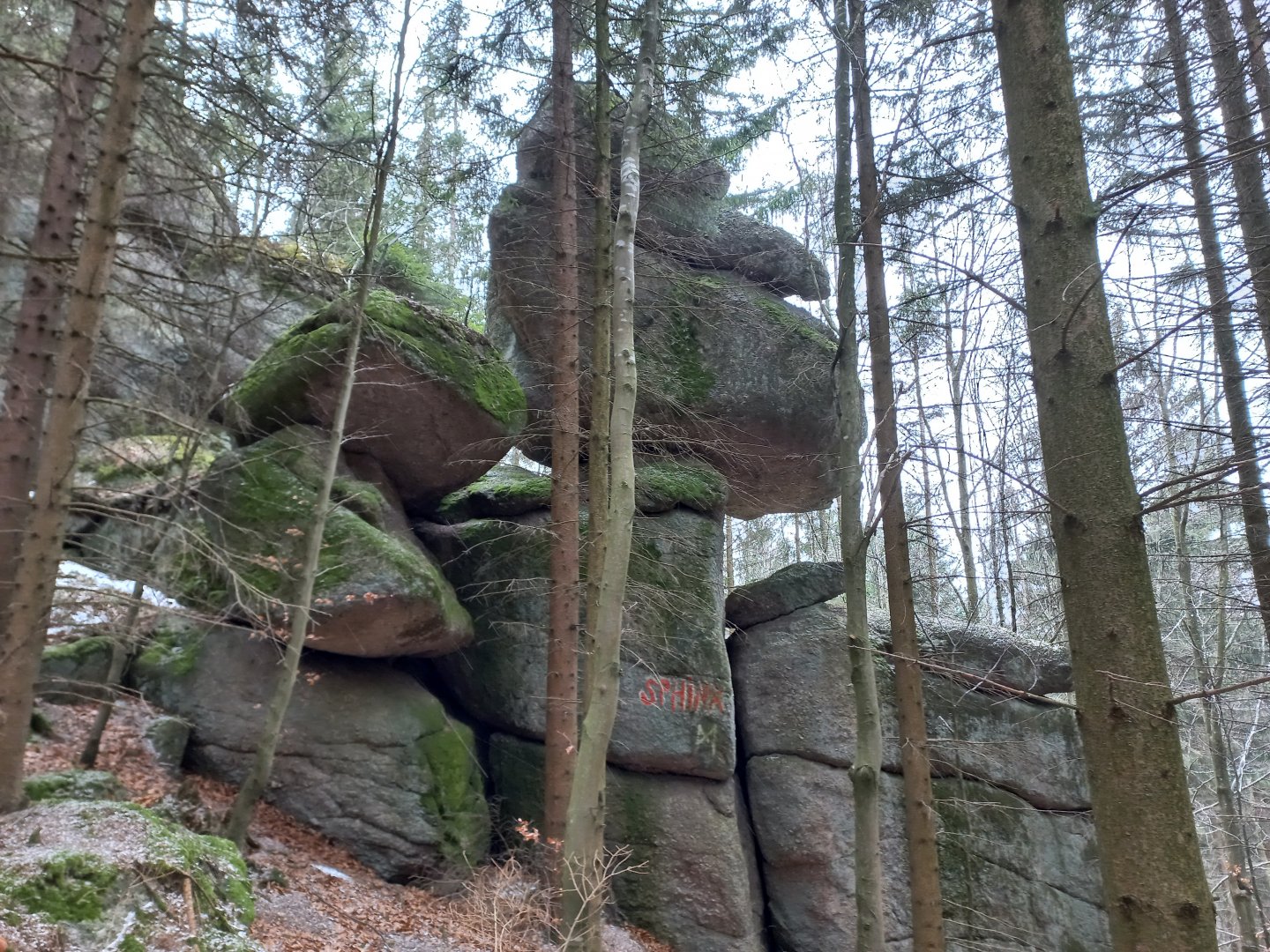
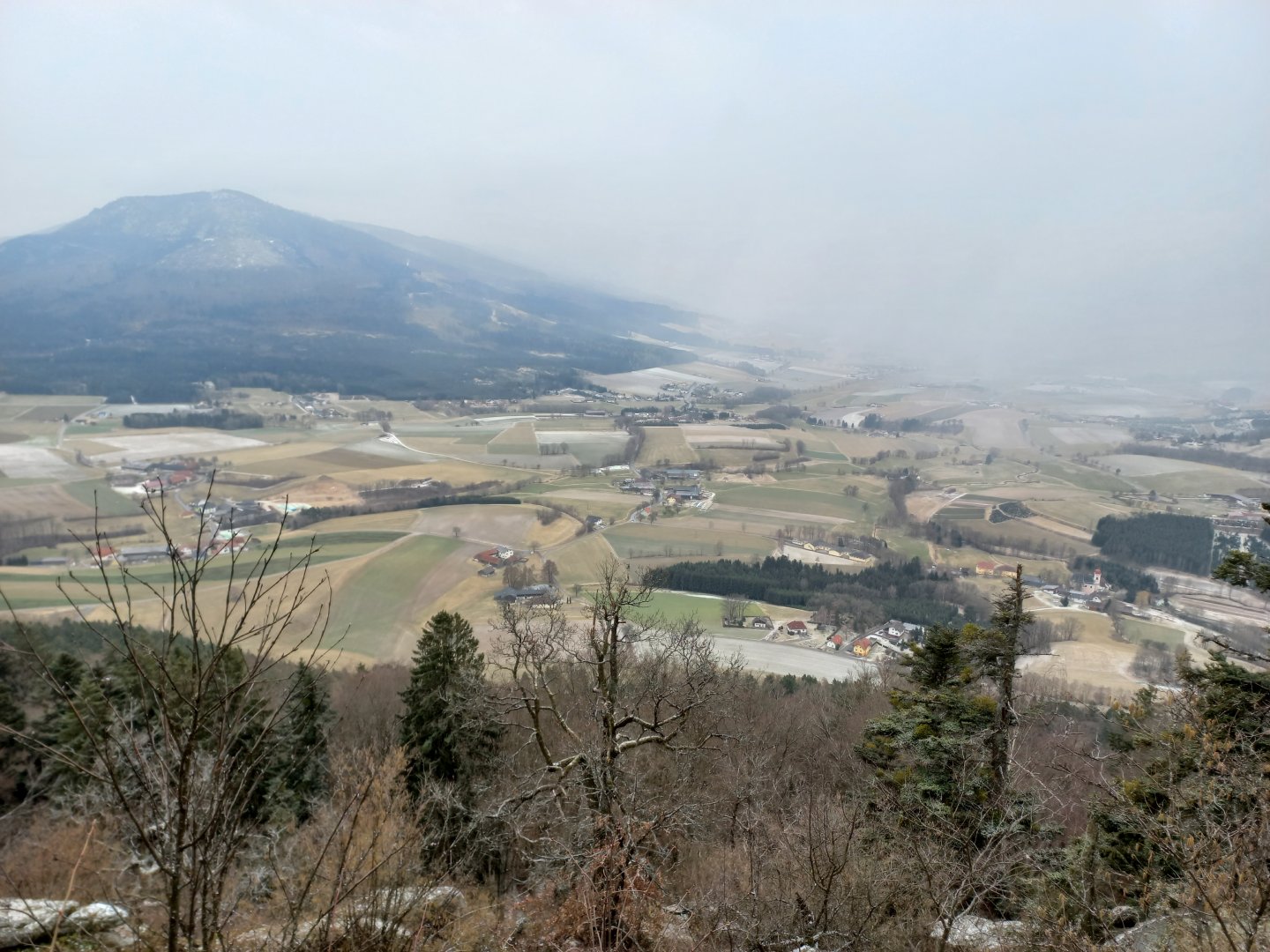
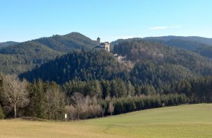
The path continues between other formations down the hill and then up again to the top of Böndel. Here too was a sacred place guarded by a ten-metre high rock later named Sphinx. Beyond the top of the hill, a turn off to the right leads to the Kaltenbergkreuz cross, a lookout point. From it, you can see down into the Yspertal valley and the nearby Ostrong massif with the thousand-foot Grosser Peilstein.
With good visibility you can also see Ötscher, which was a sacred mountain for the Celts. There is a steep path leading down from the cross, sometimes secured with a rope for safety, but don't worry - it's no klettersteig. Those who want to descend more gently must return from the cross to the crossroads and take a detour.
The descent is fast, in half an hour I am in the valley, in another quarter of an hour at the car. The whole circuit, including breaks for photos and rest, took me less than 4 hours. Anyone who is still tempted by the nearby Ostrong ridge and wants to add two cool pieces to their collection of summit crosses can drive over to the village of Laimbach am Ostrong, where the marked Peilstein Gipfelrunde hiking trail starts.
Above the village on the Kleiner Peilstein spur (1024 m), the cross is visible from afar. It is reached by a steep hike up a forest path, a quick 500 metres of ascent that will leave you sweating through your shirt between the first trees in the forest and your heart in your throat.
Deep views of the valley are the reward. The ascent is not dangerous, but it is slippery in the snow, I preferred to put on my snowshoes at the top. From the small Peilstein it's just a short walk through the forest past the Schutzhaus to the big one, the Grosser Peilstein is 1062m. The icing on the cake is Kaztenstein (963 m) with its beautiful wooden cross with a relief of the face of Christ. The descent leads along a wide forest path back to the starting route. Allow 2-3 hours for the Peilstein Gipfelrunde.
Difficulty
Easy mountain hike through the gorge and nature trail. Suitable for a trip with school children or active seniors.
Water availability
It is a short trip, we had water with us (1.5 liters). In the season there is a possibility of refreshment in the restaurant Forellenhof right at the parking lot at the entrance to the gorge.
Mountain peaks
On this trip you can climb several viewpoints such as the Kaltenbergerkreuz. There are no real mountain peaks here - unless you take a detour from the marked route to the Kaltenberg at 1,003 m above sea level, which is wooded.
Danger
The Ysperklamm and Druidenweg are not dangerous and can be done with school-age children. The only possible danger is in bad weather, when the rocks around the stream can be quite slippery.
Food
Snacks to take with you, refreshments available at the Forellenhof Inn right by the parking lot at the entrance to the gorge.
Attractions
Ysperklamm is a national natural monument. The nearby Ostrong massif with the Kleiner and Grosser Peilstein peaks is also worth a visit
Wildes Wasser - the wild water rushes between the huge granite boulders of the moss-covered Ysperklamm gorge, overcoming fallen trees, before spreading further down the valley into a quieter stream that flows twenty kilometres into the Danube.
In the 1930s, the Ysper was still used to float timber to the Danube and then on to Vienna. The Yspsper is open all year round, from April to October there is an entrance fee of € 4.
The gorge is connected to the Druidenweg, a themed nature trail following the footsteps of the Celts and the mysterious Druids.