Mountain range, region / State
/ Austria
Season
Spring
22. 04. 2023
Difficulty
2 / 5
Elevation
↑ 1434 m
↓ 1434 m
Length
19.6 km
7 hours
Altitude
max. 1399 m n.m.
min. 465 m n.m.
Tourist map of Gutenstein Alps in Austria
Tips for hikes in the country Austria

Ascent of the Trisselwand with spectacular views at Bad Aussee

Trek to the Krummbachstein mountain in the Scheeberg neighbourhood

Circular hike to Mödringkogel and three other peaks
Hiking in the Gutenstein Alps over the Reisalpe and Hochstaff mountains
Starting point
Village Kleinzell, free parking along the road. An easier option can be taken from the Ebenwald saddle, which can be reached by turning off Kleinzell (green sign Reisalpe).
Description of the hike
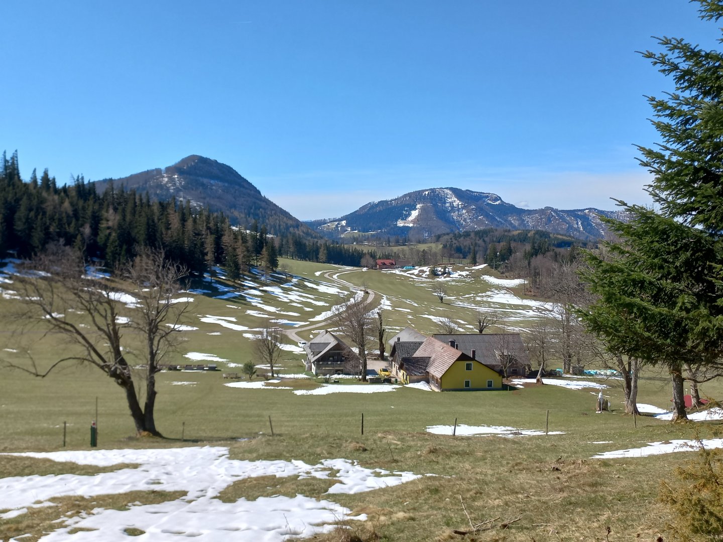
The Gutenstein Alps is a mountain group named after the Lower Austrian town of Gutenstein, located in the foothills of the Eastern Alps. The highest point of the Reisalpe (1399 m) is a popular hiking destination, accessible from several directions. I start from the east from the town of Kleinzell. Just after the church, the road begins to climb up the slopes of the Schwarzwaldeck. Those who don't want to bother with the climb can approach from Kleinzell along the narrow road to the parking lot at the Ebenwald saddle (1019 m) and save themselves 500 vertical meters. The ascent is pleasant though - through the forest, across pastures and the alm Schwarzwald of a few houses. A little above the village, the snow-capped Schneeberg, the easternmost Alpine two-thousanders, appears to the southeast and will accompany me all the way.
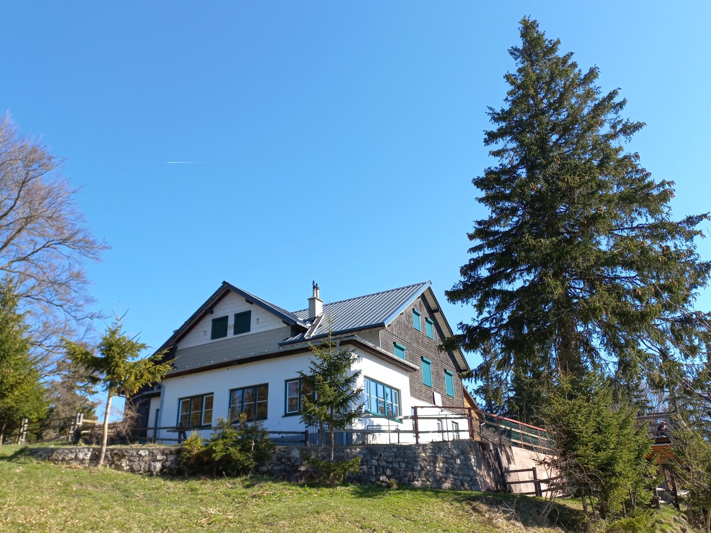
After about an hour of ascent, at the Schwarzwaldeckhaus hut, the path straightens out and I can see the first peak of the route, the Hoschstaff (1305 m) and the next one, the Reisalpe (1399 m). I walk through pastures with isolated farmhouses to the parking lot below the Hochstaff. From the car park the shortest path leads to the Reisalpe. But I turn down the unmarked path to Hochstaff. The footpath is clear and after a short steep climb through the forest I stand on the top. The view is perfect - Schneeberg and Raxy to the southeast, the outcrop of Gippel and the adjacent Göller, Hohe Veitsch and Hoschschwab in the distance, Gemeindealpe near Mariazell, Ötscher and Dürnstein. The Reisalpe seems to be just a stone's throw away, the ridge continues north to Lilienfeld via the Hinteralm and Mückenkogel.
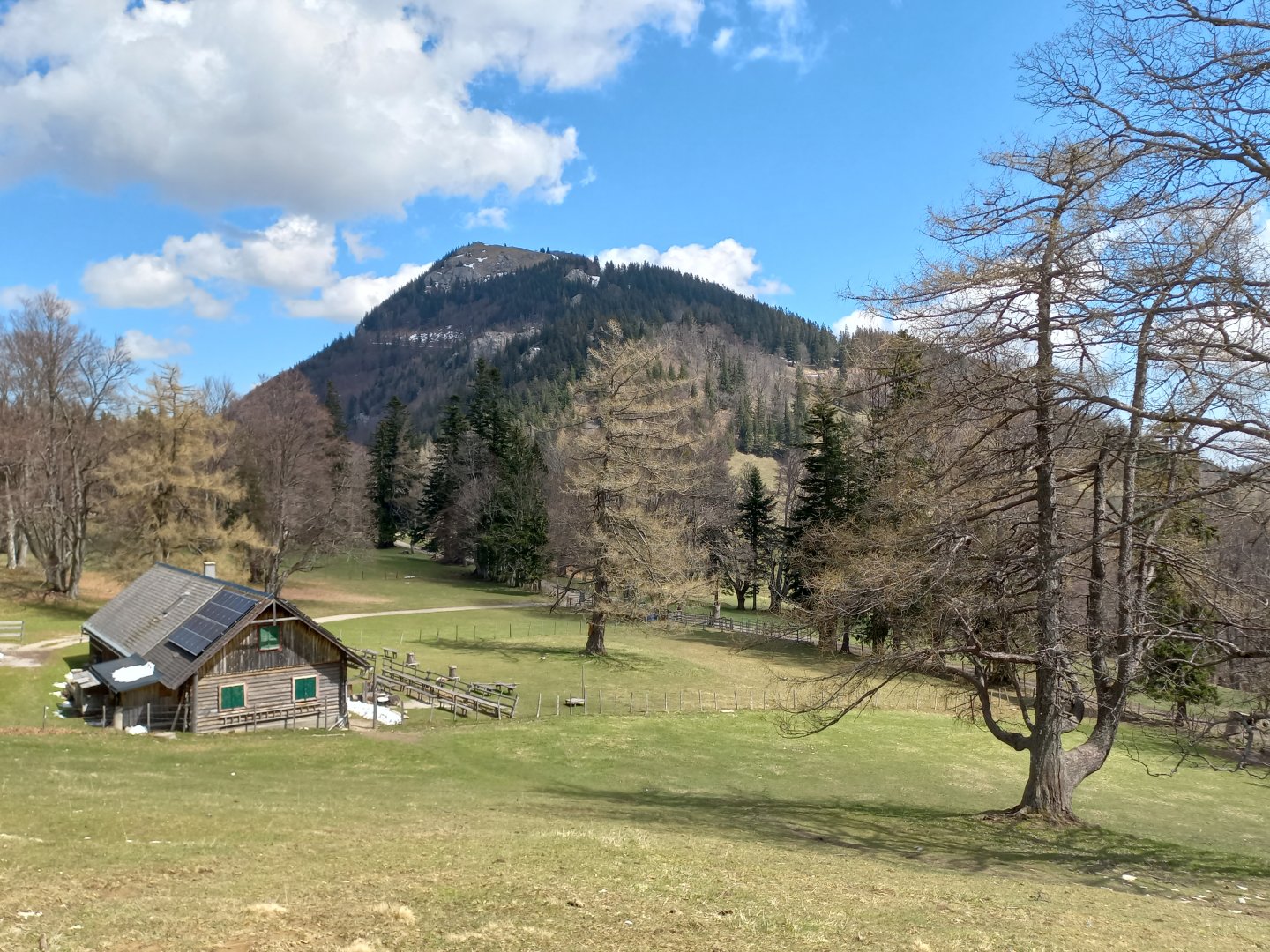
After resting for a while I get up and descend to the Kleinzeller Hinteralm, a picturesque pasture in the middle of a beech and larch forest. There is a restaurant on the almo, unfortunately still closed in April. From the almo the path climbs again, I have almost 400 vertical metres to Reisalpe. The path leads first through the pastures of the alm and then steeply in serpentines through the forest until I reach the plateau below the summit. At the top of Reisalpe is a cluster of two crosses and large stones, and a few metres below is a wooden hut. It's open, with a few hikers sitting around, fortifying themselves with garlic soup. The view here is circular, and a panoramic board helps you get to know the surrounding peaks. I rest on a bench by the cross, a nice hiker comes up to me, shows me photos of the green lake that forms here when the snow melts in spring, and gives me tips on other destinations in the area.
After a while I say goodbye and descend back to Kleinzeller Hinteralm by the same route. From there, I descend back down to Kleinzell via the Zeiβlalm and Weiβenbachalm on a wide forest path. I am early in Kleinzell and so I cross over to the nearby town of Lilienfeld. From Lilienfeld there is another ascent route to the Reisalpe, via the Mückenkogel and Hinteralm hills.
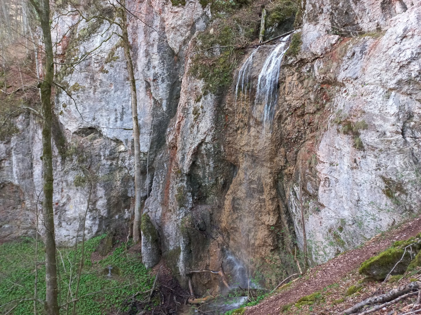
The town is mainly known for its large Baroque monastery, which I pass into the Fallgraben gorge (towards the Sessellift Mückenkogel cable car). There are two large car parks below the cable car, from where I get on the road to the Wasserfallsteig waterfalls. The path climbs uphill to the rocks between which the two waterfalls Grosser Wasserfall and Kleiner Wasserfall are hidden, from the car park it takes about 20 minutes. From the waterfalls it is possible to return the same way, or through the forest and meadows along the Jägersteig path. The circuit around the waterfalls takes about 1-2 hours.
Difficulty
A nice route in the foothills of the Eastern Alps over two of the highest peaks of the Gutenstein Alps. The route is mostly on marked hiking trails. There are no dangers. However, the elevation gain is more than 1000 vertical metres, so a good tip is advisable.
Water availability
There are several restaurants along the way in high season, and water refills are available at the Kleinzeller Hinteralm.
Sleeping options
You can spend the night at the cottage on Reisalpe. There is plenty of accommodation in the valley. There is a campsite in Kleinzell.
Mountain peaks
Ascent to the peaks of Reisalpe and Hochstaff. Views of Schneeberg, Raxy, Göller and Gippel, Hochschwab, mountains around Mariazell, Ötscher.
Danger
The trail is not dangerous, it goes all the time on forest paths or mountain meadows. There are no exposed sections.
Food
Refreshments are available at the Kleinzeller Hinteralm or at the Reisalpe. There are restaurants and a shop in Kleinzell.