Mountain range, region / State
Korsické Alpy / France
Season
Winter
19. 03. 2017
Difficulty
2 / 5
Elevation
↑ 775 m
↓ 776 m
Length
10.5 km
5 hours
Altitude
max. 1779 m n.m.
min. 1083 m n.m.
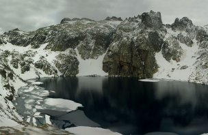
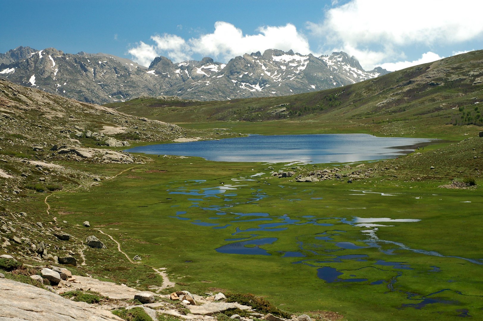
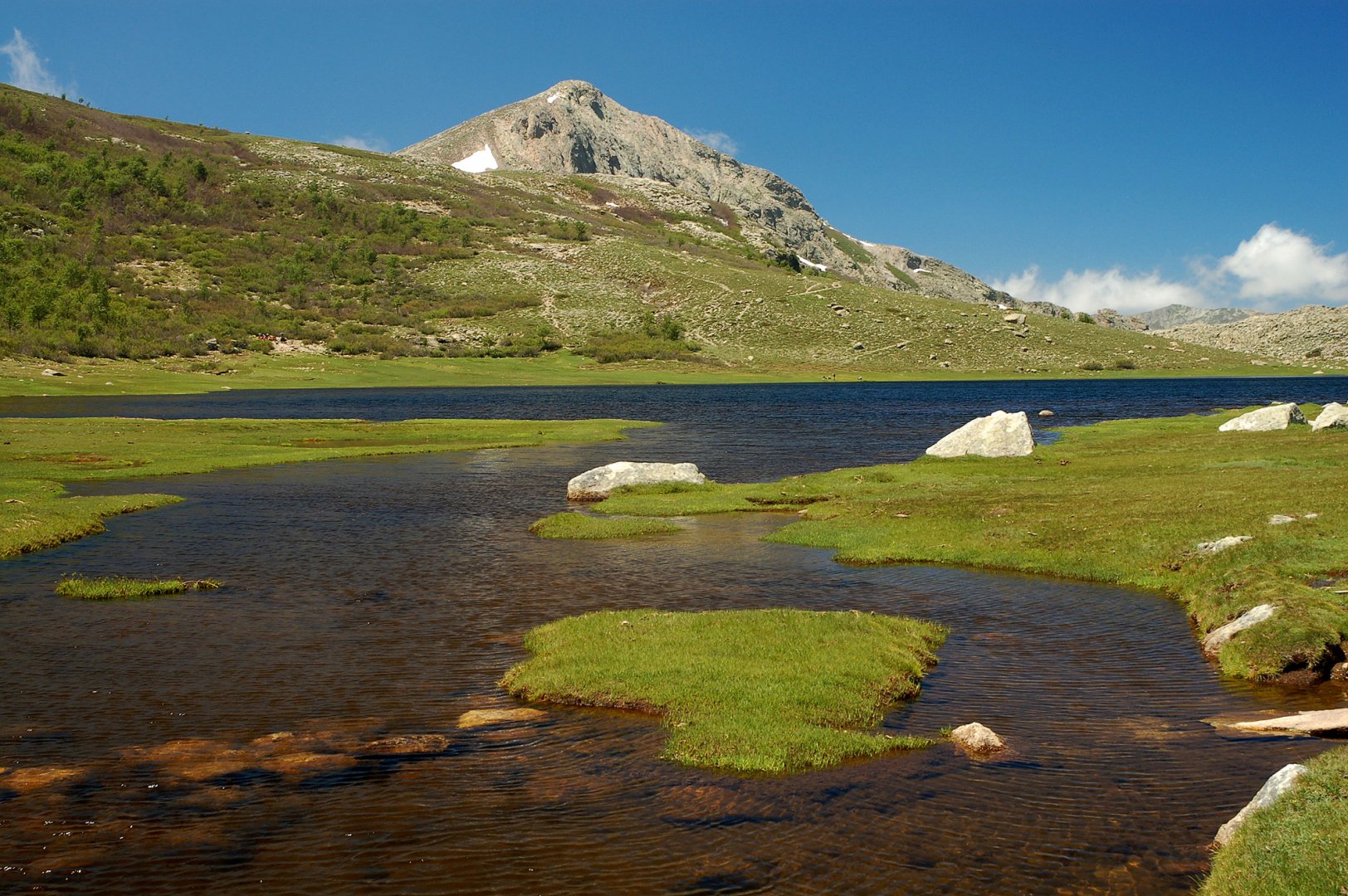
Ascent to the mountain lake Nino on the GR20 route
Starting point
For the trek to Lake Nino, you can start at the Poppaghia car park from the D84 road between the Calacuccia reservoir and the Col de Vergio pass. The trailhead is well signposted from the car park. It is a well-known route used by less skilled hikers, so you will certainly not be alone in the summer season.
Description of the hike
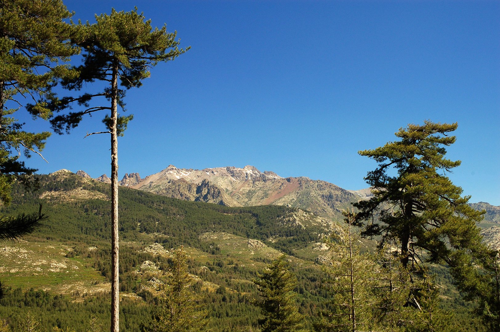
From the Poppaghia car park follow the red sign towards Lake Nino (from the car park this is the south-east direction). The path starts through the forest, which the locals call Valdo-Nielo (Black Forest).
The black forest is mostly made up of the so-called black pine (photo). A well-marked path leads over a small ridge into a wide basin leading up to the plateau with Lake Nino. About halfway through the basin, you will come across the Berg de Colga shepherd's hut, which stands close to the Colga mountain spring. From the shepherd's hut it is about 350 vertical metres to Lake Nino. The total ascent from the car park takes approximately 3 hours.
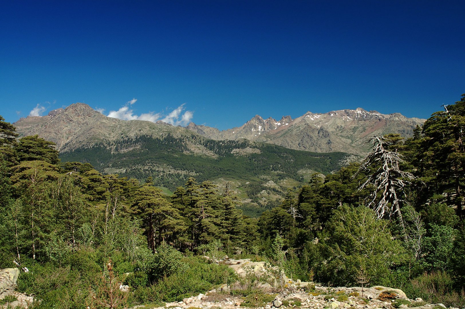
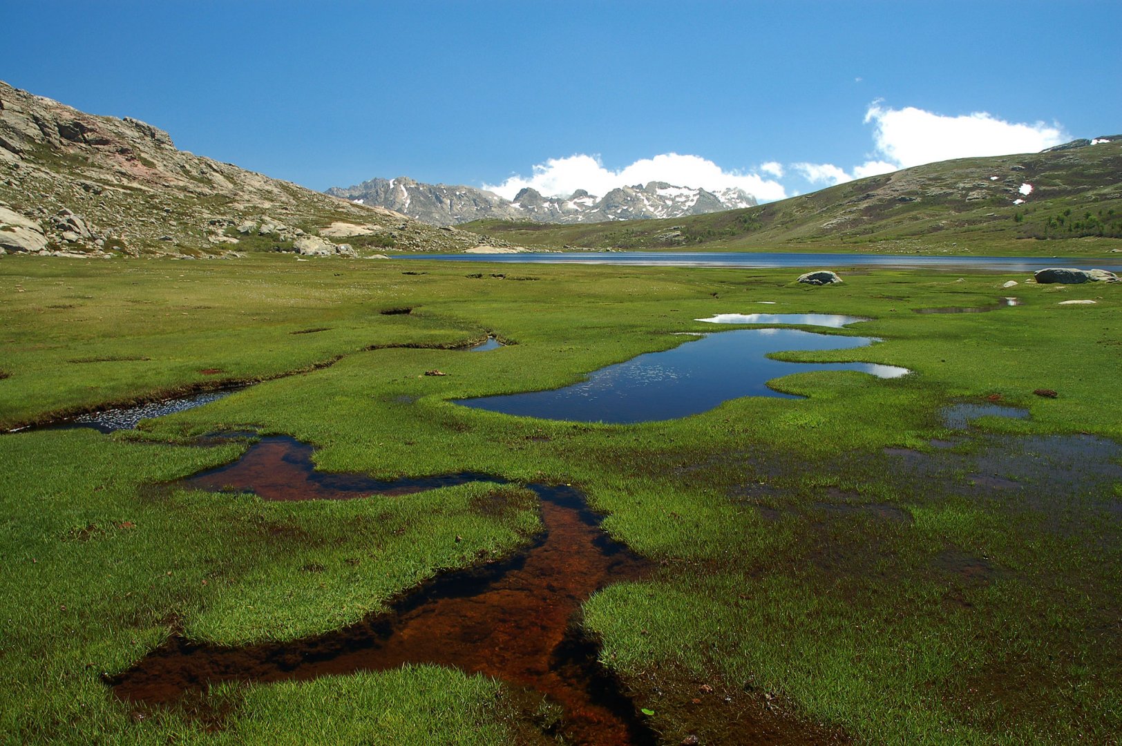
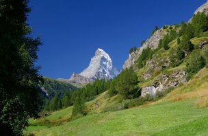
This mountain hike is especially popular because of the beautiful plateau with Lake Nino, from which there are great views of the highest mountains of Corsica, such as Monte Cinto (2,706 m above sea level - photo) or Monte Rotondo (2,622 m above sea level). At the lake, it is ideal to take a break for a snack and walk around the lake. You will get new views. Around Lake Nino, a large number of semi-wild horses graze.
You can go back the same way to the Poppaghia car park (about 1.5 hours). Alternatively, you can join the nearby GR20 and walk north-westwards past the peaks of Capu and Tozzu (2,007 m), then over the Col de St-Pierre (1,452 m) to the Bocca San Pedru saddle, where you turn right and reach the D85 road. You will then walk about 2km to the car park.
Difficulty
The hike to Lake Nino from the Poppaghia car park is very easy and can be done even by children used to longer walks. There are no difficult places along the way. The elevation gain is about 800 metres.
Water availability
As this is a one-day hike with a lower elevation (700 m), you only need to take about 2 litres of water per person. Water can also be bought at the Poppaghia car park, where a refreshment kiosk is open in the summer season. On the way to the lake you can then take drinking water from the Colga mountain stream (however, due to the higher number of tourists and the many grazing horses on the plateau, drinking from this spring can be risky).
Mountain peaks
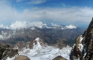
From the plateau of Lake Nino to the north you can see the main giants of Corsica such as Paglia Orba 2 525 m above sea level, Punta Minuta 2 556 m above sea level, Capa Falu 2 540 m above sea level, Monte Cinto 2 706 m above sea level. To the southwest you can see the mountains Monte Rotondo 2 622 m above sea level, Punta Muzzella 2 342 m above sea level and Punta alle Porta 2 313 m above sea level.
Danger
There are no dangerous sections on the route. The whole time you walk along the trails, first through the forest, then lightly on the rocks. The area around the lake is grassy. The path is well marked.
Food
Food on this one-day trek can only be done with chocolate or energy bars or sandwiches. This is not a long trek for which you need to specially stock up.
Attractions
The lake can also be reached via the famous GR20, which runs just a few dozen metres south of Lake Nino. The nearest GR20 trailhead is northeast of Lake Nino at the Castel de Verigo campsite.
Tip for your next trip to Corsica
If you liked the description of the trek to Lake Nino, be sure to also check out the trek to Lakes Melo and Capitelo, also on the island of Corsica. The two treks are only a few kilometres apart as the crow flies, but the accessibility of the starting points is in the tens of kilometres (you have to go around the Punta Artica massif).
Photos