Mountain range, region / State
Salzkammergut / Austria
Season
Spring
09. 06. 2023
Difficulty
3 / 5
Elevation
↑ 1526 m
↓ 1506 m
Length
15.5 km
8 hours
Altitude
max. 1839 m n.m.
min. 446 m n.m.
Tips for hikes in the mountain range Salzkammergut

Hiking up the Drachenwand wall in the Salzkammergut
Round trip above Lake Traunsee in the Salzkammergut
Hike to Mount Sandling in the Salzkammergut
Crossing the Schrottkamm ridge in the Salzkammergut
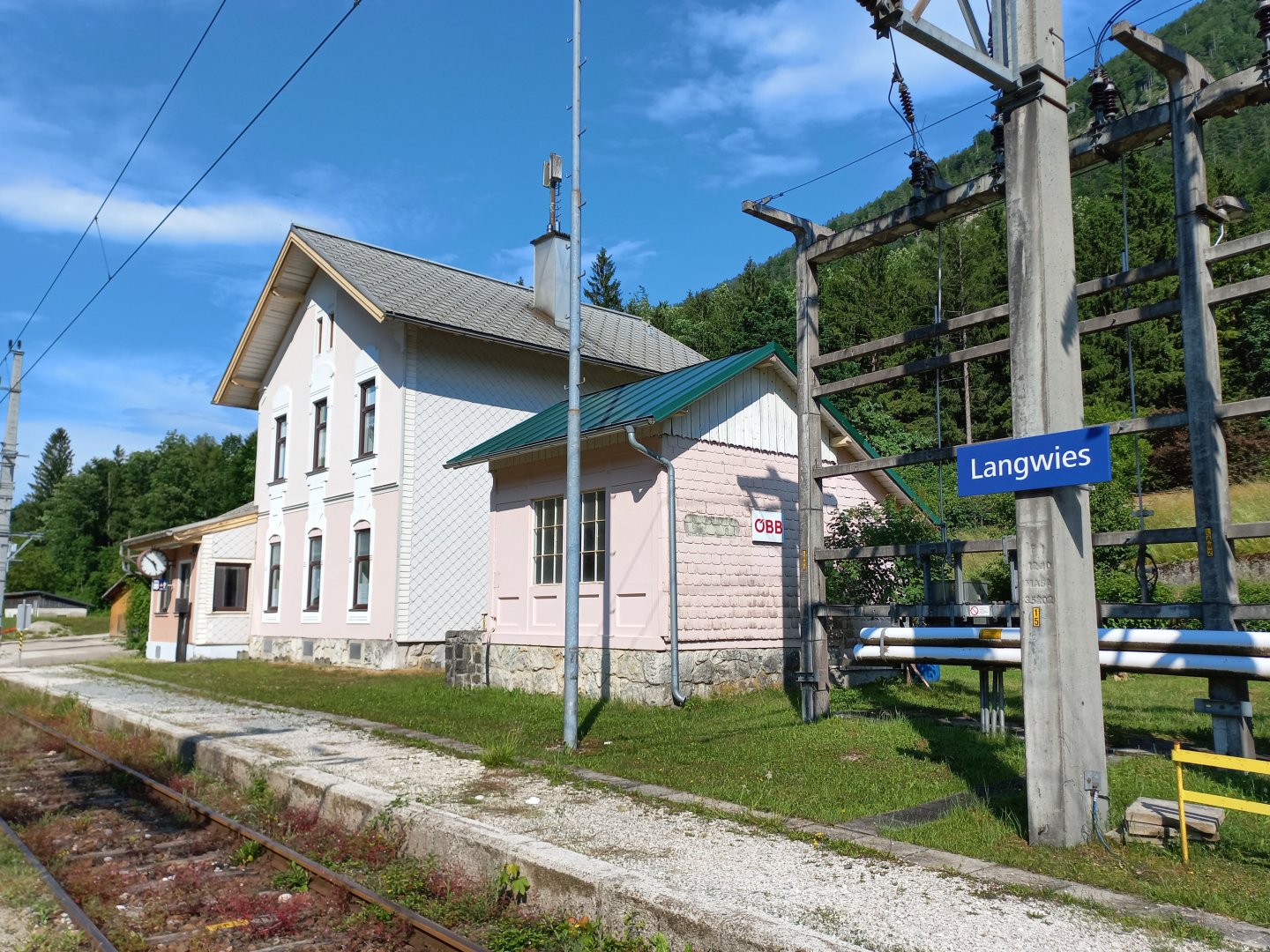
Starting point
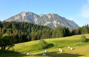
Railway station in the village of Langwies, about halfway between Ebensee an Traunsee and Bad Ischl. Parking is limited here though - only about 3 spaces, maybe better to come here by train or bus from Bad Ischl.
Description of the hike
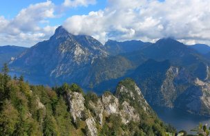
The Salzkammergut - Salzkammergut attracts visitors mainly with its clear glacial lakes Traunsee, Attersee, Mondsee and Wolfgangsee. Between them rise steep peaks that barely reach 2,000 m above sea level, but this does not detract from the challenge. The highest mountain is the Gamsfeld, measuring 2027 m. I head for the Schrottkamm ridge crossing, which offers spectacular views of the Salzkammer and the surrounding mountains - Traunstein, Totes Gebirge and Dachstein.
I start the crossing at the railway station in Langwies village. The ridge can be almost entirely overlooked from here - a massive scalloped wall above me with several prominent peaks. Langwies has only a few houses, a little past the small chapel I turn left into the woods. I emerge from an elevation of about 450m and a steep climb awaits me to the ridge, which is more than 1000m higher. The climb is sharp right from the village, serpentine through mixed forest, still uphill. Occasionally, mountains show up in the pass - first the Leonsberg above Bad Ischl, then the Höllengebirge, the hills between the Traunsee and the Attersee with the highest Grosser Höllkogel a short distance away. Below them is the Traun valley, along which the busy link between Bad Ischl and Traunsee winds.
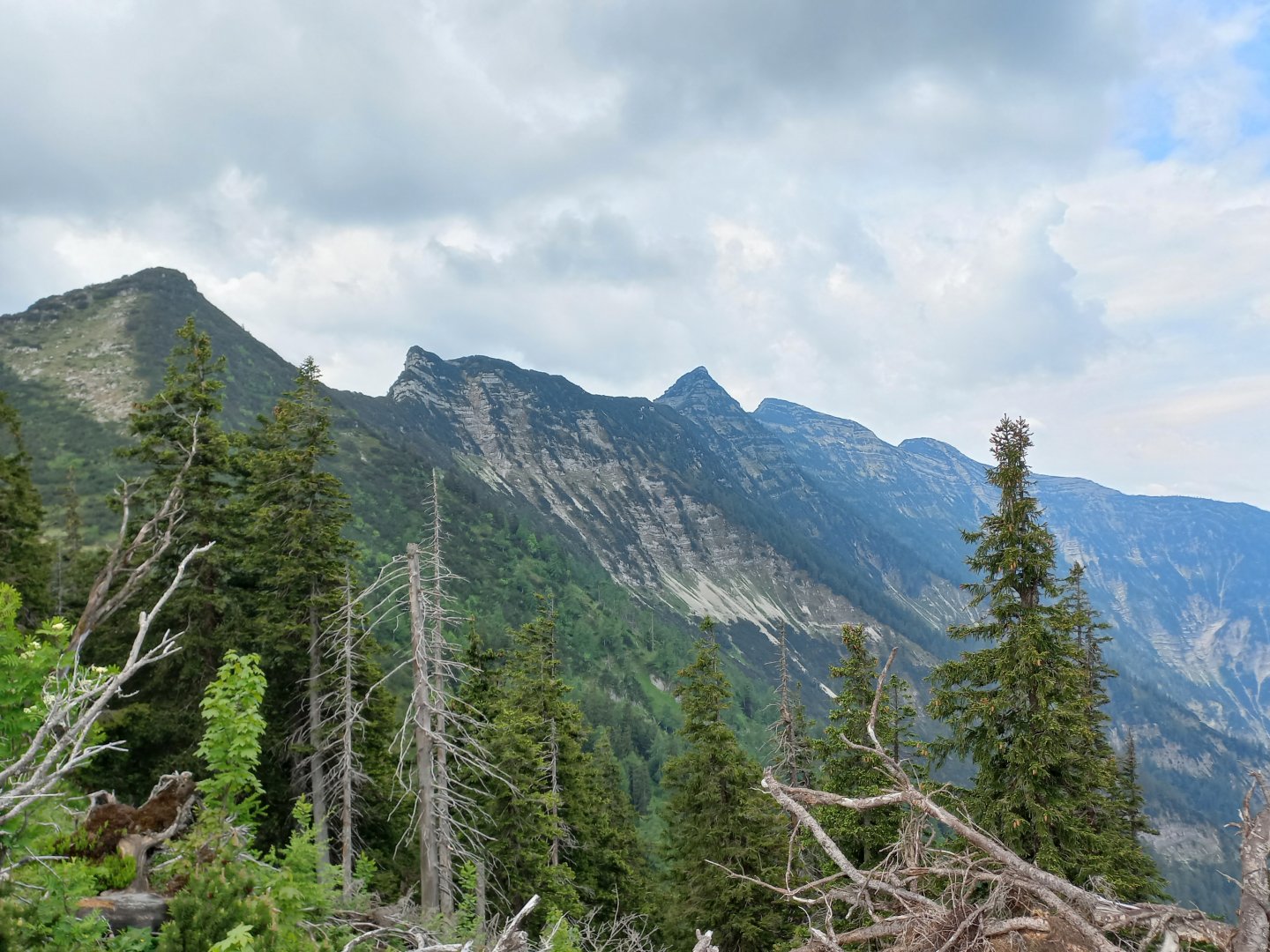
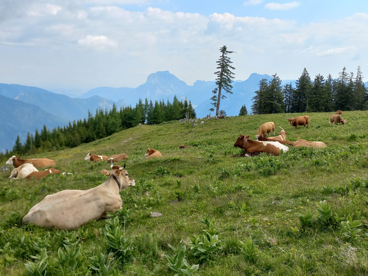
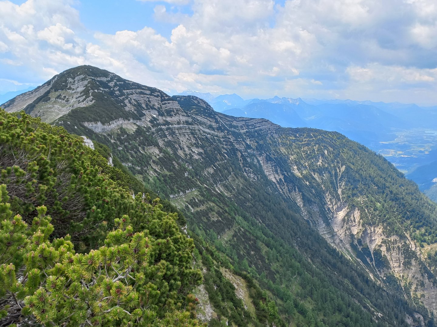
After about an hour and a half of climbing, the path turns to the north side of the ridge, to the Brombergalm alm. From the almo there are nice views of the Höllengebirge, on the eastern part you can see the Bergstation of the cable car to Feuerkogel. Below it, the Traunsee and the Traunstein massif, further east, for example, the Kasberg and a little in the haze of the Totes Gebirge. On the almo there is the possibility of refilling water, a spring with a wooden trough for cattle. From the almo I climb to the first peak of the Petergupf ridge (1646 m). From there I can already get an idea of the next route. In front of me are the sharp cones of Bannkogel (1656 m), Bergwerkkogel (1689 m), Mittagkogel (1790 m) and the highest Hohe Schrott (1839 m). I look at the map a little dismayed and can't believe that the path will take me over all the peaks.
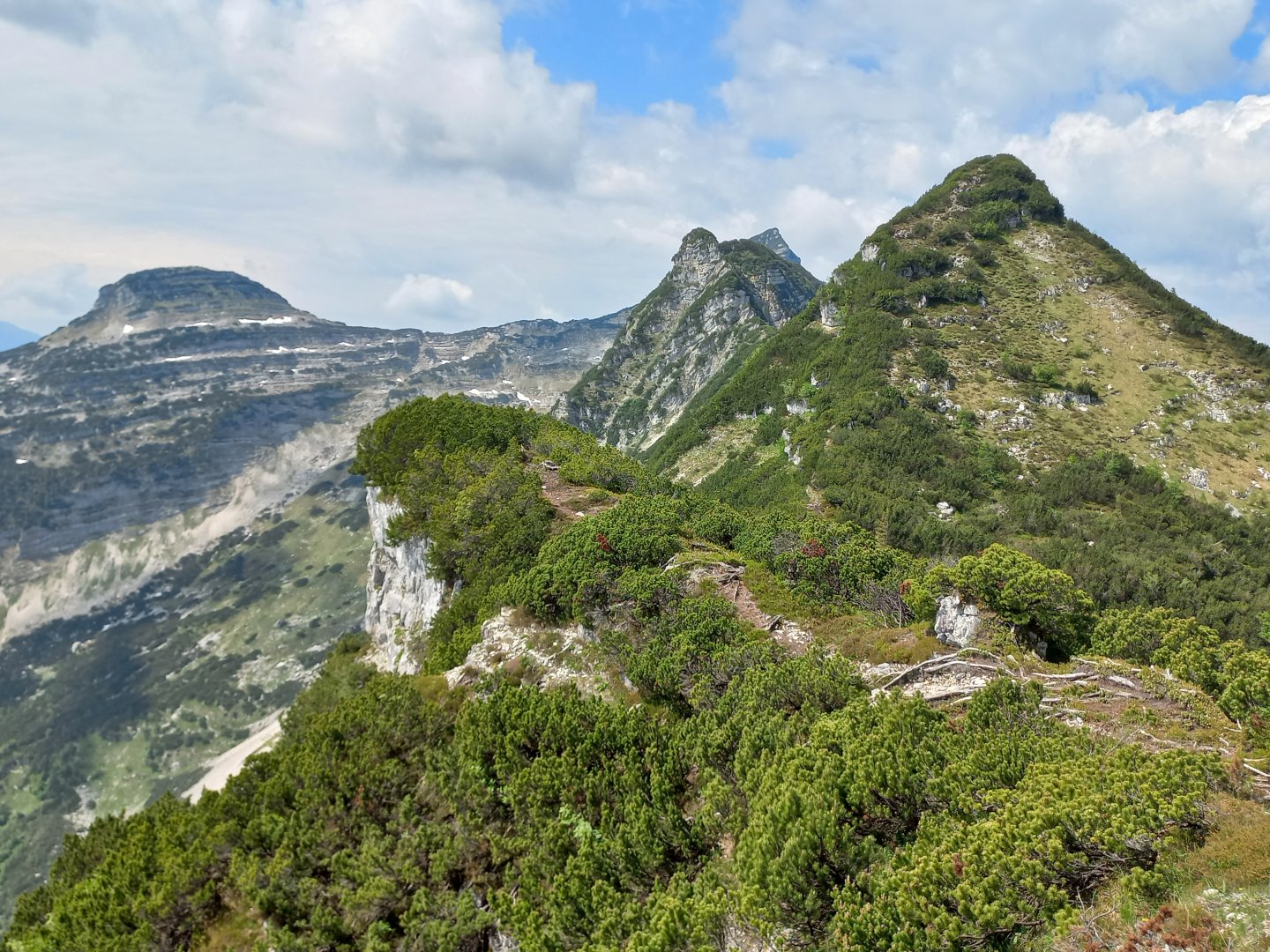
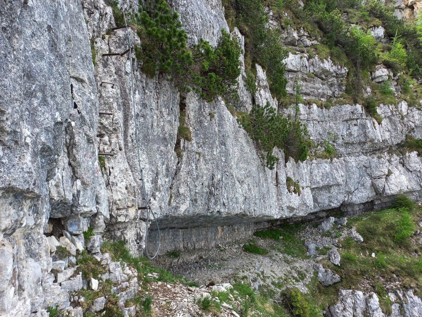
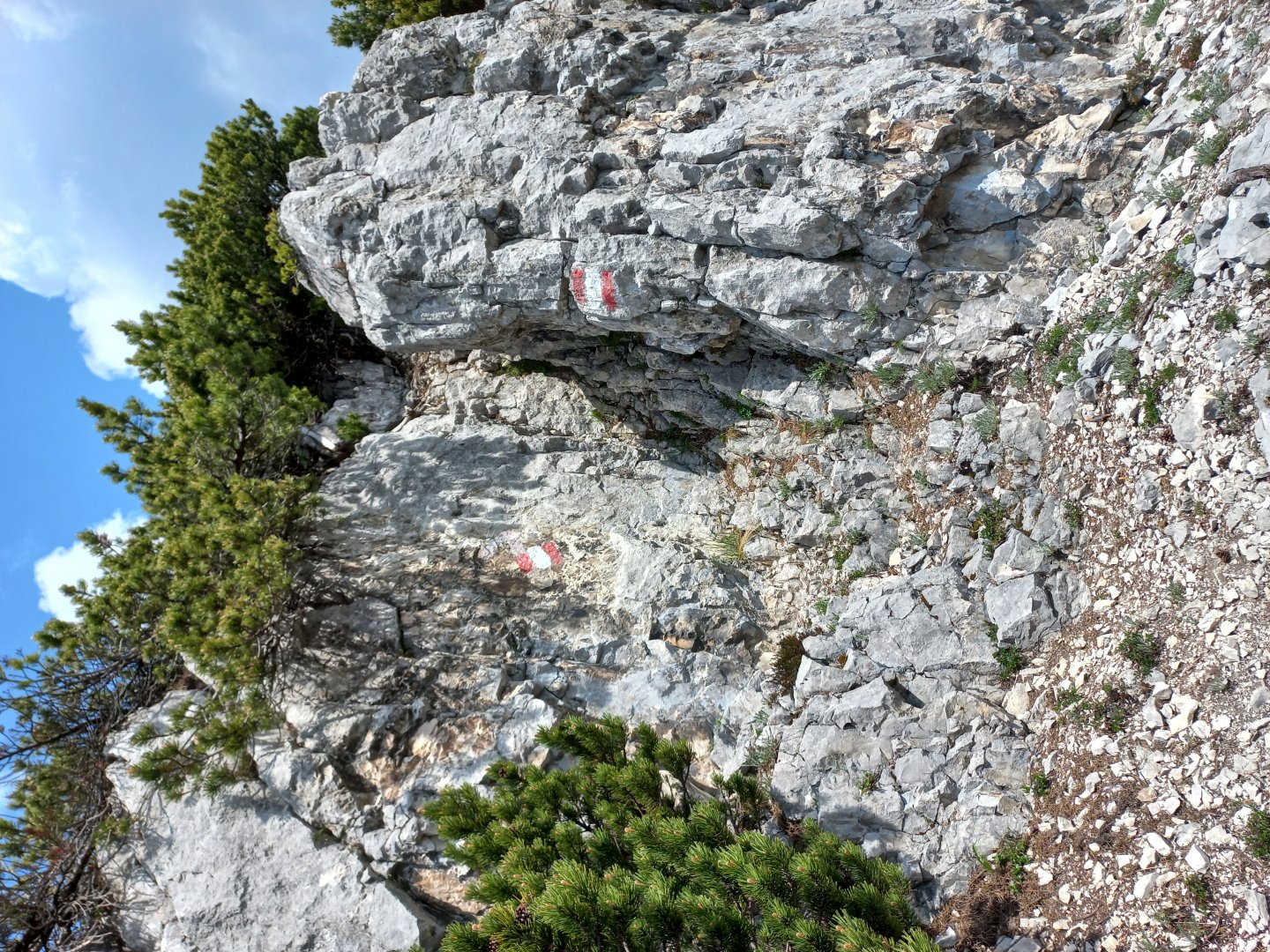
After resting for a while, I start my journey. And it always works out. The trail follows the ridge, weaving in and out of rocks and kneeling, always going over the top of the hill. But it's not an easy walk - scrambling over smaller rocks with the help of my hands and stumbling over rocks and roots while kneeling becomes the norm after a while. The signage is perfect though, I don't get lost or lost anywhere. I pass Bannkogel somehow automatically, interesting passages occur below Bergwerkkogel. Here the footpath crosses to the northern part of the ridge and passes under a wide furrow. Beyond it there is an overhang and the trail suddenly ends, or rather continues perpendicularly upwards on metal steps and a section secured by a metal rope to the summit. But it's only a few meters, the handholds hold perfectly and so even though I don't know ferrata, I'm not worried at all. Then a short straightened section without belay and once more with the rope up and to the right. Shortly after this technical passage is the top of Bergwergkogel.
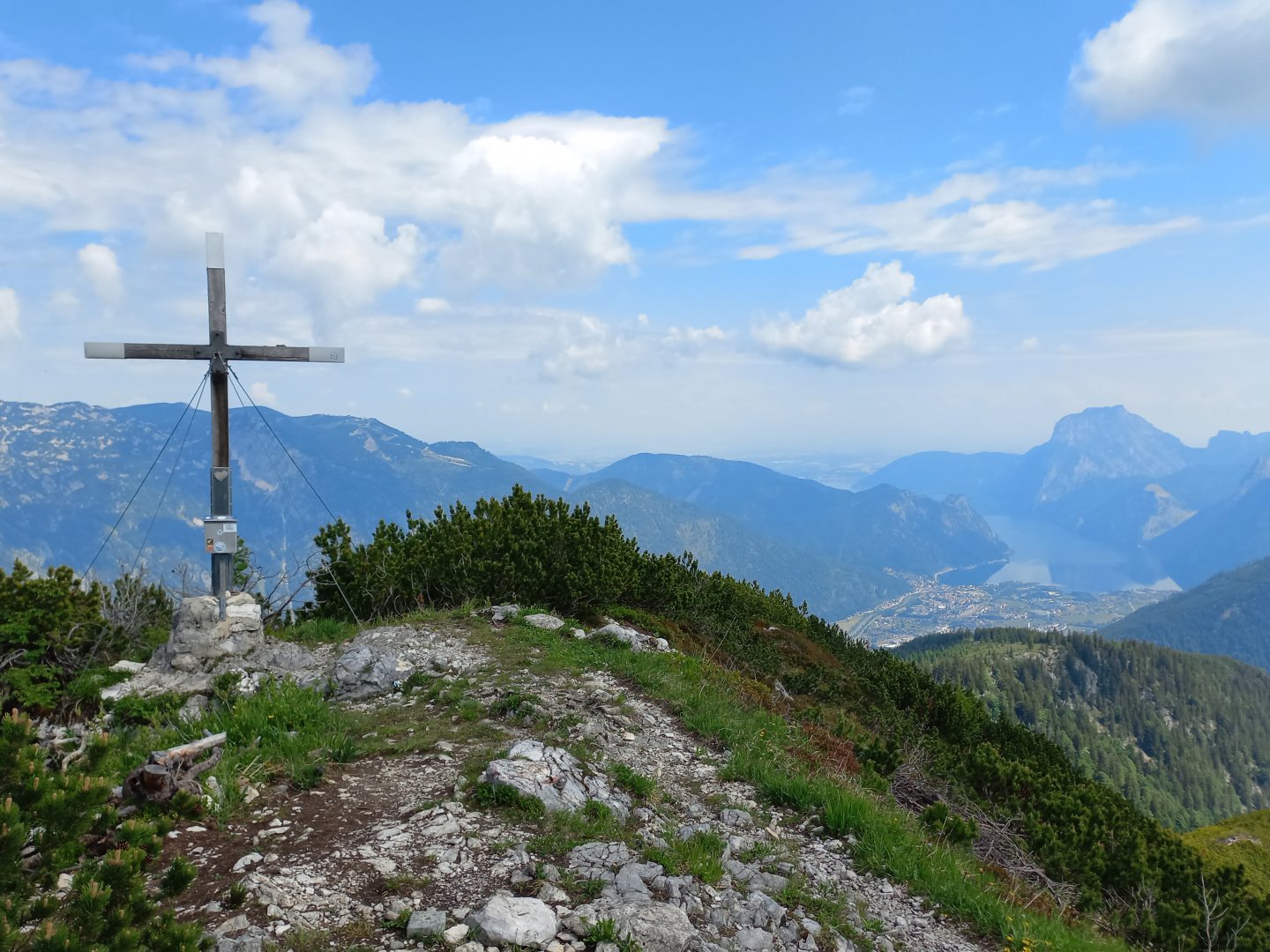
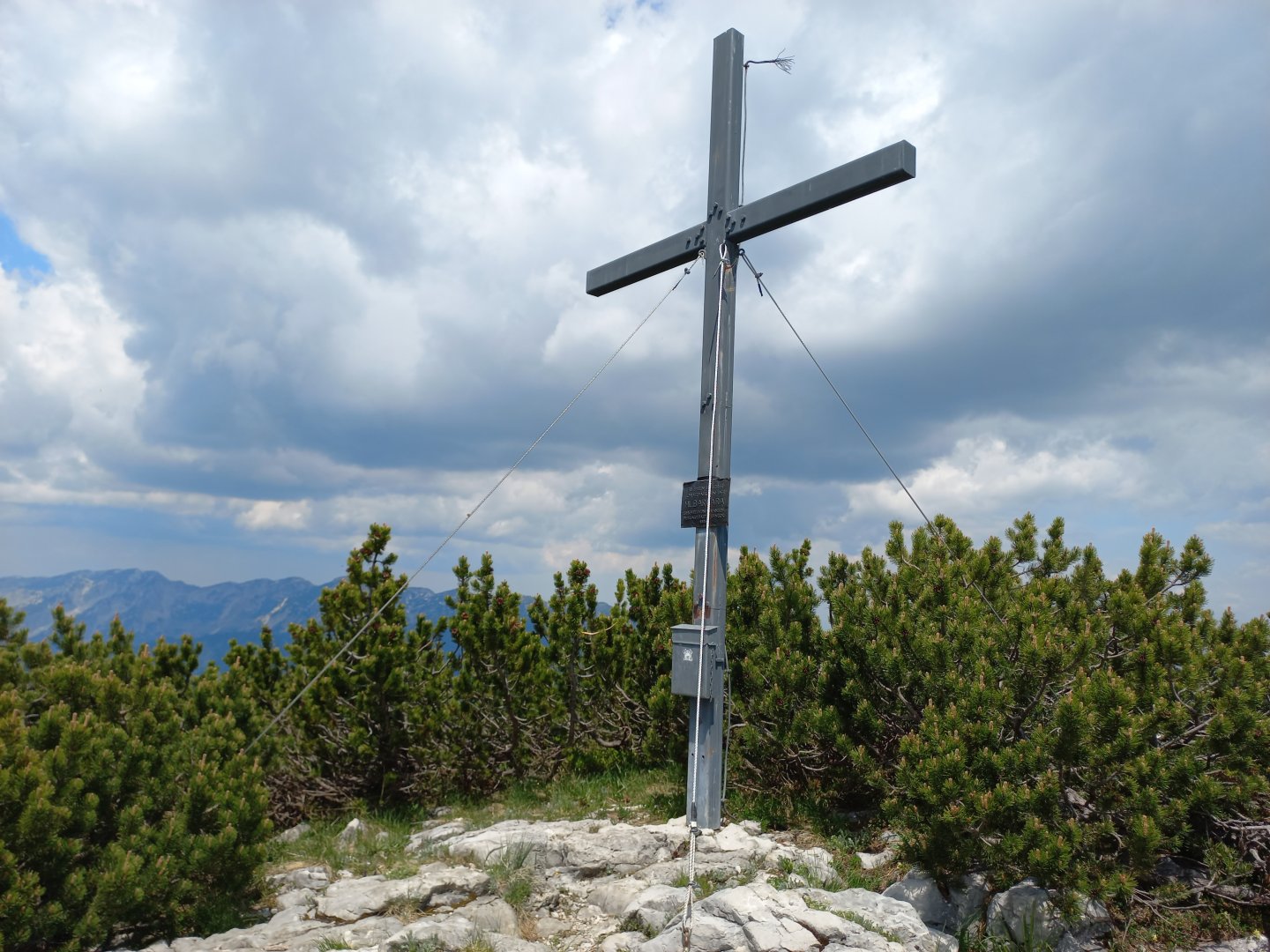
After him I continue straight along the ridge to Mittagkogel again. To the left of it is the rounded "striped" Speikkogel and behind it the westernmost double peak of the Totes Gebirge Schönberg - Grosser Wildenkogel. To the south are Loser, Sandling, Hoher Sarstein and Dachstein with a visible glacier on the north face. I follow the grassy traverse to the top of the Mittagskogel. A footpath branches off from the marked route, climbing between limestone scree and kneeling to the highest point. Here is a pleasant surprise - a simple cross woven from two branches of a slash.
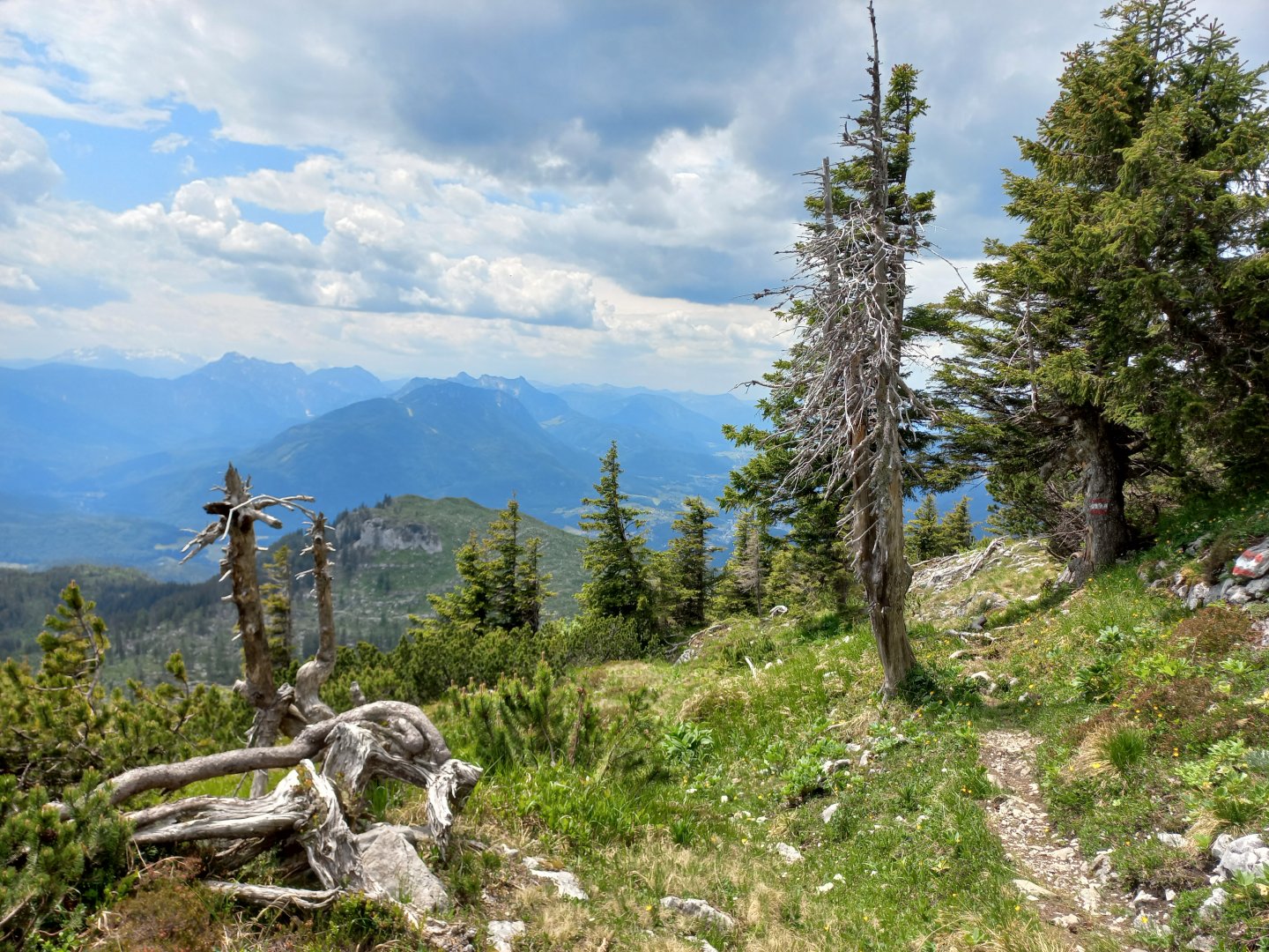
After a while of sunbathing on the limestone plateau I head to the highest point of the ridge. At Hohe Schrott I am a bit out of breath after a difficult hike. At the fork in the road, however, I still gather up the remaining strength and set off for Hochglegt (1784 m). From there it's straight down to Bad Ischl via Kotalm. The southwestern end of the ridge is bare, hurricanes have swept through and felled most of the trees, so I still have a beautiful view of the Bad Ischl valley and the famous peaks of Katrin (an old cable car from 1959) and the sloping Schafberg (a historic cog railway). About two hours later I'm down and take the bus back to the car in Langwies.
Difficulty
The path leads along a marked hiking trail. However, it is more physically and technically demanding - count 8 - 9 hours of walking, vertical metres, climbing over smaller rocks and shorter sections secured with fixed ropes.
Water availability
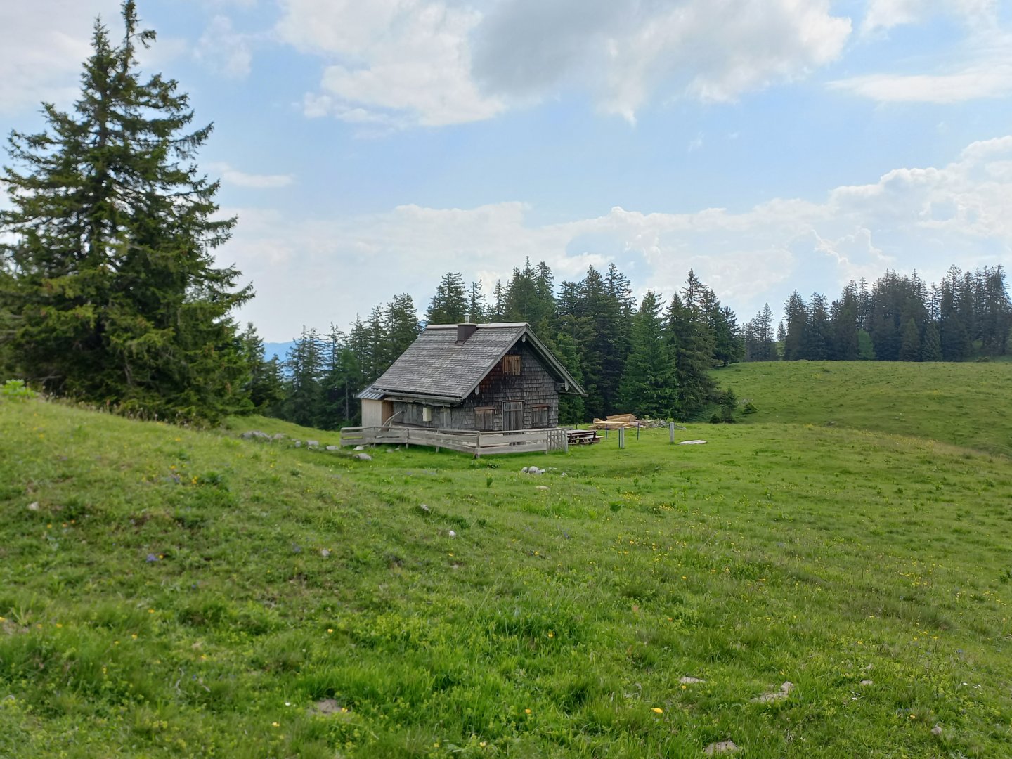
The water is at the beginning of the trail at Brombergalm - a spring and a cow trough, then at the end in Bad Ischl.
Sleeping options
There is no lodge on the road, plenty of options in the valley. There are campsites around the lakes.
Mountain peaks
On the ridge the peaks Petergupf, Bannkogel, Bergwerkkogel, Mittagkogel, Hohe Schrott and Hochglegt.
Views in order of appearance: Leonsberg, Grosser Höllkogel, Traunstein, Totes Gebirge, Loser, Sandling, Hoher Sarstein, Dachstein, Gamsfeld, Katrin, Schafberg
Danger
The trail is marked with a black dot, it goes right along the ridge, but although I don't mind exposed spots, I wasn't worried anywhere here. In places there are steel ropes stretched out to make the way easier.
Food
Water and food with you, refreshments are available in Bad Ischl.