Mountain range, region / State
Salzkammergut / Austria
Season
Spring
29. 05. 2022
Difficulty
2 / 5
Elevation
↑ 967 m
↓ 967 m
Length
12.4 km
5 hours
Altitude
max. 1717 m n.m.
min. 920 m n.m.
Tourist map of Salzkammergut in Austria
Tips for hikes in the mountain range Salzkammergut

Hiking up the Drachenwand wall in the Salzkammergut
Round trip above Lake Traunsee in the Salzkammergut
The challenging crossing of the Schrottkamm ridge to Bad Ischl
Sandling - Treasure Mountain near Bad Aussee
Starting point
Parking on the edge of the forest behind the village of Oberlupitsch (free of charge). The village is located west of Bad Aussee.
Description of the hike
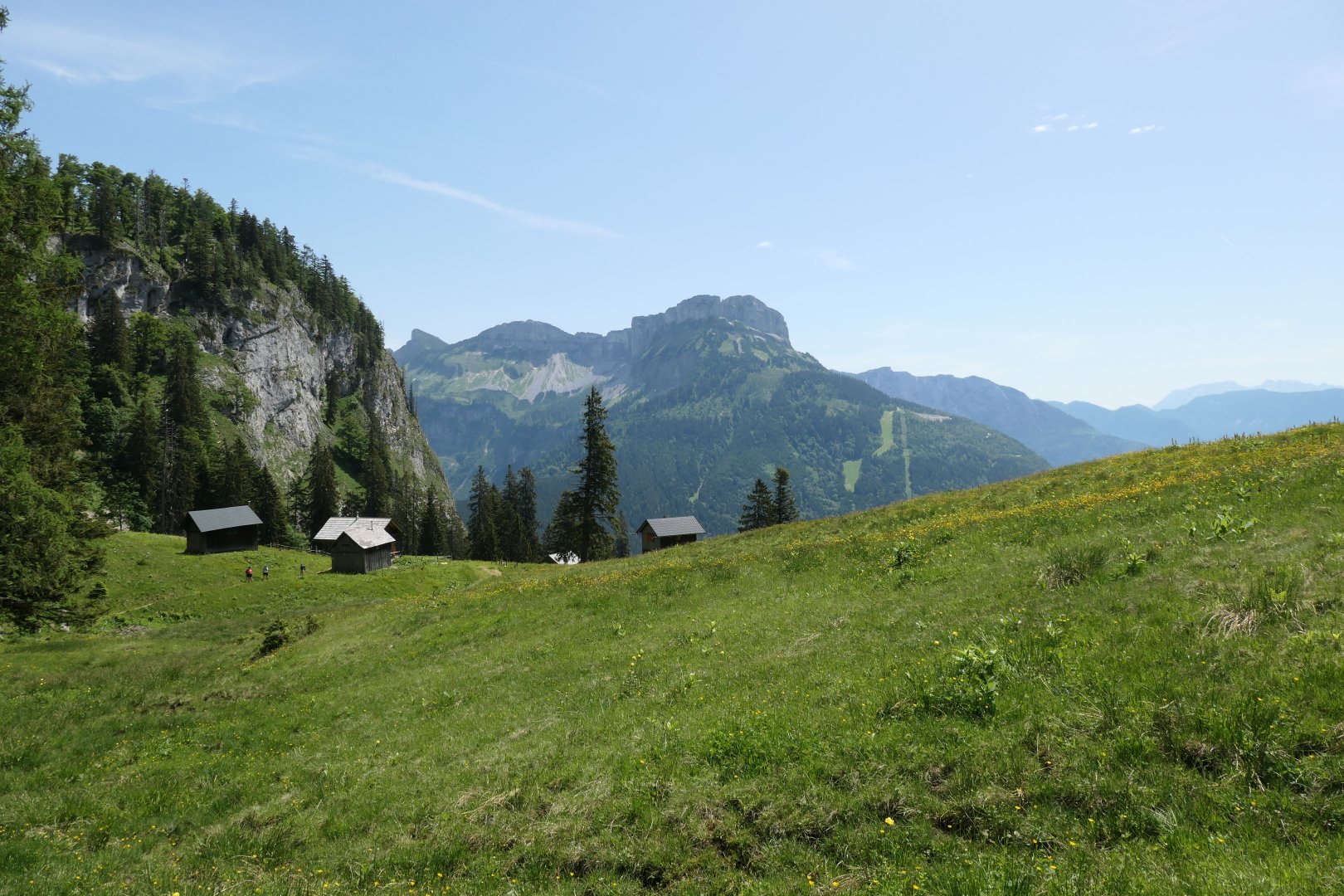
Sandling - Treasure Mountain near Bad Aussee Bad Aussee is a picturesque spa town located on the border of the Salzkammergut, the Totes Gebirge and the Dachsteingruppe. It has everything you expect from Austria - mountains, lakes, neatly decorated houses. Mountains surround the town on all sides - in the north-west the Loser massif (1837 m) dominates the area, against it the massive Trissenwand wall (1755 m) above the waters of the Altausseer See, the wooded Zinken (1854 m) in the south and the steep slopes of the Hoher Sarstein (1975 m), and to the west the Sandling (1717 m). It was the latter that I chose as the destination of the trip. Although it is the lowest of the surrounding mountains, it has a wonderful circular view and is also a mountain with a story that has caught the attention of Hollywood (more at the end).
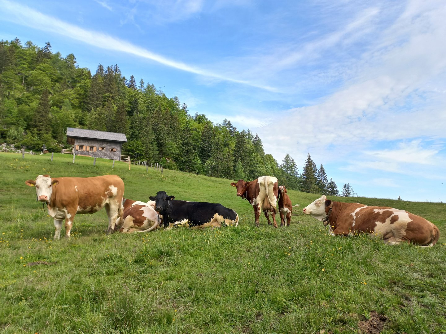
I leave my car in the spacious parking lot at the edge of the forest behind the village of Oberlupitsch and follow the marked AV trail towards Lambacher Hütte. After the Waldgraben homestead a few cottages away, I turn into the forest, the trail first follows a logging road and after a while turns into a forest path. An easy climb through the forest along the Sandlingbach stream awaits me, with views of the opposite Hoher Sarstein and the north face of the Dachstein with its glacier looming behind it. After an hour and about 400 vertical metres I reach the Vordere Sandlingalm above the forest boundary.
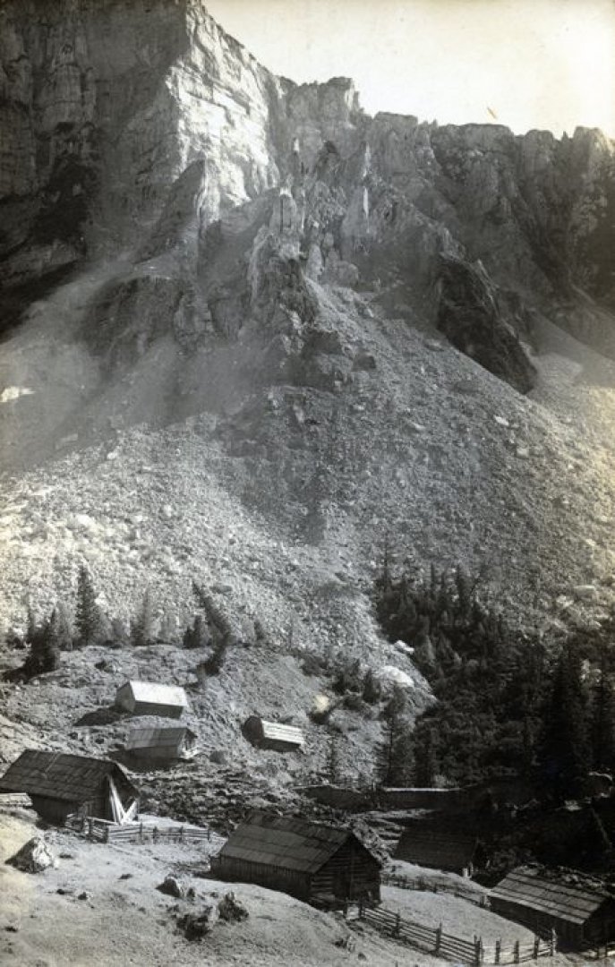
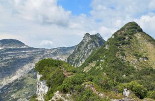
Only a few cottages remain from the almo, after the heavy rains of September 1920, part of the Sandling massif collapsed and buried the settlement under rubble and rocks. The mass of limestone was an unimaginable seven million cubic metres, and it slid down along the stream into the valley for several weeks. From the almo, two marked trails lead to the summit - the assured trail (marked "Nur für Geübte") turns right towards the wall, the hiking trail goes straight along the contour into the forest. According to the descriptions, the secured route should be of difficulty A - B and takes about an hour to ascend, the hiking route is half an hour longer. It is after rain, the limestone is slippery, so I choose the tourist route.
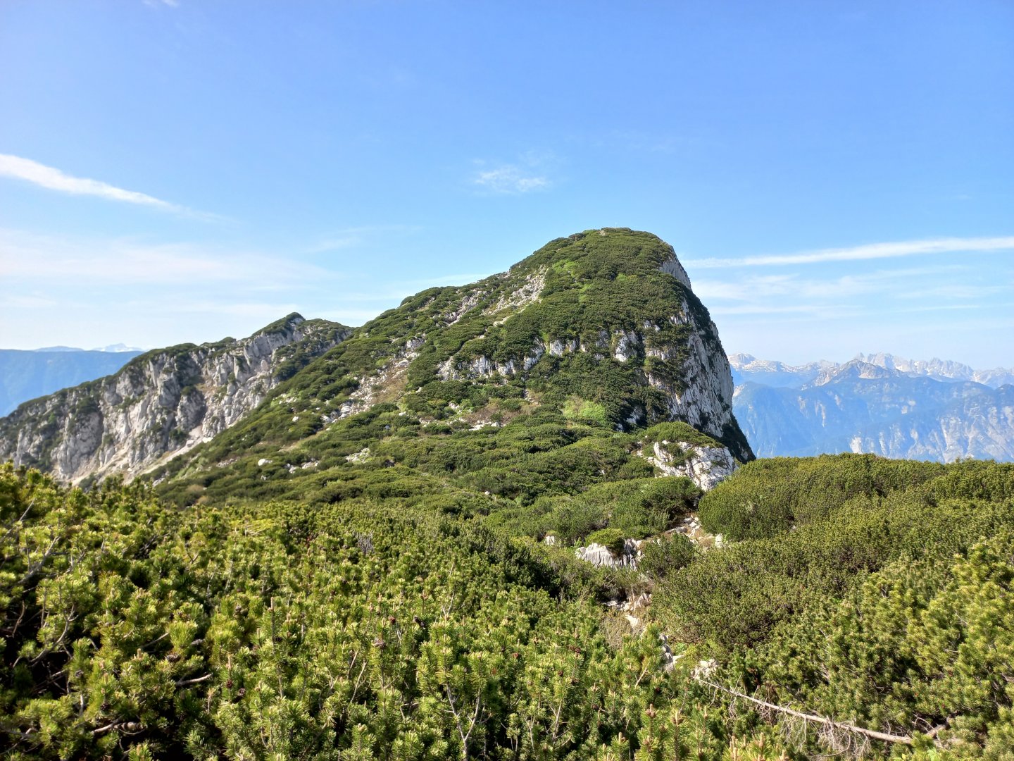
But I don't regret it - from the road you can see the views on the other side of the hill towards the Bad Ischl valley. The peaks of the Katergebirge, the sloping Shafberg massif above Wolfgangsee, Zimnitz (Leonsberg) and Hohe Schrott come into view. After a while, I come to a fork in the trail, from which a turn leads to the summit. It's only about a kilometre to the summit, but a good 300 metres of ascent mostly over limestone scree. The climb is not technically demanding, but rather physically demanding - overcoming scrapes and snow pits will be hard.
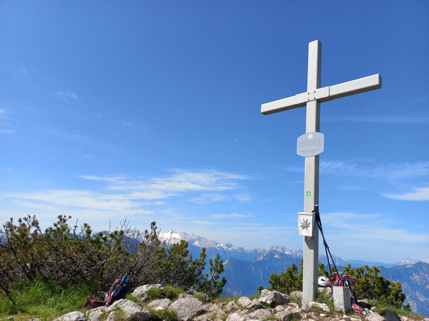
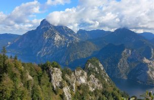
A few places are secured with fixed ropes for safety, but these are not exposed sections, the path runs between cramps. After an hour I see the summit cross. And from it, a beautiful circular view - Dachstein with its glacier shining white in the south, Hohe Sarstein in front of it, Hallstatt Lake, then clockwise Bischoffsmütze and the jagged ridge of Gosaukamm, the highest mountain of the Salzkammergut Gamsfeld, in the distance the snow-covered Tennengebirge, to the west the Katergebirge, Shafberg and Zimnitz, to the north the Hoher Schrott, the high cone of the Schönberg (Grosser Wildenkogel), the westernmost two-thousanders of the Totes Gebirge, the Loser massif and the Altaussee below it, the peaks of the Totes Gebirge and the Ennstal Alps, the Grimming and the snow-covered Schladming in the haze beyond.
After resting for a while I return the same way back to the turn to the top. It goes down much faster, gravity helps, but the wet rocks slip, you have to be careful. A little below the turn-off are the Ausseer Sandlinalm huts and a spectacular view of Loser. From the alm the road descends gently towards Altausee and Lupitsch. After a while the Via Salis hiking and cycling trail joins - a circular nature trail about salt mining in the region, which takes me back to the car park at Waldgraben.
Difficulty
A trip to the lookout hill in Salzkammergut. Moderately demanding in terms of elevation, on classic alpine paths (forest paths, knees, stones). There are several steel ropes stretched below the summit to facilitate walking.
Water availability
There are no huts on the route, there are springs and streams in the forest and on the almshouses. Even so, it is good to have at least 1.5 litres of water with you.
Sleeping options
In the valley there are plenty of guesthouses, hotels, campsites.
Mountain peaks
The ascent to Sandling offers views of Dachstein,Hoher Sarstein, Gosaukamm, Tennengebirge, Gamsfeld, Katergebirge, Schafberg, Zimnitz, Hohe Schrott, Grosser Wildenkogel, Loser, Totes Gebirge, Grimming etc.
Danger
A safe trek, below the summit there are several sections secured by a steel rope. Otherwise you can follow the classic alpine paths or forest trails. Partly on limestone scrambles to the summit.
Food
There is no refreshment option on the trail, so bring a snack (ideally a chocolate bar to replenish your energy).
Attractions
Salt - white gold - has been mined at Sandling since the early Middle Ages. To this day, the Altaussee hills contain the largest salt reserves in Austria and a large salt processing plant is located just outside Bad Ischl. The old shafts inside the mountain can be visited on the Saltzwelten tours (www.salzwelten.at). Salzwelten has three branches - in Hallstatt, Hallein near Salzburg and in Altaussee - where visitors are introduced to the history and present of salt mining.
Each mine is different - Hallstatt is probably the most touristy and best known for its mining trolley rides, in Hallein you can go boating on the salt lake and in Altaussee there is the chapel of St. There is a St. Barbara's lake built entirely out of reddish salt blocks, an underground lake with a light and music show and an exhibition on events that happened before the end of the Second World War and which have nothing to do with salt.
Hitler was a great lover of old art. He wanted to collect the spoils of war - works of art looted from museums and private collections all over Europe - in the newly built Führer Museum in Linz. After the Allies began bombing German and Austrian cities, orders were given to move paintings, sculptures and other art objects underground. In the last two years of the war, the Nazis took more than 7,000 works of incalculable value to the salt mine in Altaussee, including Vinci's Lady with a Prism, Michelangelo's Madonna, and paintings by Rubens and Rembrandt.
When it became clear in 1945 that Germany was going to lose the war, Hitler decided that the artworks would be destroyed rather than fall into Allied hands. Large anti-aircraft bombs were brought into the mine in wooden crates marked "Caution Marble - Do Not Shake" and the mine was to be blown up. Fortunately, thanks to the vigilance and courage of the mine employees, this did not happen. In the last days of the war, the German soldiers were overwhelmed and the mine and artwork were saved. The powerful story inspired writers and Hollywood made a film about it, The Monument Men (2014), starring George Clooney and Matt Damon.
As the last attraction of Bad Aussee I would like to mention the Mercedes Brücke Bridge. It is a structure in the shape of the three-pointed star of Mercedes, which has a diameter of 27 m, and it is the largest display of the Mercedes emblem in the world. The bridge was completed in 2005 with the help of the Austrian and Swiss subsidiaries of DaimlerChrysler/Mercedes-Benz and, like the Mercedes three-pointed star, is supposed to symbolise the connection between earth, water and air.