Mountain range, region / State
Doupov Mountains / Czech Republic
Season
Spring
21. 03. 2022
Difficulty
1 / 5
Elevation
↑ 373 m
↓ 373 m
Length
10.9 km
4 hours
Altitude
max. 593 m n.m.
min. 284 m n.m.
Tips for hikes in the country Czech Republic

A trip with views to Pernštejn Castle in the Highlands
Trip to the Mohelno Hadec Steppe above the Jihlava River
Spring trip to the lookout tower Babí lom
Trip from Kadaň to the table mountain Úhošt'
Starting point
Parking lot at the Franciscan Monastery in Kadan. Just below the monastery there is a red hiking trail leading to the Úhošt' mountain.
Description of the hike
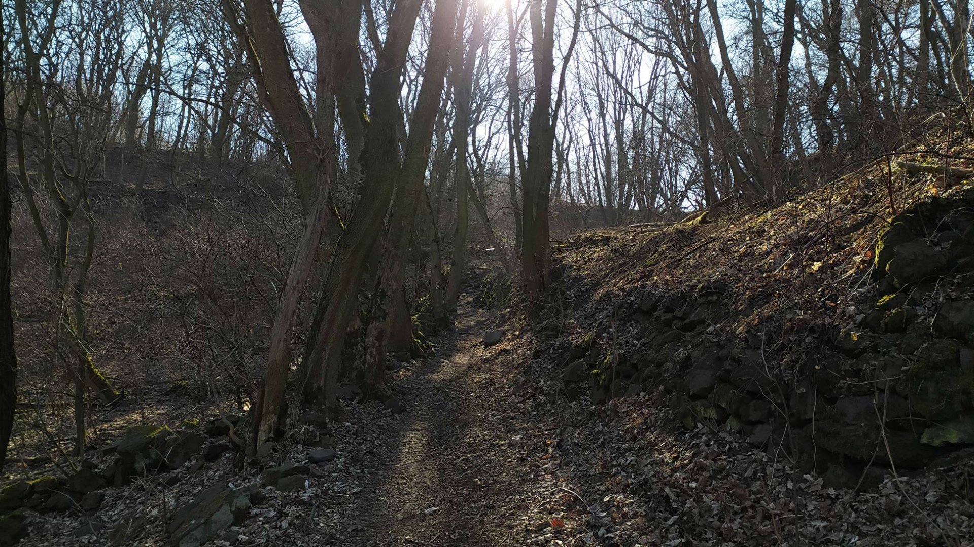
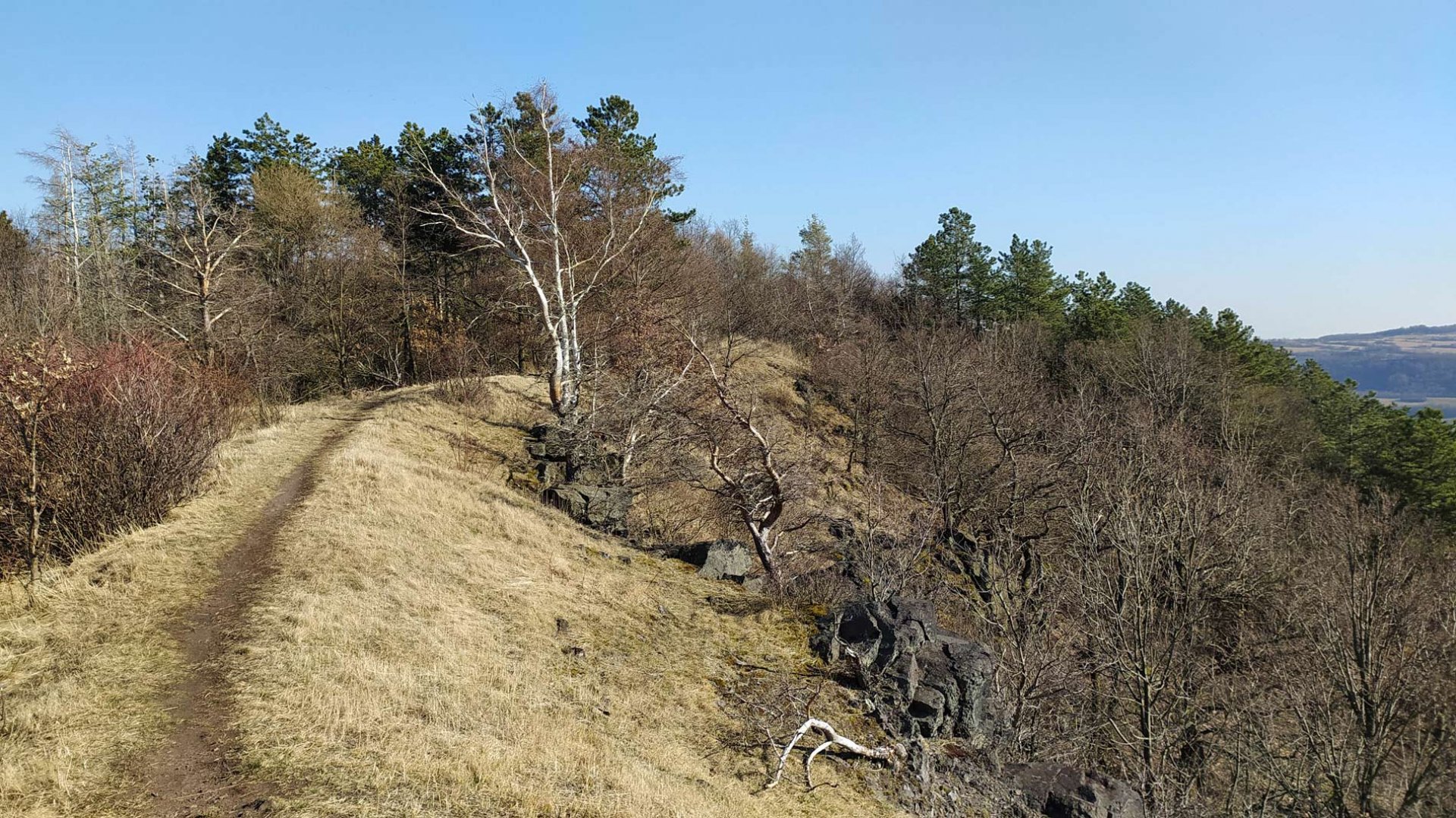
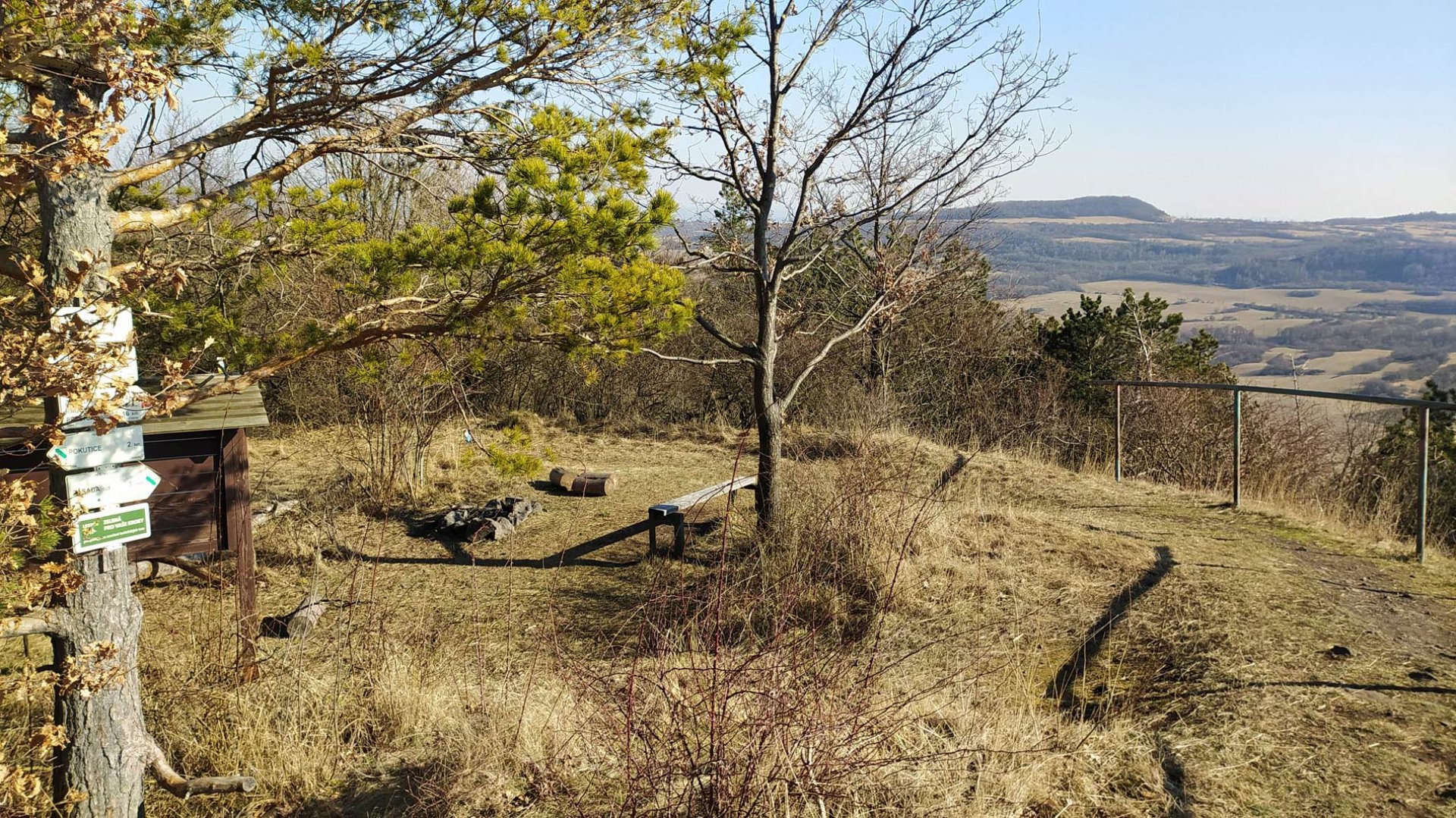
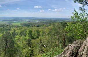
From the parking lot of the monastery I walked along the path along the monastery wall to the dam on the Ohře River. Here I joined the red hiking trail. I continued along the asphalt road until I reached the state road. I passed through the village of Pokutice. Here the trail turns off and I continued along a dirt road to the slopes of Mount Úhošt'. The climb up the mountain itself goes through the forest, it is not very steep and soon I found myself on the plateau of the mountain. As the weather was great, the views were great. The path runs along the edge of the mountain and so the views are uninterrupted all the time, especially of the Ore Mountains and their foothills. Along the trail I reached the very top of the mountain Úhošt'. From there you can see views of part of the Doupovské hory.
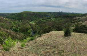
From the summit, the trail turns again to the plateau. The trail then turns and begins to descend the mountain. At the bottom, the trail turns into a wide path. I followed it below the mountain Úhošt to the Ohře River. The path goes directly under the mountain, so you can see the rock walls clearly. I reached the state road and continued through the village of Zásada near Kadana. I reached the Ohře River. There is a wide comfortable road along it, which I followed back to Kadana. I joined the road at the dam and then reached the parking lot of the monastery.
Difficulty
A very easy hike that leads for the most part on wide roads or trails. It is necessary to overcome some elevation, about 300 meters, but it is not difficult. The route is ideal for children and dogs. A stroller will not pass it, as it is on a narrower trail in places.
Water availability
I didn't come across any pubs, refreshments or a well to drink from on the trail. Therefore it is necessary to have some supplies, at least 1 liter of liquids.
Mountain peaks
Mount Úhošt' 593 m above sea level is a tabular mountain, therefore the summit is very wide. The views are mainly of the Ore Mountains and the Doupov Mountains.
Danger
The route crosses the state road twice.However, the frequency of vehicles is very low. Even so, it is a good idea to take extra care. The edges of the Úhošt' mountain are rocky in several places. It's a good idea to watch out especially for children, so they don't roll off... Otherwise, the route is technically perfectly fine.
Food
There is no pub or refreshments on the route. You will definitely need some snacks or sweets of your own.
Attractions
Mount Úhošt' is a table mountain in the Doupov Mountains, which was formed by volcanic activity in the Tertiary period. It is currently a national protected reserve, established for the protection of endangered plants and animals. The plateau was already inhabited in the Neolithic period. According to some historians, the Vogatisburg was even located here, where Sámi troops were to defeat the Frankish Empire in 631 AD. However, there is no concrete evidence for this. The village has been mentioned since the beginning of the 15th century. It was finally displaced in 1950.
Photos