Mountain range, region / State
Moravian-Silesian Beskydy / Czech Republic
Season
Fall
28. 10. 2022
Difficulty
1 / 5
Elevation
↑ 916 m
↓ 915 m
Length
14.9 km
4 hours
Altitude
max. 1324 m n.m.
min. 504 m n.m.
Tourist map of the ascent to Lysa mountaing in Jesenik
Tips for hikes in the mountain range Moravian-Silesian Beskydy
Three-day long distance hike along the border with Slovakia in the Beskydy Mountains
Trip to Prašivá mountain chalet in the Moravian-Silesian Beskydy Mountains
Sightseeing family trip from Ostravice to Hotel Sluníčko
Hike up to mountain Lysa on the yellow trail from Šance
Starting point
We drive to the Šance dam from Ostravice and leave our car in the unpaid parking lot right by the road. It is not an official parking lot, it is more like a bigger bay by the road, but there are other cars parked here, so we are not worried about a fine (no sign restricting parking anywhere).
Description of the hike
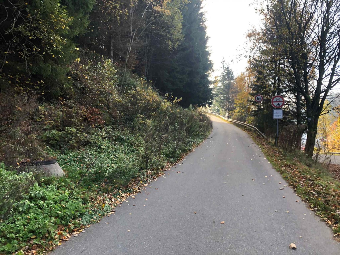
We leave our car near the dam of the Šance dam on the road 56 in the parking bays - it is not a parking lot, but there is no sign about no parking and there are a lot of other cars. We walk from the car to the Šance dam, which is actually a yellow sign that goes up to the top of Lysá hora.
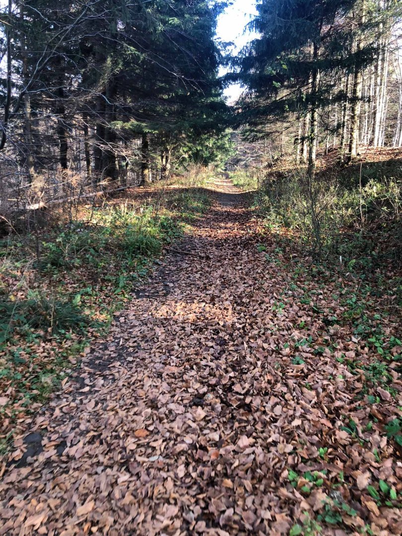
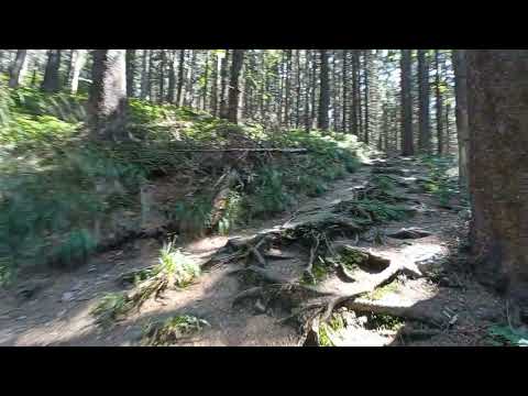
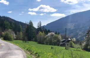
There is an asphalt road a little further past the dam, from which we soon turn into the forest. The climb starts very gently on a wide forest path. A little steeper gradient starts below the peak of Čupel 943 m above sea level, but the yellow sign traverses it, so we do not go over the top. The traverse below Čupel to the fork below Čupel is actually a straight line along a forest path.
The next steeper climb starts below Kobylanka 1 054 m above sea level, the top of which the yellow marker just misses. These steeper climbs are not dangerous - always a wide forest path, only it is in a steeper hill, which, however, can be easily managed by more fit seniors.
From Kobylanka we go again for a while almost on the contour, so almost on the flat. The final climb is already below the top of Lysá hora and the terrain and path changes to more rocky. However, not as rocky as the red sign to Lysá hora from Malenovice.
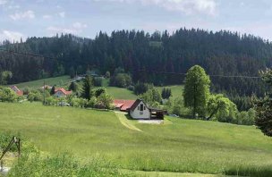
The great thing about this yellow trail is that it goes almost all the way through a mixed, mainly beech forest. Especially in autumn, it plays with all colours.
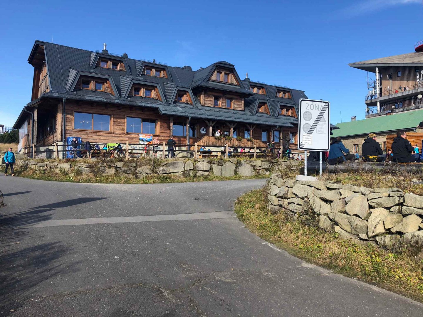
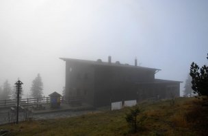
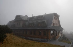
There were an extreme number of people at the top of Lysá hora on October 28, 2022. My estimate is definitely more than 500. This is due to the fact that there is also a classic road to the top, so lots of cyclists. Another factor is that there are four hiking signs leading to the summit from all directions, and the fact that it was a beautiful autumn day, plus a public holiday on a Friday. Fortunately, the newly opened Emil Zátopek Marathon hut is huge and together with the open Bezruč hut it managed this onslaught very well even around lunchtime.
Difficulty
The yellow trail to Lysá hora from the Šance dam is slightly shorter than the blue trail from Malenovice, but the gradient is steeper. It is not dramatic, but it is more often uphill on a forest path.
On the other hand, this path is almost entirely through the forest, which I personally found more pleasant. Even smaller children or more fit pensioners can manage the route. I don't recommend this route with a stroller - it's fine with a baby carrier.
Water availability
There is no spring on the road in the wilderness where you can get water. One litre of water per person will be enough to climb Lysá hora from Šanka. At the top of Lysá hora there is the Emil Zátopek - Maraton hut open all year round, where you can eat and drink well.
Mountain peaks
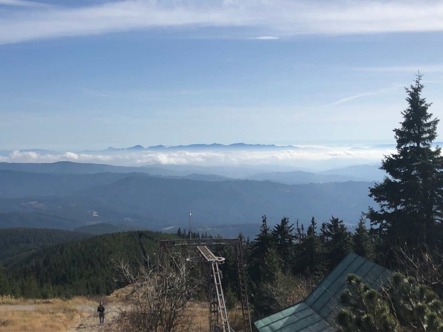
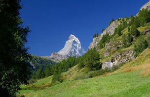
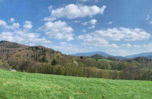
On the way we pass two smaller peaks Čupel 943 m above sea level and Kobylanka 1 054 m above sea level, but we do not climb either of them. The yellow hiking trail does not lead through them, so it is up to you to make a detour - it is about 150 metres from the yellow trail to Kobylanka. From the top of Lysá hora 1 324 m above sea level, the highest mountain of the Moravian-Silesian Beskydy, there are great views of the Slovak mountains in good weather. You can see the Malá Fatra Mountains and also the Western Tatras of the Roháče Mountains.
Danger
The route along the yellow trail from the Šance dam to Lysá hora is absolutely trouble-free. That is why we also state that it can be managed by both school-age children and seniors. The paths are mostly wide with no exposed places. It is still a mixed forest. There are only three steeper sections, but nothing difficult - just steeper uphill.
Photos and video