Mountain range, region / State
Schladming Tauern / Austria
Season
Summer
24. 07. - 25. 07. 2021
Difficulty
3 / 5
Elevation
↑ 3600 m
↓ 3729 m
Length
32.2 km
2 days
Altitude
max. 2577 m n.m.
min. 1093 m n.m.
Tourist map of the Schladming Tauern in Austria
Tips for hikes in the mountain range Schladming Tauern
Four-day trek in the Schladming Tauern region around the Hochgolling mountain
Round trip in the Schladminger Tauern with ascent to the Grosses Gurpitscheck
Circular trek in the Schladming Tauern
Summer crossing of the Schladming Tauern - in two days around Hochgolling
Starting point
Eschachalm car park (payable), or you can use the shuttle bus from Schladming.
Description of the hike
1. day
The Schladming Tauern are beautiful steep mountains rising from the Ennstal valley south of Schladming. Depending on time availability, you can plan one-day tours or multi-day mountain crossings. I opted for a two-day route in July 2021 from the Obertal valley to the high mountain lakes of Giglachseen, the Keinprechtshütte hut where they make excellent homemade cakes, via the Trockenbrotscharte and Gollingscharte saddles to the glacial lake plain of Klaferkessel. The journey back to Schladming was made even more interesting by the Wilde Wasser waterfalls at the end of the Untertal valley.
I leave the car in Schladming, the talerbus doesn't leave until around 9:00 and so I try my luck and hitchhike to the beginning of the Obertal valley. The first car stops for me - a friendly Austrian woman saves me a few kilometres of the journey and drives me to the car park at Eschachalm (1200 m). At the end of the valley a toll is collected. I leave the Eschachalm behind and head up the climb through the forest to the Duisitzkarsee lake. The ascent is easy, a forest path, crossing roots and stones.
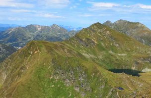
After about an hour I hear the tinkling of cowbells and emerge from the forest towards the green Duisitzkarsee and the nearby cottages Duisitskarseehütte and Fahrlechhütte. Stopping only for a short breath and a photo, I go around the lake from the right and continue uphill on Wanderweg 775. The path is steep, about 300 vertical metres from the lake, but I am rewarded with views back to the Duisitzkarsee and the idyllic alm beside it.
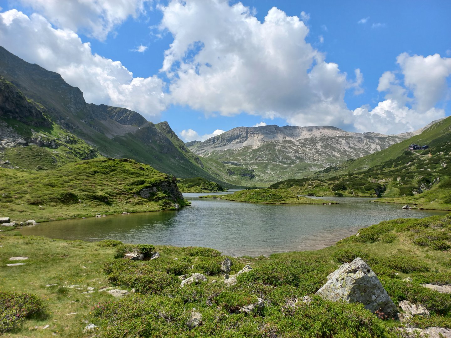
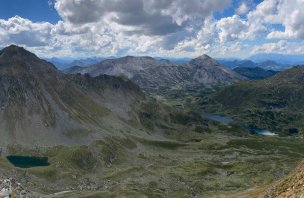
I've got about 800 vertical feet in the saddle now, so I'm grateful for a moment of respite on the contour. I can already see Giglachseen ahead of me - blue clear lakes with islands and green grassy ripples all around. I'm about to climb to the highest point of the first day's trek - the saddle below Rotmandlspitze (2,353m). I have to stop at the saddle - one of the most beautiful views of Schladming - Giglachseen below me, Dachstein in the clouds to the north, finally the mighty massif of Hochgolling to the east, the highest mountains of the Schladming Tauern, the white limestone Lungauer and Steirische Kalkspitze to the west.
A rocky path takes me to another saddle, from which I can already see the Keinprechtshütte hut. At the hut I order coffee and a delicious Linzerschnitte with currants. Slowly I collect myself for the final stage of the journey - a traverse under the Pietrach mountain to the Trockenbrotscharte saddle (2 237 m). In the saddle, I have Hochgolling, the Landawirseen lakes and the first day's destination, the Landawirseehütte, where I will sleep.
2. day
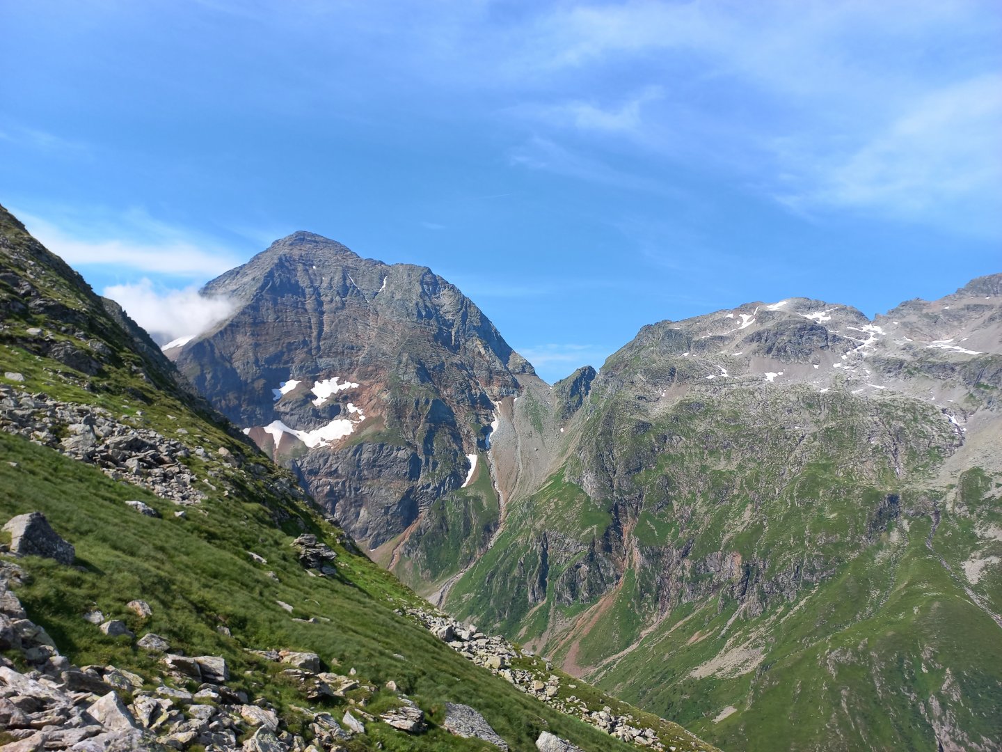
The next morning I wake up to fog and clouds, but before I have breakfast and get ready for the journey, the fog shrouds in the valley below Hochgolling break and I see the massif in all its glory. A beautiful, massive mountain. From the hut, it is possible to take the upper traverse, but there are still snow fields, so I prefer to descend a few hundred metres along the wide path from the hut below the Gollingscharte saddle (2,325m) and then take the steep path across the stone fields straight up. It's a shock to the unstirred body in the morning, 500 metres of sharp ascent up. In the saddle I breathe for a while and meet the first hikers and ferratistas heading up the Hochgolling from the other side.
The descent from Gollingscharte is also worth it - I lose 600 vertical metres in less than a kilometre, the route goes over rocks, the gravel is slippery, I pull out my poles for support. Finally I'm down by the stream, bypassing the horses grazing by the water and heading along the now wider path to the Gollinghütte (about 1,650m). Here I mentally prepare myself for the next challenging section - 1,000 vertical metres up to Greifenberg (2,618 m). The beginning is not nice - narrow path, shovels, wet grass, sometimes slippery mud, alder bushes.
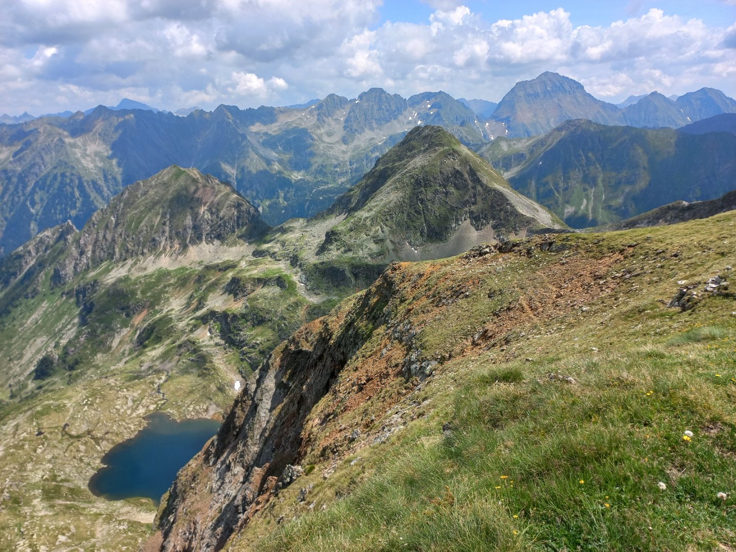
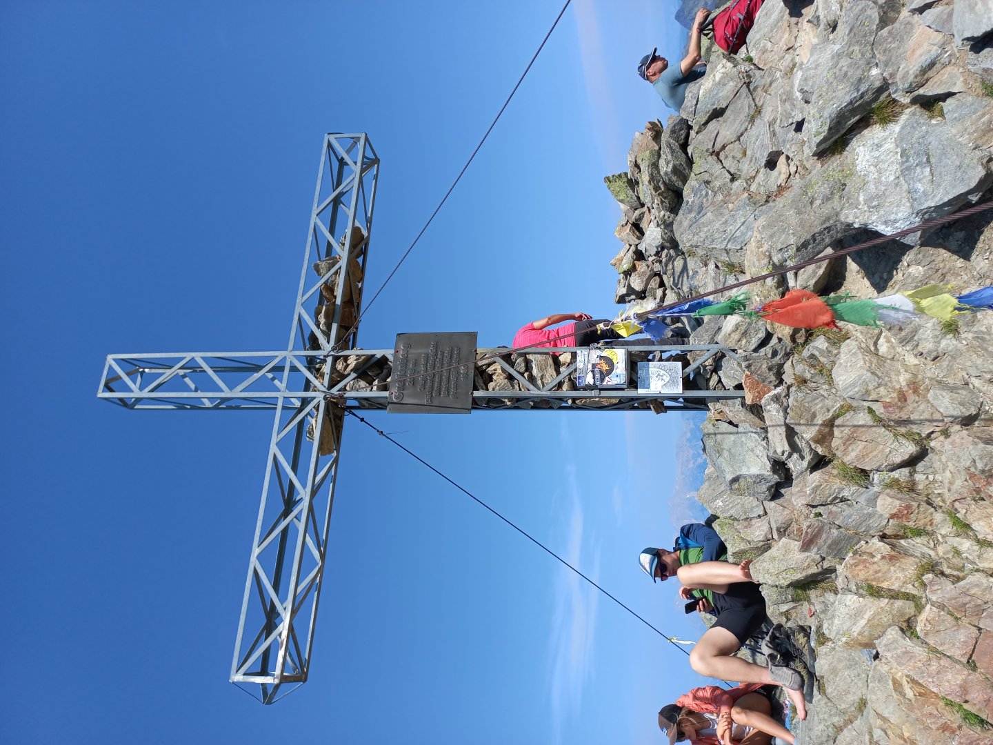
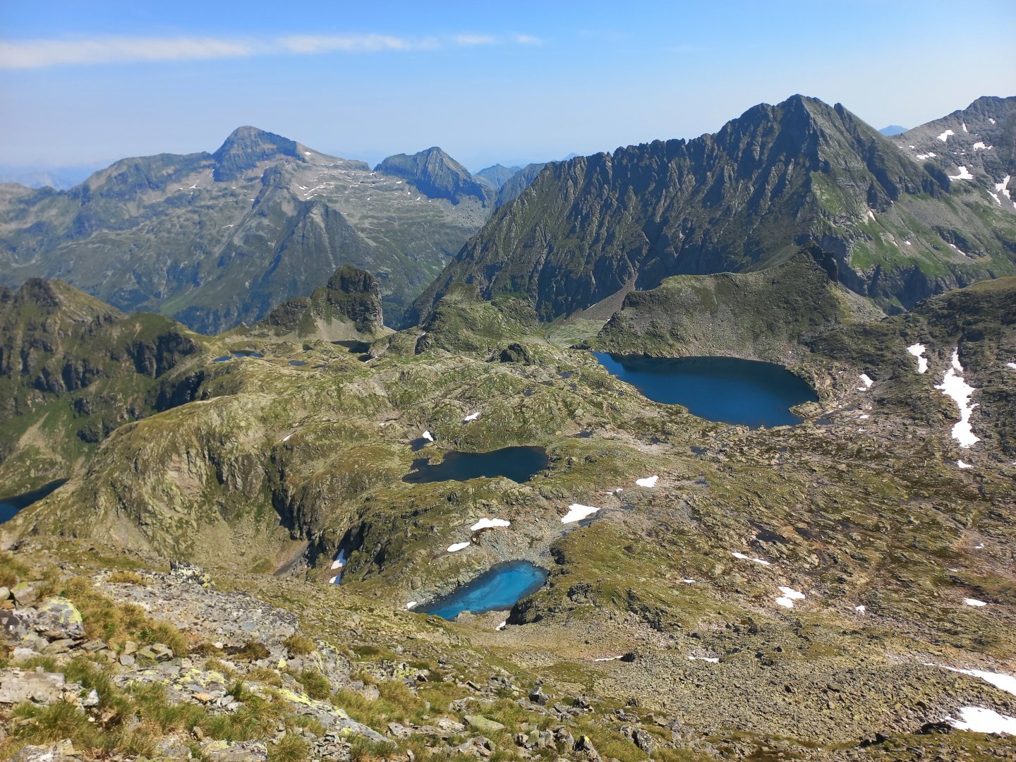
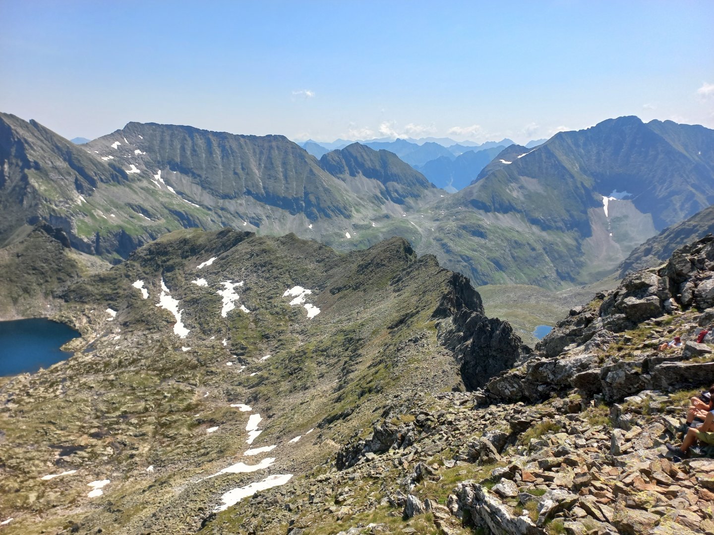
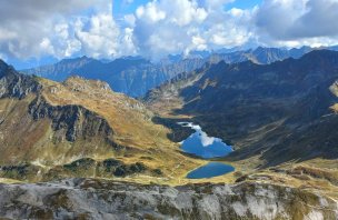
A couple of sections secured with rope over rocks, but nothing difficult. Around 2,000m, views of the valley and Hochgolling open up. Progressing towards the Greiffenbergsattel (2,450 m), I meet more and more people, Greifengerg is apparently a popular hiking destination. The Greifenbergsattel is a delight - the Sattlesee lake appears among the rocks, mirroring the blue sky. From a certain point of view it gives the impression of an edge pool, as if it overflows over the edge of the rock. The top of Greiffenberg is only a half-hour walk away. But now I understand why so many people head here - from Greiffenberg there are beautiful views of the prehistoric glacier-shaped Klaferkessel plain with dozens of lakes, each a different shade of blue. Above the lakes looms the Waldhorn massif (2,702 m), with the sloping profile of the Hochwildstelle (2,747 m) in the distance.
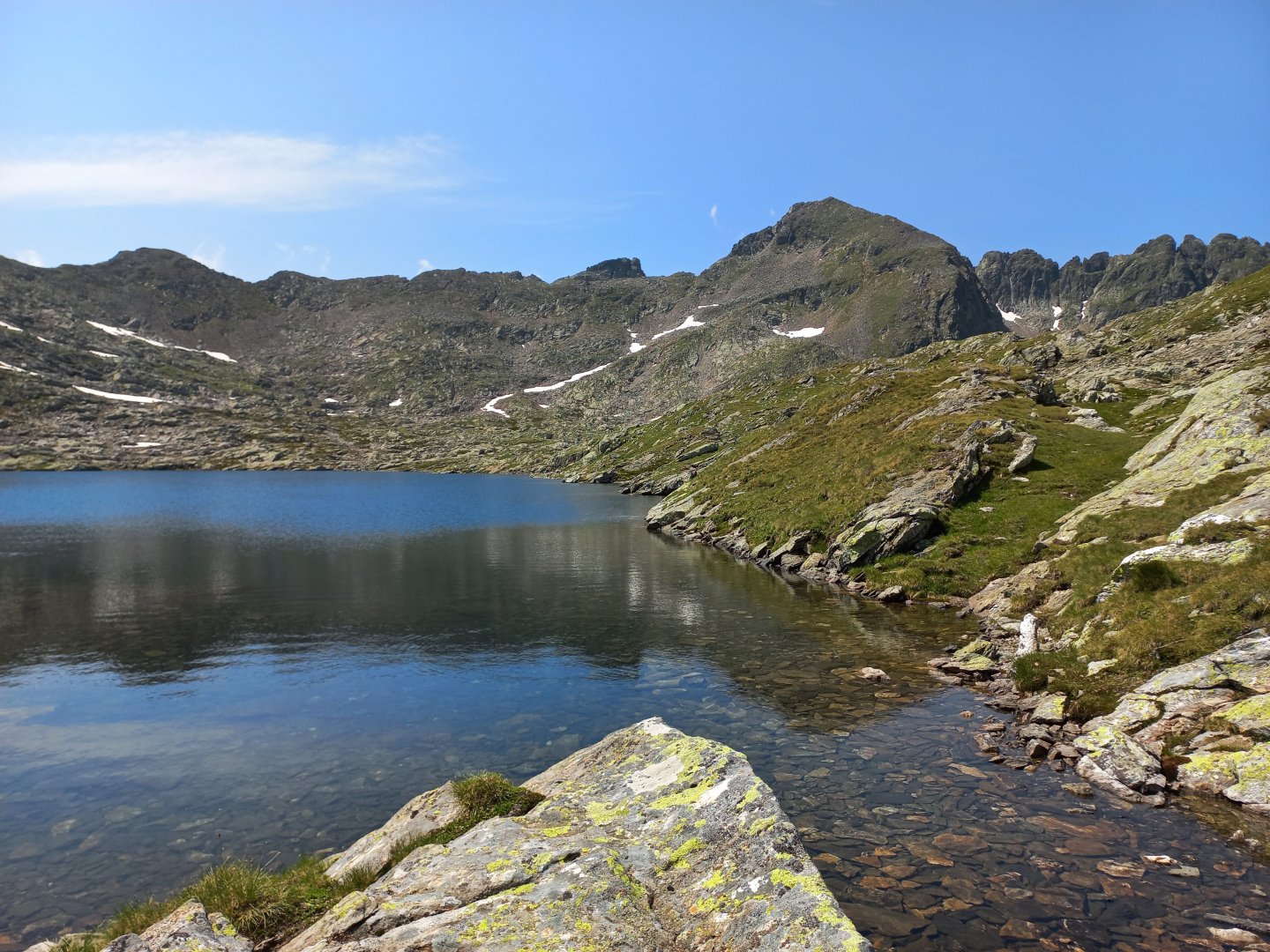
I say goodbye to Hochgolling and descend to the plain. I climb over rocks, jump over streams, bypass puddles and pools. One last look at the Greiffenberg and I disappear over the edge, along the stream towards the Preintalerhütte and the Riesachsee lake. The sun is baking in the afternoon, so I stop at the lake for a swim. There's a refreshment area at the Gföller Alm, and after the alm I turn onto the Wilde Wasser Weg trail into the gorge where the stream forms a cascade of Riesachfälle waterfalls.
The trail runs directly over the water on metal footbridges, ascending and descending on narrow steps, nothing for those suffering from vertigo. The main attraction is the suspension bridge, be careful to break stride and don't swing! The waterfalls are beautiful - masses of water tumble down tens of metres, the predatory current and fallen trees have carved strange shapes in the rock, water splinters rain down all around. The road ends at a restaurant car park, a short distance away a talerbus stops to take me back to Schladming.
Difficulty
A beautiful alpine trek in the heart of the Schladming Tauern, around the highest mountain Hochgolling. A classic alpine hike, no climbing, challenging to climb, several huts along the way. The vast majority of the route is on mountain paths. In places a steel rope is stretched to ease the walk. These are passages where you walk more in the rocks. The end of the route goes around a mountain stream on steel steps and footbridges. It's slightly adrenaline-fuelled but safely secured.
Water availability
There is plenty of water from streams along the way, refreshments are available at the huts along the route.
Sleeping options
On the route it is possible to stay overnight at the following huts - Ignaz-Mattis-Hütte , Kainprechthütte ,Landawirseehutte, Gollinghütte a Preintalerhütte.
Mountain peaks
On the route there are views of Dachstein, Hochgolling, Lungauer and Steierische Kalkspitze, Waldhorn, Hochwildstelle, Greifenberg. If the visibility is good, you can also see the High Tatras (from Rotmandlspitze in the west direction). The route itself leads over the Greifenberg 2 618 m above sea level.
Danger
The trail is not dangerous, it follows marked paths all the time. Some sections are secured with steel ropes. The final section is on metal steps and footbridges on the rushing waters of the mountain river. Everything is well secured.
Food
There are plenty of refreshment options along the way, with cooking available at all the huts along the route.
Attractions
From Schladming there are countless possibilities for further hikes:
- To the Giglachseen lakes via the ridge from the cable car to Hochwurzen (approx. 6 hours), the talerbus back from Ursprungalm, or Hopfriesen
- One-day tour Duisitzkarsee - Giglachsee - Keinprechtshütte - Duisitzkarsee (approx. 8 hours)
- Ascent of the Hochgolling (watch out for more difficult sections with belay)
- From the Preintalerhütte it is possible to continue on to the peaks of Hochwildstelle, Planai or Höchstein (more difficult sections), from Planai and Hauser Kaibling cable cars with summer operation