Mountain range, region / State
Hochschwab / Austria
Season
Spring
04. 06. 2022
Difficulty
2 / 5
Elevation
↑ 1046 m
↓ 1046 m
Length
9.7 km
7 hours
Altitude
max. 2081 m n.m.
min. 1205 m n.m.
Tips for hikes in the mountain range Hochschwab
Climb to Grosser Buchberg in the foothills of the Hochschwab
Trek to Krautgartenkogel in the Hochschwab
A fair mountain climb up the Hochturm
Hike to the Hochturm mountain in the western part of the Hochschwab
Starting point
Parking in the Präbichl saddle. Thanks to the small ski resort, there are plenty of places to park. We drove to the last possible spot, the closest to the trek. The road connecting the towns of Eisenerz and Trofaiach runs through the Präbichl saddle. Parking is free.
Description of the hike
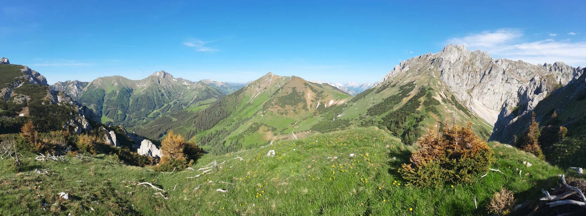
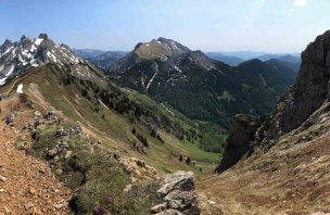
After arriving in the evening at the parking lot in the Präbichel saddle, we quietly prepared the car for the night and enjoyed the dramatic evening weather. The night cleared up beautifully and we were able to start our early morning climb. The marked trail first took us along a wide forest path. It climbed gently and was very pleasant to walk. The meadows were slowly opening up to views of the surrounding mountains. After about 1.5 kilometres we crossed a small river and started to climb towards the shepherds' huts. After them the path turned into a forest trail and the climb became more pronounced again. There are several streams in the forest where you can replenish your water supply. The forest trail eventually led us to the Lamingsattel saddle. Here, views of the Hochschwab mountain range also opened up. The view is really beautiful, so we took a short break here.
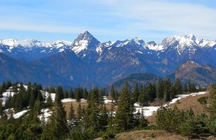
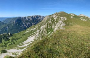
Then we continued along the trail and crossed the rock step. We found ourselves in a beautiful mountain basin, at the edge of which we again enjoyed the views of the surroundings. We then continued along the trail, which is cut into a gentle slope. The ascent is gradual. At the top, the rocky peak of Mount Hochturm was already revealed. The trail thus led us to a slightly different terrain. From the small saddle below the mountain, the terrain is now downright rocky to rocky. From the saddle, we decided to take the fastest option of the ascent and followed the faintly visible trail upwards. In places we held on to the rock with our hands, but it was not necessary. Eventually we reached the surprisingly wide summit of Hochturm. The views were great, the weather was perfect and we spent quite a bit of time there. It's a popular mountain and there were quite a few tourists on the top. Eventually we headed back. We briefly considered going over to the opposite mountain, Polster, but the younger member of the expedition was getting a bit tired so we descended back to the car along the same path that led to the climb.
Difficulty
One of the easiest climbs in the Alps. I chose it mainly because the route was completed by a seven-year-old boy. And without any problems. There is some elevation gain, but there are no particularly steep sections on the route. Except perhaps the final 100 metres or so to the summit. Here, after all, the terrain is rocky to rocky and sometimes the hands came into play. But that's just to be sure. The rest of the route is along classic alpine paths or forest trails. The route is ideal for dogs and children who can at least tread a little.
Water availability
There are quite a few small streams to the Lamingsattel saddle, from which we also refilled water. There is no water above the saddle. We had about 1,5 litres of water per person.
Sleeping options
After arriving in the mountains in the evening, we spent the night in the car. But there are many accommodation options around the Präbichl saddle.
Mountain peaks
The destination of this trek is Hochturm 2 081 m above sea level. We were able to see the Hochschwab, the Seckauer Tauern, the Enntal Alps or even the Dachstein.
Danger
The vast majority of the route is on trails or footpaths. Only the last 200 metres or so are more rocky and lead up a steep slope. There are several trails leading to the summit itself, it is possible that some of the others are better trodden and therefore more comfortable.
Food
There is no hut directly on the route. That's why we had all our food with us. However, it is possible to go to the nearby Leobner Hütte.
Photos