Mountain range, region / State
Mürzsteger Alps / Austria
Season
Winter
30. 12. 2022
Difficulty
2 / 5
Elevation
↑ 1243 m
↓ 1245 m
Length
11.8 km
6 hours
Altitude
max. 1903 m n.m.
min. 803 m n.m.
Hiking map of the Schneealpe
Tips for hikes in the mountain range Mürzsteger Alps
Trek to Mount Tonion from the saddle of Niederalpl Pass
A leisurely trek to the Windberg in the Schneealpe mountains
Crossing the Grosser Wildkamm
Winter ascent of the Windberg in the Schneealpe mountain range
Starting point
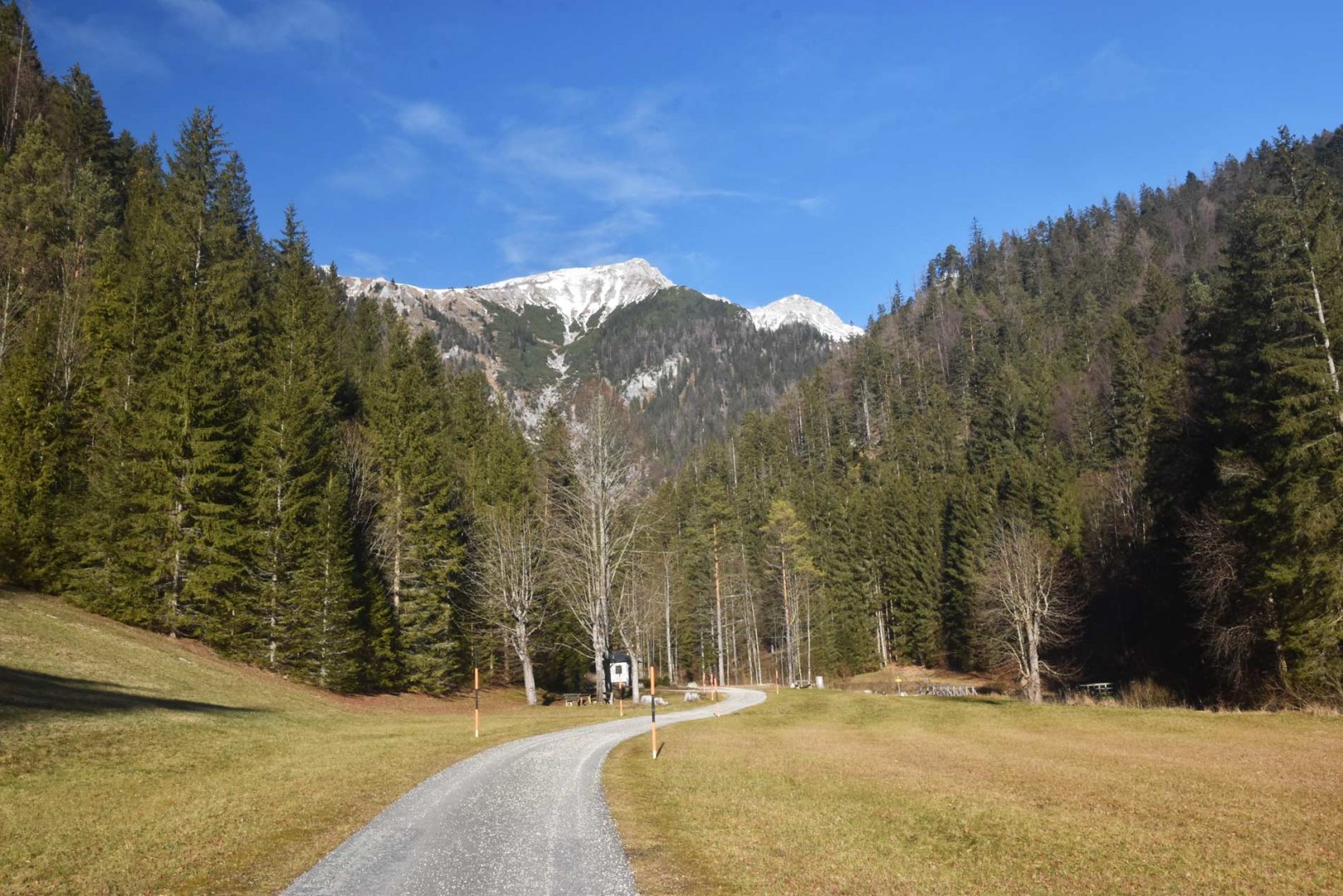
Car park is at the mouth of the Karlgraben valley in the southern part of the Schneealpe. The turn-off to the valley is from the road connecting Krampen and Neuberg an der Mürz.
Description of the hike
Access to the mountains was slightly complicated by the ski race in Semmering, when the police closed the S6 motorway. But that was the only complication on this beautiful day. Nevertheless, my legs started to ache already at the sight of the wall of mountains towering over me from the parking lot in the valley. More than 1000 vertical metres in a few kilometres.
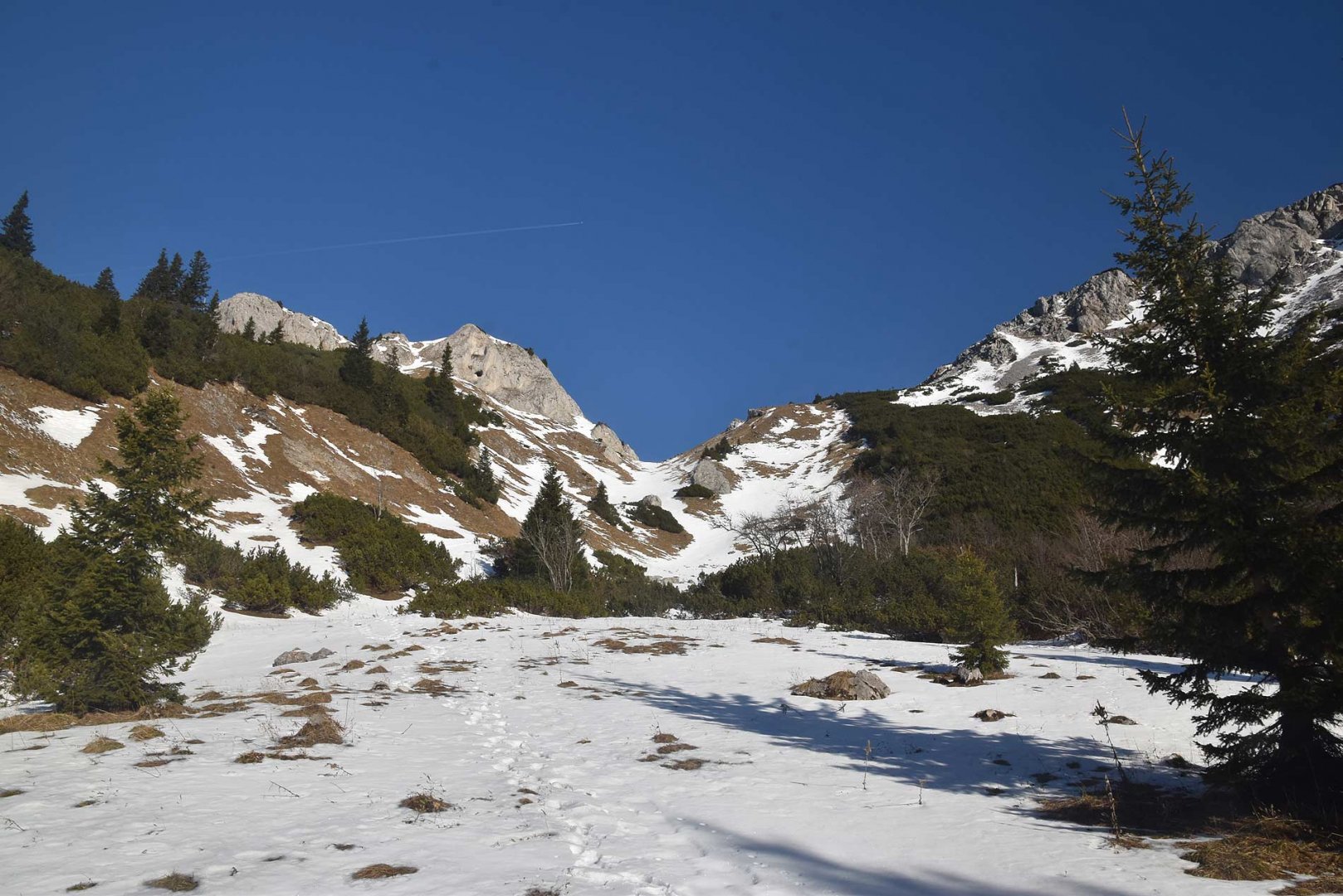
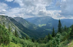
The first part of the climb through the forest is not difficult. Gradually, however, the trail cuts more into the slope and in serpentines overcomes a large elevation gain. In places the climb is really steep. However, the vision of beautiful views drove me on and so I climbed up to the edge of the plateau. There I was greeted by a herd of cheerful chamois. Which were also the only living creatures I met all day. I continued on towards the Michlbauerhütte shepherd's hut.
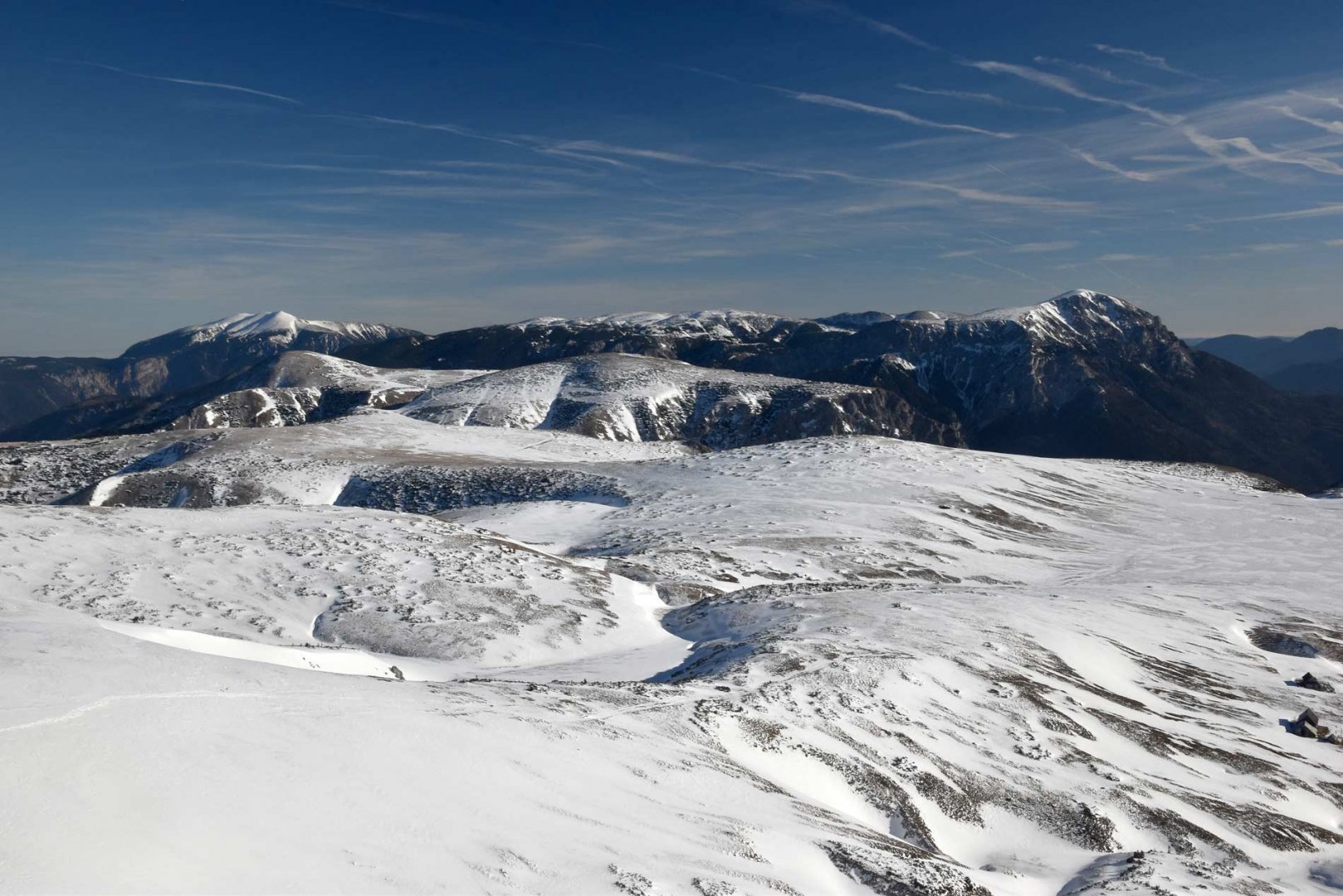
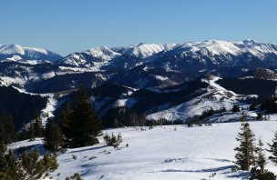
Here there was already a regular snow cover, so both poles and snowshoes came in handy. After a few dozen metres, views of the Schneealpe plateau and the surrounding mountains opened up in front of me. I turned left and climbed to the highest peak of the Schneealpe, Mount Windberg. The visibility was perfect and I enjoyed my time on the summit. I descended towards the east, where the ridge of the mountain leads. However, I soon turned left and returned to the mouth of the Karlgraben cauldron. I then descended back down into the valley by the same route.
Difficulty
Due to the favourable winter conditions, it was actually a winter trek only in the highest parts of the mountains. A forest trail leads to the plateau, which climbs very steeply in places. From the rock break of the Karlgraben basin it is already a relaxing hike. But getting to an altitude of about 1,700 m above sea level is really tough. That's why it's really good to have a bit of a head start so that the climb doesn't hurt so much. But you'll sweat a lot anyway...
Water availability
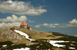
In summer, the Schneealpenhaus is a hut on the plateau. All year round, it is possible to refill water at the spring just below the final part of the Karlgraben boiler during ascent or descent.
Mountain peaks
The Windberg peak at 1,903 m above sea level offers great views, especially when visibility is good. Therefore, it was no problem to see the distant Totes Gebirge to the west or the Seetaler Alps to the south.
Danger
If there is no danger of avalanches, it is a nice safe winter trek. The ascent to the plateau is steep and the trail may be covered with ice or icy snow in places. Otherwise I don't see any problem on the trail.
Food
In winter, it is necessary to have your own food. In summer, the Schneealpenhaus is open.
Photos