Mountain range, region / State
/ Austria
Season
Spring
16. 04. 2022
Difficulty
3 / 5
Elevation
↑ 1414 m
↓ 1414 m
Length
15.6 km
6 hours
Altitude
max. 1256 m n.m.
min. 436 m n.m.
Tips for hikes in the mountain range
Ascent of the Rossschopf mountain in the Kasberggruppe
Steinerner Jäger Spring Ridge in the Hornorakous foothills of the Alps
A challenging trek to the Kremsmauer ridge
Circular easy ridge hike in the Hornorakous foothills
Starting point
I leave the car in the village of Sonnseite above Molln, in the free parking lot for the Mollnerhütte, and head up the forest path towards the Mollner Hütte.
Description of the hike
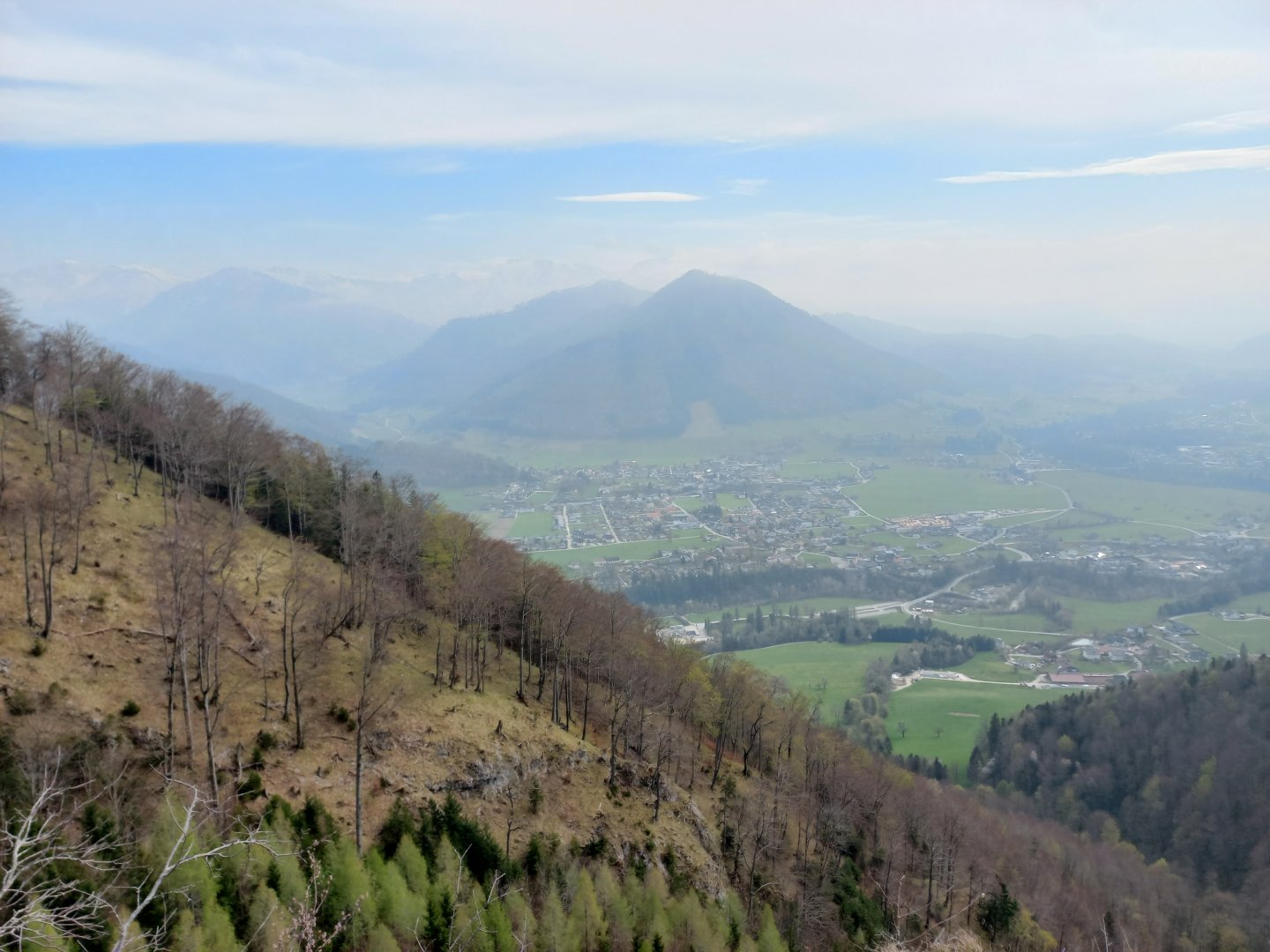
Along the way, views of Molln and the snow-capped mountains beyond - Sengsen and Totes Gebirge - open up. After about an hour and a half I arrive at the Mollnerhütte (1 005 m above sea level). The hut is open and you can refresh yourself on the terrace with a view.
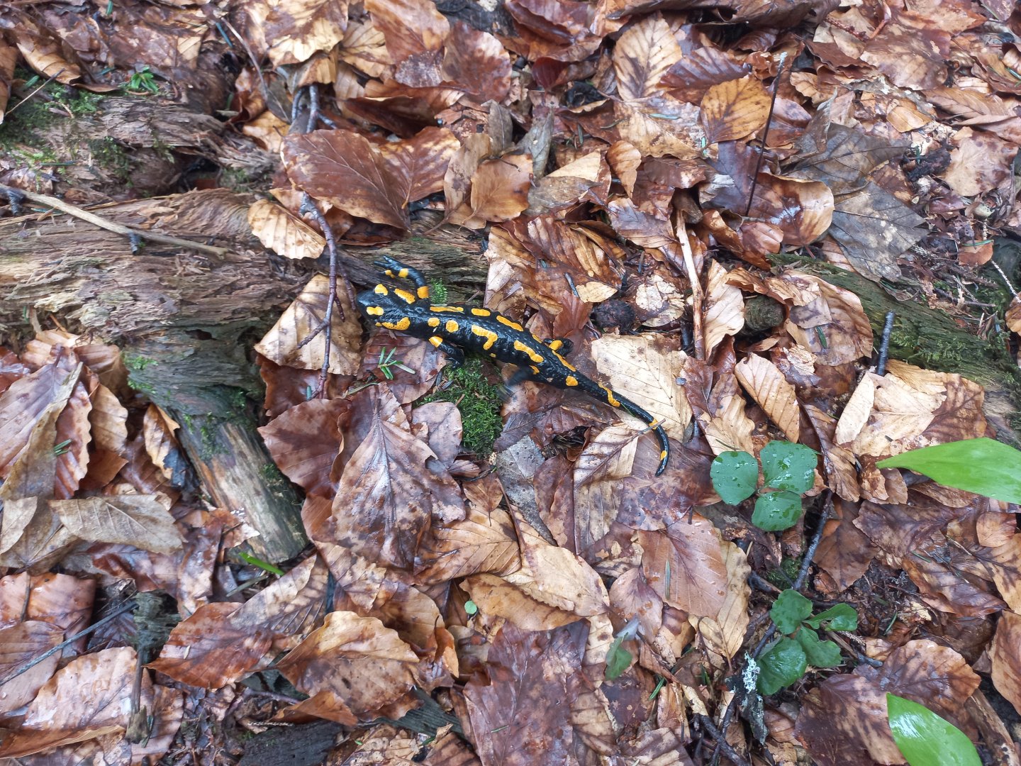
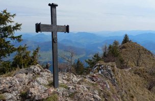
Not far from the cottage a rare chamois is grazing in the meadow, in the wet beech leaves I meet a salamander - a newt. The trail continues to the saddle between the peaks of Dürres Eck and Gaisberg. I go first left on Dürres Eck. There is a wooden cross on it, a stunning drop into the valley behind the cross and a view to the northwest, unfortunately in a thin mist.
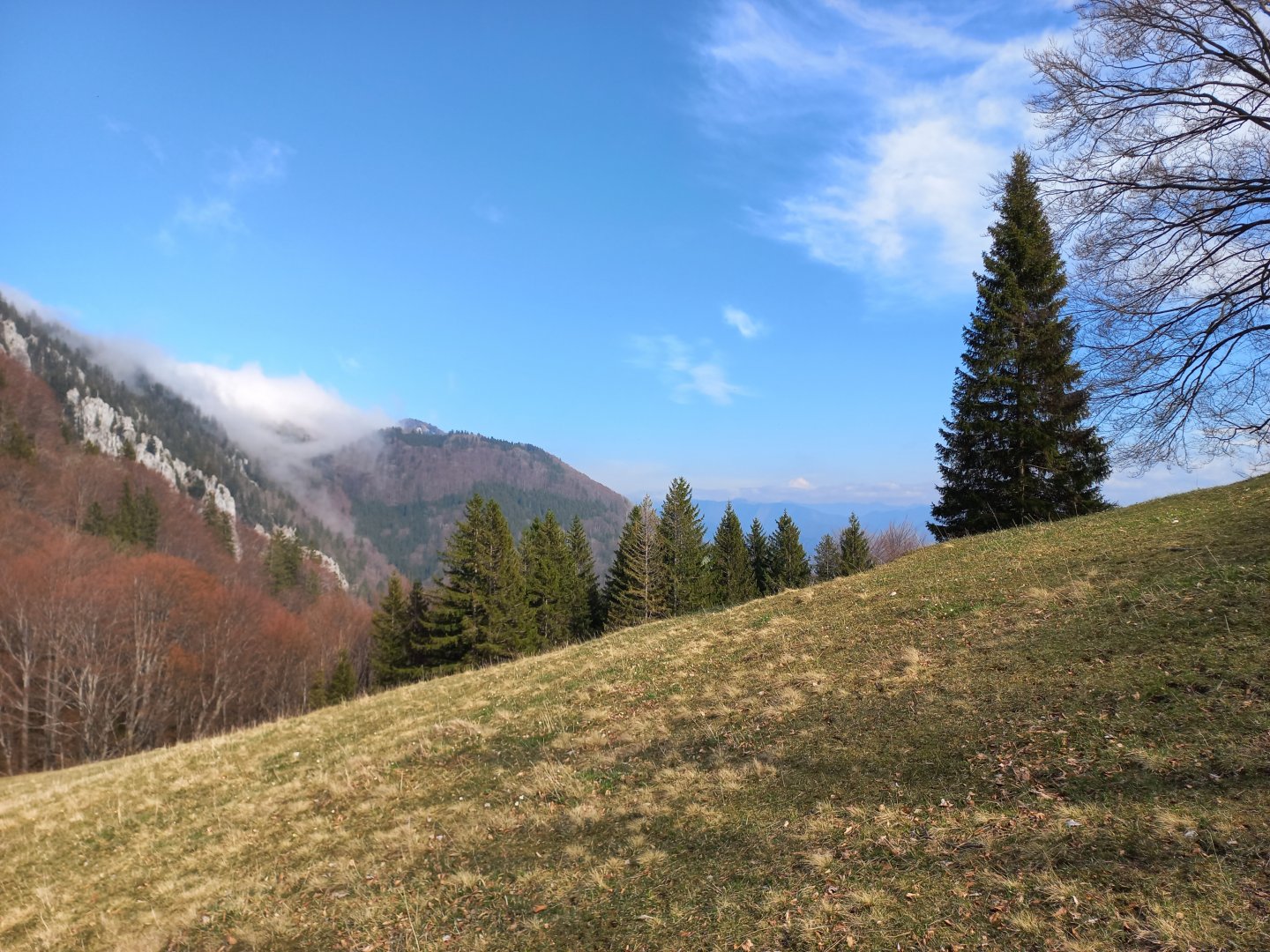
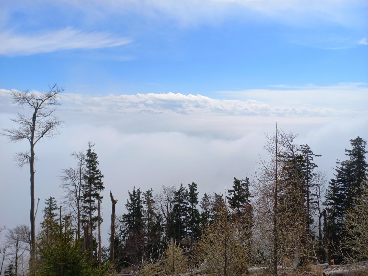
I continue along the ridge to the next thousand Gaisberg and the mist alternately obscures and offers me views of the sun-drenched white mountains in the distance. The top of Gaisberg is adorned with a new metal cross dedicated to the firefighters' associations in the area.
A short distance behind Gaisberg is a large limestone quarry. Here so much fog had fallen that I could hardly find the markers, sometimes replaced by little men made of stones. I go around the quarry from the left, the second marked route from the right is closed due to the quarry expansion. After the quarry I make a short detour to the wooden Mandlmais Kapelle.
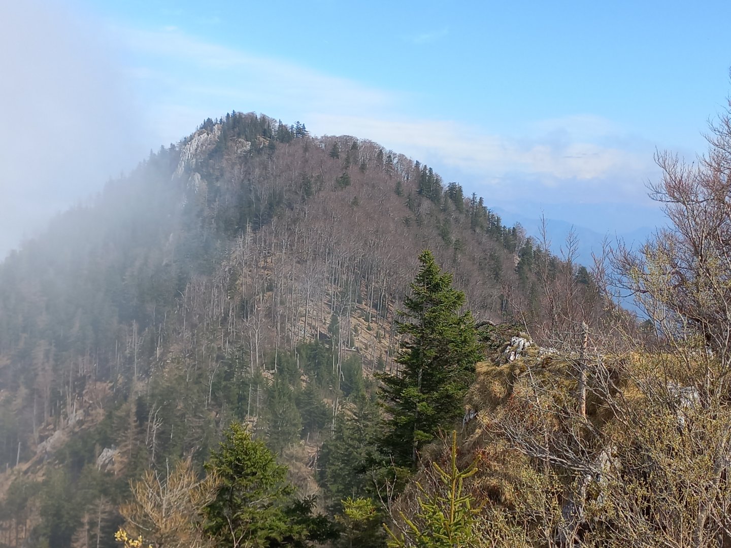
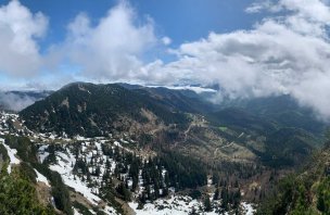
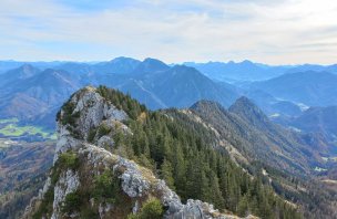
I continue on through Koglerstein with its colourful cross and view deep into the valley to the last peak of the route, Schoberstein. Here the fog finally breaks a little and the grassy pastures and mountains in the distance come into view.
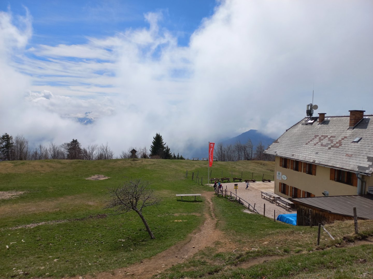
The hut on Schoberstein (1260 m) is open, offering food, drink and probably accommodation. I sit on a bench by a wooden cross and admire the views of the mountains breaking through the fog and clouds.
From Schoberstein I wanted to follow the marked hiking trail down into the valley and along the Krumme Steyrling to complete the circuit to Molln (estimated total 6 hours), but I was tempted by the improving weather and returned the same way along the ridge (7 hours).
Difficulty
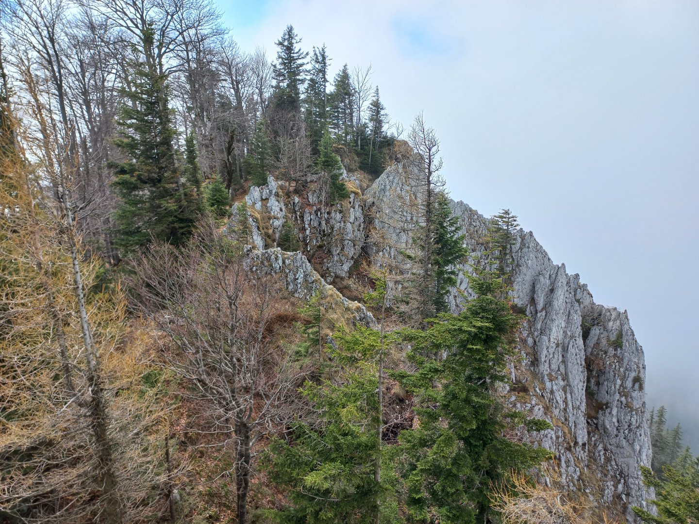
The ascent will leave no one in doubt that this is the Alps. A steep 700 metres of mixed forest. In April, it smells of garlic, bear's garlic, and besides that, there are parsley, spleenwort, forget-me-nots, Alpine Schneerosen and many other flowers. The ascent is not technically demanding, serpentines through the forest, AV markings.
Water availability
There are no springs on the trail to get water, but you have the option of refreshments during the hike at two mountain huts. At the Mollnerhütte or at the hut on Schoberstein.
Mountain peaks
On this mountain hike you will climb several smaller peaks slightly above 1,000 metres - Dürres Eck (1,222 m), Gaisberg (1,267 m), Schoberstein (1,285 m).
Danger
The path leads along a marked hiking trail on forest paths. Beware - part of the trail goes around the quarry - poorly marked, a few fallen trees, but otherwise it is a safe route.
Food
On the route there are huts where you can eat in the season. I still recommend having some bars or snacks with you.
Attractions
Last autumn I was thrilled to cross the Dürrensteigkamm ridge with the ascent to the Almkogel in the Hornorakous foothills. Most of the peaks of the Oberösterreichische Voralpen barely reach 1,500 m above sea level, but they offer beautiful views of the higher mountains in the area.
Another route I did in the spring was part 3 of the Tausender Tour - a route over three thousand. This goes over the peaks of Dürres Eck (1222 m), Gaisberg (1267 m) and Hochbuchberg (1273 m). I didn't go to the last one, but extended my route to Schoberstein (1285 m).
The original intention was to take the route as a circuit from the small town of Molln. However, as the weather played tricks on me and there was thick fog almost all the way to Schoberstein, I ended up taking the same route there and back to enjoy the views in the afternoon.