Mountain range, region / State
/ Austria
Season
Spring
07. 04. 2023
Difficulty
3 / 5
Elevation
↑ 1423 m
↓ 1422 m
Length
19.5 km
7 hours
Altitude
max. 1159 m n.m.
min. 355 m n.m.
Hiking map of the Upper Austrian foothills of the Alps
Tips for hikes in the mountain range
Ascent of the Rossschopf mountain in the Kasberggruppe
A challenging trek to the Kremsmauer ridge
Spring Ridge Route through Gaisberg and Schoberstein
Climbing the Steinerner Jäger - Schieferstein in Voralpen in Upper Austria
Starting point
The starting point, the town of Losenstein, lies about 20 km south of the district town of Steyr. Free parking is available in the car parks around Losenstein Castle.
Description of the hike
Last year in April I hiked the beautiful Dürres Eck - Schoberstein ridge of the Oberösterreichische Voralpen. This year, for my first spring climb in the Alps, I chose the nearby Schieferstein ridge (1206 m) with its landmark Steinerner Jäger (Petrified Hunter, 1185 m).
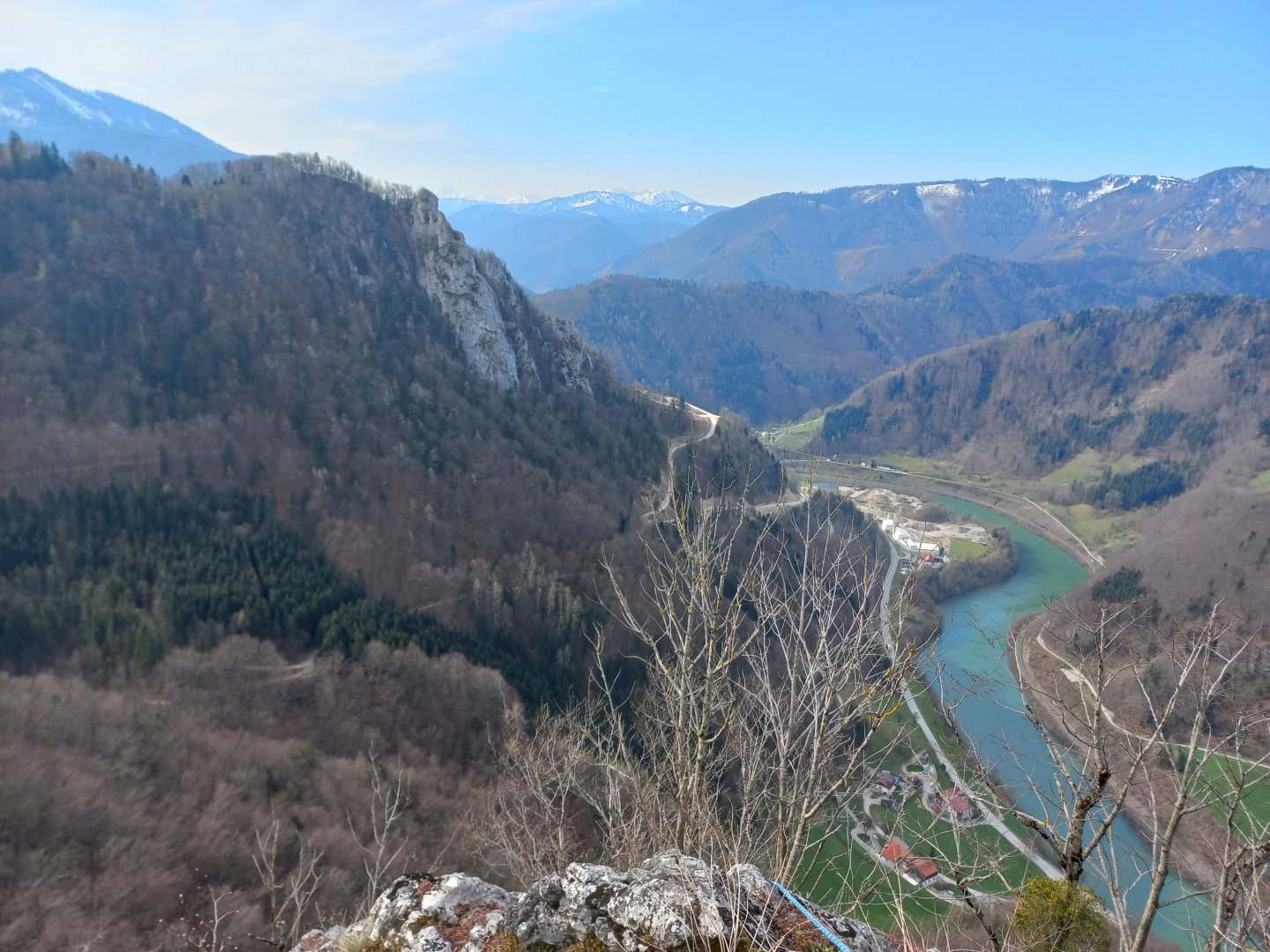
I park my car under the ruins of Losenstein Castle in the town of the same name, about 20 km south of the district town of Steyr. Losenstein lies in the valley of the Enns, which here has an incredible turquoise colour. From the river I can already see a rock with a cross high above the valley - this is my destination Steinerner Jäger.
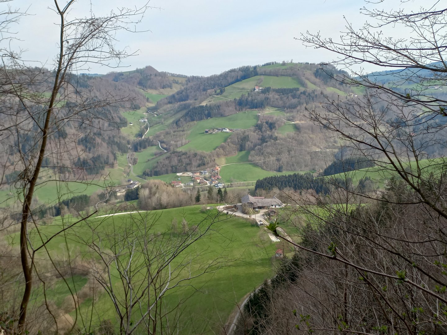
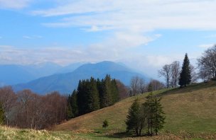
I pass the cemetery and follow the narrow asphalt road up the hill. The gradual ascent through the serpentine paths warms up and the spring hillsides covered with primroses and anemones are a delight to the eye. Behind me, the view opens up to Losenstein and the hills on the other side of the Enns - the high Hohe Dirn and the striking Reitnerkogel.
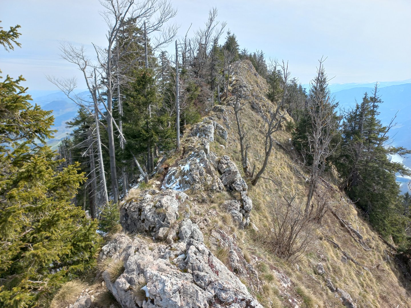
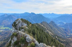
The last serpentine climb to the farmhouse on the hillside above and then I enter the forest. The footpath goes around the rocks and soon I am standing under the climbing wall of Pfenningstein (759 m). I can't reach it, but from the nearby stones there is a deep view of the valley at the bend of the Enns. Behind Pfenningstein the ridge begins. The footpath goes right along the narrow ridge, but it is not dangerous, there are stones and trees around.
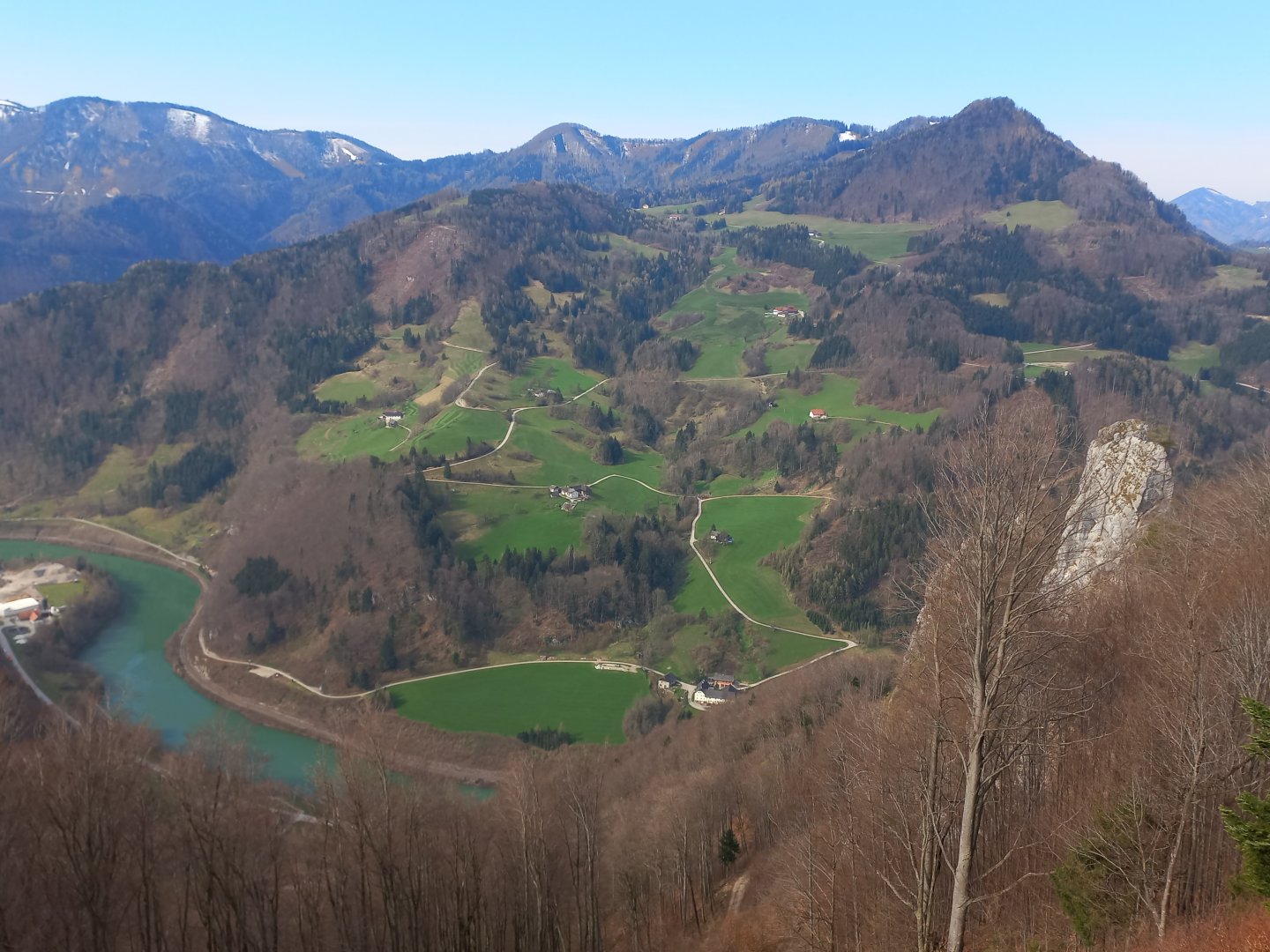
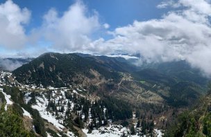
The path offers views in both directions - to the north to the green round hills with scattered farmhouses, to the south to the Enns valley and especially to the already snow-covered Alps. I can make out the Haller Mauern and almost the entire Sengsengebirge. Continuing uphill, a meadow with a transmitter appears on the right. I continue along the ridge, in a few places I have to help myself over rocks with my hands. A steep place of about three metres is overcome with a ladder.
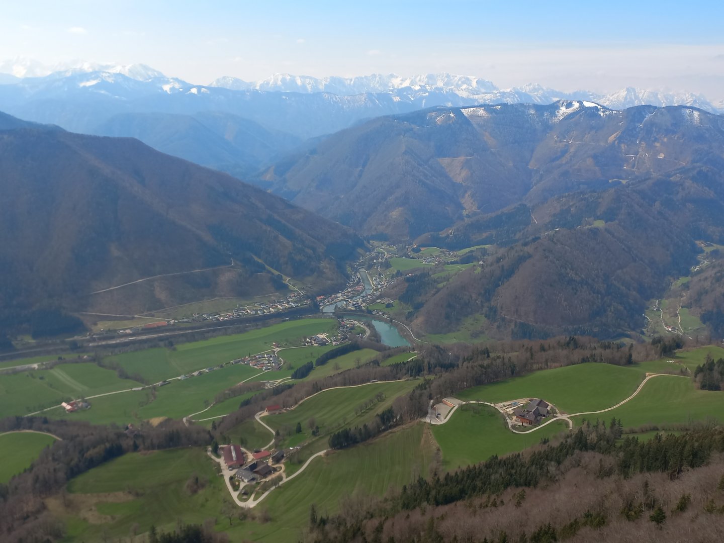
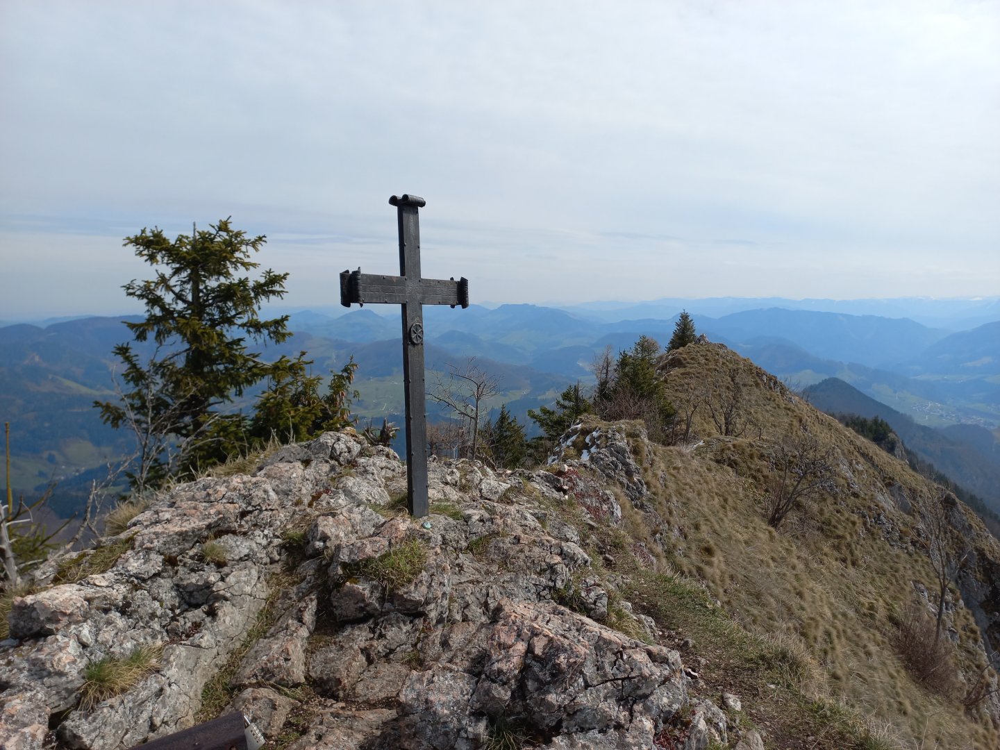
After nearly three hours of climbing I stand in a narrow saddle below the summit. It is here that the Steinerner Jäger is revealed in all its grandeur - perhaps a hundred-metre high perpendicular wall with a rounded top and a cross. The narrow path around the rock to the cross is secured with a rope. The view is stunning - green valleys, blue Enns and other peaks - from the west Kremsmauer, Kasberg, nearby Schoberstein and Hohe Dirn, Totes Gebirge, Pyhrgas, Haller Mauern with its distinctive Hexenturm, Gesäuse with Grosser and Kleiner Buchstein, much to the rear Hochtor, to the east in the haze Dürnstein and Ötscher. In the north and east the green hills and valleys of Lower Austria.
When I get tired, I continue along the rocky ridge to Schieferstein, a few hundred metres away. Here I have to be more careful, the ridge is very narrow, the snow still clings to the north side and the rocks sometimes slip. There is a low metal cross on Schieferstein. I sit down to rest and get to talking with a friendly Austrian from Freistadt, he shows me mountains I don't know. After a while I go back to Steinerner Jäger and on to the crossroads.
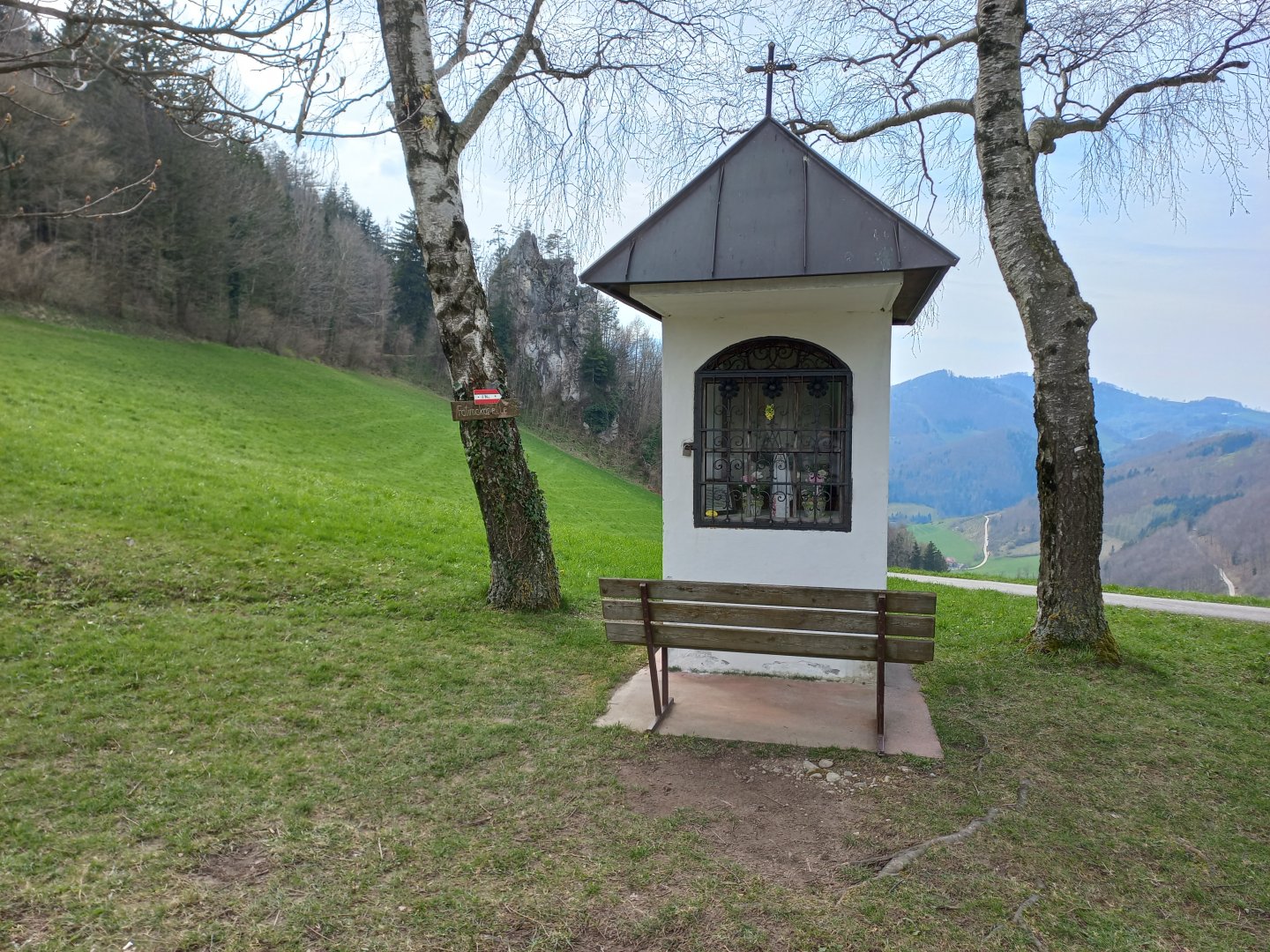
The trail descends through the forest to the Gscheid saddle. Here it is possible to shorten the route and return to Losenstein. But I still go around the Gröβtenberg hill and follow the asphalt road to the nearby Sauzahn (Pig's Tooth). The rock does justice to its name - a narrow needle on which climbers train. After Sauzahn I turn back to Losenstein. Through the undulating landscape I follow green meadows and a narrow road to a crossroads where the small Fatimakapelle stands. It was built to thank the men for their happy return from the war. From the chapel, follow the forest path to Ramlerhöhe.
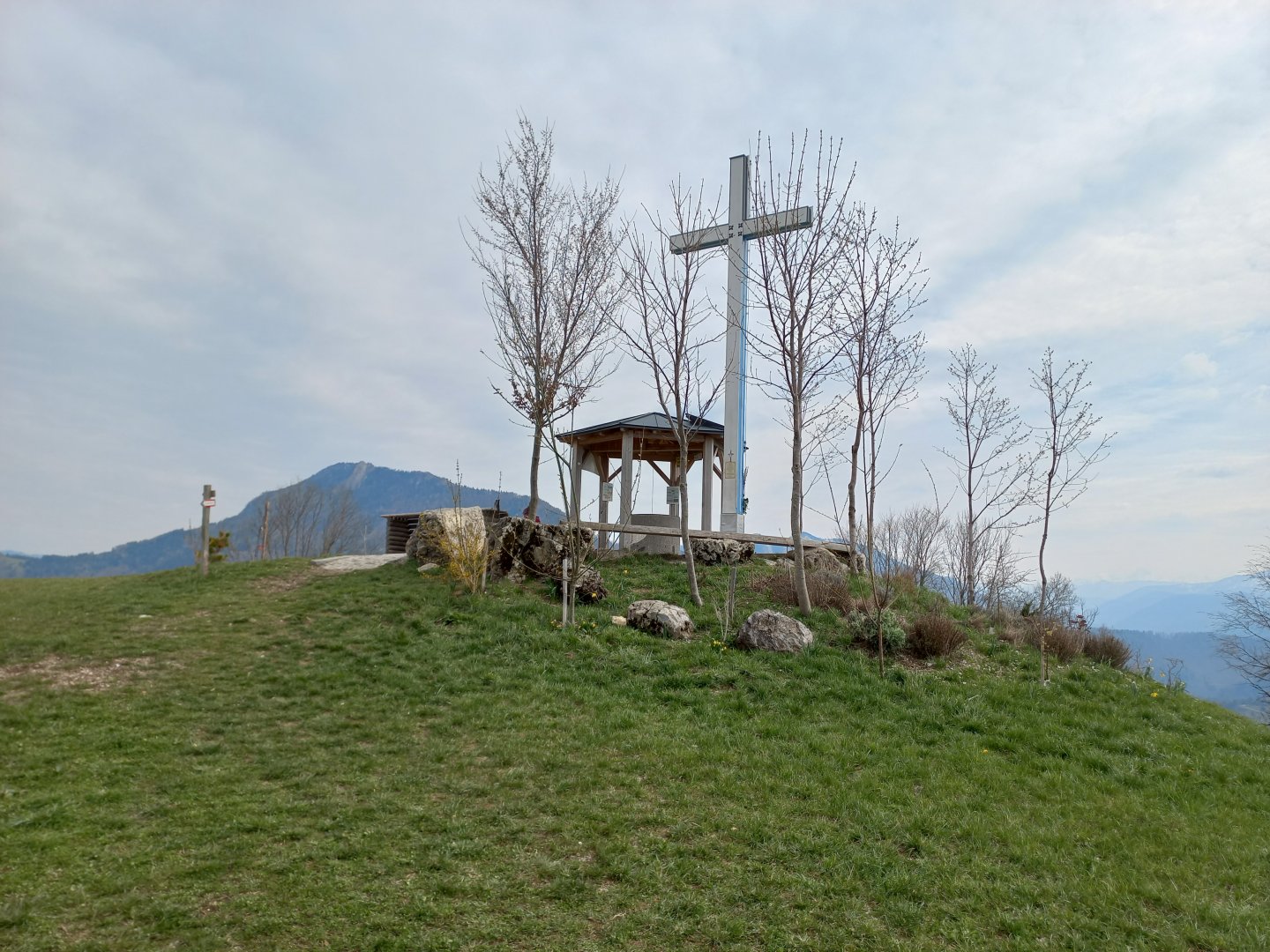
At Ramlerhöhe, the Lichtkreuz - the Cross of Light - was erected in 2021 on the initiative of the local Christian youth. It has multiple symbols - it measures 7.38 m, which is one hundred times less than the height of Golgotha; it is white and blue, which are the colours of the Virgin Mary symbolizing purity and the garment with which the Mother of God protects her children; and the meaning of the light with which the cross is lit at night probably does not need to be explained. From the cross it is a short walk back down to the village. One more tour of the castle and a look across to Hohe Dirn and other hills that must wait for another time.
Difficulty
The first half of the trail is a marked ridge trail, mostly along forest paths. The path is narrow and rocky, in a few places you will have to help yourself with your hands, but it is not dangerous - there are trees around.
The second part of the route from the Gscheid saddle is a respite between meadows with views of the countryside. The route can be shortened in a few places and you can return to Losenstein along the marked trail or the narrow asphalt road.
Water availability
There are shops and restaurants in Losenstein where you can easily buy the necessary refreshments. At the end of the trail on the Ramlerhöhe, there is a self-service refreshment well at the cross, from which you can take cold drinks and leave your money in the money box.
Mountain peaks
During this trek you will climb the peaks Steinerner Jäger, Schieferstein, views of the Hornorakous foothills, Sengsengebirge, Kasberg, Kremsmauer, Totes Gebirge, Haller Mauern, Gesäuse, Otscher, Dürnstein.
Danger
The ridge trail is moderately challenging in terms of elevation, rocky, you have to look under your feet, but I wouldn't call it dangerous.
Food
I had food with me, there is no hut on the route. There are shops and restaurants in Losenstein where you can refresh yourself.
Photos