Mountain range, region / State
Hochschwab / Austria
Season
Summer
07. 07. 2021
Difficulty
2 / 5
Elevation
↑ 1500 m
↓ 1500 m
Length
17.4 km
8 hours
Altitude
max. 2277 m n.m.
min. 886 m n.m.
Tips for hikes in the mountain range Hochschwab
Climb to Grosser Buchberg in the foothills of the Hochschwab
Trek to Krautgartenkogel in the Hochschwab
A fair mountain climb up the Hochturm
Circuit trek in the Hochswab mounta
Starting point
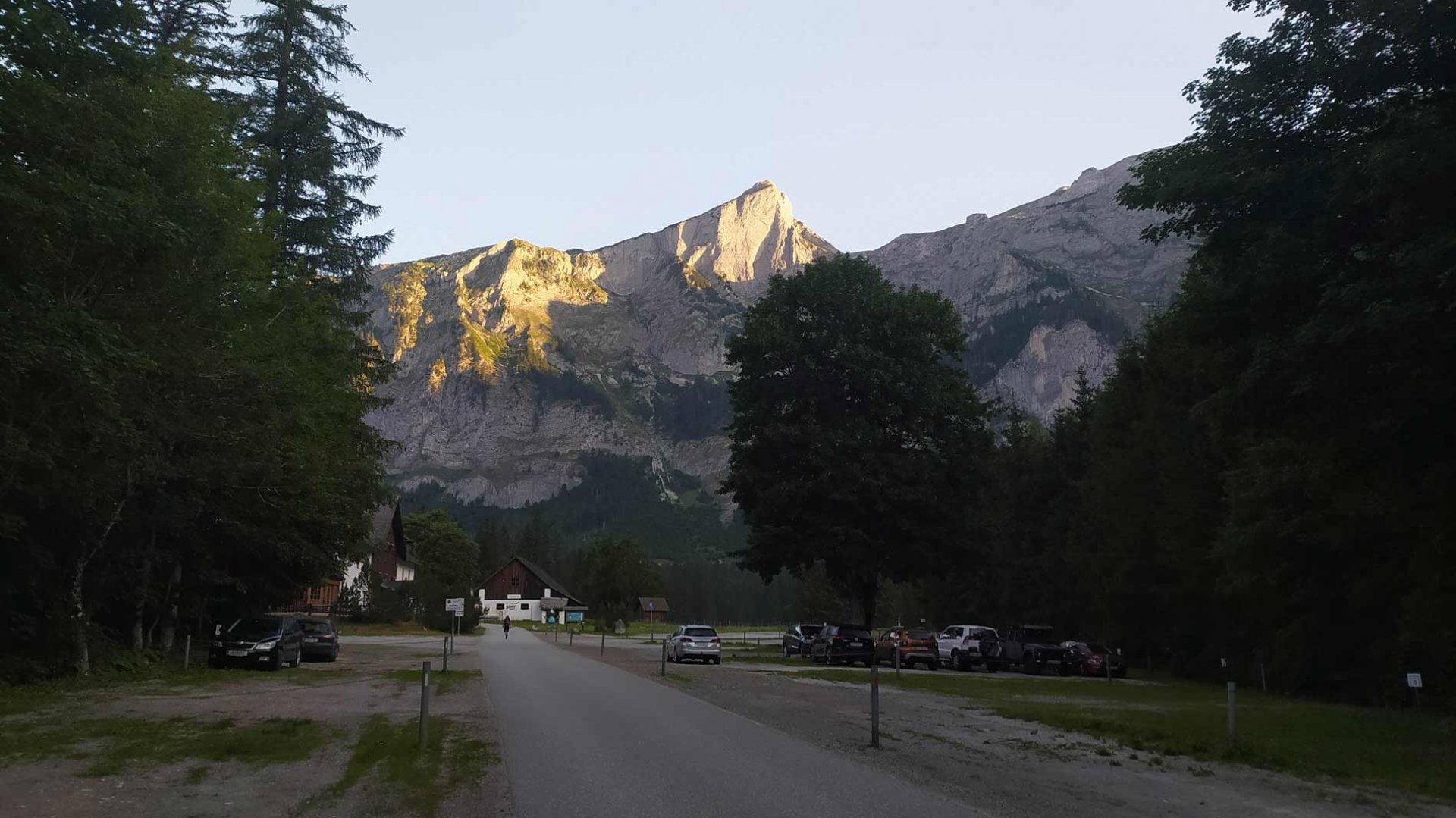
Parking lot at the Gasthaus Bodenbauer hut in the southern part of the Hochschwab. The road leads here from the village of Sankt Ilgen. Turn off the S6 motorway in Kapfenberg.
Description of the hike
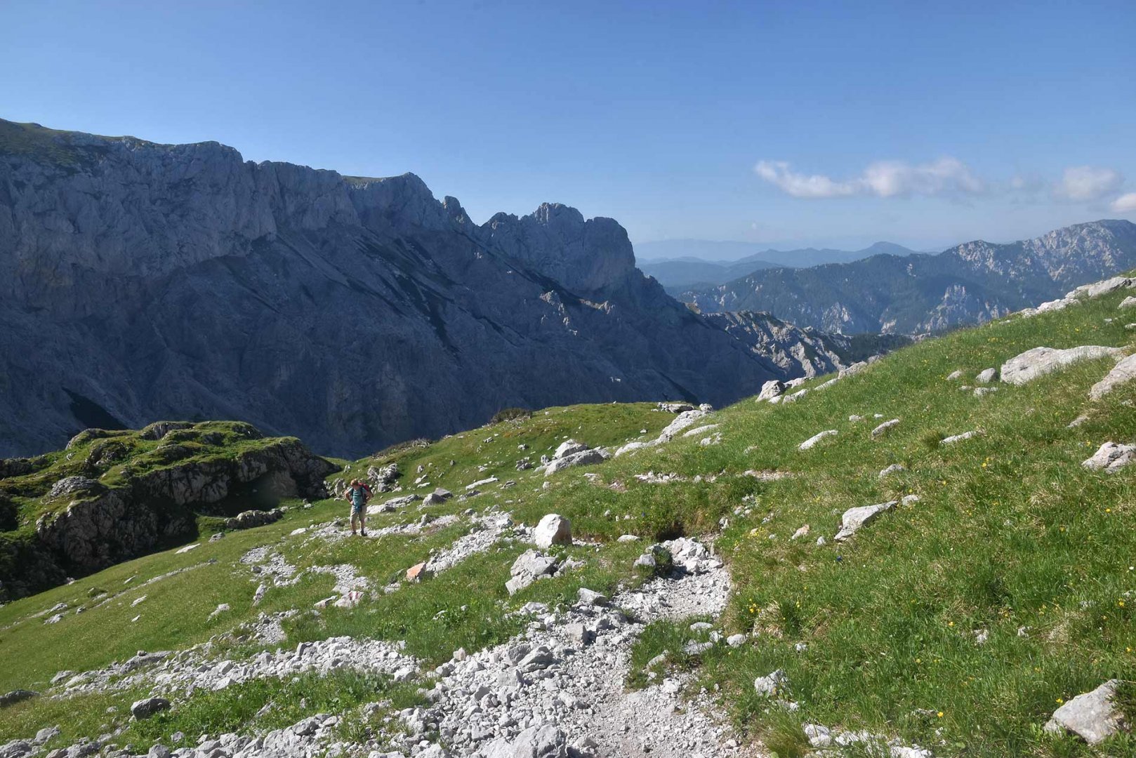
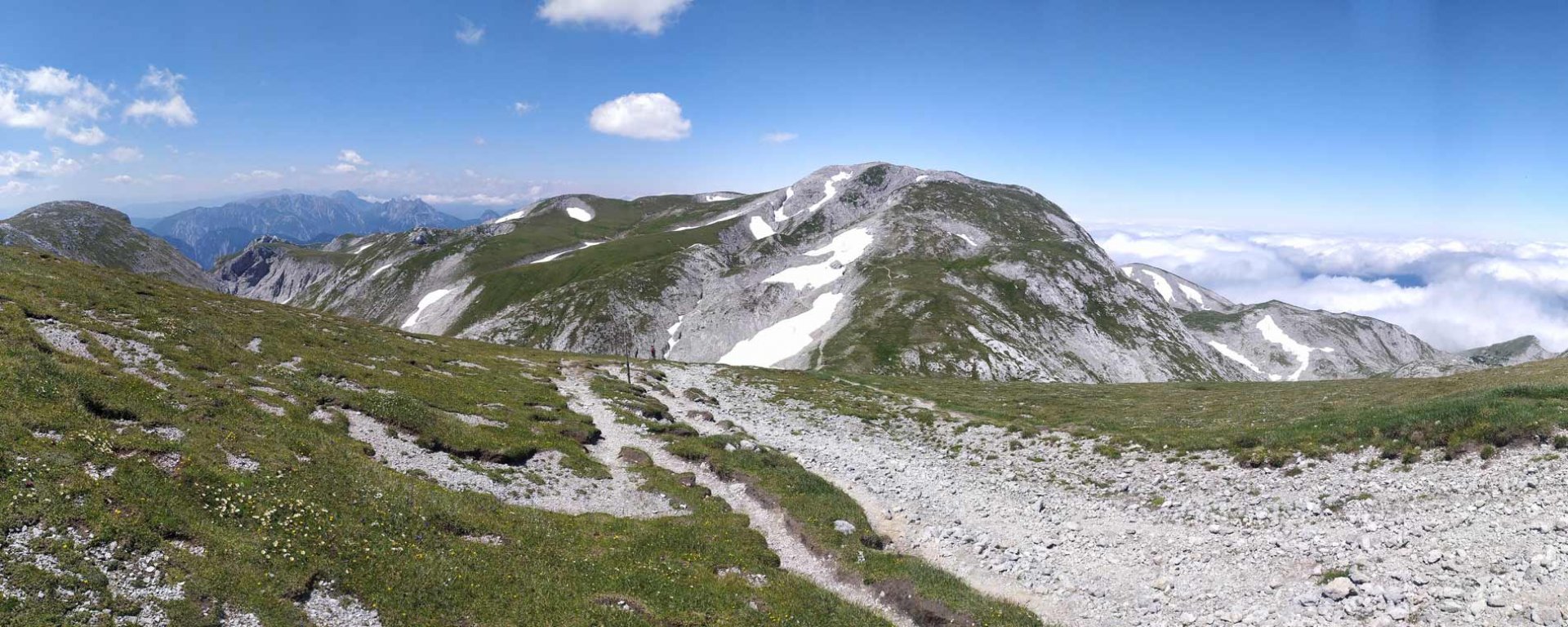
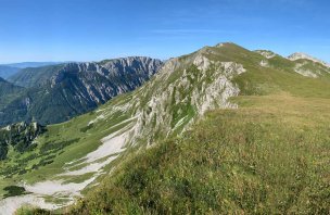
We arrived at the parking lot below Hoschschwab late in the evening. Camping is forbidden here, but sleeping in the car is not. And so we spent a pleasant night in our luxury carriage. Early the next morning we went hiking. The trail first follows a wide path, but as we enter the forest it changes to a trail. It also begins to climb more steeply. However, we still had strength to spare and so we proceeded quite briskly. After leaving the forest boundary, probably the steepest part of the climb begins. It is partly between the slashwood, partly between the rocks. However, it is still a classic trail. Finally we climbed up to the mountain saddle. Just below it we got water from the spring. Not much water flowed, but we managed. Then came the hardest part of the climb. The Das G´hackte trail. This part of the climb is complete with chains all the way, and a ladder/stairs at the bottom. The ascent is very steep, but not too technically demanding. Even our mountain dog, whom we helped in places, managed it. After overcoming this route we finally found ourselves on the plateau of the Hochschwab.
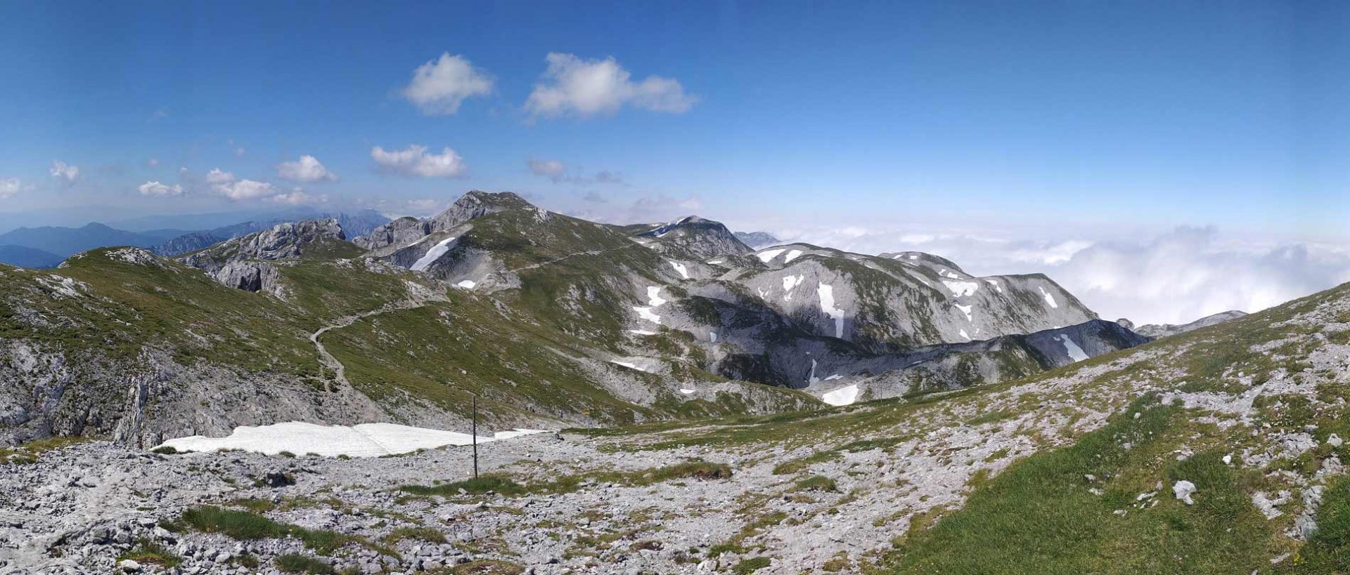
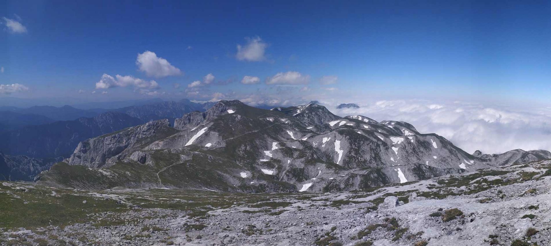
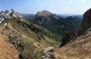
We took a rest at the bivouac booth and then made an easy run up to the highest point of the Hochschwab mountains at 2 277 m above sea level. We returned to the bivouac and continued westwards. Here the trail is absolutely easy to follow. It ascends slightly, but gradually descends more and more. We really enjoyed this part of the trail. The views of the western part of the Hochschwab and the Enntal Alps also opened up. The trail eventually starts to descend more steeply amongst the slash and burn. We continued descending along the path until we reached the Häuslalm Hütte. It was open, so we had a beer. We had originally wanted to take a short walk to the Sackwiesensee lake, but the fatigue was getting pretty bad. So we started descending back down into the valley. The descent is quite steep in places, but after about an hour we were back at the car park.
Difficulty
An honest alpine hike. Mostly on mountain paths and trails. The hardest part of the route is the rocky ascent of Das G´hackte. It is protected by steel steps and chains. However, it is not a Klettersteig. However, the ascent here is very steep. The rest of the route is technically easy. The overall elevation gain is quite high, so it is good to have some fitness. The route is not suitable for small children, even the bigger ones will probably have a problem with strength. We did the trek with our dog, but we had to help him a lot on the G´hackte trail, sometimes we even carried him. That's why I don't recommend dogs on this trail.
Water availability
The spring is just below the saddle under the Das G´hackte road. It's an ideal water refill, so you don't have to haul too much water directly from the car. It is true, though, that for us the spring was quite weak and it took us longer to fill the bottles. Another liquid refill is at the Häuslalm Hütte. Even though it is closed, there is water. For us, however, it was open.
Sleeping options
After arriving under the mountains we spent the night in the car in the parking lot. Camping is forbidden here, but such an overnight stay is not a problem. In the mountains it is possible to have an emergency overnight stay in Fleischer-Biwak or in the Häuslalm Hütte when it is open.
Mountain peaks
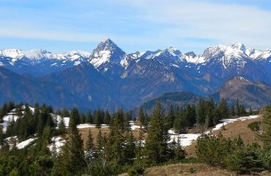
From the top of the Hochschwab 2 277 m above sea level, there are great views of the surrounding mountains. To the east are the Veitschalpe, Raxalpe, Schneealpe and Schneeberg, and to the west the Enntal Alps or the Seckauer Tauern. If visibility is good, you can also see the Dachstein.
Danger
There is only one difficult section on the route. The already mentioned ascent couloir Das G´hackte. There are chains stretched practically the whole length, the first part of the ascent is also facilitated by a steel ladder/stairs. However, a trained person can manage this passage without any problems. The rest of the route is a classic walk, trails through meadows or between boulders.
Food
Since we went on this trek on Wednesday, the Häuslalm Hütte was open. It is open Wednesday-Sunday in summer. Here it is possible to have a meal. We had some of our own delicacies. We only had beer at the hut.
Photos