Mountain range, region / State
Schladming Tauern / Austria
Season
Summer
07. 08. 2021
Difficulty
2 / 5
Elevation
↑ 1177 m
↓ 1177 m
Length
12.5 km
9 hours
Altitude
max. 2491 m n.m.
min. 1638 m n.m.
Tips for hikes in the mountain range Schladming Tauern
Four-day trek in the Schladming Tauern region around the Hochgolling mountain
Round trip in the Schladminger Tauern with ascent to the Grosses Gurpitscheck
Hike around Hochgolling in the Schladming Tauern
Foggy ascent of the Gamskarspitze mountain
Starting point
Parking at the top station of the cable car at the Bottinghaus hut. The entrance to the car park is free of charge, as is the parking itself. The road to the car park leads from the town of Pruggern.
Description of the hike
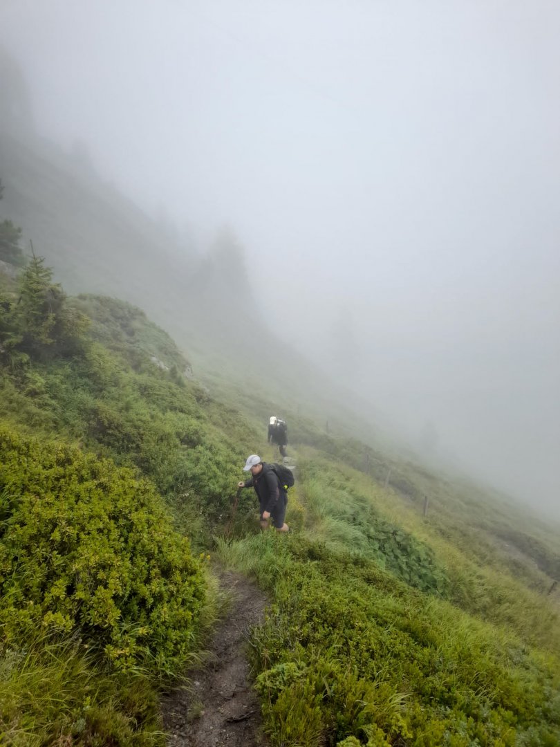
Although the weather forecast was lousy, it didn't deter us and we set off on a fair day's trek. From the car park, we started to zigzag and climb up the trail to the top station of the cable car where the Galsterbergalmhütte hut is. From there we continued up the slopes steadily to the Pleschnitzzinkenhütte hut. From the hut then began the final ascent to the Pleschnitzzinken mountain. It is on a trail in the slope, which, although still ascending, is not too steep. We walked it in total fog, so we didn't even know what to expect next.
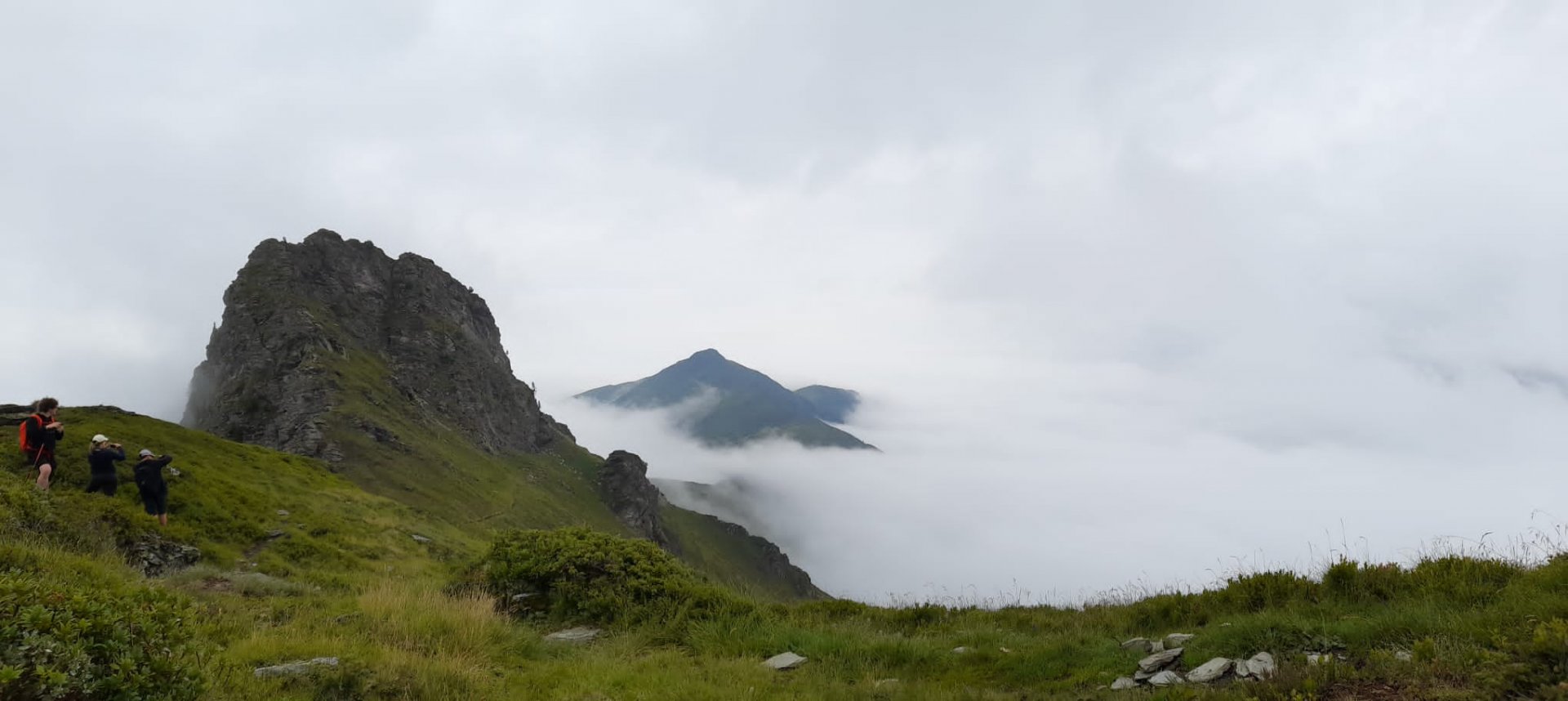
From the summit we descended to the saddle on a more rocky trail and continued on another, this time steeper climb to Mount Scheibleck. However, we did not go up it and continued on the trail. It traverses the Tritachkogel mountain. By this time the clouds were finally breaking through as well, offering us a beautiful view of the mountain ridges. However, the steepest part of the climb awaited us. The summit of Gamskarspitze itself. The landscape has already changed and is much rockier. The trail slightly bypasses the summit and then we climbed almost on stones to the top.
Difficulty
It was a rather difficult climb, which we also completed in less than ideal weather. Milder passages alternate with steeper climbs. The steepest is probably the climb to the top. It is also quite rocky. Otherwise, it's all along the trail. Orientation was not a problem even in the dense fog. Only older children can handle the trail. Dogs will climb it if they enjoy it.
Water availability
Water can only be refilled at the Pleschnitzzinkenhütte, which is, however, at the beginning of the route. Therefore it is necessary to have at least 1.5 litres of water per person.
Sleeping options
Overnight stays are possible at the huts along the way - Pleschnitzzinkenhütte and Galsterbergalmhütte. We had private accommodation down in the valley.
Mountain peaks
On the route we climbed the peaks of Pleschnitzzinken 2 112 m above sea level and Gamskarspitze 2 491 m above sea level. We had almost zero views, otherwise it would have been possible to see Dachstein, Schladminské Taurus, Rottenmann Taurus and others.
Danger
Most of the route is on mountain paths. The climb to the top of Gamskarspitze is steeper and rockier. But it is not technically demanding. The steep slopes are mainly behind the Tritachkogel. Otherwise, the route is well marked and we had no problem with orientation even in the heavy fog that usually accompanied us.
Food
Food is offered in the huts along the way - Pleschnitzzinkenhütte and Galsterbergalmhütte. However, both are at the start of the trek, so you need to have your own snacks.