Mountain range, region / State
Dachstein / Austria
Season
Fall
23. 10. 2021
Difficulty
3 / 5
Elevation
↑ 1615 m
↓ 1616 m
Length
17.7 km
7 hours
Altitude
max. 2175 m n.m.
min. 749 m n.m.
Tips for hikes in the mountain range Dachstein
Trek through the lunar landscape of the eastern Dachstein
Improvised crossing over the Großer Donnerkogel
Easy climbing the mountain of Stoderzinken in Austria Alps
The Kufstein lookout in the eastern part of the Dachsteingebirge
Starting point
Parking lot at Weissenbach bei Haus im Ennstal. The car park is located behind the village in the woods and is free of charge. Wießenbach is just off the road connecting Liezen and Schladming, southeast of Dachstein.
Description of the hike
For several years I have wished to experience the autumn mountains as they are depicted in calendars with pictures of mountains under the month of October. Blue skies, yellow larches glowing in the sun, mountain tops dusted with the first snow. So far it hasn't worked out so well - the snow came too early, there was no time off, the borders closed... Maybe this year. I can't go to the high mountains because of the snow, so I'm looking for tips for a hike to some hill around 2000 m above sea level. On the Austrian website I find the scenic mountain Kufstein (2 049 m) in the eastern part of the Dachsteingebirge. The photos look promising, the weather forecast also looks promising and so I set off on the penultimate weekend of October.
I turn off the Ennstal road onto Weissenbach bei Haus (im Ennstal), where I leave the car in a large parking lot on the edge of the village. There is a signpost right by the car park, it's a 5 hour walk to Kufstein. I walk briskly up the wide forest path. To the left of the road I see a clear stream through the trees, which is artificially led into several troughs, and there is a natural kneipping place (Kneippanlage). After about half an hour I come to the game preserve, but the gate is open and I don't see any game. A short detour takes me to the Gradenbachfall waterfall behind a rock and then the path takes me uphill.
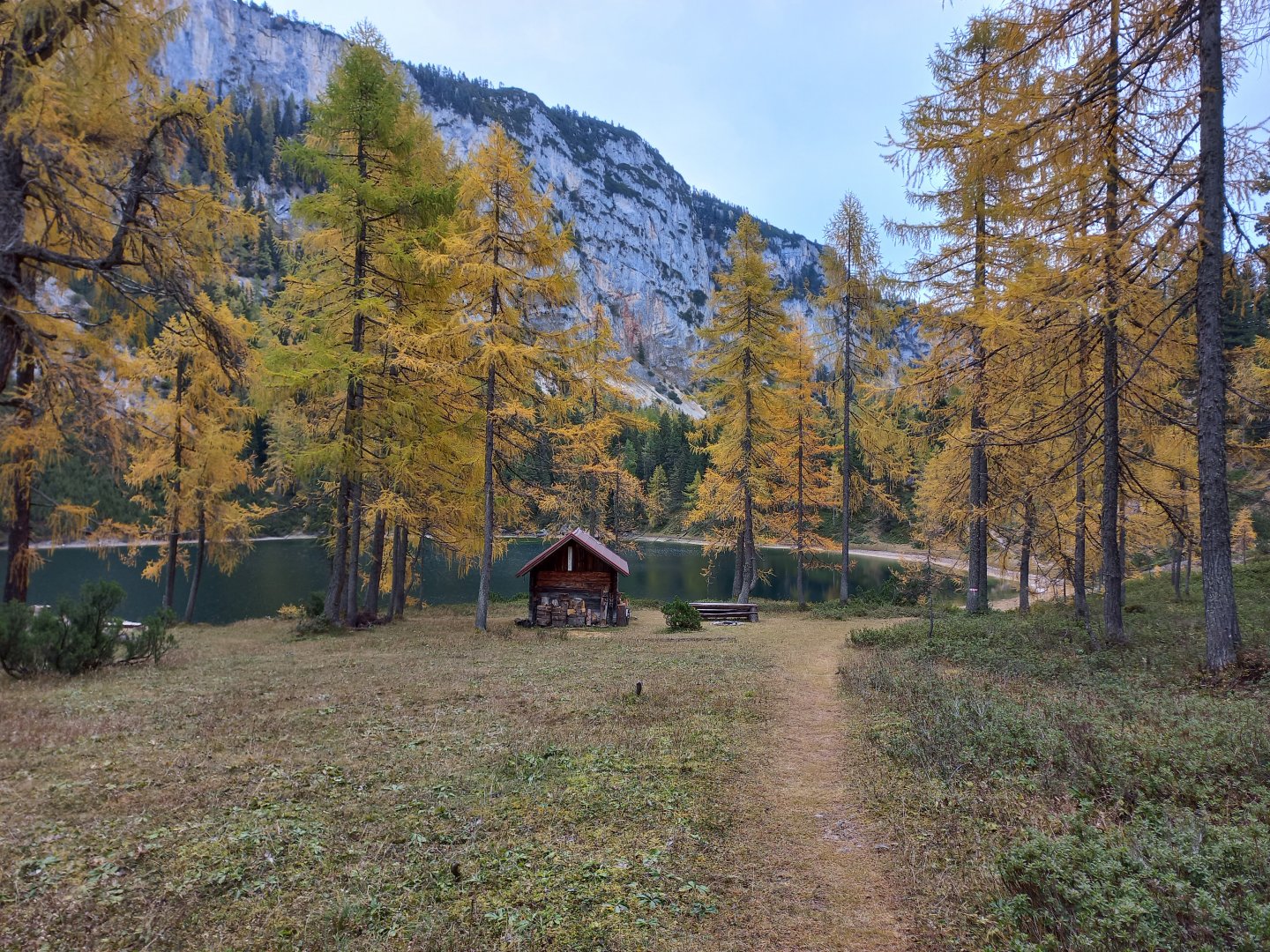
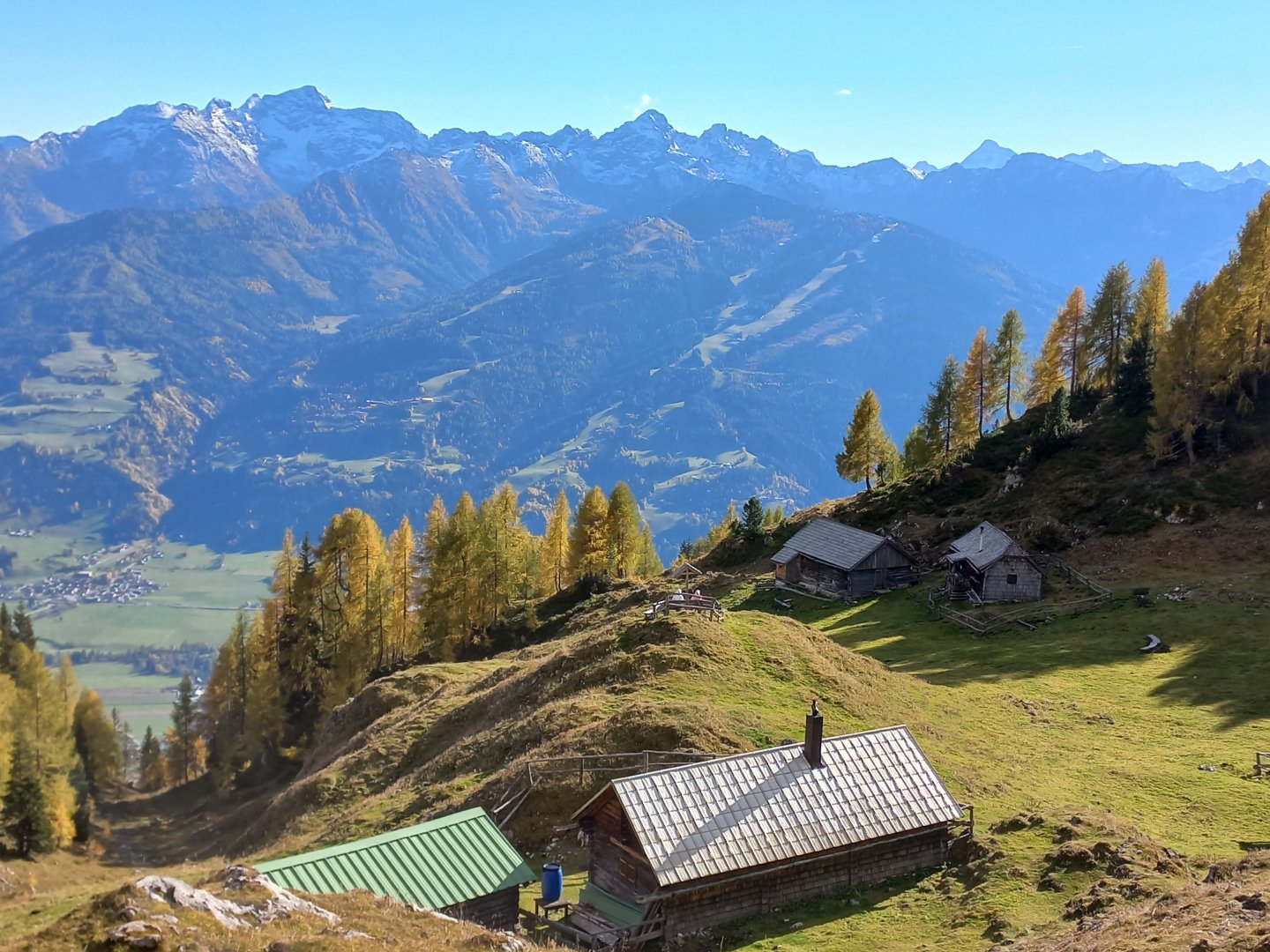
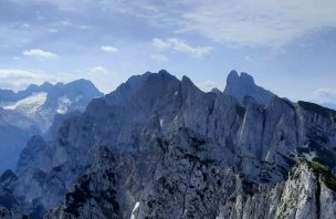
The ascent goes through the forest, over rocks, roots, crosses a stream, which is rather dry after the summer, or flows only in a small stream. The valley is at my back and sometimes a view of the snow-covered Schladming Tauern opens up between the trees. After two hours, I see Lake Ahornsee glimmering through the trees. And finally the yellow larches - they are mirrored on the almost motionless green-blue surface. I continue on to the second lake, Grafenbergsee, about a kilometre away. It too is a clear blue-green, must be a beautiful place to swim in summer. A little above the lake, I get above forest level and the surrounding hills start to appear. First the Stodezinken with its slopes, just behind it the sharp Kammspitz and finally the massive Grimming, said to be the highest single mountain in Europe. In front of me is Grafenbergalm, several private huts and cow sheds. To the northeast I can see the grey mass of the Totes Gebirge in the clouds. I claw my way further uphill over limestone scree towards the Kufsteinscharte saddle (2 004 m).
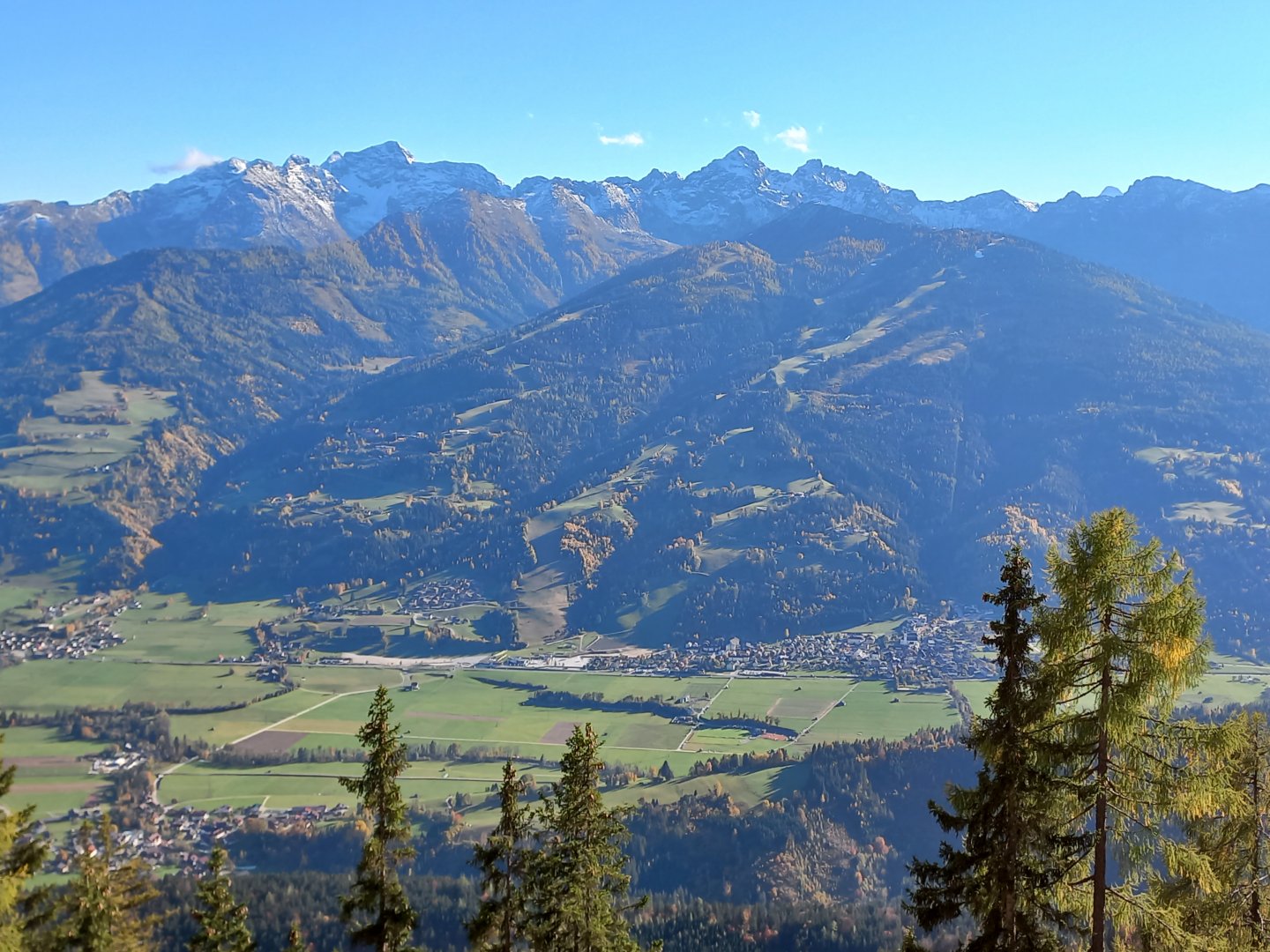
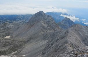
Here, you will have a view of the snow-capped Schladming Tauern with the dominant features of Hochwildstelle and Höchstein. The Kleiner Miesberg (2,175 m) rises above the Kufsteinscharte off the marked route. I have a good time and so I decide to make an unplanned ascent. I weave my way along a narrow path, climbing up over rocks and snowfields. The last few metres are decorated with frost on the grass, then I'm standing on the summit and the view takes my breath away - the massive Dachstein massif towers against the blue sky in front of me. I sit by a small cairn of stones and look around - the Dachstein plays with the clouds, the Schladmingen and the Sölktal Alps shine in the midday sun in the south, the Stoderzinken, Kammspitz and Grimming above Ennstal like three kings. Behind my back, the overgrown plateau of the northern Dachstein kneels, the tin crystal of the viewing platform above the cable car to Krippenstein glittering in the distance. I can see the Totesky better now too, I can make out Lawinenstein with its slopes and the Tauplitzalm ski resort.
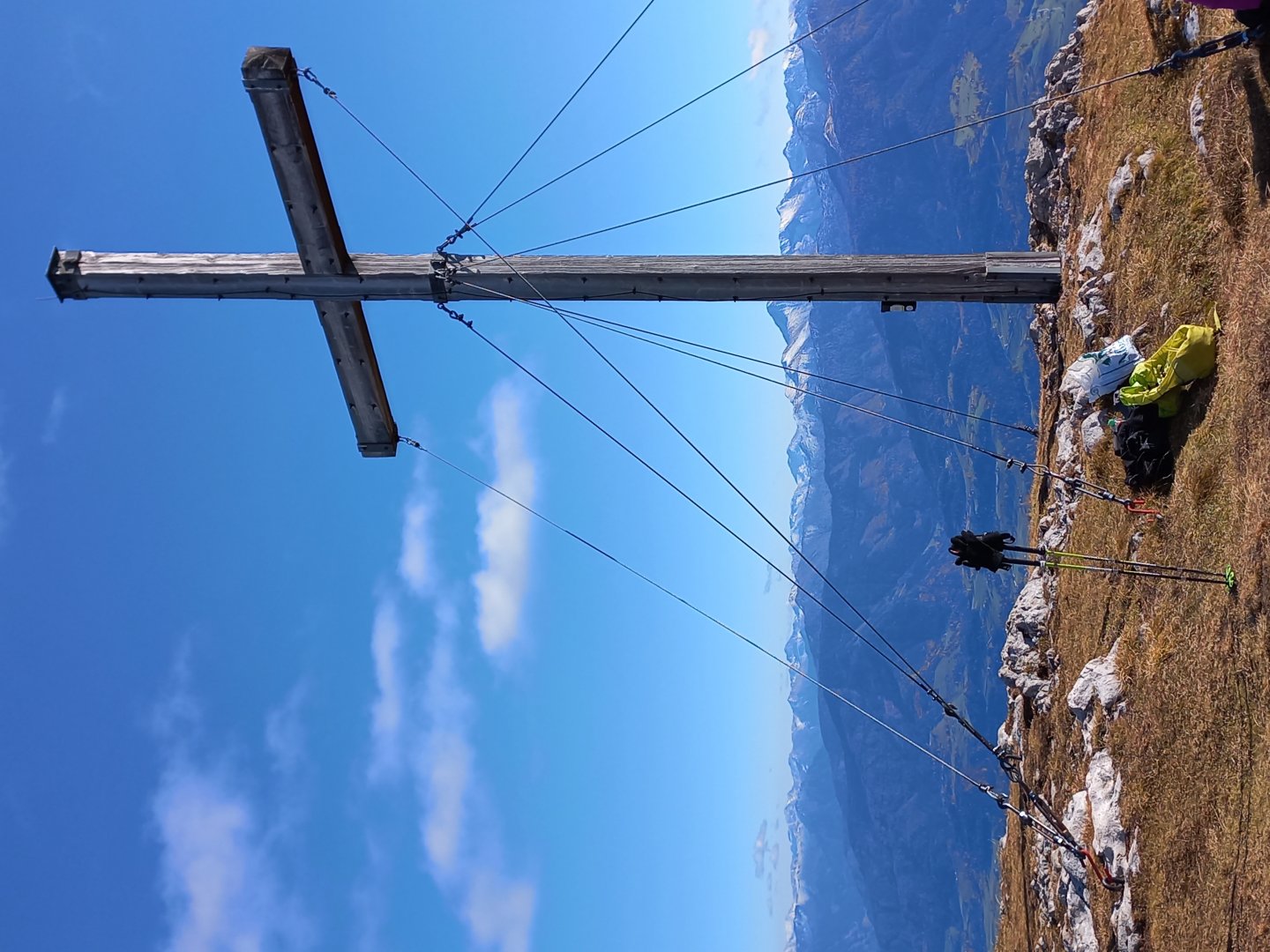
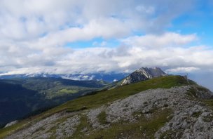
I don't want to leave, but time is pressing and so I go back to the saddle and continue to the cross on Kufstein. The cross is not quite at the top of the hill, but rather where the best view is. I sit here for a while and then descend to the wooden cottages of Stornalm. On the southern slope I enjoy the aforementioned calendar pictures. The footpath weaves through the golden larches, the sun burns so hot it's shirtless, and the entire descent back down is accompanied by the snow-covered Höchstein and Hochwildstelle opposite. After about an hour and a half I'm back at the car. 7 hours on the road, about 18 km and 1,500 vertical metres trodden.
Difficulty
Technically easy trek, the route leads through forest paths or alpine meadows. The elevation is about 1,500 meters, so it is good to have a little bit of fit. There is an unmarked but clear trail to the Kleiner Miesberg. Orientation is not a problem.
Water availability
Water can be collected from streams along the way. Otherwise carry at least 1.5 litres of water.
Sleeping options
There is no possibility to stay overnight on the route, on the contrary, there is a large number of accommodation facilities in the valley.
Mountain peaks
The route leads over the mountains Kleiner Miesberg 2 175 m above sea level and Kufstein 2 049 m above sea level. Views of the Dachstein massif from the east, Totes Gebirge, Ennstal , Grimming, Schladming Tauern, Sölktal Alps, with good visibility even the High Tauern.
Danger
A safe relaxing trek. Mostly on marked trails or paths. There is no exposed or airy area.
Food
Food from own supplies, there is no mountain hut on the route.
Attractions
Kneipping place by the car park - water wheels, carved cottages.